 Block
Springfield, Tennessee
8 topographic sheets cover this place, the earliest surveyed in 1952 and the latest in 1985. It stands in District 12. It lies in ZIP code area 37172. It stands on Black Branch. The Survey maps it on the Springfield North quadrangle. 18,782 people lived here at the 2020 count. It stands 666 feet above sea level.
Research this city
On record in Springfield
Buildings and businesses the archive holds for this place. Each opens its own page, with the source record it came from.
On the National Register 12 records
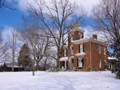 Beeches, Thelisted 1982
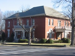 Mollie and Neel Glenn Houselisted 2012
 Mansfield Cheatham Houselisted 1978
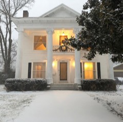 William M. McMurry Houselisted 2017
 Robertson County Courthouselisted 1978
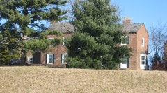 Russell Houselisted 2011
 Dr. Martin Walton Houselisted 1996
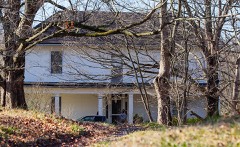 Walton-Wiggins Farmlisted 1997
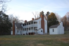 Woodard Halllisted 1975
 Woodard Hall Farm (Boundary Increase)listed 1995
- Arthur Pitt House and Distillerylisted 1973
- Springfield Town Square Historic Districtlisted 1979
Population over time
2 figuresSpringfield grew from 16,440 to 18,782 between 2010 and 2020. These are the recorded population figures Wikidata holds for this place, reached through the Geographic Names Information System number this page is keyed on rather than by name, so they belong to this place and not to another of the same name. Most are census counts, but not all are: an early figure may be a founding or settlement estimate, and an estimate published within five years of a census is left out. The change column is computed, and is left blank where more than 20 years separate a figure from the one before it, because a gap that long is not a change between two counts.
| Year | People | Change |
|---|---|---|
| 2010 | 16,440 | |
| 2020 | 18,782 | +2,342 (+14%) |
Topographic sheets covering this place
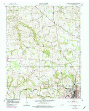
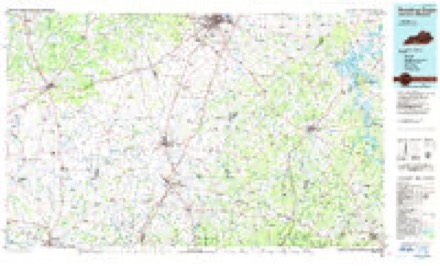
4 surveys from 8 printed sheetsMatched by testing this settlement's coordinate against the published boundary of every sheet in the United States Geological Survey's historical collection. Each opens the scanned sheet at the Survey.
- 1952 USGS Springfield North quadrangle1:24000, 2 printings
- 1956 USGS Nashville quadrangle1:250000, 2 printings
- 1959 USGS Nashville quadrangle1:250000
- 1985 USGS Bowling Green quadrangle1:100000, 3 printings


Fires near this place
11 since 1998Regional context, not property-specific evidence. The federal wildfire occurrence database lists 11 fires within 5 miles of Springfield between 1998 and 2016, burning about 76 acres in total. None started naturally. None was recorded as arson. Distance is straight-line from the map coordinates, so a fire counted here may appear on a neighbouring settlement's page as well.
| Reported cause | Fires |
|---|---|
| Debris and open burning | 8 |
| Equipment and vehicle use | 2 |
| Missing data/not specified/undetermined | 1 |
The most recent of them, most recent first, with the day each was reported and the service that recorded it.
| Date | Cause | Size | Reported by | Name on the report |
|---|---|---|---|---|
| 9 September 1999 | Missing data/not specified/undetermined | 2.0 acres | Tennessee Division of Forestry | not named |
| 2 September 1999 | Debris and open burning | 6.0 acres | Tennessee Division of Forestry | not named |
| 30 August 1999 | Equipment and vehicle use | 15 acres | Tennessee Division of Forestry | not named |
| 9 June 2007 | Debris and open burning | 5.0 acres | Tennessee Division of Forestry | U.T. AGR |
| 26 February 1998 | Debris and open burning | 1.0 acres | Tennessee Division of Forestry | not named |
| 4 December 1998 | Debris and open burning | 5.0 acres | Tennessee Division of Forestry | not named |
| 20 November 2012 | Debris and open burning | 4.0 acres | Tennessee Division of Forestry | HYDE RD |
| 18 November 2016 | Equipment and vehicle use | 20 acres | Tennessee Division of Forestry | MURPHEY, AIRPOERT RD FIRE |
Settlements close enough to share some of these fires:
Mines and quarries near this place
4 within 5 milesRegional context, not property-specific evidence. The federal mineral resources record lists 4 workings within 5 miles of Springfield: 2 producers, 2 occurrences. 2 still produce. What was taken out: Zinc, Stone, Crushed/Broken, Limestone, General, Stone, Crushed/Broken. Distance is straight-line from the map coordinates, so a quarry counted here may appear on a neighbouring settlement's page as well.
| Where | Site | Commodity | Status | Recorded |
|---|---|---|---|---|
| Porter Brown Limestone Co. Quarry | Stone, Crushed/Broken, Limestone, General | Producer | Limestone | |
| Springfield Quarry | Stone, Crushed/Broken | Producer | ||
| Deep Well-Sphalerite Occurrence | Zinc | Occurrence | Sphalerite | |
| Deep Well-Sphalerite Occurrence | Zinc | Occurrence |
Storms near this place
60 of 89 shownRegional context, not property-specific evidence. The National Weather Service names Springfield in 89 storm reports between 1993 and 2025: 54 thunderstorm wind, 24 hail, 4 lightning, 2 flash flood. The reports record 7 injuries. Each account below is quoted exactly as the forecast office filed it, from the NOAA Storm Events Database, and each date opens the federal record of that event.
| When | Event | Place named | Harm | What the report says |
|---|---|---|---|---|
| December 2023 | Tornado (EF2) | Springfield | 4 hurt, $10,000,000 | This EF-2 tornado touched down north of C.M. Martin Road to the west of Highway 431 where it blew down a few trees. The tornado crossed Highway 431 south of Main Street where it knocked over some power poles, then continued to blow down trees east of the highway. The tornado moved into southern Springfield near Fairway Trail and Kemper Court, snapping and uprooting trees along many residential streets and causing minor damage to a few homes. More significant damage to homes occurred further northeast on Rudolph Street and Brentlawn Drive. The tornado strengthened as it crossed Highway 41 near the Kroger shopping center, with numerous businesses damaged from high-end EF1 to low-end EF2 intensity (110-115 mph). 25 vehicles in the Kroger parking lot were flipped with some thrown into nearby ditches. The tornado then crossed the railroad tracks behind Kroger and reached its peak intensity as it entered an industrial area, where multiple warehouse structures were heavily damaged. With the majority of these metal building systems having Grade 5 bolts holding down the columns, winds were estimated at EF-2/120 mph in this area. The tornado then struck a fire department and strip mall (EF-1/110 mph) and bent a steel transmission pole at a power substation (EF-2/115 mph) on the east side of the industrial park. As the tornado continued northeast, it significantly weakened but still uprooted trees and caused minor roof damage to homes on Greystone Drive and Sloan Lane. On Roy Pitt Road, the tornado destroyed a two car garage and rolled a trailer on its side (EF-1). The tornado continued to blow down trees as it moved northeast across Highway 76E near Oakland Road before finally lifting north of Sloan Road. |
| April 1998 | Tornado (F2) | Springfield | 3 hurt, $500,000 | 30 homes were damaged and 7 trailers were totally destroyed. Most of the damage was on Hwy 431 in Coopertown, Reader School Rd. and also along Hwy 41 near Greenbrier. Many trees and power lines were down. One mobile home was hurled 100 yards across Hwy 431and totally destroyed. 3 were slightly injured in the mobile home. |
| May 2020 | Thunderstorm Wind | Springfield | $254,530 | Numerous trees and power lines were blown down across Robertson County. |
| June 2019 | Thunderstorm Wind | Springfield | $50,000 | Approximately 40 trees were downed across Robertson County with two trees landing on houses but causing no damage. A couple buildings received minor damage from high winds, and downed power lines resulted in 5,200 people without power. |
| July 2009 | Thunderstorm Wind | Springfield | $50,000 | Trees were downed county wide. |
| April 2024 | Thunderstorm Wind | Springfield | $25,000 | Severe thunderstorm winds caused a tree to fall on a house along Shelton Street in Springfield. Minor to moderate damage was reported. Damages are a rough estimate. |
| April 2024 | Thunderstorm Wind | Springfield | $25,000 | A Facebook user reported a tree down at Blackwood Road and Wilks Road near Springfield. Other trees and power lines were reported downed in the Cross Plains and Springfield area, leaving about 1,300 customers without power. Damages are a rough estimate. |
| September 2024 | Lightning | Springfield | $25,000 | The Robertson County Emergency Operations Center was struck by lightning, causing minor damage. |
| April 2011 | Thunderstorm Wind | Springfield | $25,000 | Numerous trees were blown down across the county. |
| May 2017 | Thunderstorm Wind | Springfield | $20,000 | Forty reports of trees down throughout the county with several roadways blocked. |
| May 2024 | Thunderstorm Wind | Springfield | $15,000 | Severe thunderstorm winds downed a large tree onto a home on the 3200 block of Burr Road in Springfield. Damages are a rough estimate. |
| June 2022 | Thunderstorm Wind | Springfield | $15,000 | Widespread trees and power lines were blown down across Robertson County. |
| March 2025 | Thunderstorm Wind | Springfield | $10,000 | Severe thunderstorm winds downed a tree onto a home on Circle Drive in Springfield. No injuries were reported. Damages are a rough estimate. |
| June 2025 | Thunderstorm Wind | Springfield | $10,000 | Severe thunderstorm winds downed several trees across Robertson County. Damages are a rough estimate. |
| June 2025 | Thunderstorm Wind | Springfield | $10,000 | Severe thunderstorm winds downed several trees across Robertson County. Damages are a rough estimate. |
| July 2022 | Thunderstorm Wind | Springfield | $10,000 | Smokey Barn News reported several trees and power lines were blown down across Robertson County with some roads blocked. |
| March 2017 | Thunderstorm Wind | Springfield | $10,000 | Trees were blown down across the county. |
| July 2016 | Thunderstorm Wind | Springfield | $10,000 | Numeorus trees and power lines were blown down across Robertson County. |
| May 2011 | Thunderstorm Wind | Springfield | $10,000 | Several trees were downed in Springfield. |
| June 2009 | Thunderstorm Wind | Springfield | $10,000 | Large limbs of several trees were reported down in Springfield. |
| July 2008 | Lightning | Springfield | $10,000 | Lightning struck a garage which caused a fire. The fire destroyed the garage and its contents. |
| June 2005 | Thunderstorm Wind | Springfield | $10,000 | Strong thunderstorm wind gust blew down a tree on 20th Avenue which landed on a trailer and car. 5 homes had minor damage and a barn had major damage. Several trees and power lines were down. |
| June 2024 | Thunderstorm Wind | Springfield | $5,000 | Multiple reports of downed trees were received in Springfield. Damages are a rough estimate. |
| January 2020 | Thunderstorm Wind | Springfield | $5,000 | Trees were blown down across Springfield. One tree fell onto a home but the home did not sustain damage. |
| August 2019 | Thunderstorm Wind | Springfield | $5,000 | Numerous trees and power lines were blown down across Robertson County with several roads blocked, including Highway 76 at New Hall Road, Kinneys Road, Glen Raven Road at Dortch Road, and Bethel Road between I-65 and Highway 31. Over 6000 customers were without power. |
| June 2019 | Thunderstorm Wind | Springfield | $5,000 | A trained spotter measured a 78 mph wind gust in Springfield. He also reported numerous trees down in the area and pea size hail. |
| December 2018 | Thunderstorm Wind | Springfield | $5,000 | A tree was blown down onto a house on Bessie Street. |
| May 2018 | Thunderstorm Wind | Springfield | $5,000 | Facebook photo showed a tree was blown down on a car at 408 Circle Drive in Springfield. |
| June 2016 | Thunderstorm Wind | Springfield | $5,000 | Several trees and power lines were blown down throughout Robertson County. |
| July 2016 | Thunderstorm Wind | Springfield | $5,000 | Smokey Barn News reported several trees and power lines down across Robertson County. One tree fell onto a garage in Springfield. |
| August 2012 | Thunderstorm Wind | Springfield | $5,000 | Trees and power lines were blown down on Central Avenue. |
| April 1999 | Hail | Springfield | $5,000 | A lady reported hail the size of quarters which damaged her roof. Also, strong thunderstorm winds damaged her gutters. Her home was located at 6232 Highway 76. |
| June 2022 | Thunderstorm Wind | Springfield | $3,000 | A storm chaser reported 60 mph winds with trees blown down in Springfield. |
| May 2021 | Thunderstorm Wind | Springfield | $3,000 | Trees were blown down in the 200 block of North Main Street in Springfield. |
| July 2021 | Thunderstorm Wind | Springfield | $3,000 | Multiple trees were blown down onto power lines. |
| October 2014 | Thunderstorm Wind | Springfield | $3,000 | Trees were blown down on Lahr Road. |
| November 2010 | Thunderstorm Wind | Springfield | $2,000 | Trees were blown down on Guthrie Road. |
| August 2023 | Lightning | Springfield | $1,000 | Lightning struck and brought down a tree near Springfield. Damages are a rough estimate. |
| June 2018 | Thunderstorm Wind | Springfield | $1,000 | Twitter photos showed a large tree blown down in southeast Springfield. |
| April 2025 | Hail | Springfield | - | Estimated quarter size hail was reported in Springfield. |
| July 2024 | Thunderstorm Wind | Springfield | - | Thunderstorm winds were estimated to be 55 to 60 mph in Springfield. |
| April 2024 | Hail | Springfield | - | Quarter size hail was reported from a severe thunderstorm near Springfield. |
| June 2019 | Thunderstorm Wind | Springfield | - | Spotter estimated 60 mph wind gusts. |
| June 2019 | Thunderstorm Wind | Springfield | - | A spotter estimated an 80 mph wind gust in Springfield. |
| August 2019 | Thunderstorm Wind | Springfield | - | A trained spotter in Springfield estimated a wind gust of 60 mph. |
| June 2018 | Hail | Springfield | - | Public reported dime to nickel size hail with estimated winds of 35 to 45 mph. |
| September 2017 | Heavy Rain | Springfield | - | A 72 hour rainfall total of 8.98 inches was measured at CoCoRaHS station Springfield 1.8 WSW. |
| March 2017 | Funnel Cloud | Springfield | - | A video posted to a Nashville TV station Facebook page showed a small funnel cloud 10 miles east of Springfield. No touchdown or damage occurred. Time estimated. |
| June 2016 | Thunderstorm Wind | Springfield | - | A home weather station measured a 67 mph wind gust. |
| June 2015 | Hail | Springfield | - | Nickel to quarter size hail was reported by the COOP observer in Springfield. |
| August 2012 | Hail | Springfield | - | Dime size hail reported on Central Avenue in Springfield. |
| June 2011 | Thunderstorm Wind | Springfield | - | A trained spotter estimated a wind gust of 60 mph in Springfield. |
| April 2007 | Hail | Springfield | - | Spotter reported quarter size hail. |
| May 2004 | Thunderstorm Wind | Springfield | - | Tree and power line down on a vehicle near intersection of Fish Road and Hatderry Road. |
| May 2004 | Thunderstorm Wind | Springfield | - | Barns were blown down. |
| May 2004 | Hail | Springfield | - | Golf ball size hail was reported. |
| July 2004 | Thunderstorm Wind | Springfield | - | Sheriff's Office reported trees and power lines down on Highway 49E between Springfield and Orlinda. |
| July 2003 | Thunderstorm Wind | Springfield | - | Public reported trees were down. |
| July 2003 | Thunderstorm Wind | Springfield | - | Public reported trees were down. |
| November 2002 | Thunderstorm Wind | Springfield | - | Law enforcement reported tree down on Highway 49 at Caars Creek Bridge. |
Nearest settlements
The eight closest, with where each one stands in the county. Distances are straight-line, computed from the Geographic Names Information System coordinates.
| Map | Place | Distance | Sheets |
|---|---|---|---|
| Mount Denson | 2.3 miles | 8 | |
| Perry Park | 2.5 miles | 15 | |
| Oakland | 2.9 miles | 8 | |
| Courtland | 3.5 miles | 15 | |
| Kinneys | 3.5 miles | 8 | |
| Chestnut Orchard | 3.9 miles | 16 | |
| Lakeview | 5.1 miles | 8 | |
| Flewellyn | 5.1 miles | 16 |
Elsewhere
Matched on this settlement's Geographic Names Information System number rather than its name, so it cannot be a different place of the same name in another state.
| Wikipedia article on Springfield | An encyclopaedic summary. Its text is share-alike, so it is linked here rather than copied. |
| Wikidata item Q185323 | The structured record the population and elevation above come from. Public domain (CC0). |
Provenance
This settlement is recorded in the Geographic Names Information System as feature 1271139. The sheet list is computed by point-in-boundary test against the United States Geological Survey's historical topographic inventory. Both are works of the United States government and carry no copyright under 17 U.S.C. 105.
Wildfire. Short, Karen C. 2022. Spatial wildfire occurrence data for the United States, 1992-2020 [FPA_FOD_20221014]. 6th Edition. Fort Collins, CO: Forest Service Research Data Archive. https://doi.org/10.2737/RDS-2013-0009.6 Collected with United States Government funding and usable without additional permissions or fees.
Mines and quarries. USGS Mineral Resources Data System (MRDS) https://mrdata.usgs.gov/mrds/ A work of the United States government, no copyright under 17 U.S.C. 105.
Storms. NOAA National Centers for Environmental Information, Storm Events Database https://www.ncei.noaa.gov/stormevents/ A work of the United States government, no copyright under 17 U.S.C. 105. Narratives are quoted verbatim from the National Weather Service report and are not edited or summarised.