 Block
Suggs Creek, Tennessee
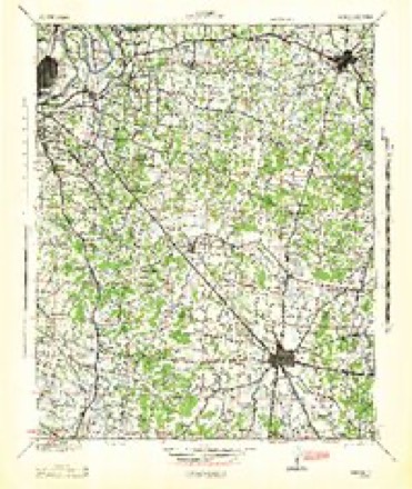
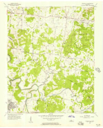
10 topographic sheets cover this place, the earliest surveyed in 1942 and the latest in 1984. It stands in District 13. It lies in ZIP code area 37122. It stands on North Fork Suggs Creek. The Survey maps it on the Gladeville quadrangle. It stands 548 feet above sea level.
Topographic sheets covering this place
5 surveys from 10 printed sheetsMatched by testing this settlement's coordinate against the published boundary of every sheet in the United States Geological Survey's historical collection. Each opens the scanned sheet at the Survey.
- 1942 USGS Lebanon quadrangle1:100000
- 1956 USGS Gladeville quadrangle1:24000, 5 printings
- 1956 USGS Nashville quadrangle1:250000, 2 printings
- 1959 USGS Nashville quadrangle1:250000
- 1984 USGS Nashville quadrangle1:100000



Fires near this place
11 since 1997Regional context, not property-specific evidence. The federal wildfire occurrence database lists 11 fires within 5 miles of Suggs Creek between 1997 and 2014, burning about 119 acres in total. None started naturally. 1 was recorded as arson. Distance is straight-line from the map coordinates, so a fire counted here may appear on a neighbouring settlement's page as well.
| Reported cause | Fires |
|---|---|
| Debris and open burning | 6 |
| Equipment and vehicle use | 3 |
| Arson/incendiarism | 1 |
| Fireworks | 1 |
The most recent of them, most recent first, with the day each was reported and the service that recorded it.
| Date | Cause | Size | Reported by | Name on the report |
|---|---|---|---|---|
| 19 September 1998 | Debris and open burning | 10 acres | Tennessee Division of Forestry | not named |
| 10 September 2002 | Debris and open burning | 24 acres | Tennessee Division of Forestry | not named |
| 17 July 1997 | Debris and open burning | under an acre | Tennessee Division of Forestry | not named |
| 26 June 2012 | Fireworks | 17 acres | Tennessee Division of Forestry | 9500 CENTRAL PIKE |
| 9 April 2001 | Debris and open burning | 1.5 acres | Tennessee Division of Forestry | not named |
| 31 March 2014 | Equipment and vehicle use | 47 acres | Tennessee Division of Forestry | MIRES ROAD FIRE |
| 18 March 2009 | Debris and open burning | 1.0 acres | Tennessee Division of Forestry | HARKREADER |
| 8 February 2001 | Equipment and vehicle use | 5.0 acres | Tennessee Division of Forestry | not named |
Settlements close enough to share some of these fires:
Mines and quarries near this place
2 within 5 milesRegional context, not property-specific evidence. The federal mineral resources record lists 2 workings within 5 miles of Suggs Creek: 2 past producers. None of them still produces. What was taken out: Barium-Barite, Iron. Distance is straight-line from the map coordinates, so a quarry counted here may appear on a neighbouring settlement's page as well.
| Where | Site | Commodity | Status | Recorded |
|---|---|---|---|---|
| Bannister Mine | Barium-Barite, Iron | Past Producer | Barite, Limonite | |
| Bannister Mine | Barium-Barite, Iron | Past Producer |
Storms near this place
29 since 2007Regional context, not property-specific evidence. The National Weather Service names Suggs Creek in 29 storm reports between 2007 and 2024: 15 thunderstorm wind, 5 hail, 2 flash flood, 2 tornado. No death or injury is recorded in these reports. Each account below is quoted exactly as the forecast office filed it, from the NOAA Storm Events Database, and each date opens the federal record of that event.
| When | Event | Place named | Harm | What the report says |
|---|---|---|---|---|
| March 2021 | Flash Flood | Suggs Creek | $1,000,000 | Major flash flooding affected Mount Juliet, with most roadways flooded and closed, numerous water rescues conducted from vehicles and homes, and many homes and businesses flooded. Homes were flooded on Creedwood Drive and West Division Street with people rescued. The Valley Center Mall shopping center on Mount Juliet Road at Old Lebanon Dirt Road was also flooded. |
| March 2017 | Lightning | Suggs Creek | $300,000 | A house in the 800 block of Harrisburg Lane in Mount Juliet was struck by lightning, and the resulting fire completely destroyed the home. |
| November 2017 | Tornado (EF1) | Suggs Creek | $50,000 | An EF-1 tornado began in far southeast Davidson County where weak tree and roof damage (EF-0) was noted on Hampton Blvd in the Villages of Long Hunter subdivision of Antioch. The tornado then crossed Percy Priest Lake into far northwest Rutherford County where numerous trees were blown down and the roofs of a few homes suffered minor damage. Moving into Wilson County, the tornado intensified to EF-1, snapping or uprooting dozens of trees and destroying several outbuildings on Fellowship Road and Underwood Road. The worst damage was in Gladeville where a few homes suffered roof damage on Cobblestone Way and Stonefield Drive, several fences were blown down, and a few outbuildings were destroyed. The steeple of a church on McCreary Road collapsed into the sanctuary, and part of an exterior brick wall was blown down. An RV carport across the street from the church was also destroyed. Another outbuilding was destroyed on Odum Lane and several more trees were blown down before the tornado lifted in inaccessible areas south of Highway 265. The ending point, ending time, and path length of the Wilson County portion of this tornado were updated in July 2018 based on newly available high resolution satellite imagery in Google Earth, giving an updated total path length across Davidson, Rutherford, and Wilson Counties of 10.93 miles. |
| February 2011 | Tornado (EF2) | Suggs Creek | $50,000 | Damaged occurred in the Smith Springs Area of southeast Davidson County. Damage began near the intersection of Butler and Smith Springs Road where two churches experienced significant roof damage. Damage continued to the northeast across the Priest Lake Forecast Community where approximately ten homes suffered significant roof damage. A couple of homes had complete roof loss including a two story home which lost most of its second floor. Damage continued northeast across Percy Priest Lake and eventually into Wilson County. The last evidence of damage was near the intersection of Gladieville Circle and Stewarts Ferry Pike. |
| June 2023 | Thunderstorm Wind | Suggs Creek | $20,000 | The emergency manager reported that two power poles were snapped near Central Pike and Lohman Road south of Mount Juliet. There were also about 8,200 power outages across Wilson County. Damages are a rough estimate. |
| July 2024 | Thunderstorm Wind | Suggs Creek | $15,000 | Severe thunderstorm winds downed a large tree branch onto a home in Mount Juliet, causing minor roof damage. Damages are a rough estimate. |
| August 2014 | Thunderstorm Wind | Suggs Creek | $15,000 | A house at 688 Poplar Drive in Rural Hill was heavily damaged due to a fallen tree. |
| April 2011 | Thunderstorm Wind | Suggs Creek | $15,000 | Trees, power lines, and telephone poles were downed along the 6300 block of Stewarts Ferry Pike. |
| June 2023 | Thunderstorm Wind | Suggs Creek | $10,000 | Several trees were blown down along Stewarts Ferry Pike in Rural Hill. One of these trees fell on a car and blocked the road. No injuries were reported. Damages are estimated for the trees and the car. |
| September 2019 | Thunderstorm Wind | Suggs Creek | $5,000 | A tree was blown down, a barn and house roof were damaged, and a trampoline was blown a long distance at 2929 Harkreader Road. |
| August 2014 | Thunderstorm Wind | Suggs Creek | $5,000 | A barn at 846 Corinth Road in Rural Hill was blown down onto its side. |
| August 2014 | Lightning | Suggs Creek | $5,000 | A house was struck by lightning on Clark Drive in Rural Hill which caused a small fire and minor damage to an upstairs room. |
| May 2011 | Thunderstorm Wind | Suggs Creek | $5,000 | Several trees were downed in the Providence Community. |
| June 2023 | Thunderstorm Wind | Suggs Creek | $3,000 | Facebook photos and reports showed several trees downed in the Tinnell Valley Subdivision just northeast of Rural Hill. Damages are estimated for the trees. |
| March 2017 | Thunderstorm Wind | Suggs Creek | $3,000 | Several trees and power lines were blown down into the roadway in the 5700 block of Alvin Sperry Road. |
| June 2014 | Thunderstorm Wind | Suggs Creek | $3,000 | Trees were blown down at Stewarts Ferry Pike and Logue Road near Gladeville.. |
| September 2024 | Thunderstorm Wind | Suggs Creek | $1,000 | Severe thunderstorm winds downed a tree over Logue Road in Rural Hill. Damages are a rough estimate. |
| August 2019 | Thunderstorm Wind | Suggs Creek | $1,000 | A tree was blown down into the road at 430 South Rutland Road. |
| April 2018 | Thunderstorm Wind | Suggs Creek | $1,000 | A tree was blown down on Logue Road at Masters Way. |
| May 2016 | Thunderstorm Wind | Suggs Creek | $1,000 | A Facebook report showed a photo of a tree down near a home on Stewarts Ferry Pike about 3 miles west of Gladeville. |
| September 2009 | Flash Flood | Suggs Creek | $1,000 | At 8494 Central Pike, three inches of water covered the road. |
| June 2023 | Hail | Suggs Creek | - | A Twitter photo showed nickel size hail northeast of Rural Hill. |
| August 2023 | Funnel Cloud | Suggs Creek | - | Facebook video showed a funnel cloud near Rural Hill. |
| June 2022 | Hail | Suggs Creek | - | Multiple social media reports indicated quarter to golf ball size hail fell in Mount Juliet near Pine Creek Golf Course. |
| June 2020 | Flood | Suggs Creek | - | Central Pike from south Mount Juliet Road to Logue Road had four spots underwater with traffic significantly backed up. |
| May 2016 | Heavy Rain | Suggs Creek | - | CoCoRaHS Station Mount Juliet 4.0 SE measured a 24 hour rainfall total of 3.69 inches. |
| July 2016 | Hail | Suggs Creek | - | A tSpotter Twitter report indicated a brief burst of nickel size hail occurred on Dunnwood Loop in the Providence area of Mount Juliet. |
| April 2012 | Hail | Suggs Creek | - | Quarter size hail reported between Mount Juliet and Gladeville. |
| November 2007 | Hail | Suggs Creek | - | Wife of NWS employee reported penny size hail at her home. |
Nearest settlements
The eight closest, with where each one stands in the county. Distances are straight-line, computed from the Geographic Names Information System coordinates.
| Map | Place | Distance | Sheets |
|---|---|---|---|
| Rural Hill | 0.9 miles | 10 | |
| Lohmans Store (historical) | 2.3 miles | 9 | |
| Dodoburg (historical) | 2.7 miles | 18 | |
| East Point | 2.7 miles | 18 | |
| Belinda City | 3.4 miles | 9 | |
| Gladeville | 4.2 miles | 10 | |
| Centralville (historical) | 4.4 miles | 18 | |
| Lindsayville (historical) | 4.4 miles | 9 |
Elsewhere
Matched on this settlement's Geographic Names Information System number rather than its name, so it cannot be a different place of the same name in another state.
| Wikipedia article on Suggs Creek | An encyclopaedic summary. Its text is share-alike, so it is linked here rather than copied. |
| Wikidata item Q7635099 | The structured record the population and elevation above come from. Public domain (CC0). |
Provenance
This settlement is recorded in the Geographic Names Information System as feature 1271741. The sheet list is computed by point-in-boundary test against the United States Geological Survey's historical topographic inventory. Both are works of the United States government and carry no copyright under 17 U.S.C. 105.
Wildfire. Short, Karen C. 2022. Spatial wildfire occurrence data for the United States, 1992-2020 [FPA_FOD_20221014]. 6th Edition. Fort Collins, CO: Forest Service Research Data Archive. https://doi.org/10.2737/RDS-2013-0009.6 Collected with United States Government funding and usable without additional permissions or fees.
Mines and quarries. USGS Mineral Resources Data System (MRDS) https://mrdata.usgs.gov/mrds/ A work of the United States government, no copyright under 17 U.S.C. 105.
Storms. NOAA National Centers for Environmental Information, Storm Events Database https://www.ncei.noaa.gov/stormevents/ A work of the United States government, no copyright under 17 U.S.C. 105. Narratives are quoted verbatim from the National Weather Service report and are not edited or summarised.