 Block
Tullahoma, Tennessee
17 topographic sheets cover this place, the earliest surveyed in 1936 and the latest in 1981. It stands in District 7. It lies in ZIP code area 37388. It stands on West Fork Rock Creek. The Survey maps it on the Tullahoma quadrangle. 20,339 people lived here at the 2020 count. It stands 1,060 feet above sea level.
On record in Tullahoma
Buildings and businesses the archive holds for this place. Each opens its own page, with the source record it came from.
On the National Register 7 records
 Smotherman Houselisted 2018
 Tullahoma Municipal Buildinglisted 2018
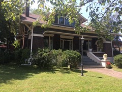 Wilson-Crouch Houselisted 2017
- Fox Houselisted 2023
- North Atlantic Street Historic Districtlisted 1988
- North Washington Street Historic Districtlisted 1993
- T-201 Aircraft Hangarlisted 2021
Population over time
2 figuresTullahoma grew from 18,655 to 20,339 between 2010 and 2020. These are the recorded population figures Wikidata holds for this place, reached through the Geographic Names Information System number this page is keyed on rather than by name, so they belong to this place and not to another of the same name. Most are census counts, but not all are: an early figure may be a founding or settlement estimate, and an estimate published within five years of a census is left out. The change column is computed, and is left blank where more than 20 years separate a figure from the one before it, because a gap that long is not a change between two counts.
| Year | People | Change |
|---|---|---|
| 2010 | 18,655 | |
| 2020 | 20,339 | +1,684 (+9%) |
Topographic sheets covering this place
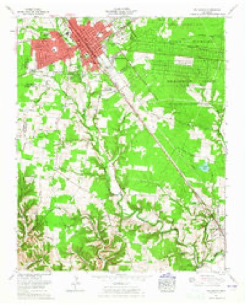
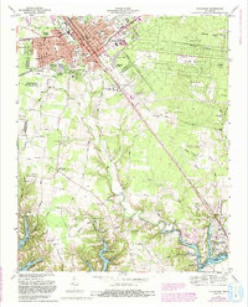
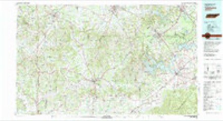
7 surveys from 17 printed sheetsMatched by testing this settlement's coordinate against the published boundary of every sheet in the United States Geological Survey's historical collection. Each opens the scanned sheet at the Survey.
- 1936 USGS Camp Peay quadrangle1:24000
- 1941 USGS Camp Forrest quadrangle1:24000, 2 printings
- 1943 USGS Mc Minnville quadrangle1:100000
- 1956 USGS Columbia quadrangle1:250000, 6 printings
- 1962 USGS Tullahoma quadrangle1:24000
- 1972 USGS Tullahoma quadrangle1:24000, 5 printings
- 1981 USGS Tullahoma quadrangle1:100000

Fires near this place
76 since 1997Regional context, not property-specific evidence. The federal wildfire occurrence database lists 76 fires within 5 miles of Tullahoma between 1997 and 2020, burning about 546 acres in total. None started naturally. 11 were recorded as arson. Distance is straight-line from the map coordinates, so a fire counted here may appear on a neighbouring settlement's page as well.
| Reported cause | Fires |
|---|---|
| Debris and open burning | 46 |
| Arson/incendiarism | 11 |
| Equipment and vehicle use | 7 |
| Missing data/not specified/undetermined | 6 |
| Railroad operations and maintenance | 3 |
| Misuse of fire by a minor | 1 |
| Power generation/transmission/distribution | 1 |
| Fireworks | 1 |
The most recent of them, most recent first, with the day each was reported and the service that recorded it.
| Date | Cause | Size | Reported by | Name on the report |
|---|---|---|---|---|
| 27 September 2007 | Debris and open burning | under an acre | Tennessee Division of Forestry | LAWSON |
| 25 September 2008 | Railroad operations and maintenance | under an acre | Tennessee Division of Forestry | not named |
| 24 September 1999 | Arson/incendiarism | 5.0 acres | Tennessee Division of Forestry | not named |
| 19 September 2019 | Equipment and vehicle use | 1.0 acres | Tennessee Division of Forestry | POWER LINE FIRE |
| 15 September 1999 | Equipment and vehicle use | 65 acres | Tennessee Division of Forestry | not named |
| 25 August 1999 | Arson/incendiarism | 12 acres | Tennessee Division of Forestry | not named |
| 23 August 2011 | Debris and open burning | 3.0 acres | Tennessee Division of Forestry | HWY 41A |
| 22 August 2007 | Equipment and vehicle use | 18 acres | Tennessee Division of Forestry | BLACK BERRY LN |
Settlements close enough to share some of these fires:
Mines and quarries near this place
2 within 5 milesRegional context, not property-specific evidence. The federal mineral resources record lists 2 workings within 5 miles of Tullahoma: 2 occurrences. None of them still produces. What was taken out: Uranium, Oil Shale, Uranium, Oil Shale. Distance is straight-line from the map coordinates, so a quarry counted here may appear on a neighbouring settlement's page as well.
| Where | Site | Commodity | Status | Recorded |
|---|---|---|---|---|
| Outcrop Sample For Uranium | Uranium, Oil Shale | Occurrence | ||
| Outcrop Sample For Uranium | Uranium, Oil Shale | Occurrence |
Storms near this place
60 of 79 shownRegional context, not property-specific evidence. The National Weather Service names Tullahoma in 79 storm reports between 1993 and 2025: 43 thunderstorm wind, 17 hail, 10 flash flood, 5 lightning. The reports record 1 injury. Each account below is quoted exactly as the forecast office filed it, from the NOAA Storm Events Database, and each date opens the federal record of that event.
| When | Event | Place named | Harm | What the report says |
|---|---|---|---|---|
| November 2016 | Tornado (EF1) | Tullahoma | 1 hurt, $750,000 | An EF-1 tornado touched down just inside the Coffee County line west of Tullahoma. This tornado tracked through the northside of Tullahoma crossing over State Route 16/Jackson Street damaging several businesses with mostly roof damage observed. The tornado then moved across the Lakewood Golf and Country Club and Lake Tullahoma Estates neighborhoods where several hundred trees were uprooted and snapped. Almost all of the structural damage in these neighborhoods were due to downed trees. One person sustained a minor injury when a tree fell on their car. Once the tornado crossed the lake, it lifted just before Cherry Springs Road. |
| October 2011 | Hail | Tullahoma | $1,000,000 | Hail ranging from quarter to baseball size damaged numerous cars, homes, businesses, and schools in and around Tullahoma. The majority of the hail was quarter to golfball size, but some hailstones were reportedly up to baseball size. Videos showed the hail fell for around five minutes. |
| April 1996 | Lightning | Tullahoma | $500,000 | no account filed |
| May 2020 | Thunderstorm Wind | Tullahoma | $202,740 | Numerous trees and power lines were blown down across Tullahoma and much of the rest of Coffee County with widespread power outages. |
| July 2023 | Flash Flood | Tullahoma | $50,000 | Heavy rain in the Tullahoma area caused flash flooding in numerous areas, including along Wilson Avenue, Ovoca Road, and along North Jackson Street where the O'Reilly's parking lot was flooded. Damages are a rough estimate. |
| July 2012 | Thunderstorm Wind | Tullahoma | $50,000 | Numerous trees were blown down on the west side of Tullahoma in the Bel Aire Neighborhood including near the interstection of Lincoln Street and Crestwood Drive. One tree destroyed a shed and damaged a house. Another home on George Lane had its garage doors blown in. |
| August 2010 | Thunderstorm Wind | Tullahoma | $50,000 | Trees were blown down in the Viola, Hillsboro, and Tullahoma areas. Dozens of trees were blown down in the Bel-Aire neighborhood in Tullahoma. |
| October 2010 | Thunderstorm Wind | Tullahoma | $50,000 | A spotter reported large trees uprooted near the downtown square and also large trees branches downed also across the city of Tullahoma. |
| October 2004 | Thunderstorm Wind | Tullahoma | $50,000 | 200 trees fell in the western part of Tullahoma. The storm appeared to have started near Wilson Avenue and Braggs, downing 5 trees. The storm continued to march east. 50 homes received some damage either from fallen trees or flooding. 11 homes received major damage from fallen trees. 3 homes received damage from flooding.The city cemetery receieved damage to headstones due to trees falling on them. Areas affected by fallen trees were Cowan Lane, Braggs Circle, Cumberland Avenue, Crestwood Drive, Sharondale, and Bel-Aire. High winds blew an aluminum storage shed from 207 Ashley Court to the front of 201 Ashley Court, which is about 100 yards. |
| October 2004 | Flash Flood | Tullahoma | $50,000 | Vehicles were trapped in flooding water on Highway 55 in Tullahoma. By 0320 AM CST, numerous streets were flooded along with 2 vehicles. By 0525 AM CST, widespread flooding was occurring in Tullahoma by law enforcement. Storm drains had backed up. One vehicle stalled in high water at Waggoner Park. The Tullahoma Water Plant received 5.34 inches. One estimate in an EMA report placed the rainfall at about 8 inches in a few hours. An EMA report said 3 homes were damaged due to flooding. |
| April 2011 | Thunderstorm Wind | Tullahoma | $30,000 | Several large trees were downed near and around the city of Tullahoma and in the downtown area. The arms on a railroad crossing sign were also broken. |
| June 2008 | Thunderstorm Wind | Tullahoma | $30,000 | Trees and power lines were down in Tullahoma. A 100-year-old oak tree was blown down on Polk St. Another tree was blown down on Lincoln St. In addition, a tree fell on a house on Lindenwood Street in Tullahoma, and also just 4 houses away, a tree fell on a 2007 Dodge Grand Caravan.||1,300 people were without power in Tullahoma at one time during the thunderstorm. |
| July 2004 | Thunderstorm Wind | Tullahoma | $30,000 | 6 trees blew down on homes. |
| May 2012 | Thunderstorm Wind | Tullahoma | $25,000 | Multiple trees were downed resulting in power outages in Tullahoma. |
| August 2010 | Thunderstorm Wind | Tullahoma | $25,000 | Spotter reported numerous trees downed on Polk Street in Tullahoma. |
| February 2020 | Thunderstorm Wind | Tullahoma | $15,000 | Numerous trees, power lines, power poles, and railroad crossing bars were blown down across Tullahoma with many roads blocked. A restaurant on East Lincoln Street lost its metal roof and a fallen tree heavily damaged a mobile home on East Gizzard Street. |
| April 2014 | Thunderstorm Wind | Tullahoma | $10,000 | A few trees were blown down in and around Tullahoma, including on Linda Lane, Carter Blake Road, and Flowertown Road. One tree fell onto a home on Ovoca Road. Time estimated. |
| August 2012 | Thunderstorm Wind | Tullahoma | $10,000 | Numerous trees were blown down throughout Tullahoma. |
| July 2009 | Lightning | Tullahoma | $10,000 | Lightning struck the chimney caps at Tullahoma High School. This resulted in two capstones, estimated to weigh between 250 and 300 pounds, located on the chimney's top brick layer, to topple to the roof below, crashing through it, and causing structural damage. The hole made by the capstone also allowed rainwater to cause further damage inside the school. Total affected area was less than 30 square feet. |
| October 2004 | Lightning | Tullahoma | $10,000 | Lightning struck a house in the Westwood area. The fire was contained to 2 rooms. |
| June 2025 | Thunderstorm Wind | Tullahoma | $5,000 | Severe thunderstorm winds downed a tree which fell into powerlines along Clement Drive in Tullahoma. Damages are a rough estimate. |
| July 2023 | Thunderstorm Wind | Tullahoma | $5,000 | Severe thunderstorm winds downed a tree onto a vehicle along Cedar Lane in Tullahoma. Damages are a rough estimate. |
| June 2019 | Thunderstorm Wind | Tullahoma | $5,000 | Trees were blown down in Tullahoma and across northern Coffee County. |
| January 2008 | Thunderstorm Wind | Tullahoma | $5,000 | Ham radio operator reported damage to trees, signs and street lights. |
| April 1993 | Thunderstorm Wind | Tullahoma | $5,000 | A few trees were blown down. One tree punctured a building roof. |
| May 1995 | Hail | Tullahoma | $5,000 | no account filed |
| May 2021 | Thunderstorm Wind | Tullahoma | $3,000 | A report indicated large trees were blown down on Davis Street in Tullahoma. |
| August 2018 | Thunderstorm Wind | Tullahoma | $2,000 | A Twitter tSpotter report and photo indicated a tree was split in half on 12 Oaks Road and large tree limbs blown down on Huntington Place in Tullahoma. |
| June 2016 | Thunderstorm Wind | Tullahoma | $2,000 | A tSpotter Twitter report indicated a tree and power line were blown down near East Lincoln Elementary School in Tullahoma. |
| June 2011 | Thunderstorm Wind | Tullahoma | $2,000 | Large tree branches were blown down on roads in Tullahoma. |
| July 1998 | Thunderstorm Wind | Tullahoma | $2,000 | Strong thunderstorm winds hit near the Parkland subdivision on the north side of Tullahoma toppling 12 to 15 trees. The largest tree fell on a 6-year-old Arabian mare. Even though she had no broken bones, she was never able to get up and had to be euthenized. |
| May 1995 | Thunderstorm Wind | Tullahoma | $2,000 | A few trees were knocked down. |
| June 2025 | Thunderstorm Wind | Tullahoma | $1,000 | Severe thunderstorm winds downed a large tree at Maplewood Cemetary in Tullahoma. Damages are a rough estimate. |
| September 2022 | Thunderstorm Wind | Tullahoma | $1,000 | Thunderstorm winds in Tullahoma downed a tree that fell on a car on Bel-Aire Drive. Damages are estimated for the car. |
| July 2018 | Thunderstorm Wind | Tullahoma | $1,000 | A Facebook photo showed a tree blown down on Lynn Street in Tullahoma. |
| March 2017 | Thunderstorm Wind | Tullahoma | $1,000 | A tSpotter Twitter report indicated a large tree was uprooted on Hillcrest Drive in Tullahoma. |
| April 2016 | Thunderstorm Wind | Tullahoma | $1,000 | A tree was blown down on North Atlantic Street in Tullahoma. |
| December 2016 | Thunderstorm Wind | Tullahoma | $1,000 | A power line was blown down on North Jackson Street. |
| August 2012 | Thunderstorm Wind | Tullahoma | $1,000 | A tree was blown down in the yard of a home in Tullahoma. |
| July 2008 | Lightning | Tullahoma | $1,000 | Lightning struck the side of a barn causing a small fire. The damage was not major. |
| March 2006 | Lightning | Tullahoma | $1,000 | Lightning struck a tree in New Kent Court In Macon Manor, causing branches to fly and smash into windows of two residences. |
| April 2008 | Thunderstorm Wind | Tullahoma | $500 | A large tree was uprooted near Circle Dr. |
| August 1993 | Thunderstorm Wind | Tullahoma | $500 | A few trees were knocked down. |
| July 2015 | Thunderstorm Wind | Tullahoma | $250 | A large tree branch was snapped by an estimated wind gust of 50 mph. |
| April 2007 | Thunderstorm Wind | Tullahoma | $100 | The 911 Dispatch reported a large tree limb was blown down. |
| July 2023 | Hail | Tullahoma | - | Penny to nickel size hail fell along Maplehill Drive in Tullahoma. |
| February 2022 | Flood | Tullahoma | - | A Twitter tSpotter report indicated Jerry Street at East Lincoln Street in Tullahoma was flooded. |
| March 2019 | Flash Flood | Tullahoma | - | Numerous roads were flooded and closed across Tullahoma and Manchester. |
| February 2019 | Flash Flood | Tullahoma | - | Several roads were flooded and closed across Coffee County, including Skinner Flat Road, Lumley Stand Road, Stephenson Road, Hickory Grove Road, and Rock Road. |
| May 2018 | Hail | Tullahoma | - | A Facebook video showed dime sized hail falling on Old Estill Springs Road. |
| April 2017 | Hail | Tullahoma | - | Quarter size hail reported in Tullahoma. |
| June 2016 | Flood | Tullahoma | - | Standing water was reported on streets on the south side of town. |
| March 2011 | Funnel Cloud | Tullahoma | - | A funnel cloud was reported in Tullahoma. |
| April 2005 | Hail | Tullahoma | - | Spotter reported dime to nickel size hail. |
| April 2005 | Hail | Tullahoma | - | Spotter reported nickel to quarter size hail. |
| March 2004 | Flash Flood | Tullahoma | - | Trained Spotter reported ditches were overflowing and street flooding in Tullahoma. |
| May 2004 | Thunderstorm Wind | Tullahoma | - | Ham radio report of winds estimated to be around 60 mph. Newspaper article reported trees and power lines were down in Tullahoma, with the hardest hit area being in the Jackson Circle area of Tullahoma. |
| July 2004 | Hail | Tullahoma | - | Nickel size hail reported. |
| April 2003 | Hail | Tullahoma | - | Ham reported penny size hail. |
| May 2003 | Flash Flood | Tullahoma | - | Major flooding occurred around the city with several roads closed. |
Nearest settlements
The eight closest, with where each one stands in the county. Distances are straight-line, computed from the Geographic Names Information System coordinates.
| Map | Place | Distance | Sheets |
|---|---|---|---|
| Briarwood | 1.0 miles | 18 | |
| Forrest Park | 1.0 miles | 17 | |
| Johnstown | 1.1 miles | 17 | |
| Plainview Heights | 1.1 miles | 17 | |
| Pineview Heights | 1.2 miles | 17 | |
| Westside Heights | 1.2 miles | 17 | |
| Southgate Park | 1.4 miles | 17 | |
| Kaywood | 1.4 miles | 17 |
Elsewhere
Matched on this settlement's Geographic Names Information System number rather than its name, so it cannot be a different place of the same name in another state.
| Wikipedia article on Tullahoma | An encyclopaedic summary. Its text is share-alike, so it is linked here rather than copied. |
| Wikidata item Q3292530 | The structured record the population and elevation above come from. Public domain (CC0). |
Provenance
This settlement is recorded in the Geographic Names Information System as feature 1272964. The sheet list is computed by point-in-boundary test against the United States Geological Survey's historical topographic inventory. Both are works of the United States government and carry no copyright under 17 U.S.C. 105.
Wildfire. Short, Karen C. 2022. Spatial wildfire occurrence data for the United States, 1992-2020 [FPA_FOD_20221014]. 6th Edition. Fort Collins, CO: Forest Service Research Data Archive. https://doi.org/10.2737/RDS-2013-0009.6 Collected with United States Government funding and usable without additional permissions or fees.
Mines and quarries. USGS Mineral Resources Data System (MRDS) https://mrdata.usgs.gov/mrds/ A work of the United States government, no copyright under 17 U.S.C. 105.
Storms. NOAA National Centers for Environmental Information, Storm Events Database https://www.ncei.noaa.gov/stormevents/ A work of the United States government, no copyright under 17 U.S.C. 105. Narratives are quoted verbatim from the National Weather Service report and are not edited or summarised.