 Block
Waterloo, Tennessee
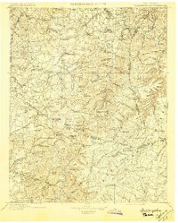
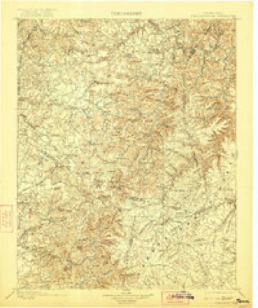
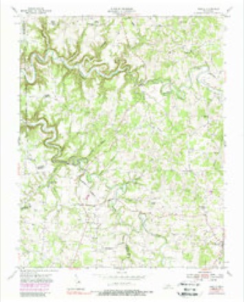
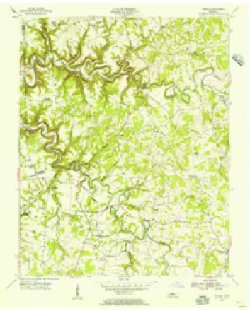
16 topographic sheets cover this place, the earliest surveyed in 1897 and the latest in 1982. It lies in ZIP code area 38506. It stands on Lovelady Branch. The Survey maps it on the Windle quadrangle.
Topographic sheets covering this place
7 surveys from 16 printed sheetsMatched by testing this settlement's coordinate against the published boundary of every sheet in the United States Geological Survey's historical collection. Each opens the scanned sheet at the Survey.
- 1897 USGS Standingstone quadrangle1:125000
- 1898 USGS Standingstone quadrangle1:125000, 8 printings
- 1951 USGS Windle quadrangle1:24000
- 1955 USGS Windle quadrangle1:24000
- 1956 USGS Corbin quadrangle1:250000, 3 printings
- 1958 USGS Corbin quadrangle1:250000
- 1982 USGS Cookeville quadrangle1:100000
Fires near this place
25 since 1997Regional context, not property-specific evidence. The federal wildfire occurrence database lists 25 fires within 5 miles of Waterloo between 1997 and 2019, burning about 212 acres in total. None started naturally. 5 were recorded as arson. Distance is straight-line from the map coordinates, so a fire counted here may appear on a neighbouring settlement's page as well.
| Reported cause | Fires |
|---|---|
| Debris and open burning | 18 |
| Arson/incendiarism | 5 |
| Smoking | 1 |
| Equipment and vehicle use | 1 |
The most recent of them, most recent first, with the day each was reported and the service that recorded it.
| Date | Cause | Size | Reported by | Name on the report |
|---|---|---|---|---|
| 7 August 2006 | Debris and open burning | 3.1 acres | Tennessee Division of Forestry | not named |
| 22 August 1999 | Debris and open burning | 21 acres | Tennessee Division of Forestry | not named |
| 21 August 2007 | Debris and open burning | 5.0 acres | Tennessee Division of Forestry | CHAPEL |
| 16 August 2007 | Equipment and vehicle use | 15 acres | Tennessee Division of Forestry | CRAWFORDS |
| 15 June 2012 | Arson/incendiarism | under an acre | Tennessee Division of Forestry | PARSONS |
| 10 June 2012 | Debris and open burning | 2.0 acres | Tennessee Division of Forestry | GLOVER |
| 19 April 2014 | Debris and open burning | 1.0 acres | Tennessee Division of Forestry | TORNADO ALLEY |
| 11 April 2002 | Arson/incendiarism | 22 acres | Tennessee Division of Forestry | not named |
Settlements close enough to share some of these fires:
Mines and quarries near this place
3 within 5 milesRegional context, not property-specific evidence. The federal mineral resources record lists 3 workings within 5 miles of Waterloo: 2 occurrences, 1 prospect. None of them still produces. What was taken out: Uranium, Oil Shale, Zinc, Cadmium, Dolomite. Distance is straight-line from the map coordinates, so a quarry counted here may appear on a neighbouring settlement's page as well.
| Where | Site | Commodity | Status | Recorded |
|---|---|---|---|---|
| Outcrop Sample For Uranium | Uranium, Oil Shale | Occurrence | ||
| Outcrop Sample For Uranium | Uranium, Oil Shale | Occurrence | ||
| Right Fork | Zinc, Cadmium, Dolomite | Prospect | 1968 |
Storms near this place
7 since 2007Regional context, not property-specific evidence. The National Weather Service names Waterloo in 7 storm reports between 2007 and 2025: 3 thunderstorm wind, 2 tornado, 1 lightning, 1 flash flood. The reports record 1 death and 1 injury. Each account below is quoted exactly as the forecast office filed it, from the NOAA Storm Events Database, and each date opens the federal record of that event.
| When | Event | Place named | Harm | What the report says |
|---|---|---|---|---|
| June 2007 | Lightning | Waterloo | 1 killed | A man was struck by lightning while attending an outdoor festival on June 23, 2007. The 47-year-old Indiana man was among a crowd watching a stage show. A bolt of lightning struck the man, knocking him unconscious. No one else was injured. He was leaning against a motorcycle when the bolt hit his right shoulder and exited out both of his feet according to Sheriff's Deputy Sgt. Durham. He was initially taken to Livingston Regionally Hospital, and then he was transferred to Cookeville Regional Hospital. He died the following day on Sunday June 24. ||The Junebug Boogie festival is held every summer on private property in the Waterloo area of Overton County. It draws motorcycle and music fans from all over the country. It features shows, games, exhibitions, and contests in the open air. The festival ran for four days from June 21 through June 24. |
| February 2025 | Tornado (EF1) | Waterloo | 1 hurt, $500,000 | This is a continuation of the tornado that began in Putnam County. This EF-1 tornado then uprooted and snapped trees along Duncans Chapel Road as well as caused minor roof damage and downed trees on Ben Mason Road. Further east along Tommy Dodson Highway, several trees were uprooted and two barns had roof damage, and a barn was destroyed. On Highway 111, there was damage to a gas station and retail|building and more trees damaged near Rickman. Minor roof damage to a barn and some branches found along Okalona Road east of Rickman before the tornado dissipated. This tornado was responsible for one injury in Overton County. Damages are a rough estimate. |
| March 2012 | Tornado (EF2) | Waterloo | $1,000,000 | The tornado that began in southeast Jackson County and crossed into northern Putnam County continued northeastward, producing EF2 damage across southern Overton County. Several homes were damaged as the tornado crossed Highway 136 just south of Hardys Chapel Road. Curving more eastward, the tornado continued down Hardys Chapel Road where several mobile homes were destroyed and other frame homes were heavily damaging. Hundreds of trees were blown down in this area. More homes were damaged on Windle Community Road and Highway 111 before the tornado lifted north of the intersection of River Trace Road and East Howard Road, about 4 miles south-southwest of Livingston. The total path length of the tornado was 12.3 miles. |
| May 2017 | Thunderstorm Wind | Waterloo | $50,000 | A NWS storm survey found a severe 17 mile long by 1 mile wide downburst caused major wind damage along the Putnam/Overton County border from southwest of Rickman southeastward to around Monterey. Damage was first reported on Cindy Lane in northern Putnam County where trees were blown down. Numerous more trees were snapped and uprooted along Ben Mason Road just north of the county line in Overton County. The roof was blown off a large warehouse at a flea market on Highway 111, and a nearby outbuilding lost many wood panels on the outside walls. Dozens of large trees were also snapped and uprooted along Spring Creek Road in Rickman, with several falling on homes and vehicles. Farther to the east, a barn lost much of its roof on Highway 84 near Lewis Lane, and numerous trees and power lines were blown down along Highway 84 south of Boswell Road. Large trees were blown down and playground equipment destroyed in Whittaker Park in Monterey, and several more trees were blown down on Clinchfield Drive and Meadow Creek Road southeast of Monterey. Wind speeds were estimated up to 85 mph. |
| February 2025 | Thunderstorm Wind | Waterloo | $25,000 | Inflow winds from a tornadic thunderstorm caused minor roofing damage to a home near Ben Mason Road and Duncans Chapel Road in Overton County. Damages are a rough estimate. |
| February 2025 | Thunderstorm Wind | Waterloo | $10,000 | Inflow from a tornadic thunderstorm caused trees to uproot and snap along Ben Mason Road. Damages are a rough estimate. |
| February 2020 | Flash Flood | Waterloo | $1,000 | A water rescue from a vehicle was conducted on Hardys Chapel Road. Numerous roads were flooded and closed across mainly the western half of the county. |
Nearest settlements
The eight closest, with where each one stands in the county. Distances are straight-line, computed from the Geographic Names Information System coordinates.
| Map | Place | Distance | Sheets |
|---|---|---|---|
| Hardy | 1.8 miles | 16 | |
| Poplar Springs | 2.5 miles | 16 | |
| Miranda (historical) | 2.7 miles | 16 | |
| Crawford (historical) | 4.0 miles | 16 | |
| Sulphur | 4.7 miles | 16 | |
| Windle | 5.2 miles | 16 | |
| Rickman | 5.5 miles | 16 | |
| Netherlands (historical) | 5.9 miles | 21 |
Provenance
This settlement is recorded in the Geographic Names Information System as feature 1314477. The sheet list is computed by point-in-boundary test against the United States Geological Survey's historical topographic inventory. Both are works of the United States government and carry no copyright under 17 U.S.C. 105.
Wildfire. Short, Karen C. 2022. Spatial wildfire occurrence data for the United States, 1992-2020 [FPA_FOD_20221014]. 6th Edition. Fort Collins, CO: Forest Service Research Data Archive. https://doi.org/10.2737/RDS-2013-0009.6 Collected with United States Government funding and usable without additional permissions or fees.
Mines and quarries. USGS Mineral Resources Data System (MRDS) https://mrdata.usgs.gov/mrds/ A work of the United States government, no copyright under 17 U.S.C. 105.
Storms. NOAA National Centers for Environmental Information, Storm Events Database https://www.ncei.noaa.gov/stormevents/ A work of the United States government, no copyright under 17 U.S.C. 105. Narratives are quoted verbatim from the National Weather Service report and are not edited or summarised.