 Block
From the record
6 National Register listings published here.
Sources: the National Register database, National Park Service
62 topographic sheets cover 69 settlements here, and 6 properties are on the National Register of Historic Places.
6 National Register listings published here.
Sources: the National Register database, National Park Service
Every property in this county listed on the National Register of Historic Places, with the year it was listed and the federal nomination document.
| Photograph | Property | Type | Listed | Reference |
|---|---|---|---|---|
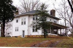 | Alpine Institute | district | 2002 | 02001339 |
 | American Legion Bohannon Post #4 | building | 2012 | 12000489 |
| Officer Farmstead | district | 2001 | 01000469 | |
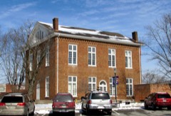 | Overton County Courthouse | building | 1980 | 80003852 |
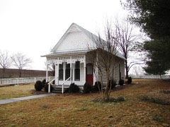 | Gov. Albert H. Roberts Law Office | building | 1975 | 75001773 |
 | Standing Stone Rustic Park Historic District | district | 1986 | 86002794 |
Every wildfire the federal occurrence database records inside this county: 165 of them, burning about 8,248 acres. None started naturally and 71 were recorded as arson. Each settlement page carries the fires within five miles of it.
| Reported cause | Fires |
|---|---|
| Arson/incendiarism | 71 |
| Debris and open burning | 64 |
| Missing data/not specified/undetermined | 22 |
| Equipment and vehicle use | 3 |
| Power generation/transmission/distribution | 2 |
| Misuse of fire by a minor | 2 |
| Other causes | 1 |
The five largest, by the area the report gives. Five of them were set deliberately.
| Date | Cause | Size | Reported by | Name on the report |
|---|---|---|---|---|
| 22 December 2001 | Arson/incendiarism | 4,646 acres | Tennessee Division of Forestry | not named |
| 12 November 2001 | Arson/incendiarism | 2,214 acres | Tennessee Division of Forestry | not named |
| 1 November 2011 | Arson/incendiarism | 148 acres | Tennessee Division of Forestry | OLD BAKER LN |
| 31 October 2001 | Missing data/not specified/undetermined | 100 acres | Tennessee Division of Forestry | not named |
| 7 April 2001 | Arson/incendiarism | 92 acres | Tennessee Division of Forestry | not named |
| 26 February 2005 | Debris and open burning | 85 acres | Tennessee Division of Forestry | not named |
| 18 March 2019 | Debris and open burning | 80 acres | Tennessee Division of Forestry | GOOLSBY |
| 4 April 1997 | Arson/incendiarism | 66 acres | Tennessee Division of Forestry | not named |
Every settlement page carries the fires within five miles of it - see the settlement index below.
The NOAA Storm Events Database holds 291 reports for this county, causing 5 deaths, 133 injuries and about $27,628,060 in recorded property damage. Each settlement page carries the reports that name it.
| Kind of event | Reports |
|---|---|
| Thunderstorm Wind | 170 |
| Hail | 59 |
| Flash Flood | 28 |
| Tornado | 14 |
| Lightning | 9 |
| Flood | 7 |
| Funnel Cloud | 3 |
| Heavy Rain | 1 |
The most serious of them, by death, then injury, then recorded damage. The accounts are quoted exactly as the forecast office filed them.
| When | Event | Place named | Harm | What the report says |
|---|---|---|---|---|
| April 1974 | Tornado (F3) | not stated | 3 killed, 120 hurt, $2,500,000 | no account filed |
| August 1998 | Lightning | Northeast Portion | 1 killed, 2 hurt | Lightning struck a man while working in his tobacco field in the Wirmingham community. A bolt of lightning struck him in the back of his head. The lightning bolt also knocked down 2 others nearby. |
| June 2007 | Lightning | Waterloo | 1 killed | A man was struck by lightning while attending an outdoor festival on June 23, 2007. The 47-year-old Indiana man was among a crowd watching a stage show. A bolt of lightning struck the man, knocking him unconscious. No one else was injured. He was leaning against a motorcycle when the bolt hit his right shoulder and exited out both of his feet according to Sheriff's Deputy Sgt. Durham. He was initially taken to Livingston Regionally Hospital, and then he was transferred to Cookeville Regional Hospital. He died the following day on Sunday June 24. ||The Junebug Boogie festival is held every summer on private property in the Waterloo area of Overton County. It draws motorcycle and music fans from all over the country. It features shows, games, exhibitions, and contests in the open air. The festival ran for four days from June 21 through June 24. |
| March 1997 | Tornado (F2) | Livingston | 2 hurt, $250,000 | no account filed |
| May 2021 | Tornado (EF0) | Okalona | 2 hurt, $10,000 | A brief EF-0 tornado touched down south of Livingston to the west of Bilbrey Road. Security camera video from Clydesdale Farms on Dale Gunnels Lane showed the tornado heavily damaging a barn and blowing down numerous trees. 2 people in the barn suffered minor injuries. Further to the east, more trees were blown down on Difficult Lane before the tornado lifted near Monterey Highway. |
| March 1996 | Tornado (F2) | Livingston | 1 hurt, $5,500,000 | no account filed |
| February 2025 | Tornado (EF1) | Hanging Limb | 1 hurt, $1,000,000 | This EF-1 tornado touched down near Coy Phillips Road, west of Hanging Limb in Overton County. It then tracked east-southeast into Hanging Limb where it snapped dozens of trees and caused roof damage to outbuildings along E Fork Lane. The tornado continued along E Fork Lane where it caused significant roofing damage to a residence and uprooted trees. Along Steel Tram Ridge Lane, the tornado completely ripped a porch off the front of a house and caused a camper to roll on its side. The tornado presumably lifted near the end of Indian Creek Trail east of Hanging Limb. This tornado was also responsible for one injury in Overton County. Damages are a rough estimate. |
| February 2025 | Tornado (EF1) | Waterloo | 1 hurt, $500,000 | This is a continuation of the tornado that began in Putnam County. This EF-1 tornado then uprooted and snapped trees along Duncans Chapel Road as well as caused minor roof damage and downed trees on Ben Mason Road. Further east along Tommy Dodson Highway, several trees were uprooted and two barns had roof damage, and a barn was destroyed. On Highway 111, there was damage to a gas station and retail|building and more trees damaged near Rickman. Minor roof damage to a barn and some branches found along Okalona Road east of Rickman before the tornado dissipated. This tornado was responsible for one injury in Overton County. Damages are a rough estimate. |
| October 1977 | Tornado (F0) | not stated | 1 hurt, $250,000 | no account filed |
| April 2006 | Thunderstorm Wind | Livingston | 1 hurt, $20,000 | 2 trailers and one home destroyed. Trees down. 80% of the county without power. A big tree landed on a trailer number 7 on Miller St. A man, Paul Stewart, was pinned inside the trailer by the tree. The tree was lifted to free the resident. He was taken to Livingston General Hospital to be checked out. |
| January 2000 | Thunderstorm Wind | Rickman | 1 hurt, $2,000 | Strong winds damaged a mobile home on East Speck Road, just north of Rickman. A boy suffered glass cuts to his legs. |
| July 1999 | Lightning | Livingston | 1 hurt | A farmer had his hand on a fence. Lightning struck the fence and left him unconscious. A neighbor performed CPR. He was taken to the hospital and recovered. |
| August 2010 | Flood | Timothy | $10,000,000 | Several roads across the county were closed due to flooding. A house experienced flooding on Tommy Dodson Highway. In excess of a foot of water was over roads and in houses in and near Sulpher. Six houses in this area had water up to the doors and windows with one of these houses having water to middle of its doors. A boat was also used to rescue an elderly woman from her house in this area.||Newspapers reported that 75 roads received damage, along with 20 of those roads being destroyed. In addition to this, 70 homes were damaged. Extent of damage to individual homes was unknown. Some vehicles were also damaged, including a car that was nearly submerged when water covered the roadway on State Highway 293 near Ramsey's Market. A few swift water rescues were also preformed across the county. Many bridges and electrical services were also damaged. Extent of damage to bridges and electrical services was unknown. County schools were also closed and let out early on Wednesday, August 18th, because of the flooding.||Newspapers also reproted that tree structures were destroyed, 10 with major damages, 12 with moderate damage, and 30 with minor damage. Several small wood framed structures were also washed away. Several pets were also rescued from multiple flooded homes. Spring Creek overgrew its banks and caused additional flooding problems. Many fences across the county were also destroyed.||All of this damage was the result of a little more than seven inches of rainfall that had fallen across the county. |
| July 2009 | Flash Flood | Bonsack | $4,000,000 | Flash flooding reported at several locations across the county. State Highway 42 was impassible along southern portions of the county. Oak Street in Livingston was closed due to flooding.||Newspaper reported the following information. A section of Windle Community Road was left rippled and broken away after the flash flood in that area caused a small creek to swell and flow over the road. A large travel trailer was marked by emergency management officials after flood waters carried it approximately 300 feet from a residence on the other side of East Howard Road. Masters Road had extensive damage near two culverts where flood waters washed the road away. A 25 foot section of Bilbrery Road was missing after being washed out. Sink hole developed|on Thursday, July 16th on Fair Street. Water gushed over the spillway at Livingston City Lake, and the nearby bridge on Old Highway 42 was underwater for a time. A car was submerged under flood waters off West Volunteer Drive as the road collapsed, leading to the rescue of a man and women who were in the car and had to cling to a tree until they could be pulled away from the flooded waters. Neither was seriously injured. Several homes were damaged from flooding. Extent of damage to homes unknown.||Total maximum rainfall amount reported to the National Weather Service Office in Old Hickory was 8.9 inches. |
| March 2012 | Tornado (EF2) | Waterloo | $1,000,000 | The tornado that began in southeast Jackson County and crossed into northern Putnam County continued northeastward, producing EF2 damage across southern Overton County. Several homes were damaged as the tornado crossed Highway 136 just south of Hardys Chapel Road. Curving more eastward, the tornado continued down Hardys Chapel Road where several mobile homes were destroyed and other frame homes were heavily damaging. Hundreds of trees were blown down in this area. More homes were damaged on Windle Community Road and Highway 111 before the tornado lifted north of the intersection of River Trace Road and East Howard Road, about 4 miles south-southwest of Livingston. The total path length of the tornado was 12.3 miles. |
| July 2009 | Lightning | Livingston | $500,000 | Overton County 911 Center was damaged by a direct lightning strike which caused a power surge and did major damage to the operations center. |
| July 2015 | Flash Flood | Hilham | $250,000 | Major flash flooding affected much of Overton County from the evening hours on July 2 into the morning hours on July 3. Numerous roads throughout the county were flooded, including multiple roads flooded and not passable in Rickman such as June Chapel Road, Highway 42, and Spring Creek Road. A mobile home park and an auto sales business were also flooded in Rickman on Highway 42, and another mobile home park was flooded on Highway 293. A COOP observer in Livingston measured 7.75 inches of rain over the 24 hour period ending at 300am on July 3. |
| February 2019 | Flash Flood | Rickman | $230,460 | Overton/Pickett County 911 Center reported some homes and businesses were flooded in Livingston along the Highway 111 Bypass near Celina Highway. Roads were also flooded and closed across Overton County, including Highway 111 Bypass Southbound, Highway 52, Cedar Chapel Road, Shiloh Road, Columbia Hill Road, and Cedar Springs Road. |
| June 2009 | Lightning | Livingston Arpt | $100,000 | A lightning stike directly hit an oil well off Airport Road in Livingston. It caused the entire lid to bend and fly off. |
| July 2009 | Lightning | Livingston | $100,000 | Norris Body Shop was destroyed when it was struck by lightning. |
| May 2020 | Thunderstorm Wind | Livingston | $84,800 | Numerous trees and power lines were blown down across Overton County. Trees were down blocking Greenbriar Road and Hilham Highway at Standing Stone Highway. Power lines were blown down on Carmack Street. |
| March 2025 | Thunderstorm Wind | Oakley | $50,000 | A church had a large portion of its roof blown off. Based on radar, imagery provided, as well as a news report on this event, the damage occurred with a secondary line of storms that moved through after the main line of storms. Wind speeds up to 80 mph may have caused this damage to the church though little to no damage was noted in imagery surrounding the church. Damages are a rough estimate. |
| May 2017 | Thunderstorm Wind | Waterloo | $50,000 | A NWS storm survey found a severe 17 mile long by 1 mile wide downburst caused major wind damage along the Putnam/Overton County border from southwest of Rickman southeastward to around Monterey. Damage was first reported on Cindy Lane in northern Putnam County where trees were blown down. Numerous more trees were snapped and uprooted along Ben Mason Road just north of the county line in Overton County. The roof was blown off a large warehouse at a flea market on Highway 111, and a nearby outbuilding lost many wood panels on the outside walls. Dozens of large trees were also snapped and uprooted along Spring Creek Road in Rickman, with several falling on homes and vehicles. Farther to the east, a barn lost much of its roof on Highway 84 near Lewis Lane, and numerous trees and power lines were blown down along Highway 84 south of Boswell Road. Large trees were blown down and playground equipment destroyed in Whittaker Park in Monterey, and several more trees were blown down on Clinchfield Drive and Meadow Creek Road southeast of Monterey. Wind speeds were estimated up to 85 mph. |
| July 2011 | Lightning | Big Spgs | $50,000 | A lightning strike caused an oil well near Monroe on Garrett Mill Road near Frogtown Road to explode. Witnesses say debris landed more than 200 yards away from the scence, and smoke was visible for miles. Specific information concerning total amount of damage that occurred to the oil well and associated damage repair costs were unknown. |
| June 2009 | Thunderstorm Wind | Livingston Arpt | $50,000 | Several large trees and power lines were downed in the city of Livingston. Power outages occurred across the majority of the city and lasted for several hours. One of the reasons was that a tree fell on a substation distribution line crossing North Oak Street owned by the Upper Cumberland Electric Membership Corporation. |
| June 2009 | Thunderstorm Wind | Livingston | $50,000 | Winds associated with a thunderstorm knocked down the WLIV-AM Radio Station Tower on Rock Grusher Mountain. |
| April 2006 | Lightning | Livingston | $50,000 | Lightning struck an expensive 2-story home on Fairview Lane in Livingston. |
| June 2005 | Thunderstorm Wind | South Portion | $50,000 | Law enforcement reported numerous trees were blown down across the southern part of the county starting about 9 miles southwest of Livingston at 1709 CST. EMA reported that about 7.5 miles southwest of Livingston several homes sustained damage. One mobile home was destroyed by the strong winds on West Wilmouth Rd. A regular home had a tree fall on it. A mobile home was moved from its foundation by the strong winds in the same area. |
| June 1998 | Hail | Livingston | $50,000 | SKYWARN Spotter reported baseball size hail that damaged the windshield to his car and truck. Newspaper article reported other damages to cars and homes in the area. |
| June 1998 | Thunderstorm Wind | Livingston | $50,000 | EMA Director reported widespread structural damage with numerous roofs blown off buildings. Roads were blocked by trees and downed power lines. About 15 to 20 homes were affected by the storm. |
| June 1998 | Hail | Allons | $50,000 | SKYWARN Spotter reported soft ball size hail which dmaged his truck and nearby structures. |
| February 2009 | Thunderstorm Wind | Livingston | $40,000 | Numerous trees and power lines were downed. In the Allons area, a storage building was picked up and blown into a neighboring field. |
| June 2009 | Thunderstorm Wind | Rickman | $35,000 | Trees were blown down causing power outages in Algood. |
| February 2025 | Thunderstorm Wind | Waterloo | $25,000 | Inflow winds from a tornadic thunderstorm caused minor roofing damage to a home near Ben Mason Road and Duncans Chapel Road in Overton County. Damages are a rough estimate. |
| February 2025 | Thunderstorm Wind | Bonsack | $25,000 | Severe winds from a tornadic thunderstorm caused minor roof damage to a home on East Fork Lane near Hanging Limb. Damages are a rough estimate. |
| June 2010 | Thunderstorm Wind | Oak Grove | $25,000 | Trees were blown down along Jamestown Highway and across several other areas of Eastern Overton County. |
| April 1974 | Tornado (F1) | not stated | $25,000 | no account filed |
| November 1973 | Tornado (F1) | not stated | $25,000 | no account filed |
| March 1956 | Tornado (F2) | not stated | $25,000 | no account filed |
| June 2005 | Thunderstorm Wind | Rickman | $20,000 | Roof damage to a home was reported by trained spotter. There were many homes that had trees fall on and through roofs in the Rickman area according to a newspaper article. A mobile home was completely destroyed on West Wilmouth Road, about 1.5 miles WNW of Rickman. A tree fell on a home in the southwest part of Overton County on Forrest Hill Rd. In addition, Poston Whitaker Road was completely blocked by fallen trees, in southwest Overton County. |
| November 2000 | Thunderstorm Wind | Livingston | $20,000 | EMA and SKYWARN Spotters reported trees down and some roofs blown off. Also some signs were damaged. |
| August 1999 | Flash Flood | Livingston | $20,000 | Sheriff's office reported 2 cars flooded in Livingston. |
| March 1996 | Hail | Livingston | $20,000 | no account filed |
| July 2022 | Thunderstorm Wind | Livingston | $15,000 | Numerous trees and some power poles were blown down across Overton County. |
| December 2021 | Tornado (EF0) | Unity | $15,000 | An EF0 tornado touched down west of Independence Road northeast of Allons and moved east across Mullins Lane and Stover Road blowing down trees and damaging the roofs of several barns. The tornado took a slight northeast turn across the intersection of Willow Grove Highway and Cherokee Lane where it blew the metal roof off of one home and damaged several outbuildings and barns. Numerous trees were downed in this area as well. Tree damage continued to the east before the tornado lifted west of Jaybird Lane. This tornado is the first December tornado on record for Overton|County. |
| December 2021 | Thunderstorm Wind | Livingston Arpt | $15,000 | Trees and power lines were blown down in and around Livingston and Rickman. |
| June 2019 | Thunderstorm Wind | Livingston | $15,000 | Trees and power lines were blown down across Overton County, including on 4916 Willow Grove Highway, 2179 Standing Stone Highway, 3812 West Paron Road, Rickman Road at Young Road, Lee Dillon Road, Spruce Street, East Fork Lane at Water Tank Road, and Raymond Road. A tree fell on the emergency manager's home at 104 River Trace Drive. |
| December 2016 | Thunderstorm Wind | Holly Spgs | $15,000 | Trees were blown down and blocking the road on Hillham Highway near Flat Creek Bridge. There was also roof damage in the same area due to trees down. |
| February 2025 | Thunderstorm Wind | Waterloo | $10,000 | Inflow from a tornadic thunderstorm caused trees to uproot and snap along Ben Mason Road. Damages are a rough estimate. |
| September 2025 | Thunderstorm Wind | Oakley | $10,000 | Severe thunderstorm winds downed trees and powerlines onto a home near Livingston. Damages are a rough estimate. |
| May 2024 | Thunderstorm Wind | Ozone | $10,000 | Severe thunderstorm winds downed numerous trees along Heard Ridge Road near Fairview. Damages are a rough estimate. |
| July 2024 | Thunderstorm Wind | Hanging Limb | $10,000 | Severe thunderstorm winds uprooted twelve trees in the yard of a home in Hanging Lamb northeast of Monterey. Damages are a rough estimate. |
| May 2024 | Thunderstorm Wind | Livingston Arpt | $10,000 | Severe thunderstorm winds downed multiple trees in the Livingston area. Damages are a rough estimate. |
| August 2020 | Flash Flood | Okalona | $10,000 | One home was flooded and almost completely underwater along the river by Rickman Road and Southwood Road. |
| June 2019 | Thunderstorm Wind | Hilham | $10,000 | An intense 2 mile long by 3/4 mile wide microburst blew down dozens of trees from Old Union Road at Boles Road to Standing Stone Highway at Campground Road. |
| July 2018 | Thunderstorm Wind | Livingston Arpt | $10,000 | Numerous trees were blown down in Livingston including on Preston Street, West Main Street, Monterey Highway, 1972 Villa Drive, and 900 North Church Street. Power lines were also blown down at 605 High Street. |
| May 2018 | Thunderstorm Wind | Rickman | $10,000 | Large tree limbs were blown down blocking Melton Road with windows reportedly blown out of a home at 205 Melton Road. A tree and power lines were also blown down on Thompson Place Lane at Paron Road just west of Highway 111 with the roadway blocked, with other trees blown down on West Netherland Road. |
| May 2017 | Thunderstorm Wind | Livingston | $10,000 | Numerous trees were blown down across Overton County. The worst damage was in the Spring Creek Road area near the Putnam County line, where some homes and vehicles suffered minor damage due to fallen trees. |
| July 2016 | Thunderstorm Wind | Livingston | $10,000 | Overton County EMA director reported numerous trees down across Overton County and personally watched 2 trees get blown down from the 911 center. Power pole fires also reported due to downed power lines. |
| February 2014 | Thunderstorm Wind | Poplar Spgs | $10,000 | Trees were blown down in the Allons, Hilham, and Timothy communities, including across Allens Chapel Road in Hilham. |
The Survey's mineral resources record lists 16 workings inside this county. 7 still produce and 9 are closed or unrecorded. Each settlement page carries the workings within five miles of it.
| Commodity | Workings |
|---|---|
| Stone, Crushed/Broken | 5 |
| Strontium | 3 |
| Stone, Crushed/Broken, Limestone, General | 2 |
| Clay | 2 |
| Limestone, General | 1 |
| Uranium, Oil Shale | 1 |
| Zinc | 1 |
| Uranium | 1 |
| Oil Shale | 1 |
The least common of them first, because a county's hundredth gravel pit says nothing its first ten did not.
| Where | Site | Commodity | Status | Recorded |
|---|---|---|---|---|
| Allred | Zinc | Occurrence | ||
| Outcrop Sample For Uranium | Uranium, Oil Shale | Occurrence | ||
| Outcrop Sample For Uranium | Uranium, Oil Shale | Occurrence | ||
| South Quarry | Limestone, General | Past Producer | Sedimentary | |
| Livingston Limestone Co. East Quarry | Stone, Crushed/Broken, Limestone, General | Producer | Limestone | |
| Overton County Hwy, Dept. Quarry | Stone, Crushed/Broken, Limestone, General | Producer | 1967 | |
| Stites Number 1 Pit | Clay | Past Producer | Sedimentary | |
| Stites Number 1 Pit | Clay | Producer | ||
| Alloms Sand Pit | Strontium | Past Producer | ||
| Gullet Mountain Prospect | Strontium | Prospect | ||
| Pilot Knob Prospect | Strontium | Prospect | ||
| Livingston Limestone Co East Quarry | Stone, Crushed/Broken | Producer | ||
| Overton County Highway Dept. Quarry | Stone, Crushed/Broken | Producer | ||
| Sand Plant and Mine | Stone, Crushed/Broken | Producer | ||
| South Quarry | Stone, Crushed/Broken | Past Producer | ||
| Stites No. 1 Pit | Stone, Crushed/Broken | Producer | Sedimentary |
Named settlements recorded in the Geographic Names Information System, each with the topographic sheets covering it. Villages, hamlets and abandoned places alike. Each is shown with the nearest named watercourse or landform and the survey quadrangle it falls on.
District 3 · 38580 · Near Kitty Ray Mountain · Monterey quadrangle
19 sheets, 1897 to 1982
District 2 · 38573 · On Little Eagle Creek · Livingston quadrangle
20 sheets, 1897 to 1982
District 3 · 38554 · Near Green Pond Mountain · Obey City quadrangle
17 sheets, 1897 to 1982
District 3 · 38574 · Near France Mountain · Monterey quadrangle
19 sheets, 1897 to 1982
No longer a settlement
District 3 · 38574 · Near Flower Mountain · Obey City quadrangle
17 sheets, 1897 to 1982
District 5 · 38568 · On Cleek Branch · Windle quadrangle
16 sheets, 1897 to 1982
No longer a settlement
District 3 · 38570 · Near Hog Wallow Ridge · Okalona quadrangle
17 sheets, 1897 to 1982
No longer a settlement
District 2 · 38573 · On Marr Branch · Alpine quadrangle
17 sheets, 1897 to 1982
No longer a settlement
District 2 · 38570 · Near Cooper Mountain · Hilham quadrangle
16 sheets, 1897 to 1982
No longer a settlement
District 3 · 38554 · Near Norrod Mountain · Obey City quadrangle
17 sheets, 1897 to 1982
District 5 · 38570 · Near Collins Cove · Okalona quadrangle
17 sheets, 1897 to 1982
No longer a settlement
District 2 · 38570 · Near Linder Mountain · Livingston quadrangle
20 sheets, 1897 to 1982
District 5 · 38570 · On Town Creek · Okalona quadrangle
17 sheets, 1897 to 1982
No longer a settlement
District 1 · 38570 · Near Schoolhouse Mountain · Livingston quadrangle
20 sheets, 1897 to 1982
District 3 · 38574 · On Yellow Branch · Obey City quadrangle
17 sheets, 1897 to 1982
District 4 · 38506 · On Mill Hardy Branch · Windle quadrangle
16 sheets, 1897 to 1982
No longer a settlement
District 4 · 38506 · On Boles Branch · Cookeville East quadrangle
21 sheets, 1897 to 1982
No longer a settlement
District 3 · 38543 · On Nettlecarrier Creek · Alpine quadrangle
17 sheets, 1897 to 1982
No longer a settlement
District 3 · 38570 · On Oak Grove Mountain · Livingston quadrangle
20 sheets, 1897 to 1982
District 2 · 38573 · Near Heard Ridge · Dale Hollow Reservoir SE quadrangle
13 sheets, 1924 to 1985
District 3 · 38554 · Near Cub Mountain · Crawford quadrangle
17 sheets, 1897 to 1982
No longer a settlement
District 3 · 38543 · On Medlock Branch · Crawford quadrangle
17 sheets, 1897 to 1982
No longer a settlement
District 3 · 38554 · Near Center Hollow · Crawford quadrangle
17 sheets, 1897 to 1982
No longer a settlement
District 2 · 38573 · Near Mohawk Ridge · Dale Hollow Reservoir SE quadrangle
13 sheets, 1924 to 1985
District 2 · 38541 · Near Pond Ridge · Livingston quadrangle
20 sheets, 1897 to 1982
No longer a settlement
District 3 · 38543 · On Poor Branch · Alpine quadrangle
17 sheets, 1897 to 1982
No longer a settlement
The vanished settlements of Overton County: the places named above that are no longer on the map.