 Block
Westwood, Tennessee
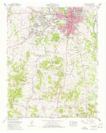
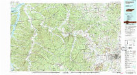
20 topographic sheets cover this place, the earliest surveyed in 1901 and the latest in 1986. It stands in District 4. It lies in ZIP code area 38401. The Survey maps it on the Columbia quadrangle.
Topographic sheets covering this place
7 surveys from 20 printed sheetsMatched by testing this settlement's coordinate against the published boundary of every sheet in the United States Geological Survey's historical collection. Each opens the scanned sheet at the Survey.
- 1901 USGS Colombia quadrangle1:125000, 2 printings
- 1901 USGS Columbia quadrangle1:125000
- 1936 USGS Columbia quadrangle1:24000, 2 printings
- 1949 USGS Columbia quadrangle1:24000, 2 printings
- 1956 USGS Columbia quadrangle1:250000, 6 printings
- 1965 USGS Columbia quadrangle1:24000, 4 printings
- 1986 USGS Hohenwald quadrangle1:100000, 3 printings

Fires near this place
16 since 1999Regional context, not property-specific evidence. The federal wildfire occurrence database lists 16 fires within 5 miles of Westwood between 1999 and 2016, burning about 47 acres in total. None started naturally. 5 were recorded as arson. Distance is straight-line from the map coordinates, so a fire counted here may appear on a neighbouring settlement's page as well.
| Reported cause | Fires |
|---|---|
| Arson/incendiarism | 5 |
| Debris and open burning | 5 |
| Misuse of fire by a minor | 3 |
| Fireworks | 1 |
| Equipment and vehicle use | 1 |
| Missing data/not specified/undetermined | 1 |
The most recent of them, most recent first, with the day each was reported and the service that recorded it.
| Date | Cause | Size | Reported by | Name on the report |
|---|---|---|---|---|
| 15 September 1999 | Arson/incendiarism | under an acre | Tennessee Division of Forestry | not named |
| 15 September 1999 | Arson/incendiarism | under an acre | Tennessee Division of Forestry | not named |
| 30 June 2010 | Misuse of fire by a minor | under an acre | Tennessee Division of Forestry | CEMETARY AVE |
| 23 May 2007 | Equipment and vehicle use | under an acre | Tennessee Division of Forestry | MCKINLEY JOYCE RD |
| 29 April 2001 | Debris and open burning | under an acre | Tennessee Division of Forestry | not named |
| 8 March 2001 | Debris and open burning | 1.0 acres | Tennessee Division of Forestry | not named |
| 7 March 2002 | Arson/incendiarism | under an acre | Tennessee Division of Forestry | not named |
| 6 March 2010 | Debris and open burning | under an acre | Tennessee Division of Forestry | STEVE DRIVE |
Settlements close enough to share some of these fires:
Mines and quarries near this place
10 of 55 shownRegional context, not property-specific evidence. The federal mineral resources record lists 55 workings within 5 miles of Westwood: 34 past producers, 14 unknowns, 4 producers, 2 prospects. 5 still produce. What was taken out: Phosphorus-Phosphates, Stone, Crushed/Broken, Iron, Iron, Phosphorus-Phosphates. Distance is straight-line from the map coordinates, so a quarry counted here may appear on a neighbouring settlement's page as well.
| Where | Site | Commodity | Status | Recorded |
|---|---|---|---|---|
| Blue Springs Rock, Inc. | Stone, Crushed/Broken | Producer | 1976 | |
| Hooker Chemical 507 | Iron, Phosphorus-Phosphates | Past Producer | ||
| Monsanto - Columbia Plant | Phosphorus-Phosphates, Iron | Past Producer | ||
| Union Carbide/ Columbia, Tn. | Graphite | Plant | ||
| Xps 17m Pit | Aluminum | Past Producer | ||
| Church Mine Ps-17 | Phosphorus-Phosphates | Past Producer | ||
| Church Mine Ps-17 | Phosphorus-Phosphates | Past Producer | ||
| Church Ps-17 | Phosphorus-Phosphates | Producer | 1964 | |
| Cliff Harris | Phosphorus-Phosphates | Past Producer | 1856, 1974 | |
| Godwin Washer | Phosphorus-Phosphates | Past Producer |
Storms near this place
20 since 2009Regional context, not property-specific evidence. The National Weather Service names Westwood in 20 storm reports between 2009 and 2025: 12 thunderstorm wind, 4 hail, 3 flash flood, 1 tornado. The reports record 2 injuries. Each account below is quoted exactly as the forecast office filed it, from the NOAA Storm Events Database, and each date opens the federal record of that event.
| When | Event | Place named | Harm | What the report says |
|---|---|---|---|---|
| July 2023 | Thunderstorm Wind | Westwood | 2 hurt, $15,000 | Severe thunderstorm winds downed trees along Campbellsville Pike in Columbia. One of these trees fell on a truck, causing minor injuries to two people inside the truck. Damages are a rough estimate. |
| March 2025 | Tornado (EF1) | Westwood | $50,000 | An EF-1 tornado touched down near Trotwood Avenue and Old Sunny Lane south of Columbia in Maury County. Here the tornado caused timber damage by uprooting trees. The tornado continued east-southeast across a residential area in Sunnyside where mainly minor timber damage was observed. The tornado continued east-southeast, causing additional minor timber damage as it crossed Campbellsville Pike before dissipating shortly after crossing U.S. Highway 31. Damages are a rough estimate. |
| May 2011 | Thunderstorm Wind | Westwood | $25,000 | Multiple trees were uprooted with two houses having trees on them near Hidden Lake Circle. Specific details concerning any damage to the two houses along with any associated damage cost were unknown. |
| June 2018 | Thunderstorm Wind | Westwood | $15,000 | Numerous trees and power lines were blown down on the south side of Columbia with some trees falling on houses. |
| March 2016 | Thunderstorm Wind | Westwood | $10,000 | Maury County emergency management reported 15 to 20 trees were blown down on the south side of Columbia, including on Hidden Lake Circle. |
| April 2011 | Thunderstorm Wind | Westwood | $10,000 | Part of the roof was removed from Woodard Elementary School near Columbia. |
| April 2009 | Flash Flood | Westwood | $10,000 | Four inches of water was reported on roads around Legion Park in Columbia. A newspaper report stated that the storm also flooded at least two campers and blew over several tents at the park. |
| June 2013 | Thunderstorm Wind | Westwood | $5,000 | A tree was blown down on a house on Sheffield Drive causing minor damage to the home. Report via tspotter on Twitter. |
| April 2009 | Flash Flood | Westwood | $5,000 | Maury County Park was flooded. |
| October 2014 | Thunderstorm Wind | Westwood | $3,000 | Several large trees were blown down in the Glenstone subdivision on Campbellsville Pike south of Columbia. |
| November 2017 | Thunderstorm Wind | Westwood | $2,000 | A tree and a power line were blown down blocking both lanes of Campbellsville Pike in Columbia. |
| July 2023 | Thunderstorm Wind | Westwood | $1,000 | Severe thunderstorm winds downed a large tree near University Drive and Auburn Lane in Columbia. Damages are a rough estimate. |
| May 2021 | Thunderstorm Wind | Westwood | $1,000 | A report indicated a large tree was snapped. |
| March 2020 | Thunderstorm Wind | Westwood | $1,000 | A signal light was blown down at the intersection of Hampshire Pike and Lion Parkway. |
| March 2017 | Thunderstorm Wind | Westwood | $1,000 | A tSpotter Twitter report indicated a tree was blown down across from Whitthorne Middle School. |
| March 2025 | Flash Flood | Westwood | - | Heavy rain caused flooding in several spots along Highway 43 between Columbia and Mt. Pleasant. Extent of damages are unknown. |
| May 2025 | Hail | Westwood | - | Ping pong size hail was reported from a tornado-warned thunderstorm at S James Campbell Boulevard and Brooksmeade in Columbia. |
| June 2018 | Hail | Westwood | - | Videos from Maury County Emergency Management and Twitter showed quarter size hail fell along Old Sunnyside Lane in southwest Columbia. |
| March 2017 | Hail | Westwood | - | Maury County 911 Center reported quarter size hail and strong winds in southwest Columbia. |
| March 2016 | Hail | Westwood | - | Golfball size hail was reported on the west side of Columbia. |
Nearest settlements
The eight closest, with where each one stands in the county. Distances are straight-line, computed from the Geographic Names Information System coordinates.
| Map | Place | Distance | Sheets |
|---|---|---|---|
| Pleasant Hills | 0.7 miles | 20 | |
| Field Crest | 0.7 miles | 20 | |
| Graymere Manor | 0.7 miles | 20 | |
| West Haven | 1.1 miles | 20 | |
| Columbia Gardens | 1.6 miles | 20 | |
| West Meade | 1.7 miles | 20 | |
| Sunnyside | 1.9 miles | 20 | |
| Rolling Fields | 1.9 miles | 20 |
Provenance
This settlement is recorded in the Geographic Names Information System as feature 1274260. The sheet list is computed by point-in-boundary test against the United States Geological Survey's historical topographic inventory. Both are works of the United States government and carry no copyright under 17 U.S.C. 105.
Wildfire. Short, Karen C. 2022. Spatial wildfire occurrence data for the United States, 1992-2020 [FPA_FOD_20221014]. 6th Edition. Fort Collins, CO: Forest Service Research Data Archive. https://doi.org/10.2737/RDS-2013-0009.6 Collected with United States Government funding and usable without additional permissions or fees.
Mines and quarries. USGS Mineral Resources Data System (MRDS) https://mrdata.usgs.gov/mrds/ A work of the United States government, no copyright under 17 U.S.C. 105.
Storms. NOAA National Centers for Environmental Information, Storm Events Database https://www.ncei.noaa.gov/stormevents/ A work of the United States government, no copyright under 17 U.S.C. 105. Narratives are quoted verbatim from the National Weather Service report and are not edited or summarised.