 Block
From the record
One of 22 National Register listings published here for Marshall County · listed in 2001 · category: Site.
Sources: the National Register database, National Park Service
Listed on the National Register of Historic Places in 2001.
One of 22 National Register listings published here for Marshall County · listed in 2001 · category: Site.
Sources: the National Register database, National Park Service
Regional context, not property-specific evidence. The federal wildfire occurrence database lists 55 fires within 5 miles of Confederate Cemetery Monument between 1997 and 2019, burning about 145 acres in total. None started naturally. 11 were recorded as arson. Distance is straight-line from the map coordinates, so a fire counted here may appear on a neighbouring settlement's page as well.
| Reported cause | Fires |
|---|---|
| Debris and open burning | 26 |
| Arson/incendiarism | 11 |
| Missing data/not specified/undetermined | 7 |
| Equipment and vehicle use | 6 |
| Smoking | 4 |
| Railroad operations and maintenance | 1 |
The most recent of them, most recent first, with the day each was reported and the service that recorded it.
| Date | Cause | Size | Reported by | Name on the report |
|---|---|---|---|---|
| 6 September 2000 | Debris and open burning | under an acre | Tennessee Division of Forestry | not named |
| 5 September 1999 | Debris and open burning | 15 acres | Tennessee Division of Forestry | not named |
| 5 September 1998 | Debris and open burning | 1.0 acres | Tennessee Division of Forestry | not named |
| 28 September 1999 | Debris and open burning | under an acre | Tennessee Division of Forestry | not named |
| 23 September 2019 | Missing data/not specified/undetermined | 1.5 acres | Tennessee Division of Forestry | BOB CHEEK FIRE |
| 18 September 2000 | Arson/incendiarism | under an acre | Tennessee Division of Forestry | not named |
| 17 September 1998 | Equipment and vehicle use | 1.0 acres | Tennessee Division of Forestry | not named |
| 15 September 1999 | Arson/incendiarism | 1.0 acres | Tennessee Division of Forestry | not named |
Regional context, not property-specific evidence. The federal mineral resources record lists 2 workings within 5 miles of Confederate Cemetery Monument: 1 producer, 1 past producer. 1 still produces. What was taken out: Stone, Crushed/Broken, Limestone, High Calcium. Distance is straight-line from the map coordinates, so a quarry counted here may appear on a neighbouring settlement's page as well.
| Where | Site | Commodity | Status | Recorded |
|---|---|---|---|---|
| Belfast Rock Products Quarry | Stone, Crushed/Broken, Limestone, High Calcium | Producer | Limestone | |
| Belfast Rock Products Quarry | Stone, Crushed/Broken | Past Producer |
Regional context, not property-specific evidence. The National Weather Service names Farmington, the town this property stands in, in 4 storm reports between 2002 and 2016: 2 thunderstorm wind, 1 flash flood, 1 hail. The reports record 9 injuries. Each account below is quoted exactly as the forecast office filed it, from the NOAA Storm Events Database, and each date opens the federal record of that event.
| When | Event | Place named | Harm | What the report says |
|---|---|---|---|---|
| January 2002 | Flash Flood | Farmington | 9 hurt | Sheriff reported back roads still closed. 14 homes, 27 trailers, and 3 businesses were damaged. 88 people had to be evacuated. |
| August 2011 | Thunderstorm Wind | Farmington | $5,000 | Trees and power lines were blown down on Highway 31A between Henry Horton State Park and Lewisburg. |
| July 2016 | Thunderstorm Wind | Farmington | $3,000 | A tSpotter Twitter report indicated several trees were blown down in Farmington and a carport was blown a considerable distance into some trees. |
| July 2016 | Hail | Farmington | - | A tSpotter Twitter report indicated quarter size hail fell in Farmington. |
No historic map-sheet match is published for this property yet. That does not mean no map exists. This record needs a coordinate-quality review before it can be joined to a sheet boundary. Browse the county's mapped places while that work is pending.
Other National Register properties close enough to walk or drive between, ordered by distance from this one. Both positions come from the same geocoding pass that matched these properties to their map sheets.
| Photograph | Property | Distance | Listed |
|---|---|---|---|
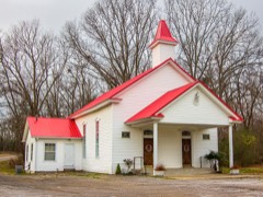 | Verona Methodist Episcopal Church, South | 4.7 miles | 1985 |
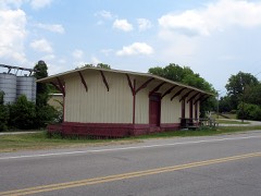 | Belfast Railroad Depot | 5.4 miles | 1984 |
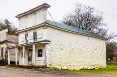 | J. C. Tate General Merchandise Store | 5.4 miles | 1978 |
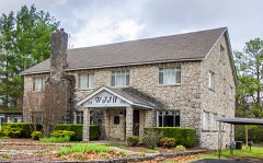 | WJJM Radio Station and Tower | 5.8 miles | 2017 |
 | Ewing Farm | 5.9 miles | 1984 |
 | Joe Chase Adams House | 5.9 miles | 1993 |
| National Archives record | The nomination case file for reference 01000731 in Record Group 79. |
| Marshall County | All 22 listed properties in this county. |