 Block
From the record
One of 29 National Register listings published here for Robertson County · listed in 2003 · category: Site.
Sources: the National Register database, National Park Service
Listed on the National Register of Historic Places in 2003.
One of 29 National Register listings published here for Robertson County · listed in 2003 · category: Site.
Sources: the National Register database, National Park Service
Regional context, not property-specific evidence. The federal wildfire occurrence database lists 4 fires within 5 miles of Red River Blockhouse Number 1 between 1998 and 2007, burning about 18 acres in total. None started naturally. None was recorded as arson. Distance is straight-line from the map coordinates, so a fire counted here may appear on a neighbouring settlement's page as well.
| Reported cause | Fires |
|---|---|
| Smoking | 1 |
| Missing data/not specified/undetermined | 1 |
| Debris and open burning | 1 |
| Equipment and vehicle use | 1 |
The most recent of them, most recent first, with the day each was reported and the service that recorded it.
| Date | Cause | Size | Reported by | Name on the report |
|---|---|---|---|---|
| 7 September 1998 | Missing data/not specified/undetermined | 2.0 acres | Tennessee Division of Forestry | not named |
| 15 September 1999 | Equipment and vehicle use | 15 acres | Tennessee Division of Forestry | not named |
| 24 August 2007 | Smoking | 1.0 acres | Tennessee Division of Forestry | ADAMS #1 |
| 7 April 2000 | Debris and open burning | under an acre | Tennessee Division of Forestry | not named |
Regional context, not property-specific evidence. The National Weather Service names Adams, the town this property stands in, in 32 storm reports between 1994 and 2025: 20 thunderstorm wind, 5 hail, 5 tornado, 2 flash flood. No death or injury is recorded in these reports. Each account below is quoted exactly as the forecast office filed it, from the NOAA Storm Events Database, and each date opens the federal record of that event.
| When | Event | Place named | Harm | What the report says |
|---|---|---|---|---|
| April 1998 | Tornado (F3) | Adams | $400,000 | Part of a roof was blown off the Jo Byrns School in Adams. Many trees fell on homes. |
| February 2018 | Tornado (EF1) | Adams | $50,000 | An EF-1 tornado touched down east of Adams near Johnson Springs Road and moved northeast. Corn from a farm on the east side of Johnson Springs Road was blown over a quarter of a mile to the northeast. One home suffered minor roof damage on Sturgeon Creek Road and dozens of trees were snapped or uprooted along both Sturgeon Creek Road and Barnes Road. Several barns and outbuildings were damaged or destroyed and more trees were blown down along a bend of Buzzard Creek Road before the tornado lifted west of the Fizer Road and Buzzard Creek Road intersection. The path of this tornado was adjusted and extended slightly in June 2020 based on newly available high resolution Google Earth satellite imagery. |
| February 2018 | Tornado (EF1) | Adams | $50,000 | An EF-1 tornado began less than one mile south of the Kentucky/Tennessee state line between Hugh Gill Road and Keysburg Road, then moved northeast snapping and uprooting numerous trees between the two roadways. The tornado then destroyed the roof of a barn on Hugh Gill Road before hitting a home on McGhee Road, causing significant roof and chimney damage. Maximum winds in Tennessee were estimated to be 95 mph. The tornado then moved into Kentucky where it intensified to EF-2 and traveled for another 11.3 miles. Please refer to NWS Louisville and Kentucky Storm Data for more information on the Kentucky portion of the path. The Tennessee portion of the path was updated and extended southwestward in June 2020 based on newly available high resolution Google Earth satellite imagery. |
| January 1999 | Tornado (F1) | Adams | $50,000 | F1 tornado at 4751 Jones Chapel Rd. Lost shingles on roof of his home. The tobacco barn was destroyed. The greenhouse was damaged. A few trees were uprooted. |
| May 2009 | Thunderstorm Wind | Adams | $25,000 | Several trees were reported blown down across roads in Adams. |
| May 2012 | Thunderstorm Wind | Adams | $10,000 | Multiple trees were downed at the intersection of Glenn Raven Road and Turnersville Road. |
| July 2010 | Thunderstorm Wind | Adams | $10,000 | Several trees were blown down in Adams. |
| July 2011 | Thunderstorm Wind | Adams | $5,000 | A few trees were downed on State Highway 76 west of Adams. |
| July 2016 | Thunderstorm Wind | Adams | $3,000 | A tree was blown down in Adams, another tree was blown down on Carter Road in Cedar Hill, and another tree was blown down in Orlinda. |
| December 2013 | Thunderstorm Wind | Adams | $3,000 | Power lines were blown down in Cedar Hill and Adams with power outages. |
| May 2018 | Thunderstorm Wind | Adams | $1,000 | Tree down at the intersection of Highway 41 and Johnson Spring Road. |
| February 2011 | Flash Flood | Adams | $1,000 | Robertson County Sherrifs office reported U.S. Highway 41 flooded near the town of Adams. |
| May 1994 | Thunderstorm Wind | Adams | $500 | Several trees were blown down. |
| April 2007 | Thunderstorm Wind | Adams | $200 | Large tree limbs were broken off a maple tree on Bryant Rd. |
| May 2025 | Thunderstorm Wind | Adams | - | Severe thunderstorm winds coming through Adams caused power outages to 643 customers. |
| May 2024 | Hail | Adams | - | Ping pong size hail was reported in Adams. |
| July 2014 | Thunderstorm Wind | Adams | - | Three trees were reported down in the yard of a home in the town of Adams. Report via Facebook. |
| May 2005 | Hail | Adams | - | Penny size hail reported. |
| November 2005 | Thunderstorm Wind | Adams | - | Trees were blown down. |
| July 2004 | Thunderstorm Wind | Adams | - | Sheriffs office reported trees down on Minnis Road near Adams. |
| July 2003 | Thunderstorm Wind | Adams | - | Sheriff's office reported trees down. |
| July 2003 | Thunderstorm Wind | Adams | - | EMA reported trees were down. |
| November 2002 | Tornado (F0) | Adams | - | Trees were twisted off and insulation debris from the mobile homes in Port Royal were found in this location. |
| July 2002 | Thunderstorm Wind | Adams | - | TDOT reported trees were down. |
| June 1999 | Thunderstorm Wind | Adams | - | Trees and power lines were down. |
| July 1997 | Thunderstorm Wind | Adams | - | A few trees were blown down. |
| June 1997 | Thunderstorm Wind | Adams | - | Several trees were blown down. |
| March 1997 | Flash Flood | Adams | - | Mint Spring Road was closed near Elk Creek in Adams. |
| April 2012 | Hail | Adams | - | no account filed |
| April 2012 | Hail | Adams | - | no account filed |
| May 1996 | Thunderstorm Wind | Adams | - | no account filed |
| March 1996 | Hail | Adams | - | no account filed |
No historic map-sheet match is published for this property yet. That does not mean no map exists. This record needs a coordinate-quality review before it can be joined to a sheet boundary. Browse the county's mapped places while that work is pending.
Other National Register properties close enough to walk or drive between, ordered by distance from this one. Both positions come from the same geocoding pass that matched these properties to their map sheets.
| Photograph | Property | Distance | Listed |
|---|---|---|---|
 | Bell Witch Cave | 1.5 miles | 2008 |
 | Glen Raven | 4.1 miles | 1973 |
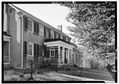 | Wessyngton | 7.5 miles | 1971 |
| National Archives record | The nomination case file for reference 03001157 in Record Group 79. |
| Robertson County | All 29 listed properties in this county. |