 Block
From the record
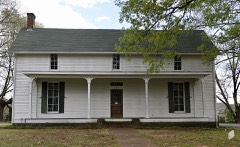
One of 216 National Register listings published here for Shelby County · listed in 2017 · category: Building · built in 1841, Greek Revival architecture.
Sources: the National Register database, National Park Service
Built in 1841 (Greek Revival architecture). Listed on the National Register of Historic Places in 2017.
One of 216 National Register listings published here for Shelby County · listed in 2017 · category: Building · built in 1841, Greek Revival architecture.
Sources: the National Register database, National Park Service
Regional context, not property-specific evidence. The federal wildfire occurrence database lists 5 fires within 5 miles of Davis Charles House between 1995 and 2014, burning about 71 acres in total. None started naturally. 1 was recorded as arson. Distance is straight-line from the map coordinates, so a fire counted here may appear on a neighbouring settlement's page as well.
| Reported cause | Fires |
|---|---|
| Debris and open burning | 3 |
| Arson/incendiarism | 1 |
| Recreation and ceremony | 1 |
The most recent of them, most recent first, with the day each was reported and the service that recorded it.
| Date | Cause | Size | Reported by | Name on the report |
|---|---|---|---|---|
| 14 September 1999 | Debris and open burning | 2.0 acres | Tennessee Division of Forestry | not named |
| 10 September 2014 | Recreation and ceremony | 15 acres | Mississippi Forestry Commission | 09320140910004 |
| 25 February 1995 | Arson/incendiarism | 30 acres | Mississippi Forestry Commission | not named |
| 26 December 1995 | Debris and open burning | 20 acres | Mississippi Forestry Commission | not named |
| 18 November 1999 | Debris and open burning | 4.0 acres | Tennessee Division of Forestry | not named |
Regional context, not property-specific evidence. The federal mineral resources record lists 15 workings within 5 miles of Davis Charles House: 10 producers, 5 past producers. 10 still produce. What was taken out: Sand and Gravel, Construction. Distance is straight-line from the map coordinates, so a quarry counted here may appear on a neighbouring settlement's page as well.
| Where | Site | Commodity | Status | Recorded |
|---|---|---|---|---|
| #1 Ballard Pit | Sand and Gravel, Construction | Producer | Unconsolidated Sediments | |
| #3 Mensi Pit | Sand and Gravel, Construction | Producer | Unconsolidated Sediments | |
| Collierville Pit | Sand and Gravel, Construction | Producer | Unconsolidated Sediments | |
| Collierville Pit | Sand and Gravel, Construction | Producer | ||
| Crops Syndicate Pit | Sand and Gravel, Construction | Producer | Unconsolidated Sediments | |
| Crops Syndicate Pit | Sand and Gravel, Construction | Past Producer | Sedimentary | |
| Crops Syndicate Pit | Sand and Gravel, Construction | Producer | ||
| Frank Road Pit | Sand and Gravel, Construction | Producer | ||
| Gallina Pit | Sand and Gravel, Construction | Producer | 1971 | |
| Gallina Pit | Sand and Gravel, Construction | Past Producer | Sedimentary |
Regional context, not property-specific evidence. The National Weather Service names Collierville, the town this property stands in, in 28 storm reports between 1993 and 2023: 14 thunderstorm wind, 11 hail, 2 flash flood, 1 lightning. The reports record 2 injuries. Each account below is quoted exactly as the forecast office filed it, from the NOAA Storm Events Database, and each date opens the federal record of that event.
| When | Event | Place named | Harm | What the report says |
|---|---|---|---|---|
| June 1994 | Thunderstorm Wind | Collierville | 2 hurt, $5,000,000 | Nearly 190 building were damaged or destroyed including several buildings that under construction. Numerous trees and power lines were knocked down. Shelby County Memphis,09,1240CST,,,0,0,1,0,Hail (1.00) |
| July 2009 | Flash Flood | Collierville | $500,000 | Heavy rain produced flash flooding in Collierville. Several roads were flooded as a result including Collierville-Arlington Road, Shelton Road, Powell Road, Rowlett Road and Center Road. Water was up to a foot deep or more in a few places. Creeks overfilled their banks as well. A couple of homes, at least one business and one church was flooded as well. A total of 55 structures received at least minor water damage. Vehicles also became stalled in the flood water. |
| March 2007 | Lightning | Collierville | $500,000 | A lightning strike caused a fire at a house on Shea Road. The fire caused substantial damage to the home. Four firefighters were treated for heat exhaustion and two other firefighters were treated for other injuries. The fire took 4 to 5 hours to put out. The lightning bolt apparently traveled across the top of the house. The house was under construction and was a few weeks from being completed. |
| November 2001 | Thunderstorm Wind | Collierville | $100,000 | Several homes and businesses were damaged. Numerous trees were knocked down. |
| July 1995 | Thunderstorm Wind | Collierville | $50,000 | A church lost its steeple and a few homes were damaged in Collierville. A roof was blown off of a mobile home in Arlington. Several trees were blown down. |
| March 2021 | Thunderstorm Wind | Collierville | $10,000 | A large tree fell and knocked down power lines near the Collierville Town Square. |
| November 2001 | Thunderstorm Wind | Collierville | $10,000 | Several homes were damaged. |
| May 1998 | Thunderstorm Wind | Collierville | $5,000 | A few trees were knocked down. |
| June 1997 | Thunderstorm Wind | Collierville | $5,000 | Several large trees were blown down. |
| August 1993 | Thunderstorm Wind | Collierville | $5,000 | Numerous trees were knocked down. |
| March 2008 | Hail | Collierville | $5,000 | no account filed |
| April 2022 | Thunderstorm Wind | Collierville | $3,000 | Large tree uprooted in Collierville, TN. |
| June 2007 | Thunderstorm Wind | Collierville | $2,000 | Straight line winds knocked a few trees down at North Byhalia Road and Wolf River Boulevard. |
| November 2007 | Hail | Collierville | $1,000 | no account filed |
| April 2007 | Hail | Collierville | $1,000 | no account filed |
| January 1996 | Hail | Collierville | $1,000 | no account filed |
| May 1997 | Hail | Collierville | $50 | no account filed |
| April 2003 | Hail | Collierville | $10 | no account filed |
| June 2020 | Thunderstorm Wind | Collierville | - | Straight-line winds damaged the roof of a gas station at the intersection of Poplar Avenue and Collierville-Arlington Road. |
| May 2013 | Hail | Collierville | - | Quarter size hail fell at the intersection of Collierville-Arlington Road and Raleigh-Lagrange Road, north of Collierville. |
| September 2012 | Thunderstorm Wind | Collierville | - | Straight line winds knocked down several trees across Collierville Arlington Road just north of Collierville. One tree landed on a vehicle. |
| April 2011 | Thunderstorm Wind | Collierville | - | Straight line winds knocked down power lines on Highway 205 South and Raleigh LaGrange Road, north of Collierville. |
| August 2011 | Hail | Collierville | - | Quarter size hail fell at the intersection of Raleigh-LaGrange Road and Collierville-Arlington Road, north of Collierville. |
| May 2011 | Hail | Collierville | - | Quarter size hail covered the ground. |
| August 2009 | Flash Flood | Collierville | - | Two inches of rain fell in 45 minutes in Collierville. Six to eight inches of water covered the intersection of Collierville-Arlington Road and Fletcher Road. The water spilled over the curbs as as result. |
| June 1998 | Thunderstorm Wind | Collierville | - | A 68 mph wind gust was reported by a remote weather site in Collerville. |
| April 2023 | Hail | Collierville | - | no account filed |
| May 2010 | Hail | Collierville | - | no account filed |
No historic map-sheet match is published for this property yet. That does not mean no map exists. This record needs a coordinate-quality review before it can be joined to a sheet boundary. Browse the county's mapped places while that work is pending.
Other National Register properties close enough to walk or drive between, ordered by distance from this one. Both positions come from the same geocoding pass that matched these properties to their map sheets.
| Photograph | Property | Distance | Listed |
|---|---|---|---|
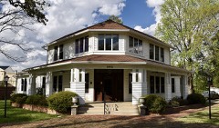 | Crisscross Lodge | 1.2 miles | 1989 |
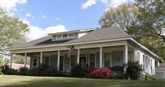 | John W. Thomas House | 2.4 miles | 1991 |
| Collierville Historic District | 2.6 miles | 1990 | |
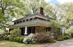 | John B. McFerrin House | 2.6 miles | 1991 |
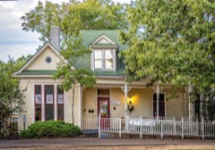 | Joseph A. Campbell House | 2.6 miles | 1991 |
 | J. W. Houston House | 2.6 miles | 1991 |
| National Archives record | The nomination case file for reference 100000980 in Record Group 79. |
| Shelby County | All 216 listed properties in this county. |