BlockBefore

Shelby County, Tennessee

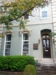
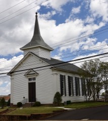
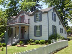
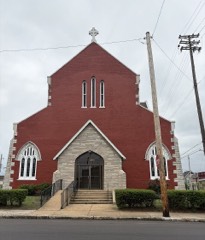
124 topographic sheets cover 113 settlements here, and 216 properties are on the National Register of Historic Places.

Research this county

From the record

“Poplar boulevard and McLean avenue, about two miles from the city. A large dwelling-house was standing on this place, which includes twenty-five acres. It was intended as a place of refuge for the orphans in case of another epidemic, and to it they were removed in 1879, but it has since become the permanent asylum.”

Various Associations Of Mempiiis - Standard History of Memphis, Tennessee, from a Study of the Original Sources (1912). Machine-read text.

216 National Register listings published here, 5 of them National Historic Landmarks · the county-history sources tell 5 stories and name 17 people · people the book names include Thomas Hampton Allen (Memphis, 1888) (machine-read).

Sources: the county history on the Internet Archive · the National Register database, National Park Service

Tennessee within the United States
Shelby County within Tennessee

What the record shows

  • 1,559 topographic sheet readings cover the county's settlements.
  • 216 properties here are on the National Register of Historic Places: 142 buildings, 63 districts, 10 sites and 1 structure.
  • 43 of the 216 listings were added during the 1970s.
  • The Geographic Names Information System records 113 populated places in this county; 113 are covered by at least one topographic sheet.

What happened here

5 accounts

Among them: Chapter Vii; Chapter Viii; Chapter Ix. These passages come from the identified county-history source books. Each inset names its own source and opens the exact section it comes from.

From Standard History of Memphis, Tennessee, from a Study of the Original Sources, published 1912 - Memphis

Chapter Vii

Memphis Captured by the Federal Fleet. Exciting Scenes in the City. jMemphis Under IMilitary Law. Sherman in Command. His Cruelty and Tyranny. Seizure of the Municipal Government by Military Commander. Close of the Civil War. Reconstruction Pleasures. Trouble with the Negroes. Great Riot in the City. The Freedman's Bureau.

Read the rest of this passage

From Standard History of Memphis, Tennessee, from a Study of the Original Sources, published 1912 - Memphis

Chapter Viii

John Loague, Mayor. Financial Difficulties. Census of 1875. New Charter. The Flippin Administration. Schemes to Retire City Debt. Sale of Navy Yard. Surrender of Cl^arter Considered. Great Epidemic of Yellow Fever Begins. Panic and Stampede of Citizens. Terrible Scenes of Suffering and Death. Howard Association and Relief Committees.

Read the rest of this passage

From Standard History of Memphis, Tennessee, from a Study of the Original Sources, published 1912 - Memphis

Chapter Ix

Debt and Disaster Follow the Fever. Surrender of the City Charter. The Taxing District Act. Struggle with Creditors. How Memphis had been Robbed. The Taxing District Officials. How Memphis was Redeemed. Another Epidemic Breaks Out. Efficient Sanitary Measures Discussed. The Meeting of Refugees in St. Louis. Colonel Waring Plans Sewer System.

Read the rest of this passage

From History of the City of Memphis and Shelby County Tennessee, published 1888 - Memphis

Chapter Vl

Character of Early Trade - Indian Trade - List of Early Merchants - Total Value of Trade in 1861 - Effect of War Upon Commercial Interests of Memphis - Slow Revival of Trade after the War - Amount of Import Articles for 1866-67 - Repeal of the Cotton Tax - Bright Trade Prospects in 1870 - Blighting Effects of the Yellow Fever Epidemic of 18735, 1878, and 1879 - The New Era of Prosperity in 1880 - Tables of Articles of Receipt and Shipment for 1883.

Read the rest of this passage

From History of the City of Memphis and Shelby County Tennessee, published 1888 - Memphis

Various Associations Of Mempiiis

Poplar boulevard and McLean avenue, about two miles from the city. A large dwelling-house was standing on this place, which includes twenty-five acres. It was intended as a place of refuge for the orphans in case of another epidemic, and to it they were removed in 1879, but it has since become the permanent asylum.

Read the rest of this passage

Places on the National Register

216

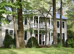
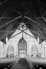
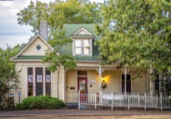
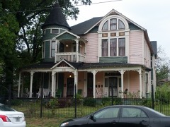
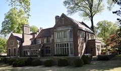
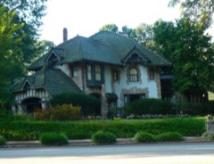
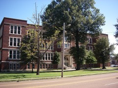
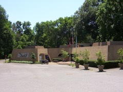
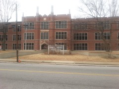
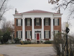
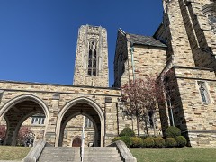
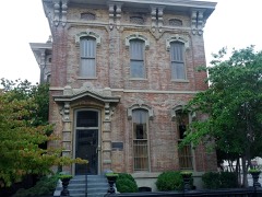
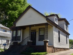
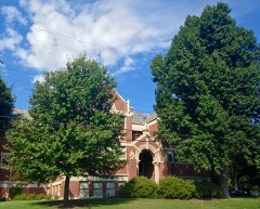
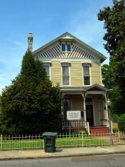
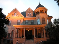
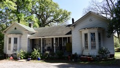
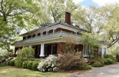
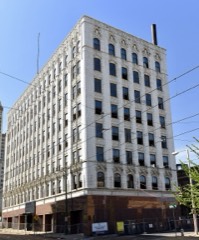
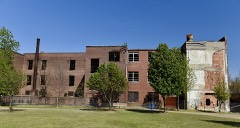
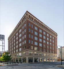
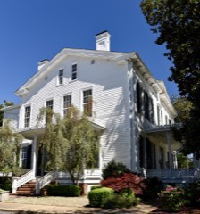
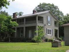
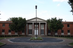
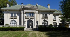
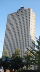
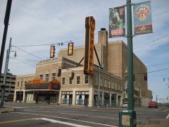
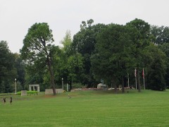
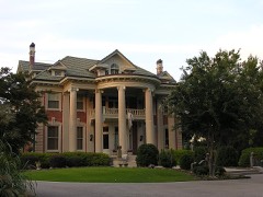
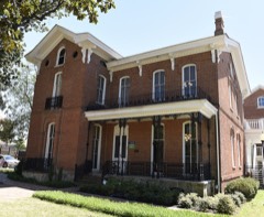
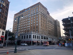
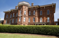
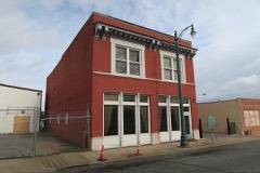
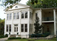
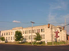
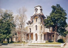
Every property in this county listed on the National Register of Historic Places, with the year it was listed and the federal nomination document.

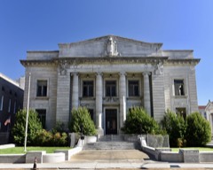
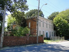
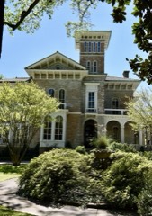
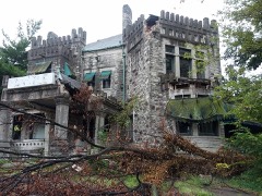
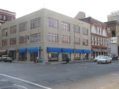
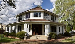
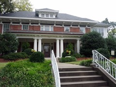
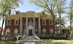
Photograph PropertyType ListedReference
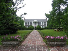
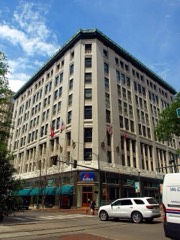
Adams Avenue Historic Districtdistrict198080004481
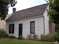
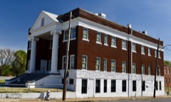
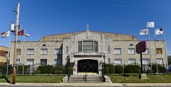
Walter Granville Allen Housebuilding199090000320
American Snuff Company Historic Districtdistrict2018100002755
Anderson-Coward Housebuilding198686000404
Annesdalebuilding198080003856
Annesdale Park Historic Districtdistrict197878002630
Annesdale-Snowden Historic Districtdistrict197979002460
Anshei Sphard-Beth El Emeth Synagoguebuilding2020100005388
Arlington Historic Districtdistrict198282004038
Ashlar Hallbuilding198383003061
Audubon Park Historic Districtdistrict2022100008389
John Alexander Austin Housebuilding198484003684
Bank of Commerce and Trust Company Buildingbuilding198080003857
Barksdale Mounted Police Stationbuilding2019100004695
Barretville Bank and Trust Company Buildingbuilding2019100003904
Pauline Cheek Barton Housebuilding199595001069
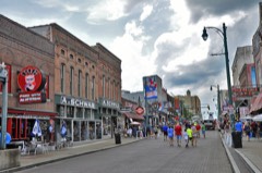
Beale Street Historic Districtdistrict196666000731
Beale Street Historic District (Boundary Increase)site199392001581
Bennett, Gladys "MaDear", Housebuilding2020100005136
Boyce-Gregg Housebuilding197979002462
Bradford-Maydwell Housebuilding197979002463
John Willard Brister Librarybuilding198080003858
Wilks Brooks Housebuilding198080003859
Calvary Episcopal Church and Parish Housebuilding198282004039
Joseph A. Campbell Housebuilding199191000314
Capleville Methodist Churchbuilding197979002459
Capt. Harris Housebuilding197979002464
Robert M. Carrier Housebuilding198080003860
Central Gardens Historic Districtdistrict198282004040
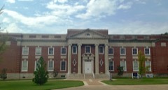
Central High Schoolbuilding198282004041
Davis Charles Housebuilding2017100000980
Cherokee Armsbuilding2024100010039
Chickasaw Heritage Parksite199797001441
Chucalissa Indian Villagesite197373001830
Cornelius Lawrence Clancy Housebuilding198383004294
Clayborn Templebuilding197979002478
Collierville Historic Districtdistrict199090000305
Collins Chapel CME Church and Sitebuilding199191000307
Columbian Mutual Towerbuilding197878002631
Cooper-Young Historic Districtdistrict198989000508
Cordova Schoolbuilding199595000932
Cotton Row Historic Districtdistrict197979002467
Court Square Historic Districtdistrict198282004042
West J. Crawford Housebuilding2024100010997
Crisscross Lodgebuilding198988002627
E. H. Crump Housebuilding197979002465
Rowland J. Darnell Housebuilding197979002466
Davies Manordistrict197575001787
Delmar-Lema Historic Districtdistrict199898000242
Dermon Buildingbuilding198484003688
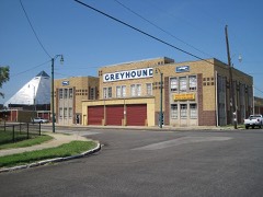
Dixie Greyhound Bus Lines Complexbuilding200303001193
Jack Dudney Housebuilding199191000315
East Buntyn Historic Districtdistrict199595001332
Elam Homesteadbuilding198080003861
Ellis, William C., and Sons Ironworks and Machine Shopbuilding198383003062
Elmwood Cemeterysite200202000233
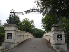
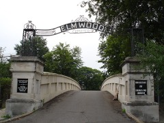
Elmwood Cemetery Office and Entrance Bridgebuilding197878002632
Evergreen Historic Districtdistrict198585000080
Fairview Junior High Schoolbuilding199090001571
First Baptist Churchbuilding197171000833
First Baptist Churchbuilding200505000182
First Colored Baptist Churchbuilding200000000807
First Congregational Church and Parish Housebuilding198080003862
First National Bank Operations Centerbuilding2024100011179
First Presbyterian Churchbuilding200505000183
John M. Fleming Home Placedistrict199090001763
Forrest Park Historic Districtdistrict200909000118
Fountain Court Historic Districtdistrict199898001531
Fowlkes-Boyle Housebuilding197474001928
Galloway-Speedway Historic Districtdistrict200404000766
Gaston Park Historic Districtdistrict198989000521
Gayoso-Peabody Historic Districtdistrict198080003863
Gayoso-Peabody Historic District (Boundary Increase, Boundary Decrease)district200605001556
Germantown Baptist Churchbuilding197575001786
Germantown Redoubtsite199191000623
Glenview Historic Districtdistrict199999001244
Goodwinslowbuilding197979002482
Goodwyn Street Historic Districtdistrict199090000302
Nicholas Gotten Housebuilding200202000236
Grace Episcopal Churchbuilding200505000184
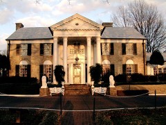
Gracelanddistrict199191001585
Green Meadows-Poplar Glen Historic Districtdistrict200303000304
Greenlaw Addition Historic Districtdistrict198484003704
Greenlevelbuilding198787000397
Greenstone Apartmentsbuilding198080003864
Greenwoodbuilding197979002468
Griggs Business and Practical Arts Collegebuilding2023100008765
Daniel Hanley Housebuilding2021100007127
Hein Park Historic Districtdistrict198888002613
High Point Terrace Historic Districtdistrict200202001513
Hotel Claridgebuilding198282004045
J. W. Houston Housebuilding199191000313
L.C. Humes High Schoolbuilding200498000368
Hunt-Phelan Housebuilding197171000834
Idlewild Historic Districtdistrict199999000278
Idlewild Presbyterian Churchbuilding200909000539
Knickerbocker Apartments, Thebuilding200707001165
Lauderdale Courts Public Housing Projectdistrict199696000819
LeMoyne College Historic Districtdistrict200505001215
LeMoyne Gardens Public Housing Projectdistrict199696000820
Lee and Fontaine Houses of the James Lee Memorialbuilding197171000835
James Lee Housebuilding197878002633
Lt. George W. Lee Housebuilding199494000372
Lenox Schoolbuilding198181000579
George Collins Love Housebuilding197979002472
Lowenstein Housebuilding197979002473
Abraham Lowenstein Housebuilding198484003705
Lowenstein, B., & Brothers Buildingbuilding198383003063
Madison-Monroe Historic Districtdistrict198383003064
Magevney Housebuilding197373001831
Martin Memorial Temple CME Churchbuilding200202001379
Mason Temple, Church of God in Christbuilding199292000286
Maxweltonbuilding198080003866
John H. McFadden Housebuilding199494000577
John B. McFerrin Housebuilding199191000316
Medical Arts Building and Garagebuilding198484003707
Melrose Schoolbuilding200198000367
Memphis Bank and Trust Buildingbuilding201313000502
Memphis Federation Of Musicians Local 71 Buildingbuilding201716000812
Memphis Landingsite201111000460
Memphis Merchants Exchangebuilding197979002474
Memphis National Cemeterysite199696001233
Memphis Overland Companybuilding2021100006385
Memphis Parkway Systemdistrict198989000520
Memphis Pink Palace Museumbuilding198080003870
Memphis Queen II Floating Vesselstructure200606000550
Memphis Trust Buildingbuilding198080003867
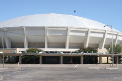
Mid-South Coliseumbuilding200000001429
Missouri Portland Cement Terminalbuilding2021100006384
William R. Moore Dry Goods Buildingbuilding198282004049
Mosby-Bennett Housebuilding198080003868
Mt. Airybuilding200202000011
National Cotton Council Buildingbuilding201212000441
National Trust Life Insurance Company Buildingbuilding2018100002756
Nelson-Kirby Housebuilding198686002913
Joseph Newburger Housebuilding198282004050
Normal Station Historic Districtdistrict200505000866
Oaklawn Gardendistrict2018100002262
Omicron Sigma Chapter House of Sigma Gamma Rho Sorority, Incorporatedbuilding2023100009581
One Hundred North Main Building (Additional Documentation)building201515000187
Orpheum Theatrebuilding197777001289
Overton Park Court Apartmentsbuilding2021100006712
Overton Park Historic Districtdistrict197979002475
Overton Parkway Historic Districtdistrict199999001370
Paisley Hallbuilding198080003869
Parkview Hotel Apartmentsbuilding2022100007910
Patton-Bejach Housebuilding197979002476
Peabody Elementary Schoolbuilding198282004051
Peabody Hotelbuilding197777001290
Ell Persons Lynching Sitesite2024100009136
Picardy Place Historic Districtdistrict201414000450
Pinch-North Main Commercial District (Boundary Increase)building199090001637
Pinch-North Main Commercial Districtdistrict197979002477
Dr. D. T. Porter Buildingbuilding197777001291
Porter-Leath Homebuilding197979002471
Elvis Presley Housebuilding200605001217
Eli Rayner Housebuilding197777001292
Newton Copeland Richards Housebuilding198484003709
Rock of Ages Christian Methodist Episcopal Churchbuilding2017100000859
Rosemark Historic Districtdistrict201313000400
Dr. Christopher M. Roulhac Housebuilding200404000301
Rozelle Elementary Schoolbuilding198282004052
Scimitar Buildingbuilding198383003065
Sculptures of Dionicio Rodriguez at Memorial Park Cemeterysite199190001867
Sears, Roebuck and Company Catalog Distribution Center and Retail Storebuilding201313000954
Second Congregational Churchbuilding198282004053
Second Presbyterian Churchbuilding197979002478
Shadowlawn Historic Districtdistrict199595000941
Shrine Buildingbuilding197979002479
South Bluffs Warehouse Historic Districtdistrict198787000453
South Main Street Historic Districtdistrict198282004054
South Main Street Historic District (Boundary Increase)building199797000224
South Main Street Historic District (Boundary Increase)building199999000756
South Main Street Historic District (Boundary Increase)district201313000503
South Parkway-Heiskell Farm Historic Districtdistrict198383003066
Southern Railway Industrial Historic Districtdistrict200707000361
Southwestern at Memphis Historic Districtdistrict197878002635
Southwestern at Memphis Sorority Row Historic Districtdistrict200606000583
Speedway Terrace Historic Districtdistrict199999000280
Squire's Restbuilding200707000533
St. Mary's Cathedral, Chapel, and Diocesan Housebuilding197979002480
St. Mary's Catholic Churchbuilding197474001929
St. Paul Avenue Historic Districtdistrict199898001533
St. Thomas Catholic Church and Conventbuilding200505000185
Steele Hallbuilding197979002481
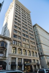
Sterick Buildingbuilding197878002636
Sterick North Garage and Hotelbuilding2018100002263
Stonewall Place Historic Districtdistrict198282004055
Strathmore Place Historic Districtdistrict199898001532
Leslie M. Stratton YMCAbuilding198383003067
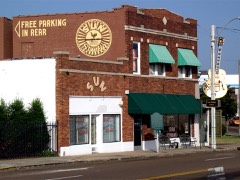
Sun Record Company, Memphis Recording Servicebuilding200303001031
Sweeney Hallbuilding200505001215
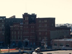
Tennessee Brewerybuilding198080004482
Tennessee Club-Overall Goodbar Buildingbuilding198282004056
Tennessee Trust Buildingbuilding198282001732
Third Additon to Jackson Terrace Historic Districtdistrict200101001260
John W. Thomas Housebuilding199191000312
Toof Buildingbuilding198282004057
John S. Toof Housebuilding198282004058
Tri State Iron Worksbuilding199797000339
Tri-State Bankbuilding197171000836
U.S. Marine Hospitalbuilding2019100003905
U.S. Marine Hospital Executive Building and Laundry-Kitchenbuilding198080003872
U.S. Post Office-Front Street Stationbuilding198080003873
Universal Life Insurance Companybuilding200707000762
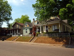
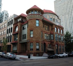
Victorian Village Districtdistrict197272001253
Vollintine Evergreen Avalon Historic Districtdistrict199797000476
Vollintine Evergreen Historic Districtdistrict199696000410
Vollintine Evergreen North Historic Districtdistrict199797000475
Vollintine Hills Historic Districtdistrict200707000684
Wells Schoolbuilding199595000292
Wells-Arrington Historic Districtdistrict99000463
Wildwood Farms (Additional Documentation)district2017100001371
Ernest C. Withers Housebuilding2022100007909
Wooten Fallout Shelterbuilding2019100004683
Zion Cemeterysite199090000301

Wildfire, 1999 to 2006

4 fires

Every wildfire the federal occurrence database records inside this county: 4 of them, burning about 32 acres. None started naturally and none was recorded as arson. Each settlement page carries the fires within five miles of it.

Reported cause Fires
Debris and open burning4

The five largest, by the area the report gives. None of them was recorded as arson.

DateCause SizeReported by Name on the report
8 January 2006Debris and open burning18 acresTennessee Division of Forestrynot named
16 October 1999Debris and open burning10 acresTennessee Division of Forestrynot named
14 September 1999Debris and open burning2.0 acresTennessee Division of Forestrynot named
7 November 2001Debris and open burning2.0 acresTennessee Division of Forestrynot named

Every settlement page carries the fires within five miles of it - see the settlement index below.

Storms, 1950 to 2026

60 of 1,184 shown

The NOAA Storm Events Database holds 1,184 reports for this county, causing 17 deaths, 162 injuries and about $2,386,141,140 in recorded property damage. Each settlement page carries the reports that name it.

Kind of event Reports
Thunderstorm Wind574
Hail312
Flash Flood195
Tornado56
Lightning27
Flood18
Heavy Rain2

The most serious of them, by death, then injury, then recorded damage. The accounts are quoted exactly as the forecast office filed them.

WhenEvent Place namedHarm What the report says
November 1994Tornado (F3)not stated3 killed, 25 hurt, $50,000,000The tornado started just southwest of Germantown and moved northeast through the eastern part of Shelby County and then continued into the northwest part of Fayette County. Three persons were killed in Germantown when the tornado struck a home where 16 people had gathered for a family reunion. Twenty-five persons were injured in the Germantown area. Overall, 28 homes were destroyed and 300 other homes were damaged. Houston High School was badly damaged and a nearby church sustained significant damage. Thirty utility poles were blown down along with a several trees. Two mobile homes were destroyed in Fayette County. M44H,M11H,M48H
February 2008Tornado (EF2)Whitehaven3 killed, 13 hurt, $100,000,000A tornado continued northeast from DeSoto County, Mississippi. After the tornado crossed into Tennessee, several warehouses sustained damage. The DSC warehouse near Clarke Road was struck causing EF-2 damage. Three people were killed inside the warehouse. Hardy Bottling Company sustained substantial damage as well. Tractor-trailers were tossed about in the area. Windows were shattered in the Willow Lake Business Park and utility poles and trees were snapped in the area. A utility substation sustained severe damage along Clarke Road causing major power outages in the area. The tornado then continued northeast and struck homes along Maple Tree Drive and Pinbranch Court. Five homes received major damage and had to be condemned. Other homes sustained roof damage. The tornado continued northeast and struck the Hickory Ridge Mall causing a wall to collapse at the Sears Department Store. Six injuries occurred at the mall. This damage was estimated at EF-1. The tornado then struck a Taco Bell along Winchester Road before lifting. Thirteen people in all were transported to an area hospital due to injuries sustained from the tornado.
March 2023Thunderstorm Wind(Mem)Memphis Intl Ar3 killed, $500,000NWS meteorologists determined that straight-line winds impacted portions of southern and southeast Shelby County on the evening of March 31. Strong winds developed in the forward flank downdraft of a supercell thunderstorm and caused considerable tree damage and downed power lines in the area. Peak winds were estimated at 85 mph. A tree fell on a house near the Memphis International Airport resulting in the 3 fatalities.
July 2003Thunderstorm WindCountywide1 killed, 3 hurt, $40,000,000Shelby County was hit hard by a downburst wind event. Numerous trees, power lines and power poles were blown down. Some of the trees fell on houses producing some major damage. At least 20 buildings collapsed. Numerous homes and buildings were damaged and a few were destroyed. Among the damaged buildings was the Gibson Guitar Factory in downtown Memphis. One person was killed when a tree fell on his house crushing him. Over 300,000 homes in the county were without electricity. Most were without power for anywhere from 2 days to 2 weeks. Several people will killed due to post storm related issues such as carbon monoxide poisoning from improperly using generators.
May 2010Flash FloodKerrville1 killed, $28,900,000Very heavy rain produced devastating flash flooding across Northwestern Shelby County. Up to 16 inches of rain fell causing widespread flooding. Millington was the hardest hit area where a levee holding back water from Big Creek was topped. As many as 200-300 homes in base housing at the Naval Support Activity Base were flooded. Numerous people had to be rescued. Four to five feet of water covered the navy base. Some locations around Millington were covered by as much as 8 feet of water. All roads in Millington were closed. Power outages occurred due to the flood waters. Raleigh, Frayser and Bartlett also received widespread flooding where water was as deep as vehicles windshields. One fatality occurred in Raleigh as a vehicle became stranded in flood waters. Water covered some streets in Downtown Memphis with water as high as vehicles wheel wells. In total, 576 homes received some kind of flood damage. Of those, 77 were completely destroyed. Eight businesses were damaged and 403 mobile homes were completely destroyed. Several other buildings including apartment complexes were damaged as well. The flash flooding event transitioned into a flood event where rivers rose rapidly spilling over their banks.
December 2021Thunderstorm WindBuntyn1 killed, $250,000Numerous trees were knocked down from Orange Mound into East Buntyn. Several trees fell onto houses and vehicles. A fatality occurred when a large tree landed on a house.
July 2009Flash FloodMillington1 killed, $20,000Heavy rain produced flash flooding in Millington. One motorist was stranded in flood water at the intersection of Navy Road and Wasp Road. In addition, Arapaho Road was flooded. One child was swept away by flood waters in a drainage ditch at the corner of Sigler Lane and Highway 51. The child was found an hour later.
April 2008FloodCollierville Arpk1 killed, $10,000A 56 year old tow truck driver was one of two drivers who arrived to help a man who had driven into flood waters off of Holmes Road near the intersection of Reynolds Road after falling asleep at the wheel. The tow truck driver tied an air hose around his waist for safety and climbed onto the car to attach the cable from the tow truck. The car began to float. The water forced the car through the culvert into the raging Nonconnah Creek tributary, with the force of the current snapping the hose that tethered the man to the tow truck. The car sank 75 feet.
March 2008Flash FloodBenjestown1 killedA 7 year old boy drowned when he fell into a rain-swollen creek near Steamboat Bend in Northaven.
March 2008Flash FloodPisgah Hgts1 killedA nineteen year old man fell from a bridge near McKellar Lake into a swollen ditch near an apartment complex where he lived and drowned.
September 2004LightningArlington1 killedA man was killed by a lightning strike while hunting in a field.
August 1978Tornado (F2)not stated26 hurt, $2,500,000no account filed
December 1987Tornado (F3)not stated21 hurt, $2,500,000no account filed
April 1970Tornado (F3)not stated13 hurt, $2,500,000no account filed
February 1950Tornado (F1)not stated8 hurt, $2,500no account filed
July 2001Flash FloodMemphis6 hurt, $25,000Heavy rain caused part of the roof at a Sears store to collapse. Six persons suffered minor injuries. Some street flooding also occurred.
April 1970Tornado (F3)not stated5 hurt, $2,500,000no account filed
March 1998LightningMemphis5 hurtFive Westwood High School students were injured when lightning struck the tree they were under.
April 1968Tornado (F3)not stated4 hurt, $2,500,000no account filed
April 1984Tornado (F3)not stated3 hurt, $2,500,000no account filed
April 1970Tornado (F3)not stated3 hurt, $2,500,000no account filed
March 1979Tornado (F2)not stated3 hurt, $25,000no account filed
March 1964Tornado (F2)not stated3 hurt, $25,000no account filed
June 1994Thunderstorm WindCollierville2 hurt, $5,000,000Nearly 190 building were damaged or destroyed including several buildings that under construction. Numerous trees and power lines were knocked down. Shelby County Memphis,09,1240CST,,,0,0,1,0,Hail (1.00)
April 1967Tornado (F1)not stated2 hurt, $250,000no account filed
May 2001Thunderstorm WindMillington2 hurt, $1,000A tent was blown over during an air show at the Millington Naval Air Station injuring one person.
April 2016LightningOakville2 hurtTwo airport workers at Memphis International Airport suffered injuries from a lightning strike.
February 2008Tornado (EF2)Bolton1 hurt, $1,000,000A tornado touched down one quarter mile east of Brunswick Road interchange along Highway 385 in the Salem Estates Subdivision. The tornado tracked non-continuously northeast to the Tipton County line, near the Collierville-Arlington Road. Damage sustained in the Salem Estates subdivision was rated an EF-0. One roof of a home was partially removed along with several blown out windows. In addition, some minor tree damage occurred in this area. Further northeast, along Moose Road west of Beaver Creek, the tornado intensified and produced EF-2 damage. Significant tree damage occurred from the tornado in this area. In addition, two power line support towers were knocked down and one was twisted. Significant damage occurred further northeast along Osborntown Road as extensive tree damage was observed. Large trees were snapped and uprooted. In addition, two large well constructed new homes were heavily damaged. One home had more than half of its roof removed along with all windows blown out. Brick was also dislodged from portions of the structure. The second home received extensive damage with the entire second story being removed from the tornado. Inside walls were compromised and debris was deposited inside the home and in the front yard. One minor injury occurred from this segment of EF-2 rated damage. Additional damage occurred further northeast across Macedonia Road producing additional tree damage and minor damage to one home and one mobile home. Damage also occurred just south of where the tornado crossed into Tipton County where five homes sustained light to moderate damage along Collierville-Arlington Road. This damage has been rated EF-1. One of the homes sustained significant damage to portions of the roof and adjoining levels. The other four homes had damage to the roofs and windows. Large trees, some up to 3 feet in diameter were snapped and uprooted. The tornado then tracked into Tipton County.
June 1998Thunderstorm WindMemphis1 hurt, $1,000,000A 13-year-old boy was injured when the chimney of his home toppled and crashed through the roof and landed on him. Numerous homes and businesses were damaged. Numerous trees were knocked down.
June 2025Thunderstorm WindWhite Station1 hurt, $25,000A large tree fell on a house in the 500 block of Shotwell Street near Southern Avenue.
July 2023Thunderstorm WindWhite Station1 hurt, $15,000A tree fell on a car on Park Avenue.
May 2008Thunderstorm WindWhitehaven1 hurt, $15,000HAM radio operators reported 60 mph wind gusts near the intersection of Shelby Drive and Swinnea. Five power poles were snapped on Shelby Drive. A tree fell on a car on Cullenwood Avenue in Whitehaven and a person was injured.
June 1970Tornado (F1)not stated1 hurt, $2,500no account filed
February 2021Thunderstorm WindLeewood1 hurtStraight-line winds knocked a large tree onto a house at Brown Avenue near North Evergreen. A child was rescued after being trapped.
May 2012Thunderstorm WindRamsey1 hurtStraight line winds produced damage from Shelby Forest to just east of Millington. Several trees were knocked down in the vicinity of Shelby Forest. One tree fell on a mobile home along Raleigh-Millington Road causing a minor injury. A few trees were also knocked down along Highway 14 east of Millington.
August 2010LightningForest Hill1 hurtA student was struck by lightning and injured near Southwind High School in Southeast Memphis.
June 2009Thunderstorm WindNorth1 hurtStraight line winds shattered glass store fronts along South Main Street in Downtown Memphis. In addition, car windows were broken near the Amtrak Station. One serious injury occurred when a tree fell on a person near the Pyramid Arena.
June 2009Thunderstorm WindEast Jct1 hurtStrong winds knocked two limbs down in South Memphis. The limbs injured a person as they fell.
November 2002LightningMemphis1 hurtA University of Memphis professor was injured by a lightning strike while leaving his car.
April 1987Hailnot stated1 hurtno account filed
May 2011FloodDarwin$2,000,000,000The Mississippi River rose to near record levels in Memphis during the beginning to middle part of May. Portions of Beale Street, Riverside Drive, Tom Lee Park and the Pyramid parking lot were flooded. Portions of Mud Island flooded as well including the Mud Island Ampitheater. The flooding wiped out nearly half mile section of the eastern bank of Presidents Island. As a result, the port at McKellar Lake was closed. Several businesses on Presidents Island sustained damage. Backwater from the Mississippi River caused the Wolf River to rise above flood stage. Numerous homes along the Wolf River in North Memphis and Raleigh were flooded as a result. Two mobile home parks in Millington were evacuated due to concerns of high water on Big Creek from backwater of the Mississippi River. The river remained above flood stage through the end of the month.
June 2014Flash FloodEads$50,000,000Very heavy rain fell across the southern half of Shelby County. Rainfall amounts of 5 to 9 inches were reported causing widespread flash flooding. Dozens of streets were flooded across Southern Shelby County and many vehicles were trapped in water. Several people had to be rescued. Several homes and businesses were also flooded. The hardest hit area was along Nonconnah Creek where many homes and businesses from Lamar Avenue downstream to Interstate 55 experienced some degree of flooding. About 100 mobile homes were flooded in a mobile home park west of Memphis International Airport. Nonconnah Creek had a record crest at the Winchester gage of 26.64 feet and at the Farriesview gage of 34.33 feet.
May 2010FloodArlington$50,000,000Flash flooding transitioned into a flood event across Northern Shelby County as a result of up to 16 inches of rain. The Loosahatchie River rose rapidly spilling over its banks flooding numerous homes and businesses from Millington to Arlington. Many roads were underwater as well. The river crested at a record level in Arlington on May 2nd.
May 2017Thunderstorm WindBerclair$9,000,000Trees and power-lines down countywide. Several of them on cars. Many buildings damaged by falling trees. Over 180,000 people without power.
November 1991Tornado (F1)not stated$2,500,000no account filed
May 1967Tornado (F1)not stated$2,500,000no account filed
April 2011Thunderstorm WindFrayser$2,470,000Straight line winds created a swath of damage across Northern Shelby County. Damage in the Frayser and Raleigh areas consisted of broken shingles along with downed fences and trees. In the Millington area, a tree was knocked down destroying a couple of fences and power lines were knocked down across Cuba Millington Road. In the Bolton area, near the high school, roofs and buildings were damaged and many trees were knocked down. There was also minor fence damage southwest of Arlington. Across Shelby County there were 22 homes with minor damage, 13 homes with major damage and 5 homes were destroyed.
June 2023Thunderstorm WindEllendale$2,000,000Powerful straight-line winds knocked down and split trees across Bartlett. Numerous trees were knocked down across the north Bartlett. Six utility poles were snapped along US Highway 64 between Kate Bond Road and North Germantown Parkway. Over 100,000 customers lost power, mainly across northern Shelby County.
June 2019Flash FloodForest Hill$1,500,000Roads closed due to flooding. Several streets around southeast Memphis had several inches of water causing closures for a period of time. Wemberly Drive between Shelby Drive and Tumbler Ridge Lane. Winchester Road between Hacks Cross and Forest Hill Irene. Polar Avenue and International as well as Front Street and Nettleton were flooded. Several homes were flooded across portions of Germantown and Southeast Memphis.
October 2019Tornado (EF1)(Mem)Memphis Intl Ar$1,500,000Tornado began at the Memphis International Airport and lifted in the Balmoral area of East Memphis. The most significant damage occurred at the Cottonwood Apartments. Significant roof damage occurred at the apartments. Numerous trees and business signs down along the track.
June 2016Flash FloodArlington$1,500,000Exit 25 ramp on Interstate 40 had 6 to 10 inches of water flowing across impeding traffic. Flooding of deep water also occurred on Hays Road in Arlington forcing a road closure and on Arlington Road at the Arlington Self Storage Business.||In addition, the Broadcast media also reported several residential roads across Arlington were flooded as well as Arlington Trace Subdivision, Airline Road, Douglas Road and Fire Station 71.
September 2014Flash FloodMillington$1,100,000Showers and thunderstorms trained over Shelby County for several hours. At first, the heavy rain fell from Millington, to Bartlett, to Arlington. Widepread 4 to 6 inches fell across this northern corridor with isolated 7-8 inches in a few locations. Some locations picked up 1.75 to 2 inches of rain in a 1 hour and 15 minute time frame. Several homes near Millington were flooded from high water. Water rescues were needed in Mount Terrace for rescuing residents trapped in flooded homes. Numerous streets were closed some of which that had never been closed before due to heavy rain including Bartlett Boulevard and Stage Road in Bartlett. The corridor of the heavy rain shifted southward to Southern Shelby County by 8 am CDT as the cold front sagged south and stalled. Heavy rain fell from Whitehaven, to Germantown, to Collierville. Rainfall amounts ranged from 4 to 7 inches. The heavy rain produced a 20 ft hole in the roof of the Southland Mall near Whitehaven. Again, numerous streets and roads were closed in this corridor as well. In total, 74 homes sustained minor damage from flooding with one apartment complex that contained 31 units. One road also sustained damage. In addition, one business sustained minor damage from flooding as well.
June 2023Thunderstorm WindBrunswick$1,000,000Powerful straight-line winds uprooted and snapped trees across Lakeland. Part of the roof was ripped off a gas station and dental building near exit 20 on I-40. A tree fell on a vehicle.
June 2023Thunderstorm WindMillington$1,000,000Powerful straight-line winds resulted in widespread tree and powerline damage in Millington. Trees were knocked down onto homes and vehicles, and some utility poles were snapped. Some structures sustained damage. A commercial building on US Highway 51 lost its roof with additional roof damage to a nearby building.
August 2001Flash FloodMemphis$1,000,000A line of strong thunderstorm produced very heavy rain over Shelby County. Over 4 inches of rain fell over central parts of the county in about 2 hours time. Many structures in low lying areas were flooded and many streets were covered with water which disrupted traffic. Twenty-nine mobile homes were destroyed and another 100 were damaged.
April 2005Thunderstorm WindMemphis$900,000Several mobile homes were blown off of their foundation just east of the Memphis International Airport. Some trees were also knocked down. One tree limb fell on a power line and started a fire to a house in East Memphis. Another large tree fell down and damaged a home in the Midtown section of Memphis.
July 2023Thunderstorm WindForest Hill$750,000Straight-line winds knocked down several large trees along Dogwood Road from Cordes Road to Kilbirine Drive. A few houses suffered heavy damage from fallen trees.
July 2015Flash FloodMemphis$500,000Heavy rain caused flash flooding in Memphis. An underpass was flooded on McLean just south of Central Avenue and a vehicle was stranded. A roof of a vacant building on South Main Street in Downtown Memphis collapsed. Adjacent buildings, including several apartments, were flooded as a result.
July 2009Flash FloodCollierville$500,000Heavy rain produced flash flooding in Collierville. Several roads were flooded as a result including Collierville-Arlington Road, Shelton Road, Powell Road, Rowlett Road and Center Road. Water was up to a foot deep or more in a few places. Creeks overfilled their banks as well. A couple of homes, at least one business and one church was flooded as well. A total of 55 structures received at least minor water damage. Vehicles also became stalled in the flood water.
February 2008Thunderstorm Wind(Mem)Memphis Intl Ar$500,000Straight line winds damaged a roof at the Fed Ex Fire Station at the Memphis International Airport. In addition, the Pinnacle Airlines hangar also received damage. A Boeing 737 was moved a few feet by the winds as well.

Mines and quarries

80 recorded

The Survey's mineral resources record lists 80 workings inside this county. 38 still produce and 42 are closed or unrecorded. Each settlement page carries the workings within five miles of it.

Commodity Workings
Sand and Gravel, Construction73
Clay4
Lead1
Chromium1
Silica, Manganese, Iron1
Aluminum1

The least common of them first, because a county's hundredth gravel pit says nothing its first ten did not.

Where SiteCommodity StatusRecorded
(Facility) Excel Smelter/ Memphis, Tn.AluminumPlant
(Facility) Woodstock SmelterChromium, Silica, Manganese, IronPlant
Memphis Lead Co/ Memphis, Tn.LeadPlant
Denies PitClayPast Producer
Eads ProspectClayOccurrence
Memphis PitClayPast Producer
Standard Brick Co. PitClayPast Producer
#1 Ballard PitSand and Gravel, ConstructionProducerUnconsolidated Sediments
#1 Carrier Road Plant Dredge OperationSand and Gravel, ConstructionProducer1968
#1 Davenport PitSand and Gravel, ConstructionPast ProducerUnconsolidated Sediments
#1 Tuggle PitSand and Gravel, ConstructionPast ProducerUnconsolidated Sediments
#2 Airport Industrial Properties, Inc. PitSand and Gravel, ConstructionProducerUnconsolidated Sediments
#2 Bragg and Sons PitSand and Gravel, ConstructionProducerUnconsolidated Sediments
#2 Fryplant Dredge OperationSand and Gravel, ConstructionProducerUnconsolidated Sediments
#2 Hollywood PlantSand and Gravel, ConstructionProducer1967
#2 Mustin PitSand and Gravel, ConstructionPast ProducerUnconsolidated Sediments
#3 Brown PitSand and Gravel, ConstructionPast ProducerUnconsolidated Sediments
#3 Glasgow PitSand and Gravel, ConstructionProducerUnconsolidated Sediments
#3 Mensi PitSand and Gravel, ConstructionProducerUnconsolidated Sediments
#4 Highway 64 PitSand and Gravel, ConstructionProducer1971
#4 Malone PitSand and Gravel, ConstructionProducerUnconsolidated Sediments
#4 Moore PitSand and Gravel, ConstructionProducerUnconsolidated Sediments
#5 Pasino PitSand and Gravel, ConstructionProducerUnconsolidated Sediments
64 PitSand and Gravel, ConstructionPast Producer
Allen Materials, Inc. PitSand and Gravel, ConstructionPast Producer
Allen Materials, Inc. Plant Dredge OperationSand and Gravel, ConstructionProducerUnconsolidated Sediments
Allen MineSand and Gravel, ConstructionProducer
Anderson PitSand and Gravel, ConstructionProducer
Braden MineSand and Gravel, ConstructionPast Producer
Bragg PitSand and Gravel, ConstructionPast Producer
Bryant PitSand and Gravel, ConstructionPast Producer
Carroll PitSand and Gravel, ConstructionPast ProducerSedimentary
Carroll PitSand and Gravel, ConstructionPast ProducerUnconsolidated Sediments
Carroll PitSand and Gravel, ConstructionPast Producer
Collierville PitSand and Gravel, ConstructionProducerUnconsolidated Sediments
Collierville PitSand and Gravel, ConstructionPast ProducerSedimentary
Collierville PitSand and Gravel, ConstructionProducer
Connie DredgeSand and Gravel, ConstructionPast Producer
Crops Syndicate PitSand and Gravel, ConstructionProducerUnconsolidated Sediments
Crops Syndicate PitSand and Gravel, ConstructionPast ProducerSedimentary
Crops Syndicate PitSand and Gravel, ConstructionProducer
Dredge 3Sand and Gravel, ConstructionProducer
Dudley Anderson PitSand and Gravel, ConstructionProducerUnconsolidated Sediments
Dudley Anderson PitSand and Gravel, ConstructionPast ProducerSedimentary
Dudley Anderson PitSand and Gravel, ConstructionPast Producer
Duke PitSand and Gravel, ConstructionProducer
Frank Road PitSand and Gravel, ConstructionProducer
Gallina PitSand and Gravel, ConstructionProducer1971
Gallina PitSand and Gravel, ConstructionPast ProducerSedimentary
Gallina PitSand and Gravel, ConstructionProducer
Malone PitSand and Gravel, ConstructionPast Producer
Mine No. 3Sand and Gravel, ConstructionProducer
No. 1 Davenport PitSand and Gravel, ConstructionPast Producer
No. 2 Airport Industrial PitSand and Gravel, ConstructionPast Producer
No. 2 Mustin PitSand and Gravel, ConstructionPast Producer
No. 3 Brown PitSand and Gravel, ConstructionPast Producer
Number 1 Ballard PitSand and Gravel, ConstructionPast ProducerSedimentary
Number 1 Ballard PitSand and Gravel, ConstructionPast Producer
Number 1 Carrier Road PitSand and Gravel, ConstructionPast Producer
Number 2 Bragg and Sons PitSand and Gravel, ConstructionPast ProducerSedimentary
Number 2 Bragg and Sons PitSand and Gravel, ConstructionProducer
Number 2 Fry PlantSand and Gravel, ConstructionProducer
Number 3 Glasgow PitSand and Gravel, ConstructionPast ProducerSedimentary
Number 3 Glasgow PitSand and Gravel, ConstructionPast Producer
Number 3 Mensi PitSand and Gravel, ConstructionPast ProducerSedimentary
Number 3 Mensi PitSand and Gravel, ConstructionProducer
Number 4 Highway 64 PitSand and Gravel, ConstructionPast ProducerSedimentary
Number 4 Highway 64 PitSand and Gravel, ConstructionProducer
Number 4 Malone PitSand and Gravel, ConstructionPast ProducerSedimentary
Number 4 Malone PitSand and Gravel, ConstructionPast Producer
Number 4 Moore PitSand and Gravel, ConstructionPast ProducerSedimentary
Number 4 Moore PitSand and Gravel, ConstructionPast Producer
Number 5 Pasino PitSand and Gravel, ConstructionPast ProducerSedimentary
Number 5 Pasino PitSand and Gravel, ConstructionProducer
Pierce PitSand and Gravel, ConstructionPast ProducerUnconsolidated Sediments
Pierce PitSand and Gravel, ConstructionPast Producer
Pleasant Hill Road PitSand and Gravel, ConstructionProducer
Sylvia G. DredgeSand and Gravel, ConstructionProducer
Van Road PitSand and Gravel, ConstructionProducer
Warford PitSand and Gravel, ConstructionProducer

Town by town, in the county's histories

455,622 words

The part of each published history that is about one town: 2 chapters, each reproduced complete.

TownChapter FromLength
MemphisHistoryHistory of the City of Memphis and Shelby County Tennessee (1888)262,589 words in 17 parts
MemphisStandard History of Memphis, Tennessee, from a Study of the Original SStandard History of Memphis, Tennessee, from a Study of the Original Sources (1912)193,033 words in 13 parts

The people it describes

17 named

Everyone Standard History of Memphis, Tennessee, from a Study of the Original Sources stops to write about, with the section that describes them. Among them are the men who founded the place and governed the Territory. Each name opens the passage itself, in the words of 1912.

Every populated place in the county

113

Named settlements recorded in the Geographic Names Information System, each with the topographic sheets covering it. Villages, hamlets and abandoned places alike. Each is shown with the nearest named watercourse or landform and the survey quadrangle it falls on.

The vanished settlements of Shelby County: the places named above that are no longer on the map.

Provenance

  • Topographic sheets. USGS Historical Topographic Map Collection, county index, measured from the bulk metadata.
  • Fire insurance maps. Library of Congress Sanborn collection, faceted to this county.
  • Photographs. Each place queried individually against the Library of Congress Prints and Photographs search.
  • Wildfire. Short, Karen C. 2022. Spatial wildfire occurrence data for the United States, 1992-2020 [FPA_FOD_20221014]. 6th Edition. Fort Collins, CO: Forest Service Research Data Archive. https://doi.org/10.2737/RDS-2013-0009.6 Collected with United States Government funding and usable without additional permissions or fees.
  • Mines and quarries. USGS Mineral Resources Data System (MRDS) https://mrdata.usgs.gov/mrds/ A work of the United States government, no copyright under 17 U.S.C. 105.
  • Storms. NOAA National Centers for Environmental Information, Storm Events Database https://www.ncei.noaa.gov/stormevents/ A work of the United States government, no copyright under 17 U.S.C. 105. Narratives are quoted verbatim from the National Weather Service report and are not edited or summarised.