 Block
From the record
One of 25 National Register listings published here for Bradley County · listed in 2019 · category: District.
Sources: the National Register database, National Park Service
Listed on the National Register of Historic Places in 2019.
One of 25 National Register listings published here for Bradley County · listed in 2019 · category: District.
Sources: the National Register database, National Park Service
Regional context, not property-specific evidence. The federal wildfire occurrence database lists 26 fires within 5 miles of Hardwick Farms between 1998 and 2019, burning about 102 acres in total. None started naturally. 1 was recorded as arson. Distance is straight-line from the map coordinates, so a fire counted here may appear on a neighbouring settlement's page as well.
| Reported cause | Fires |
|---|---|
| Debris and open burning | 20 |
| Equipment and vehicle use | 3 |
| Misuse of fire by a minor | 1 |
| Recreation and ceremony | 1 |
| Arson/incendiarism | 1 |
The most recent of them, most recent first, with the day each was reported and the service that recorded it.
| Date | Cause | Size | Reported by | Name on the report |
|---|---|---|---|---|
| 5 September 2019 | Equipment and vehicle use | 29 acres | Tennessee Division of Forestry | CHATATA VALLEY BREAKOVER FIRE |
| 21 September 1998 | Debris and open burning | under an acre | Tennessee Division of Forestry | not named |
| 2 September 2019 | Equipment and vehicle use | 19 acres | Tennessee Division of Forestry | CHATATA VALLEY RD FIRE |
| 16 September 2019 | Equipment and vehicle use | 3.0 acres | Tennessee Division of Forestry | BENTON PIKE CORN FIELD FIRE |
| 13 September 2002 | Arson/incendiarism | 10 acres | Tennessee Division of Forestry | not named |
| 28 June 2012 | Debris and open burning | 3.0 acres | Tennessee Division of Forestry | STUART RD |
| 9 April 1999 | Debris and open burning | under an acre | Tennessee Division of Forestry | not named |
| 7 April 2002 | Debris and open burning | under an acre | Tennessee Division of Forestry | not named |
Regional context, not property-specific evidence. The federal mineral resources record lists 7 workings within 5 miles of Hardwick Farms: 5 past producers, 2 prospects. None of them still produces. What was taken out: Barium-Barite, Lead, Iron, Zinc, Barium-Barite, Manganese. Distance is straight-line from the map coordinates, so a quarry counted here may appear on a neighbouring settlement's page as well.
| Where | Site | Commodity | Status | Recorded |
|---|---|---|---|---|
| Hambright Lead Mine | Lead, Iron, Zinc, Barium-Barite | Past Producer | 1851 | |
| Hambright Lead Mine | Barium-Barite, Iron, Lead, Zinc | Prospect | ||
| Underwood Mine | Manganese | Prospect | 1918 | |
| Hambright Lead Mine | Lead | Past Producer | Galena | |
| Griffen Barite Mine | Barium-Barite | Past Producer | 1898 | |
| Griffen Barite Mine | Barium-Barite | Past Producer | ||
| Griffin Barite Mine | Barium-Barite | Past Producer | Residual |
Regional context, not property-specific evidence. The National Weather Service names Cleveland, the town this property stands in, in 233 storm reports between 1993 and 2026: 139 thunderstorm wind, 67 hail, 9 flash flood, 8 tornado. The reports record 2 deaths and 6 injuries. Each account below is quoted exactly as the forecast office filed it, from the NOAA Storm Events Database, and each date opens the federal record of that event.
| When | Event | Place named | Harm | What the report says |
|---|---|---|---|---|
| April 1998 | Tornado (F1) | Cleveland | 1 killed, $750,000 | no account filed |
| June 1999 | Lightning | Cleveland | 1 killed | no account filed |
| April 2020 | Tornado (EF2) | Cleveland | 6 hurt | The storm from Hamilton County moved into Bradley County with a mesocyclone moving directly over downtown Cleveland. A tornado then formed quickly in Cleveland, less than a mile east northeast of downtown. A residential section was hit, comprising single family homes as well as mobile homes, with 26 destroyed, 23 receiving major damage, and 62 other dwellings affected. A church in this area was heavily damaged and hundreds of trees were either uprooted, or had large limbs snapped. The tornado then moved out of the city before occluding and dissipating in rural areas near Benton Pike east of downtown. |
| May 1998 | Tornado (F1) | Cleveland | $375,000 | no account filed |
| April 2005 | Thunderstorm Wind | Cleveland | $86,000 | Bradley County EMA reported straight line wind damage across a 2 mile path in Cleveland. 13 structures were damaged. |
| June 2025 | Thunderstorm Wind | Cleveland | $50,000 | Several trees were blown down by severe thunderstorm wind gusts, blocking a local road. Elsewhere in Bradley County, numerous trees were felled, with multiple trees landing on both site built and manufactured housing, dealing various amounts of damage to structures. |
| April 2011 | Tornado (EF0) | Cleveland | $50,000 | W Cleveland Tornado. An NWS employee reported a EF1 tornado touched down near Cleveland. It had a 2 mile path length and a path width of 150 yards. The max wind of 80 mph downed trees and slightly damaged a few structures. This tornado brushed the Bradley County EMA office. |
| May 2001 | Thunderstorm Wind | Cleveland | $50,000 | Trees down on east side of county. A roof was reportedly blown off a house. |
| July 2006 | Thunderstorm Wind | South Cleveland | $50,000 | no account filed |
| July 2004 | Thunderstorm Wind | Cleveland | $50,000 | no account filed |
| April 2011 | Thunderstorm Wind | Cleveland | $30,000 | North Cleveland Tornado. Law enforcement personnel reported damage to apartments by thunderstorm wind on Crown Colony Drive in Cleveland. |
| June 2006 | Thunderstorm Wind | Cleveland | $30,000 | Several trees and powerlines down countywide. Several homes in Cleveland sustained roof damage. |
| September 2006 | Thunderstorm Wind | Cleveland | $30,000 | no account filed |
| July 2005 | Thunderstorm Wind | Cleveland | $30,000 | no account filed |
| April 2011 | Thunderstorm Wind | Cleveland | $25,000 | Law enforcement personnel reported numerous trees and powerlines downed by thunderstorm wind in Cleveland and northeast portions of the county. |
| August 2009 | Thunderstorm Wind | Cleveland | $25,000 | Law enforcement personnel reported numerous trees...traffic lights and powerlines downed by thunderstorm winds across the northern half of the county. |
| June 2014 | Thunderstorm Wind | Cleveland | $20,000 | Law enforcement personnel reported many trees and powerlines downed by thunderstorms wind across the county. |
| April 2011 | Tornado (EF0) | Cleveland | $20,000 | Northeast Cleveland Tornado. A NWS storm survey reported an EF0 tornado touched down just northeast of Cleveland. It had a path width of 50 yards and path length of around 1 mile. The 80 mph wind downed numerous trees. |
| October 2010 | Thunderstorm Wind | Cleveland | $20,000 | Law enforcement personnel reported numerous trees and traffic lights downed by thunderstorm wind across 7 area roads in and around Cleveland. Amateur radio personnel reported a 51 knot wind near Interstate 75 in Cleveland. |
| August 2010 | Thunderstorm Wind | Cleveland | $20,000 | Law enforcement personnel reported numerous trees and powerlines downed by thunderstorm winds countywide. |
| June 2010 | Thunderstorm Wind | Cleveland | $20,000 | Law enforcement personnel reported numerous trees and powerlines downed by thunderstorm winds countywide. |
| October 2009 | Thunderstorm Wind | Cleveland | $20,000 | Law enforcement officials reported several trees and powerlines downed by thunderstorm winds countywide. Numerous power outages. |
| April 2009 | Thunderstorm Wind | Cleveland | $20,000 | A trained spotter reported several trees downed by thunderstorm winds in the Cleveland area. A few homes sustained minor wind damage. |
| April 2006 | Thunderstorm Wind | Cleveland | $20,000 | Siding and roof blown off a house in the northwest portion of the county. |
| July 2002 | Thunderstorm Wind | Cleveland | $20,000 | Trees and powerlines down at Hanna and Harrison Pike. Trees down on a mobile home. |
| May 2006 | Thunderstorm Wind | Cleveland | $20,000 | no account filed |
| May 2006 | Thunderstorm Wind | East Cleveland | $20,000 | no account filed |
| July 2004 | Thunderstorm Wind | Cleveland | $20,000 | no account filed |
| July 2004 | Thunderstorm Wind | Cleveland | $20,000 | no account filed |
| August 2004 | Tornado (F0) | Cleveland | $20,000 | no account filed |
| December 2008 | Thunderstorm Wind | Cleveland | $18,000 | Law enforcement reported several trees and powerlines downed by thunderstorm winds countywide. A barn in Cleveland was also damaged. |
| June 2007 | Thunderstorm Wind | Cleveland | $18,000 | Several trees were downed across the county by thunderstorm winds. |
| February 1998 | Thunderstorm Wind | Cleveland | $18,000 | no account filed |
| June 1998 | Thunderstorm Wind | Cleveland | $16,000 | no account filed |
| April 2014 | Thunderstorm Wind | Cleveland | $15,000 | Law enforcement personnel reported numerous trees downed by thunderstorm wind countywide. |
| August 2012 | Thunderstorm Wind | Cleveland | $15,000 | A local newspaper reported trees and powerlines were downed by a thunderstorm wind in Cleveland. |
| October 2010 | Thunderstorm Wind | Cleveland | $15,000 | Law enforcement personnel reported trees downed by thunderstorm winds on Blackburn...Blythe...Linda...Lebanon Roads and Benton Pike in Cleveland. |
| October 2010 | Thunderstorm Wind | Cleveland | $15,000 | Law enforcement personnel reported numerous trees and traffic lights downed by thunderstorm winds in Cleveland. |
| June 2010 | Thunderstorm Wind | Cleveland | $15,000 | Law enforcement personnel reported numerous trees downed by thunderstorm winds in and around Cleveland. |
| October 2010 | Thunderstorm Wind | Cleveland | $15,000 | Amateur radio personnel reported trees and traffic lights downed by thunderstorm winds in Cleveland and across numerous areas of the county. |
| June 2009 | Thunderstorm Wind | Cleveland | $15,000 | A trained spotter reported several trees and powerlines downed by thunderstorm winds in Cleveland. |
| June 2008 | Thunderstorm Wind | Cleveland | $15,000 | Law Enforcement reported numerous trees and large limbs downed by thunderstorm winds countywide. |
| June 2007 | Thunderstorm Wind | Cleveland | $15,000 | Numerous trees downed by thunderstorm winds across the southern third of the county. |
| August 2006 | Thunderstorm Wind | Cleveland | $15,000 | Numerous trees down in Cleveland. |
| October 2006 | Thunderstorm Wind | Cleveland | $15,000 | A few trees and powerlines down countywide. |
| July 2004 | Thunderstorm Wind | Cleveland | $15,000 | no account filed |
| July 2004 | Thunderstorm Wind | Cleveland | $15,000 | no account filed |
| July 2004 | Thunderstorm Wind | Cleveland | $15,000 | no account filed |
| August 2002 | Thunderstorm Wind | Cleveland | $15,000 | no account filed |
| October 2010 | Thunderstorm Wind | Cleveland | $12,000 | Emergency management personnel reported trees downed by thunderstorm winds countywide. |
| August 2006 | Thunderstorm Wind | Cleveland | $12,000 | Several trees and powerlines down near Cleveland. |
| July 2005 | Thunderstorm Wind | Cleveland | $12,000 | no account filed |
| June 2002 | Thunderstorm Wind | Cleveland | $12,000 | no account filed |
| August 1999 | Thunderstorm Wind | Cleveland | $12,000 | no account filed |
| February 2014 | Thunderstorm Wind | Cleveland | $10,000 | Law enforcement reported several trees and a power pole downed by thunderstorm wind in Cleveland. |
| April 2014 | Thunderstorm Wind | Cleveland | $10,000 | Law enforcement personnel reported one tree downed on a house by thunderstorm wind in Cleveland. |
| February 2011 | Thunderstorm Wind | Cleveland | $10,000 | Amateur radio personnel reported a few trees and a flag pole downed by thunderstorm wind southeast of Cleveland. |
| April 2011 | Thunderstorm Wind | Cleveland | $10,000 | Amateur radio personnel reported many trees downed by thunderstorm wind in Old Parkersville Road in Cleveland. |
| July 2010 | Thunderstorm Wind | Cleveland | $10,000 | A few trees were downed by thunderstorm winds near Climer. |
| February 2008 | Thunderstorm Wind | Cleveland | $10,000 | Dispatch reported several trees down across the county. |
No historic map-sheet match is published for this property yet. That does not mean no map exists. This record needs a coordinate-quality review before it can be joined to a sheet boundary. Browse the county's mapped places while that work is pending.
Other National Register properties close enough to walk or drive between, ordered by distance from this one. Both positions come from the same geocoding pass that matched these properties to their map sheets.
| Photograph | Property | Distance | Listed |
|---|---|---|---|
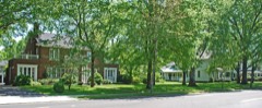 | Ocoee Street Historic District | 3.2 miles | 1995 |
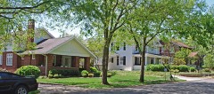 | Centenary Avenue Historic District | 3.5 miles | 1993 |
 | First Presbyterian Church | 3.7 miles | 1986 |
 | St. Luke's Episcopal Church | 3.8 miles | 1982 |
 | U.S. Post Office | 3.8 miles | 1983 |
 | Craigmiles Hall | 3.8 miles | 1980 |
| National Archives record | The nomination case file for reference 100004696 in Record Group 79. |
| Bradley County | All 25 listed properties in this county. |