Block
From the record
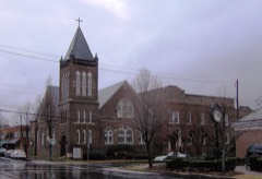
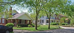
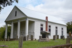
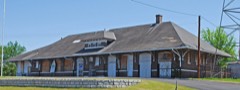
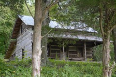
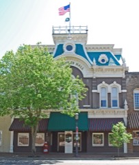
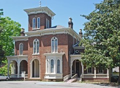
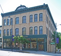
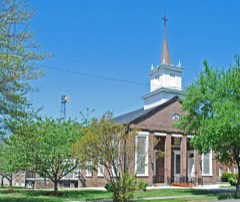
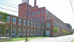
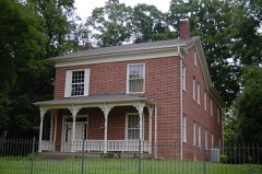
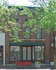
25 National Register listings published here.
Sources: the county history on the Internet Archive · the National Register database, National Park Service
77 topographic sheets cover 106 settlements here, and 25 properties are on the National Register of Historic Places.
25 National Register listings published here.
Sources: the county history on the Internet Archive · the National Register database, National Park Service
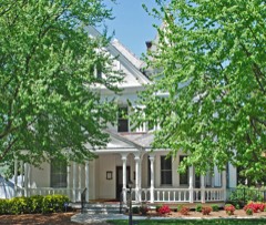
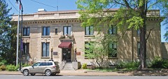
Every property in this county listed on the National Register of Historic Places, with the year it was listed and the federal nomination document.
Every wildfire the federal occurrence database records inside this county: 205 of them, burning about 1,323 acres. None started naturally and 29 were recorded as arson. Each settlement page carries the fires within five miles of it.
| Reported cause | Fires |
|---|---|
| Debris and open burning | 129 |
| Arson/incendiarism | 29 |
| Missing data/not specified/undetermined | 16 |
| Equipment and vehicle use | 9 |
| Power generation/transmission/distribution | 8 |
| Misuse of fire by a minor | 7 |
| Smoking | 4 |
| Recreation and ceremony | 3 |
The five largest, by the area the report gives. Two of them were set deliberately.
| Date | Cause | Size | Reported by | Name on the report |
|---|---|---|---|---|
| 29 January 2001 | Missing data/not specified/undetermined | 262 acres | Tennessee Division of Forestry | not named |
| 14 August 2002 | Arson/incendiarism | 152 acres | Tennessee Division of Forestry | not named |
| 26 February 2000 | Debris and open burning | 55 acres | Tennessee Division of Forestry | not named |
| 9 February 2009 | Debris and open burning | 40 acres | Tennessee Division of Forestry | WHITE OAK VALLEY |
| 30 March 2017 | Power generation/transmission/distribution | 38 acres | Tennessee Division of Forestry | OWL HOLLOW RD. |
| 22 January 2014 | Recreation and ceremony | 38 acres | Tennessee Division of Forestry | MOORE RD. FIRE |
| 11 November 2013 | Arson/incendiarism | 32 acres | Tennessee Division of Forestry | NO PONE FIRE |
| 8 February 2000 | Debris and open burning | 30 acres | Tennessee Division of Forestry | not named |
Every settlement page carries the fires within five miles of it - see the settlement index below.
The NOAA Storm Events Database holds 438 reports for this county, causing 14 deaths, 423 injuries and about $53,866,750 in recorded property damage. Each settlement page carries the reports that name it.
| Kind of event | Reports |
|---|---|
| Thunderstorm Wind | 269 |
| Hail | 111 |
| Tornado | 27 |
| Flash Flood | 16 |
| Flood | 13 |
| Lightning | 2 |
The most serious of them, by death, then injury, then recorded damage. The accounts are quoted exactly as the forecast office filed them.
| When | Event | Place named | Harm | What the report says |
|---|---|---|---|---|
| April 2011 | Tornado (EF4) | Pine Hill | 4 killed, 200 hurt, $23,000,000 | Ringgold-Apison Tornado. This tornado touched down in north Georgia and tracked northeast into Hamilton County, Tennessee, and then into Bradley County. In Bradley County, the max intensity still caused EF4 damage with the max wind extimated at 170 mph and did extensive damage to many homes and businesses. An additional 4 people were killed by the tornado in Bradley County in the Blue Springs Community. The fatalities included a 42 year old women from Wisconsin visiting her son in the Blue Springs community as well as the 3 month old boy in the same house she was trying to protect. In addition, a 40 year old women died in her home. Also, a 67 year old woman died in her home. |
| April 2011 | Tornado (EF2) | Cecilton | 4 killed, $500,000 | Cleveland-to-Etowah Tornado. A NWS storm survey reported this tornado formed south of Cleveland. The max wind of 130 mph downed many trees and caused EF2 damage to several homes. Four people died in the hardest-hit area. The fatalities included a 42 year old women as well as a 77 year old man both dying in their homes. In addition, a 34 year old women and a 56 year old women both died in their homes. The tornado continued to the east-northeast then tracked into Polk County. |
| April 1974 | Tornado (F3) | not stated | 2 killed, $250,000 | no account filed |
| April 1974 | Tornado (F3) | not stated | 1 killed, 100 hurt, $250,000 | no account filed |
| April 1998 | Tornado (F1) | Cleveland | 1 killed, $750,000 | no account filed |
| April 2011 | Tornado (EF1) | Mc Donald | 1 killed, $75,000 | Ooltewah-to-Cleveland Tornado. An EF1 tornado continued its path to the northeast from Hamilton county almost parallel to I-75 into western Bradley County. The tornado path showed a slight right bend at near 35.140N/84.993W, then continued to the northeast into the north side of Cleveland. The 90 mph wind downed numerous trees and slightly to moderately damaged several roofs throughout its path. A 56 year old man was killed due to flying debris and trees landing on the vehicle he was driving. |
| June 1999 | Lightning | Cleveland | 1 killed | no account filed |
| March 1997 | Tornado (F3) | Sw Of Cleveland | 50 hurt, $3,200,000 | no account filed |
| April 1965 | Tornado (F3) | not stated | 50 hurt, $2,500,000 | no account filed |
| March 2012 | Tornado (EF2) | Baugh Spg | 7 hurt, $3,840,000 | Harrison Tornado - Segment #2. The Harrison Tornado entered western Bradley County near the saddlepoint along a ridgeline named Mahan Gap. It roughly followed Harrison Pike ENE for about 4 miles, until the highway turned off to the south. The tornado continued into the northern parts of the city of Cleveland and then across the remainder of the county into Polk County. ||The tornado was near its strongest in the first mile or two into Bradley County where it downed vast swaths of trees along the highway. The maximum estimated winds were 130 MPH, making it a high EF2 at its peak. This area was very rugged with no houses near the county line.||Overall there were 46 houses that were damaged, included 5 destroyed, and 11 with major damage, as well as 41 other homes that were affected. Two businesses and three barns were destroyed. Overall monetary damages totaled $3.2 Million damage to homes, $640K to business, and $300K to Utilities, totaling to almost $4 Million. There were 7 injuries; all treated and released.||The last few miles in Bradley County the tornado weakened to EF1 and then to a minimal EF0 as it crossed the Hiwassee River into Polk County.||Note: this tornado had the following turns: slightly to the left at 35.2002/-84.8521 and sharper to the right (almost due east) at 35.2265/-84.8051, then continued to the county line. |
| April 2020 | Tornado (EF2) | Cleveland | 6 hurt | The storm from Hamilton County moved into Bradley County with a mesocyclone moving directly over downtown Cleveland. A tornado then formed quickly in Cleveland, less than a mile east northeast of downtown. A residential section was hit, comprising single family homes as well as mobile homes, with 26 destroyed, 23 receiving major damage, and 62 other dwellings affected. A church in this area was heavily damaged and hundreds of trees were either uprooted, or had large limbs snapped. The tornado then moved out of the city before occluding and dissipating in rural areas near Benton Pike east of downtown. |
| February 1986 | Tornado (F3) | not stated | 5 hurt, $2,500,000 | no account filed |
| March 1963 | Tornado (F2) | not stated | 3 hurt, $250,000 | no account filed |
| April 2011 | Tornado (EF2) | Etola | 1 hurt, $125,000 | The 5W Cleveland Tornado. A NWS storm survey reported an EF2 tornado developed west of Cleveland. It had a path width of 150 yards and a path length of 2 miles. The max wind 120 mph destroyed 3 mobile homes and other structures were damaged. One person was injured. |
| April 1985 | Thunderstorm Wind | not stated | 1 hurt | no account filed |
| May 2003 | Flash Flood | Countywide | $13,950,000 | Widespread flooding, road closures, damage, evacuations. |
| May 1998 | Tornado (F1) | Cleveland | $375,000 | no account filed |
| October 2010 | Tornado (EF1) | Charleston | $100,000 | An short lived EF-1 tornado with maximum wind speeds at 90 mph touched down and produced roof damage to a convenient store, knocked a gas pump over and downed two trees near highway 11. |
| April 2014 | Tornado (EF1) | Gap Spgs | $90,000 | An NWS Survey team determined an EF1 tornado touched down near Gap Springs with wind around 105 mph. It touched down 7 miles east-northeast of Cohutta Georgia and tracked into southern Bradley County, then lifted 7.5 east-northeast of Cohutta. The 100 yard wide track traveled along Hughes Lake Road SE where a home was shifted off its foundation. The path length was only 0.56 miles. No injuries or fatalities were reported. |
| April 2005 | Thunderstorm Wind | Cleveland | $86,000 | Bradley County EMA reported straight line wind damage across a 2 mile path in Cleveland. 13 structures were damaged. |
| May 2004 | Tornado (F1) | Weatherly Switch | $80,000 | no account filed |
| July 1999 | Thunderstorm Wind | Countywide | $70,000 | no account filed |
| June 2025 | Thunderstorm Wind | Cleveland | $50,000 | Several trees were blown down by severe thunderstorm wind gusts, blocking a local road. Elsewhere in Bradley County, numerous trees were felled, with multiple trees landing on both site built and manufactured housing, dealing various amounts of damage to structures. |
| April 2011 | Tornado (EF0) | Cleveland | $50,000 | W Cleveland Tornado. An NWS employee reported a EF1 tornado touched down near Cleveland. It had a 2 mile path length and a path width of 150 yards. The max wind of 80 mph downed trees and slightly damaged a few structures. This tornado brushed the Bradley County EMA office. |
| April 2005 | Flash Flood | Countywide | $50,000 | Numerous roads closed countywide. One small bridge washed out. |
| May 2001 | Thunderstorm Wind | Cleveland | $50,000 | Trees down on east side of county. A roof was reportedly blown off a house. |
| July 2006 | Thunderstorm Wind | South Cleveland | $50,000 | no account filed |
| July 2004 | Thunderstorm Wind | Cleveland | $50,000 | no account filed |
| April 2011 | Thunderstorm Wind | Cleveland | $30,000 | North Cleveland Tornado. Law enforcement personnel reported damage to apartments by thunderstorm wind on Crown Colony Drive in Cleveland. |
| June 2006 | Thunderstorm Wind | Cleveland | $30,000 | Several trees and powerlines down countywide. Several homes in Cleveland sustained roof damage. |
| July 2006 | Thunderstorm Wind | Countywide | $30,000 | no account filed |
| September 2006 | Thunderstorm Wind | Cleveland | $30,000 | no account filed |
| July 2005 | Thunderstorm Wind | Cleveland | $30,000 | no account filed |
| April 2011 | Thunderstorm Wind | Cleveland | $25,000 | Law enforcement personnel reported numerous trees and powerlines downed by thunderstorm wind in Cleveland and northeast portions of the county. |
| August 2009 | Thunderstorm Wind | Cleveland | $25,000 | Law enforcement personnel reported numerous trees...traffic lights and powerlines downed by thunderstorm winds across the northern half of the county. |
| July 2005 | Thunderstorm Wind | Countywide | $25,000 | no account filed |
| May 2004 | Thunderstorm Wind | Countywide | $25,000 | no account filed |
| July 2002 | Thunderstorm Wind | Charleston | $25,000 | no account filed |
| July 1997 | Thunderstorm Wind | Countywide | $25,000 | no account filed |
| November 1989 | Tornado (F1) | not stated | $25,000 | no account filed |
| April 1980 | Tornado (F1) | not stated | $25,000 | no account filed |
| July 2005 | Thunderstorm Wind | Charleston | $24,000 | no account filed |
| June 2014 | Thunderstorm Wind | Cleveland | $20,000 | Law enforcement personnel reported many trees and powerlines downed by thunderstorms wind across the county. |
| April 2011 | Tornado (EF0) | Cleveland | $20,000 | Northeast Cleveland Tornado. A NWS storm survey reported an EF0 tornado touched down just northeast of Cleveland. It had a path width of 50 yards and path length of around 1 mile. The 80 mph wind downed numerous trees. |
| October 2010 | Thunderstorm Wind | Cleveland | $20,000 | Law enforcement personnel reported numerous trees and traffic lights downed by thunderstorm wind across 7 area roads in and around Cleveland. Amateur radio personnel reported a 51 knot wind near Interstate 75 in Cleveland. |
| August 2010 | Thunderstorm Wind | Cleveland | $20,000 | Law enforcement personnel reported numerous trees and powerlines downed by thunderstorm winds countywide. |
| June 2010 | Thunderstorm Wind | Cleveland | $20,000 | Law enforcement personnel reported numerous trees and powerlines downed by thunderstorm winds countywide. |
| October 2009 | Thunderstorm Wind | Cleveland | $20,000 | Law enforcement officials reported several trees and powerlines downed by thunderstorm winds countywide. Numerous power outages. |
| April 2009 | Thunderstorm Wind | Cleveland | $20,000 | A trained spotter reported several trees downed by thunderstorm winds in the Cleveland area. A few homes sustained minor wind damage. |
| April 2006 | Thunderstorm Wind | Cleveland | $20,000 | Siding and roof blown off a house in the northwest portion of the county. |
| July 2002 | Thunderstorm Wind | Cleveland | $20,000 | Trees and powerlines down at Hanna and Harrison Pike. Trees down on a mobile home. |
| May 2006 | Thunderstorm Wind | Cleveland | $20,000 | no account filed |
| May 2006 | Thunderstorm Wind | East Cleveland | $20,000 | no account filed |
| March 2005 | Thunderstorm Wind | Mc Donald | $20,000 | no account filed |
| July 2005 | Thunderstorm Wind | Hopewell | $20,000 | no account filed |
| July 2004 | Thunderstorm Wind | Cleveland | $20,000 | no account filed |
| July 2004 | Thunderstorm Wind | Cleveland | $20,000 | no account filed |
| August 2004 | Tornado (F0) | Cleveland | $20,000 | no account filed |
| June 2003 | Thunderstorm Wind | Countywide | $20,000 | no account filed |
| November 2002 | Thunderstorm Wind | Countywide | $20,000 | no account filed |
The Survey's mineral resources record lists 37 workings inside this county. 4 still produce and 33 are closed or unrecorded. Each settlement page carries the workings within five miles of it.
| Commodity | Workings |
|---|---|
| Manganese | 18 |
| Barium-Barite | 3 |
| Stone, Crushed/Broken | 3 |
| Stone, Crushed/Broken, Limestone, General | 2 |
| Lead | 2 |
| Iron, Zinc, Barium-Barite | 1 |
| Lead, Zinc | 1 |
| Iron, Barium-Barite | 1 |
| Cobalt, Nickel | 1 |
| Zinc, Lead | 1 |
| Zinc, Lead, Iron, Barium-Barite | 1 |
| Clay | 1 |
| Barium-Barite, Iron, Lead, Zinc | 1 |
| Iron, Manganese, Cobalt | 1 |
The least common of them first, because a county's hundredth gravel pit says nothing its first ten did not.
| Where | Site | Commodity | Status | Recorded |
|---|---|---|---|---|
| Black Fox Quarry | Diatomite | Past Producer | ||
| Hambright Lead Mine | Lead, Iron, Zinc, Barium-Barite | Past Producer | 1851 | |
| Hambright Lead Mine | Barium-Barite, Iron, Lead, Zinc | Prospect | ||
| Hambright Mine | Silica, Iron, Manganese, Aluminum, Phosphorus-Phosphates | Past Producer | 1919 | |
| Hardwick Lead Mine | Lead, Zinc, Iron, Barium-Barite | Past Producer | 1892 | |
| Hardwick Lead Mine | Zinc, Lead | Past Producer | ||
| Hardwick Lead Mine | Zinc, Lead, Iron, Barium-Barite | Prospect | ||
| King Prospect | Clay | Prospect | ||
| Lord Mine | Iron, Manganese | Past Producer | ||
| White Oak Mountain | Cobalt, Nickel | Occurrence | Lithiophorite | |
| White Oak Mountain Mine | Iron, Manganese, Cobalt | Past Producer | ||
| Bradley County Highway Department Quarry | Stone, Crushed/Broken, Limestone, General | Producer | Limestone | |
| Bradley Limestone Quarry | Stone, Crushed/Broken, Limestone, General | Producer | Limestone | |
| Hambright Lead Mine | Lead | Past Producer | Galena | |
| Bradley County Highway Dept. Quarry | Stone, Crushed/Broken | Producer | ||
| Bradley Limestone Quarry | Stone, Crushed/Broken | Producer | ||
| Griffen Barite Mine | Barium-Barite | Past Producer | 1898 | |
| Griffen Barite Mine | Barium-Barite | Past Producer | ||
| Griffin Barite Mine | Barium-Barite | Past Producer | Residual | |
| Welch Quarry | Stone, Crushed/Broken | Past Producer | ||
| Brown Prospect | Manganese | Occurrence | ||
| D.A.M. Mine | Manganese | Past Producer | Residual | |
| D.A.M. Mine | Manganese | Past Producer | 1918 | |
| Gee Prospect | Manganese | Prospect | ||
| Hambright Mine/Lord Mine | Manganese | Past Producer | Residual | |
| Hannah Prospect | Manganese | Prospect | ||
| Home Cantrell Property | Manganese | Occurrence | ||
| J.N. Havens Property | Manganese | Occurrence | ||
| King Prospect | Manganese | Prospect | ||
| M.V. Jones Prospect | Manganese | Prospect | ||
| Sloan Prospect | Manganese | Prospect | ||
| Smallwood Prospect | Manganese | Prospect | 1951 | |
| Snyder Prospect | Manganese | Prospect | ||
| Underwood Mine | Manganese | Past Producer | Residual | |
| Underwood Mine | Manganese | Prospect | 1918 | |
| White Oak Mt. Mine | Manganese | Past Producer | Residual | |
| Wolf Prospect | Manganese | Occurrence |
One book written about this county, cut here where the book itself is cut, at its printed chapters: 15 chapters in all. Every chapter is public domain, machine-read from the scan and reproduced complete. A chapter already given under one of the county's towns is not repeated in this list.
| Chapter | Length |
|---|---|
| Chapter with an unread heading (no. 1 of those read) | 3,612 words |
| Chapter 2: Pretensiojfs of the Rebels to Divine Favor | 2,988 words |
| Chapter 3: Election for Convention and No Convention | 5,448 words |
| Chapter 4: Election for Separation and No Separation | 12,264 words |
| Chapter 8: Captain ^vm. L. Brown and the Fifth District Election | 4,385 words |
| Chapter 9: Union People of Bradley Robbed of Their Private Arms | 3,099 words |
| Chapter 10: Money Extorted from Union People, Under the Pretence of Providing for the Families of Rebel Soldiers | 20,243 words in 2 parts |
| Chapter 15: Case of Mr. William Humbert | 2,750 words |
| Chapter 16: Case of Lawyer A. J. Trewhitt | 4,743 words |
| Chapter 17: Trials and Death of S. D. Richmond | 1,916 words |
| Yiii | 11,761 words |
| Chapter 21: William Low | 4,110 words |
| Chapter 22: Murder of Fantroy A. Carter | 7,049 words |
| Chapter 24: Artificial Caves | 1,958 words |
| Chapter 25: Mr. Amos Potts | 22,958 words in 2 parts |
Named settlements recorded in the Geographic Names Information System, each with the topographic sheets covering it. Villages, hamlets and abandoned places alike. Each is shown with the nearest named watercourse or landform and the survey quadrangle it falls on.
District 4 · 37323 · On Five Mile Branch · East Cleveland quadrangle
21 sheets, 1886 to 1981
District 7 · 37311 · On Beech Springs Branch · South Cleveland quadrangle
23 sheets, 1886 to 1981
District 2 · 37312 · Near Dry Valley · East Cleveland quadrangle
21 sheets, 1886 to 1981
District 1 · 37353 · On North Fork Harris Creek · South Cleveland quadrangle
23 sheets, 1886 to 1981
District 1 · 37312 · Near Rollins Ridge · South Cleveland quadrangle
23 sheets, 1886 to 1981
District 1 · 37312 · On Bigsby Creek · South Cleveland quadrangle
23 sheets, 1886 to 1981
District 6 · 37311 · On Blue Springs Ridge · McDonald quadrangle
22 sheets, 1886 to 1981
District 5 · 37311 · Near Candies Creek Ridge · South Cleveland quadrangle
23 sheets, 1886 to 1981
District 7 · 37312 · On Fillauer Branch · East Cleveland quadrangle
21 sheets, 1886 to 1981
District 6 · 37323 · Near Blackburn Ridges · Felker quadrangle
22 sheets, 1886 to 1981
District 1 · 37312 · On Bigsby Creek · South Cleveland quadrangle
23 sheets, 1886 to 1981
District 7 · 37312 · On Lick Branch · South Cleveland quadrangle
23 sheets, 1886 to 1981
District 5 · 37323 · Near Blue Springs Valley · McDonald quadrangle
22 sheets, 1886 to 1981
District 1 · 37312 · On Greasy Creek · South Cleveland quadrangle
23 sheets, 1886 to 1981
District 1 · 37312 · Near Rabbit Valley · South Cleveland quadrangle
23 sheets, 1886 to 1981
District 5 · 37323 · Near Blue Springs Valley · McDonald quadrangle
22 sheets, 1886 to 1981
District 4 · 37323 · On Five Mile Branch · East Cleveland quadrangle
21 sheets, 1886 to 1981
District 3 · 37323 · Near Beeler Ridge · East Cleveland quadrangle
21 sheets, 1886 to 1981
District 1 · 37312 · Near Vines Hollow · South Cleveland quadrangle
23 sheets, 1886 to 1981
District 4 · 37323 · On Five Mile Branch · East Cleveland quadrangle
21 sheets, 1886 to 1981
District 2 · 37312 · On Riggins Branch · East Cleveland quadrangle
21 sheets, 1886 to 1981
District 1 · 37312 · On Bigsby Creek · South Cleveland quadrangle
23 sheets, 1886 to 1981
District 1 · 37312 · On Greasy Creek · South Cleveland quadrangle
23 sheets, 1886 to 1981
District 2 · 37312 · On Fillauer Branch · East Cleveland quadrangle
21 sheets, 1886 to 1981
District 7 · 37311 · On Beech Springs Branch · South Cleveland quadrangle
23 sheets, 1886 to 1981
District 7 · 37311 · On Beech Springs Branch · South Cleveland quadrangle
23 sheets, 1886 to 1981
District 7 · 37311 · On Beech Springs Branch · South Cleveland quadrangle
23 sheets, 1886 to 1981
District 1 · 37312 · On Bigsby Creek · South Cleveland quadrangle
23 sheets, 1886 to 1981
District 2 · 37312 · On Riggins Branch · East Cleveland quadrangle
21 sheets, 1886 to 1981
District 2 · 37310 · Near Ledford Island · Charleston quadrangle
23 sheets, 1886 to 1981
District 1 · 37312 · Near Mount Zion Ridge · Birchwood quadrangle
20 sheets, 1886 to 1981
District 2 · 37310 · On Little South Mouse Creek · Charleston quadrangle
23 sheets, 1886 to 1981
District 5 · 37323 · Near Blue Springs Valley · Felker quadrangle
22 sheets, 1886 to 1981
District 1 · 37312 · On Lick Branch · South Cleveland quadrangle
23 sheets, 1886 to 1981
District 4 · 37323 · Near Million Hill · Felker quadrangle
22 sheets, 1886 to 1981
District 1 · 37312 · On Greasy Creek · South Cleveland quadrangle
23 sheets, 1886 to 1981
District 3 · 37323 · Near Dry Valley · East Cleveland quadrangle
21 sheets, 1886 to 1981
District 2 · 37310 · Near Coon Denton Island · Calhoun quadrangle
23 sheets, 1886 to 1981
District 4 · 37323 · Near Dry Valley · East Cleveland quadrangle
21 sheets, 1886 to 1981
District 1 · 37312 · On Lick Branch · South Cleveland quadrangle
23 sheets, 1886 to 1981
District 2 · 37312 · On Fillauer Branch · East Cleveland quadrangle
21 sheets, 1886 to 1981
District 2 · 37312 · On Greasy Creek · East Cleveland quadrangle
21 sheets, 1886 to 1981
District 1 · 37312 · On Lick Branch · South Cleveland quadrangle
23 sheets, 1886 to 1981
District 2 · 37312 · Near Dry Valley · East Cleveland quadrangle
21 sheets, 1886 to 1981
District 5 · 37323 · Near Blue Springs Valley · McDonald quadrangle
22 sheets, 1886 to 1981
District 6 · 37311 · On Johnson Branch · South Cleveland quadrangle
23 sheets, 1886 to 1981
District 7 · 37312 · On Lick Branch · South Cleveland quadrangle
23 sheets, 1886 to 1981
District 1 · 37312 · On Greasy Creek · South Cleveland quadrangle
23 sheets, 1886 to 1981
District 2 · 37312 · Near Dry Valley · East Cleveland quadrangle
21 sheets, 1886 to 1981
District 6 · 37323 · Near Hickory Top · Felker quadrangle
22 sheets, 1886 to 1981
The vanished settlements of Bradley County: the places named above that are no longer on the map.