 Block
From the record
One of 38 National Register listings published here for Sumner County · listed in 2021 · category: District.
Sources: the National Register database, National Park Service
Listed on the National Register of Historic Places in 2021.
One of 38 National Register listings published here for Sumner County · listed in 2021 · category: District.
Sources: the National Register database, National Park Service
Regional context, not property-specific evidence. The federal wildfire occurrence database lists 14 fires within 5 miles of Parker's Chapel Missionary Baptist Church and Cemetery between 1997 and 2009, burning about 58 acres in total. None started naturally. 1 was recorded as arson. Distance is straight-line from the map coordinates, so a fire counted here may appear on a neighbouring settlement's page as well.
| Reported cause | Fires |
|---|---|
| Debris and open burning | 12 |
| Arson/incendiarism | 1 |
| Misuse of fire by a minor | 1 |
The most recent of them, most recent first, with the day each was reported and the service that recorded it.
| Date | Cause | Size | Reported by | Name on the report |
|---|---|---|---|---|
| 10 September 1999 | Debris and open burning | 1.0 acres | Tennessee Division of Forestry | not named |
| 1 August 2007 | Debris and open burning | 1.0 acres | Tennessee Division of Forestry | PORTLAND FIRE |
| 7 March 2001 | Debris and open burning | 3.0 acres | Tennessee Division of Forestry | not named |
| 6 March 2006 | Debris and open burning | 1.0 acres | Tennessee Division of Forestry | not named |
| 21 March 1999 | Debris and open burning | 22 acres | Tennessee Division of Forestry | not named |
| 20 March 2009 | Debris and open burning | 5.0 acres | Tennessee Division of Forestry | DOBBINS FIRE |
| 8 February 1997 | Debris and open burning | 4.0 acres | Tennessee Division of Forestry | not named |
| 2 November 2005 | Debris and open burning | 7.0 acres | Tennessee Division of Forestry | not named |
Regional context, not property-specific evidence. The National Weather Service names Portland, the town this property stands in, in 73 storm reports between 1993 and 2025: 37 thunderstorm wind, 21 hail, 6 flash flood, 4 lightning. The reports record 6 injuries. Each account below is quoted exactly as the forecast office filed it, from the NOAA Storm Events Database, and each date opens the federal record of that event.
| When | Event | Place named | Harm | What the report says |
|---|---|---|---|---|
| November 2002 | Tornado (F2) | Portland | 6 hurt, $500,000 | One person was hospitalized due to injuries from the tornado. The other 5 people were treated and released for their injuries. 7 homes were destroyed, 15 homes had major damage and 14 had minor damage. 5 mobile homes were destroyed, 3 with major damage and 2 with minor damage. One business was destroyed and 3 other businesses were damaged. Several goats and cattle were killed. The heaviest damage was at 404 Glen Have Rd. 2 mobile homes were destroyed and blown off their foundation. 18 outbuildings, 16 barns and 2 churches were damaged.A Chrysler Cirrus LX sedan was flipped and pushed 20 feet. A Ford Ranger truck flipped and rolled 90 feet. A 6 inch by 6 inch board was hurled through the roof of a modular home. Kirby Building Services located at 124 Kirby Road in the industrial park area, sustained 50 percent damage according to the Portland Fire Dept. |
| November 2013 | Tornado (EF0) | Portland | $200,000 | An NWS Storm Survey Team concluded an EF-0 tornado touched down on the northwest side of Portland, tearing the roof off of a Fire Hall Building. The tornado, with maximum winds of 70 mph, also did minor damage to a church. Several trees were also snapped along the path of the tornado. |
| September 1999 | Lightning | Portland | $40,000 | Lightning struck the upper floor of a house and set it on fire. One of the rooms sustained heavy damage. Firemen were on the scene for about 31/2 hours. The house suffered considerable smoke and water damage. |
| July 2022 | Thunderstorm Wind | Portland | $25,000 | Twitter reports and photos showed significant damage occurred to the Portland High School baseball field, with a dugout destroyed, outfield fence blow down, and roof damage to the indoor facility. Other wind damage occurred on Cora Street, College Street, and Lyon Drive. |
| May 2015 | Thunderstorm Wind | Portland | $20,000 | An NWS storm survey found a microburst caused wind damage over a 2 mile long by 1 mile wide area just west and north of downtown Portland. Numerous trees, power lines, and a few power poles were blown down in this area, with one tree falling on a house on Morningside Drive and a power pole falling on a car on College Street. A tree also fell and blocked the intersection of North Russell Street and Kirby Drive. The roof of the dugout at a baseball field at Portland High School was blown off, and a carport roof was blown down at Portland Builders Supply. Winds were estimated up to 75 mph. |
| August 2005 | Thunderstorm Wind | Portland | $20,000 | Newspaper article said that strong thunderstorm winds destroyed a 40-foot by 80-foot city maintenance building just off Highway 109. Several treees were blown down in the Portland area. |
| August 1997 | Lightning | Portland | $20,000 | Lightning struck a chimney on a house and sent rocks, weighing as much as 50 pounds, 50-75 feet into the yard. The lightning burnt up his television antenna, twisted several feet of gutters, and knocked out 2 or 3 television sets inside his house . |
| March 2017 | Thunderstorm Wind | Portland | $15,000 | A NWS storm survey found an approximately 6.5 mile long by one quarter mile wide swath of wind damage stretching from just west of downtown Portland eastward around 6 miles to just east of Parker Road. Large tree limbs were blown down on McGlothin Street, and power poles were reportedly snapped on Highway 109 according to emergency management. The metal roof was blown off a church at Market and Russell Streets, and sheet metal roofing was blown off an outbuilding on Old Westmoreland Road. A large tree snapped and fell on a home at 633 Highway 52. Farther to the east, a large pine tree was also snapped on Jaska Ann Circle, and a carport was blown over on Staggs Drive. Winds were estimated up to 65 mph. |
| May 2012 | Thunderstorm Wind | Portland | $10,000 | Several trees were blown down on North Russell Street in Portland. |
| July 2012 | Thunderstorm Wind | Portland | $10,000 | Two industrial buildings were damaged along Fred White Drive. Details concerning extent of damage to these buildings were unknown. |
| July 2004 | Thunderstorm Wind | Portland | $10,000 | Several homes and businesses in Portland suffered damaged roofs. One metal roof was blown off of Martin Realty and Auction on Main Street. The roof peeled off and was hurled across the street. |
| May 2024 | Thunderstorm Wind | Portland | $5,000 | A large tree was reported down in north Portland, causing power outages in the area. Saturated grounds likely contributed to the tree falling. Damages are a rough estimate. |
| June 2018 | Thunderstorm Wind | Portland | $5,000 | Sumner County 911 reported several trees and power lines down in northern Sumner County, especially around the Portland area. |
| July 2016 | Thunderstorm Wind | Portland | $5,000 | Several trees and tree limbs were blown down in the Portland area with some roadways blocked. |
| August 2012 | Thunderstorm Wind | Portland | $5,000 | A tree fell on a house on Main Street in Portland. |
| May 2011 | Thunderstorm Wind | Portland | $5,000 | Trees were downed on power lines in Portland. Specific details concerning if the trees falling on the power lines caused any damage were unknown. |
| July 2008 | Thunderstorm Wind | Portland | $5,000 | A large tree limb fell on a house. The house was not severely damaged. |
| August 1999 | Thunderstorm Wind | Portland | $5,000 | Newspaper article stated that part of a roof was blown off the Panther Den restaurant. |
| June 2019 | Thunderstorm Wind | Portland | $3,000 | Trees down on power lines on Old Westmoreland Road in Portland. |
| June 2018 | Thunderstorm Wind | Portland | $3,000 | A Facebook video showed trees and power lines blown down in the Scattersville Road area. |
| July 2016 | Thunderstorm Wind | Portland | $3,000 | A tree was blown down onto a car just off Main Street in Portland. |
| February 2014 | Thunderstorm Wind | Portland | $3,000 | The public reported via Facebook that a tree was uprooted onto a house in Portland. |
| June 2016 | Thunderstorm Wind | Portland | $2,000 | Tree was blown down on a house in Portland. |
| August 2014 | Thunderstorm Wind | Portland | $2,000 | Trees were reportedly blown down in Portland. |
| March 2006 | Thunderstorm Wind | Portland | $2,000 | Strong winds completed demolished 120 foot long greenhouse. |
| August 2005 | Flash Flood | Portland | $2,000 | Outer fringe bands of rain from Hurricane Katrina was moving across Middle Tennessee. The hurricane had already made landfall just east of New Orleans earlier in the morning. The rushing waters of a flooded creek in Portland washed out a concrete retaining wall meant to keep the nearby creek at bay. The property of Shirley Schnoes was flooded with 2 feet deep water in her crawlspace under the house located at Hunter's Crossings. Radar estimates placed the rainfall at about 4 inches around Portland. |
| June 2025 | Thunderstorm Wind | Portland | $1,000 | Severe thunderstorm winds downed a tree on Gibson Street in Portland. Damages are a rough estimate. |
| June 2022 | Thunderstorm Wind | Portland | $1,000 | A tree was blown down in Portland. |
| November 2017 | Thunderstorm Wind | Portland | $1,000 | A tSpotter Twitter report indicated a Bradford Pear tree was snapped on the north side of Portland. |
| February 2011 | Lightning | Portland | $1,000 | House located on Butt Road in North Central Sumner County was struck by lightning around 430 am. Details concerning any structural damage and associated cost were unknown. |
| May 1996 | Thunderstorm Wind | Portland | $500 | no account filed |
| June 2003 | Lightning | Portland | $100 | Lightning caused a natural gas service line to rupture on Corinth Rd. 8 people had to be evacuated from their homes as a precaution. One home owner was able to put out the fire with a boat fire extinguisher. |
| June 1994 | Hail | Portland | $50 | no account filed |
| April 2025 | Hail | Portland | - | Estimated golf ball size hail was reported from a severe thunderstorm in Portland. |
| May 2024 | Hail | Portland | - | Estimated half dollar size hail was reported in Portland from a severe thunderstorm. |
| July 2023 | Flash Flood | Portland | - | Heavy rain flooded a parking lot east of North Broadway Street in Portland, causing one truck to stall. |
| July 2022 | Hail | Portland | - | Twitter report of estimated penny size hail. |
| March 2021 | Hail | Portland | - | TSpotter report of 1.5 hail in Portland. |
| December 2019 | Flash Flood | Portland | - | Several roads were closed due to flooding in and around Portland, including Highway 109, Highway 52, and Jackson Road. |
| April 2017 | Hail | Portland | - | Photos showed hail up to nickel size in Portland. |
| May 2011 | Funnel Cloud | Portland | - | A funnel cloud was reported just east of Portland by EMS personnel. |
| March 2009 | Hail | Portland | - | Penny size hail was reported in Portland. |
| July 2008 | Hail | Portland | - | Hail reported at the intersection of Highway 259 and North Russell St. |
| April 2006 | Thunderstorm Wind | Portland | - | A 26 by 28 feet barn was destroyed on Highway 109 north. |
| July 2004 | Hail | Portland | - | Off duty NWS employee reported quarter size hail. |
| August 2003 | Hail | Portland | - | Quarter size hail was observed. |
| May 2003 | Thunderstorm Wind | Portland | - | Law enforcement reported several trees were blown down. |
| May 2003 | Hail | Portland | - | Penny size hail was observed. |
| July 2003 | Flash Flood | Portland | - | Several roads were impassable with 6 to 8 inches of water. Water was up to, but not inside homes in the Northview Subdivision off Highway 109...1 mile south of U.S. Highway 31W. |
| July 2003 | Thunderstorm Wind | Portland | - | Newspaper story about strong thunderstorm winds causing extensive roof damage to the old Sunbeam building where Collins Construction is now located. Four homes had minor damage. |
| August 2003 | Thunderstorm Wind | Portland | - | Trees were blown down between Portland and Gallatin. There were trees down on Boiling Springs Road and Brandy Hollow Road. Some of these trees brought down power lines. |
| July 2002 | Thunderstorm Wind | Portland | - | NWS employee reported a tree was down on Spring Valley Dr. |
| May 2001 | Hail | Portland | - | Spotter reported dime size hail. |
| June 2001 | Thunderstorm Wind | Portland | - | Newspaper article mentioned uprooted trees, including a 40 foot locust tree that was uprooted on Clearview Road, and also some shingles blown off homes from U.S. Highway 31-W to Clearview Rd. |
| April 1999 | Hail | Portland | - | Spotter reported dime size hail. |
| February 1999 | Thunderstorm Wind | Portland | - | EMA reported structural damage to a building. |
| April 1998 | Hail | Portland | - | County sheriff reported nickel size hail. |
| April 1998 | Hail | Portland | - | Sheriff reported dime size hail. |
| June 1998 | Flash Flood | Portland | - | Roads were under water at Portland. Also, there were scattered reports of flooding in the northwest part of the county. |
| May 1998 | Thunderstorm Wind | Portland | - | Local law enforcement reported several trees and power lines down. |
No historic map-sheet match is published for this property yet. That does not mean no map exists. This record needs a coordinate-quality review before it can be joined to a sheet boundary. Browse the county's mapped places while that work is pending.
Other National Register properties close enough to walk or drive between, ordered by distance from this one. Both positions come from the same geocoding pass that matched these properties to their map sheets.
| Photograph | Property | Distance | Listed |
|---|---|---|---|
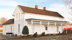 | Moye Boarding House | 1.9 miles | 2013 |
| Scattersville Public School | 4.9 miles | 2024 |
| National Archives record | The nomination case file for reference 100007121 in Record Group 79. |
| Sumner County | All 38 listed properties in this county. |