 Block
From the record
One of 10 National Register listings published here for Dyer County · listed in 2025 · category: Building.
Sources: the National Register database, National Park Service
Listed on the National Register of Historic Places in 2025.
One of 10 National Register listings published here for Dyer County · listed in 2025 · category: Building.
Sources: the National Register database, National Park Service
Regional context, not property-specific evidence. The federal wildfire occurrence database lists 57 fires within 5 miles of Cole-Boston House between 1997 and 2019, burning about 253 acres in total. 2 started naturally. 7 were recorded as arson. Distance is straight-line from the map coordinates, so a fire counted here may appear on a neighbouring settlement's page as well.
| Reported cause | Fires |
|---|---|
| Debris and open burning | 30 |
| Equipment and vehicle use | 8 |
| Arson/incendiarism | 7 |
| Missing data/not specified/undetermined | 4 |
| Power generation/transmission/distribution | 3 |
| Natural | 2 |
| Railroad operations and maintenance | 2 |
| Misuse of fire by a minor | 1 |
The most recent of them, most recent first, with the day each was reported and the service that recorded it.
| Date | Cause | Size | Reported by | Name on the report |
|---|---|---|---|---|
| 5 September 1999 | Debris and open burning | 1.0 acres | Tennessee Division of Forestry | not named |
| 4 September 2010 | Debris and open burning | 10 acres | Tennessee Division of Forestry | DESPAIN FIRE |
| 4 September 2007 | Power generation/transmission/distribution | 12 acres | Tennessee Division of Forestry | RING OF FIRE |
| 25 September 2008 | Debris and open burning | 4.0 acres | Tennessee Division of Forestry | not named |
| 24 September 1999 | Debris and open burning | 1.0 acres | Tennessee Division of Forestry | not named |
| 18 September 1999 | Debris and open burning | 11 acres | Tennessee Division of Forestry | not named |
| 17 September 2013 | Arson/incendiarism | under an acre | Tennessee Division of Forestry | MAUPIN BARN |
| 3 August 2012 | Natural | 2.0 acres | Tennessee Division of Forestry | MAUPIN ROAD |
Regional context, not property-specific evidence. The National Weather Service names Newbern, the town this property stands in, in 24 storm reports between 1995 and 2024: 12 thunderstorm wind, 6 hail, 4 tornado, 1 flash flood. The reports record 17 deaths and 71 injuries. Each account below is quoted exactly as the forecast office filed it, from the NOAA Storm Events Database, and each date opens the federal record of that event.
| When | Event | Place named | Harm | What the report says |
|---|---|---|---|---|
| April 2006 | Tornado (F3) | Newbern | 16 killed, 70 hurt, $20,000,000 | A tornado spawned from the same parent supercell that produced damaging tornadoes west of the Mississippi River moved across Dyer County during the evening of April 2nd. The most affected areas were Millsfield, Maxey, and Newbern. The F3 tornado resulted in sixteen fatalities and 70 injuries. Seventy-one homes were destroyed and one hundred eighty-two were damaged. |
| May 2006 | Lightning | Newbern | 1 killed, 1 hurt, $10 | A 37 year old man was killed when lightning struck a tree he was using for a shelter at the Oakview Links Golf Course. A 33 year old man was injured in the same strike and was transported to a hospital in Memphis. |
| December 2021 | Tornado (EF2) | Newbern | $650,000 | The first observed damage was in Newbern, Tennesee near Washington Street. A convenience store was heavily damaged. Several outbuildings were damaged in Newbern. The elementary school and an auto shop suffered roof damage. The tornado moved northeast, uprooting and snapping numerous trees along its path, and then moved into Gibson County. Peak winds were estimated at 135 mph in Dyer County. |
| April 1996 | Thunderstorm Wind (F0) | Newbern | $200,000 | no account filed |
| May 2003 | Tornado (F1) | Newbern | $25,000 | The tornado touched down just south of Newbern and traveled northeast. Several homes had their roofs blown off. Numerous trees and power lines were knocked down. |
| February 2018 | Thunderstorm Wind | Newbern | $20,000 | Multiple trees down on highway between New Bern and Trimble. |
| November 1995 | Thunderstorm Wind | Newbern | $20,000 | A canopy was torn off a car wash. A Sheriff's deputy car was blown into a ditch. Many highway signs were blown down. |
| August 2024 | Thunderstorm Wind | Newbern | $10,000 | A large tree was blown on to a vehicle in Newbern. |
| July 1997 | Thunderstorm Wind | Newbern | $10,000 | A recently contstructed dugout at the Dyer County High School's baseball field that was destroyed by a tornado on March 1 was damaged. The roof to the school gymnasium was damaged. Several trees were also knocked down. |
| May 2006 | Hail | Newbern | $5,000 | no account filed |
| November 2007 | Thunderstorm Wind | Newbern | $2,000 | Straight line winds blew down trees in Newbern. |
| July 1995 | Thunderstorm Wind | Newbern | $2,000 | A telephone pole was knocked down. |
| April 2003 | Thunderstorm Wind | Newbern | $1,000 | A couple of trees were knocked down. |
| June 1998 | Thunderstorm Wind | Newbern | $1,000 | Several large tree limbs were blown down. |
| July 1996 | Flash Flood | Newbern | $1,000 | no account filed |
| July 1995 | Hail | Newbern | $500 | no account filed |
| May 2003 | Hail | Newbern | $250 | no account filed |
| April 1998 | Hail | Newbern | $150 | no account filed |
| August 2005 | Hail | Newbern | $50 | no account filed |
| May 2020 | Thunderstorm Wind | Newbern | - | Large tree limbs were snapped in Newbern and a church steeple blown off. |
| July 2017 | Tornado (EF0) | Newbern | - | Video confirmation of a brief tornado near the community of Newbern. No damage was reported. Rated an EF-0 with wind speeds of 65 kts. |
| May 2011 | Thunderstorm Wind | Newbern | - | Straight line winds caused minor damage to the roofs of several homes in Newbern. |
| August 2009 | Thunderstorm Wind | Newbern | - | Straight line winds blew trees down in Newbern. |
| March 2017 | Hail | Newbern | - | no account filed |
No historic map-sheet match is published for this property yet. That does not mean no map exists. This record needs a coordinate-quality review before it can be joined to a sheet boundary. Browse the county's mapped places while that work is pending.
Other National Register properties close enough to walk or drive between, ordered by distance from this one. Both positions come from the same geocoding pass that matched these properties to their map sheets.
| Photograph | Property | Distance | Listed |
|---|---|---|---|
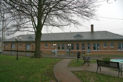 | Newbern Illinois Central Depot | 1.4 miles | 1993 |
| National Archives record | The nomination case file for reference 100012392 in Record Group 79. |
| Dyer County | All 10 listed properties in this county. |