 Block
From the record
One of 204 National Register listings published here for Davidson County · listed in 1976 · category: Building.
Sources: the National Register database, National Park Service · the Wikipedia article
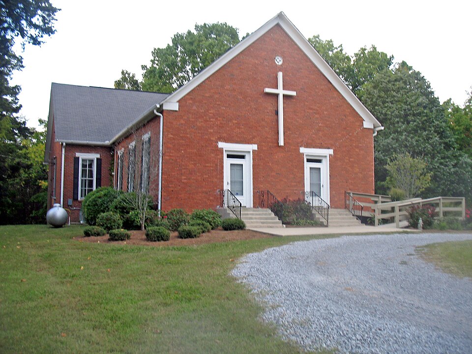
Listed on the National Register of Historic Places in 1976.
One of 204 National Register listings published here for Davidson County · listed in 1976 · category: Building.
Sources: the National Register database, National Park Service · the Wikipedia article
Regional context, not property-specific evidence. The federal wildfire occurrence database lists 5 fires within 5 miles of Cane Ridge Cumberland Presbyterian Church between 1998 and 2001, burning about 17 acres in total. None started naturally. 3 were recorded as arson. Distance is straight-line from the map coordinates, so a fire counted here may appear on a neighbouring settlement's page as well.
| Reported cause | Fires |
|---|---|
| Arson/incendiarism | 3 |
| Debris and open burning | 1 |
| Smoking | 1 |
The most recent of them, most recent first, with the day each was reported and the service that recorded it.
| Date | Cause | Size | Reported by | Name on the report |
|---|---|---|---|---|
| 26 September 1998 | Smoking | 3.0 acres | Tennessee Division of Forestry | not named |
| 3 August 1998 | Debris and open burning | 5.3 acres | Tennessee Division of Forestry | not named |
| 6 November 2001 | Arson/incendiarism | 8.0 acres | Tennessee Division of Forestry | not named |
| 29 November 2000 | Arson/incendiarism | under an acre | Tennessee Division of Forestry | not named |
| 1 November 2000 | Arson/incendiarism | under an acre | Tennessee Division of Forestry | not named |
Regional context, not property-specific evidence. The National Weather Service names Antioch, the town this property stands in, in 47 storm reports between 1996 and 2025: 25 thunderstorm wind, 13 hail, 5 flash flood, 3 lightning. The reports record 2 injuries. Each account below is quoted exactly as the forecast office filed it, from the NOAA Storm Events Database, and each date opens the federal record of that event.
| When | Event | Place named | Harm | What the report says |
|---|---|---|---|---|
| March 2023 | Thunderstorm Wind | Antioch | 1 hurt, $20,000 | Severe thunderstorm winds caused a tree to fall on a house along Bess Court north of Ocala Drive near Antioch. A child who was in the home suffered minor injuries. Damages are estimated. |
| June 2016 | Thunderstorm Wind | Antioch | 1 hurt, $3,000 | A large tree fell onto a car on Waikiki Blvd at Richards Road in Antioch. One woman in the vehicle reportedly suffered minor injuries. |
| April 2015 | Lightning | Antioch | $200,000 | A home in Antioch was struck by lightning and destroyed in the resulting fire. |
| August 2006 | Lightning | Antioch | $150,000 | Lightning struck a home on Pettus Rd. The home was completely destroyed by fire. Efforts to fight the fire were complicated by firearm ammunition which began cooking off, causing gunshot noises, and firefighters had to stand back until the explosions stopped. |
| April 2025 | Thunderstorm Wind | Antioch | $25,000 | A tree fell on a home on Old Tusculum Road in Antioch from a tornado-warned thunderstorm. Damages are a rough estimate. |
| May 2010 | Flash Flood | Antioch | $25,000 | Sheriff's Office reported that Interstate 24 at Exit 57 was flooded with 8 inches of water on the road. |
| June 2009 | Thunderstorm Wind | Antioch | $25,000 | Trees and power lines were reported down in Antioch area. |
| June 2015 | Lightning | Antioch | $20,000 | Lightning struck a house on Asheford Trace in Antioch, damaging the upstairs and attic. |
| April 2013 | Flash Flood | Antioch | $10,000 | Considerable flooding affected the Antioch area of southeast Davidson County on Saturday afternoon April 27 after radar estimates indicated 2 to 3 inches of rain had fallen since midnight. Locations along Mill Creek saw the most substantial flooding, such as Culbertson Road which was impassable due to high water, the Lighthouse Christian Ball Park along Blue Hole Road at I-24, and the old Family Fun Center on Bell Road at I-24. |
| October 2013 | Thunderstorm Wind | Antioch | $10,000 | Numerous power lines were blown down across Davidson County including some falling across roads. Roadways with power lines down included 21st Avenue, Hamilton Road, Martin Road, Country Hill Road, Pennsylvania Avenue, Franklin Road, Norwood Road, Burkitt Road, and Cornish Drive. |
| September 2009 | Flash Flood | Antioch | $10,000 | Heavy rainfall resulted in flooding near Mill Creek. Some roads were closed. |
| May 1998 | Thunderstorm Wind | Antioch | $10,000 | A few roofs were blown off homes from strong thunderstorm winds. |
| June 2019 | Thunderstorm Wind | Antioch | $5,000 | A Facebook photo showed a tree fell onto a house in Antioch. |
| April 2018 | Thunderstorm Wind | Antioch | $5,000 | Numerous trees were blown down in Antioch. |
| April 2015 | Thunderstorm Wind | Antioch | $5,000 | Three trees were blown down with nearly 4000 people without power southwest of Antioch. |
| August 2014 | Thunderstorm Wind | Antioch | $5,000 | Numerous trees and large branches were blown down, a flag pole was bent, and a stop sign was snapped in half at the Brentridge Apartments on Bell Road in Antioch. |
| August 2014 | Thunderstorm Wind | Antioch | $5,000 | A tree reportedly fell on a car in Antioch. |
| June 2016 | Thunderstorm Wind | Antioch | $3,000 | A few trees reported down in the Antioch area. |
| June 2013 | Thunderstorm Wind | Antioch | $3,000 | Trees were blown down around I-24 and Blue Hole Road in Antioch. |
| May 2022 | Thunderstorm Wind | Antioch | $2,000 | A large tree branch was blown down onto a power line causing a power outage in Antioch. |
| April 2015 | Thunderstorm Wind | Antioch | $2,000 | Trees were blown down on Piccadilly Row blocking the road and causing it to be closed. |
| June 2013 | Thunderstorm Wind | Antioch | $2,000 | A tree was blown down onto Interstate 24 near Haywood Lane. Several lanes of the interstate were blocked. |
| July 2015 | Thunderstorm Wind | Antioch | $1,000 | A Facebook report indicated a tree was snapped in Antioch. |
| May 2025 | Hail | Antioch | - | Estimated quarter size hail was reported near Antioch. |
| May 2025 | Hail | Antioch | - | Estimated quarter size hail was reported near Antioch. |
| September 2024 | Hail | Antioch | - | Penny size hail fell in Antioch. |
| May 2023 | Hail | Antioch | - | Estimated penny size hail fell in Antioch. |
| July 2020 | Flash Flood | Antioch | - | Flood waters covered several lanes of I-24 near Blue Hole Road and Haywood Lane. |
| September 2020 | Flash Flood | Antioch | - | I-24 was closed at Bell Road due to water over the interstate around Blue Hole Road. |
| October 2014 | Flood | Antioch | - | High water was reported on I-24 between Haywood Lane and Bell Road. |
| April 2014 | Hail | Antioch | - | Numerous reports from Facebook and Twitter indicated hail ranging for pea size up to half dollar size fell from Antioch to just south of the Nashvillle International Airport. Nickel size hail was reported by the public on Somerset Drive in Antioch. |
| November 2007 | Hail | Antioch | - | Trained spotter reported half-dollar size hail in the Antioch area. |
| April 2007 | Hail | Antioch | - | Nickel size hail reported. |
| January 2005 | Thunderstorm Wind | Antioch | - | Tree was down on Antioch Pike. |
| March 2005 | Hail | Antioch | - | Trained spotter reported nickel size hail in Antioch. |
| August 2005 | Thunderstorm Wind | Antioch | - | 2 trees were blown down. |
| March 2004 | Hail | Antioch | - | Dime to penny size hail reported near Hickory Hollow Mall in Antioch. |
| August 2003 | Thunderstorm Wind | Antioch | - | Large tree limbs were blown down. |
| April 2003 | Hail | Antioch | - | Spotter observed penny size hail. |
| June 2003 | Thunderstorm Wind | Antioch | - | Large tree limbs were down about one mile west of Hickory Hollow Mall. |
| June 2003 | Thunderstorm Wind | Antioch | - | Ham radio operator reported a 16 inch diameter tree blew down on a house. 2 other trees were uprooted. |
| June 2001 | Thunderstorm Wind | Antioch | - | Several trees down in Antioch and Woodbine. |
| November 1997 | Hail | Antioch | - | Quarter size hail reported by local law enforcement. |
| May 2022 | Hail | Antioch | - | no account filed |
| March 2012 | Hail | Antioch | - | no account filed |
| March 1997 | Thunderstorm Wind | Antioch | - | no account filed |
| September 1996 | Thunderstorm Wind | Antioch | - | no account filed |
No historic map-sheet match is published for this property yet. That does not mean no map exists. This record needs a coordinate-quality review before it can be joined to a sheet boundary. Browse the county's mapped places while that work is pending.
Other National Register properties close enough to walk or drive between, ordered by distance from this one. Both positions come from the same geocoding pass that matched these properties to their map sheets.
| Photograph | Property | Distance | Listed |
|---|---|---|---|
 | Benajah Gray Log House | 0.8 miles | 1985 |
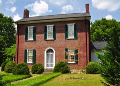 | Hays-Kiser House | 4.9 miles | 1974 |
 | Oglesby School | 6.6 miles | 2002 |
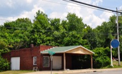 | Ellis Service Station Garage | 6.7 miles | 1991 |
| National Archives record | The nomination case file for reference 76001770 in Record Group 79. |
| Wikipedia article | Community-written account of this property, licensed CC BY-SA. |
| Davidson County | All 204 listed properties in this county. |