 Block
From the record
One of 204 National Register listings published here for Davidson County · listed in 1979 · category: Building.
Sources: the National Register database, National Park Service · the Wikipedia article
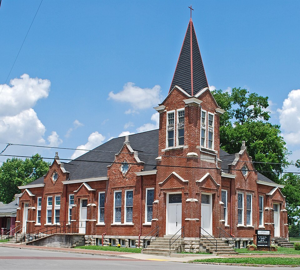
Listed on the National Register of Historic Places in 1979.
One of 204 National Register listings published here for Davidson County · listed in 1979 · category: Building.
Sources: the National Register database, National Park Service · the Wikipedia article
Regional context, not property-specific evidence. The federal wildfire occurrence database lists 2 fires within 5 miles of Third Baptist Church between 1998 and 2005, burning about 7 acres in total. None started naturally. None was recorded as arson. Distance is straight-line from the map coordinates, so a fire counted here may appear on a neighbouring settlement's page as well.
| Reported cause | Fires |
|---|---|
| Debris and open burning | 2 |
The most recent of them, most recent first, with the day each was reported and the service that recorded it.
| Date | Cause | Size | Reported by | Name on the report |
|---|---|---|---|---|
| 3 January 1998 | Debris and open burning | under an acre | Tennessee Division of Forestry | not named |
| 25 January 2005 | Debris and open burning | 7.0 acres | Tennessee Division of Forestry | not named |
Regional context, not property-specific evidence. The federal mineral resources record lists 11 workings within 5 miles of Third Baptist Church: 5 producers, 4 past producers, 2 plants. 7 still produce. What was taken out: Clay, Stone, Crushed/Broken, Stone, Crushed/Broken, Limestone, General, Limestone, General. Distance is straight-line from the map coordinates, so a quarry counted here may appear on a neighbouring settlement's page as well.
| Where | Site | Commodity | Status | Recorded |
|---|---|---|---|---|
| Derryberry Construction Bo. Quarry | Limestone, General | Past Producer | Sedimentary | |
| Herbert Sand Yard | Sand and Gravel, Construction | Producer | ||
| Nashville Plant-Uss Agri-Chemical | Fluorine-Fluorite | Plant | ||
| Eller and Olsen Stone Co. Quarry | Stone, Crushed/Broken, Limestone, General | Producer | Limestone | |
| Nashville Plant | Stone, Crushed/Broken, Limestone, General | Producer | Limestone | |
| Derryberry Construction Bo. Quarry | Stone, Crushed/Broken | Past Producer | ||
| Mat-Nel No. 1 Pit | Clay | Producer | 1950 | |
| Mat-Nel Number 1 Pit | Clay | Past Producer | Sedimentary | |
| Mat-Nel Number 1 Pit | Clay | Past Producer | ||
| Nashville Cement Plant | Stone, Crushed/Broken | Plant |
Regional context, not property-specific evidence. The National Weather Service names Nashville, the town this property stands in, in 315 storm reports between 1993 and 2026: 195 thunderstorm wind, 53 hail, 51 flash flood, 6 tornado. The reports record 2 deaths and 69 injuries. Each account below is quoted exactly as the forecast office filed it, from the NOAA Storm Events Database, and each date opens the federal record of that event.
| When | Event | Place named | Harm | What the report says |
|---|---|---|---|---|
| April 1998 | Tornado (F3) | Nashville | 1 killed, 60 hurt, $100,000,000 | This Nashville tornado on April 16, 1998 took a very similar path to another F3 tornado that occurred on March 14, 1933, which killed 11 people in Nashville. The tornado touched down at 330 PM one mile west of Charlotte Pike and I-440. A tree fell on an ROTC student at Centennial Park. He was attending an ROTC picnic. He died later on May 4 from his injuries. The tornado went through downtown Nashville at 340 PM and on toward East Nashville, Donelson and Hermitage. The tornado blew out many windows on office buildings. The Nations Bank Office Towers were one of the hardest hit buildings in Nashville. Tennessee Performance Arts Center (TPAC) and the Tennessee Towers sustained damage. TPAC had over 100 windows blown out. NOAA Weather Radio broadcasts from the Tennessee Towers and was off the air for about 24 hours. 30 private airplanes were damaged at Cornelia Fort Airport. Estimated damage to the airplanes was 3 million dollars. 35 buildings in downtown Nashville were "red tagged", meaning these buildings were structurally unsound. Many signs in Davidson county were blown down or severely damaged. The tornado blew down 3 out of 10 construction cranes on the construction site of the Tennessee Oiler's Football Stadium near the Cumberland River. The tornado continued east and hit the residential section of East Nashville. At least 300 homes were damaged in East Nashville. Many homes lost a good part of their roofs, trees were uprooted, telephone poles were knocked down. St. Ann's Episcopal Church, which is well over 100 years old, received major damage. Uprooted trees, damaged roofs to many homes was the story across Donelson and Hermitage. Numerous windows were blown out from the Gaylord Building in Donelson. About half the trees, that is over a thousand trees, were blown down at Andrew Jackson's home, The Hermitage. The Hermitage is a 600 acre estate of the former President. Some of those trees were well over 200 years old, and a few of those trees that were destroyed were planted by Andrew Jackson himself. Mayor Phil Bredesen closed downtown Nashville of Friday, April 17. Many workers had an unscheduled holiday. The downtown area was reopened Monday, April 20. This gave time for cleanup crews to remove broken glass and repair downed power lines. Nashville Electric Service said 75,000 customers were without power. |
| July 2006 | Thunderstorm Wind | Nashville | 1 killed, 3 hurt, $10,000 | Gust front ahead of an area of thunderstorms had wind gusts of 40 to 50 mph. Some of these wind gusts were measured or estimated by trained spotters in Davidson County. As this gust front entered Davidson County, a tree limb from a rotted tree fell on a vehicle, a Jeep Grand Cherokee, killing the driver and slightly injuring his wife and his 2 young children. The gust front exited the county at 1630 CST. Over 25,000 people were without power in Davidson County according to Nashville Electric Service. Wind gusts were measured up to 47 mph at Nashville International Airport at 1620 CST. The fatality occurred at the intersection of Robertson Road and Nall Avenue in the western part of Nashville. |
| August 2003 | Thunderstorm Wind | Nashville | 4 hurt, $50,000 | Law enforcement and newspaper articles reported 20 to 30 boats were overturned and part of the Elm Hill Marina was destroyed. 4 people were injured, and 2 of them had to be hospitalized. The storms struck during a fishing tournament. |
| February 2000 | Tornado (F1) | Nashville | 1 hurt, $500,000 | About 50 homes and 20 businesses received damage from this tornado. A 25 foot hackberry tree fell on a house. An oak tree crashed into the side of a building. A school trailer was destroyed at St. Vincent De Paul School. There was 15 rooftop damage at an apartment complex on Delta Street. The hardest hit area of downtown Nashville was the Eight Avenue North and Bordeaux . The tornado started around Scovel Street and 28th Avenue North. Extensive damage occurred from this location and to the eastnortheast for just over a mile in length. Numerous trees were uprooted or snapped. Powerlines were down. A number of homes suffered roof damage. The tornado crossed I-265 , moving eastnortheast reaching Arthur Avenue, 10th Ave. and 9th Ave. North, crossed the Cumberland River and then reaching Dickerson Pike and Ellington Parkway, finally dissipating around Petway Avenue and Gallatin Road.One woman was injured when an interstate sign blew into her car and caused her to wreck. |
| February 2021 | Thunderstorm Wind | Nashville | 1 hurt, $1,000 | A child was injured after coming into contact with a downed power line on University Court near downtown Nashville. |
| May 2020 | Thunderstorm Wind | Nashville | $7,580,000 | Hundreds of trees and power lines were blown down across Davidson County with some falling onto cars and houses. Over 130,000 customers lost power due to the storms, which is the largest power outage in the history of the Nashville Electric Service. Some customers were without electricity for up to 1 week. Total damage across Davidson County was estimated at $7,583,701 by the Tennessee Emergency Management Agency. |
| December 2021 | Thunderstorm Wind | Nashville | $2,000,000 | Trees and power lines were blown down across Davidson County. Around 80,000 customers lost power. Nashville Electric Service reported $2,875,057 in damage to utilities across Davidson County, with much of this damage done by the 5 tornadoes and large severe downburst that struck the county. |
| March 2021 | Thunderstorm Wind | Nashville | $500,000 | A 6 mile long by 1/2 mile wide microburst caused severe wind damage from the Napier area just southeast of downtown Nashville NNE across East Nashville and Inglewood. Numerous large trees were blown down, including several that fell onto and blocked I-40/I-24 near Fairfield Avenue. Other trees fell onto homes, including one house in the Napier area that completely collapsed from the weight of a fallen tree. Another historic home under renovation in East Nashville was blown down. Many warehouse buildings and other businesses also sustained significant roof and exterior damage, and several power poles and lines were also blown down. Winds were estimated up to 85 mph. |
| May 2003 | Tornado (F1) | Nashville | $500,000 | There was damage to the roofs of homes and businesses. Several businesses had their signs damaged as well. The Davidson County tornado started about 5.3 miles northeast of downtown Nashville near Riverwood Drive. The tornado crossed the Cumberland River and affected the Opryland area and dissipated around Bonnameade Road or about 8.9 miles east northeast of downtown Nashville. |
| April 1998 | Tornado (F2) | Nashville | $500,000 | EMA official reported a tornado touchdowns at 12th and Charlotte and 6th and Union. Damage was mainly blown out windows and downed trees and power lines. |
| February 2011 | Thunderstorm Wind | Nashville | $250,000 | In the Cleveland Street area north of downtown Nashville, at least 100 large hardwood trees were uprooted and a few were snapped. Fallen trees damaged some roofs and vehicles. Some loss of shingles noted on house roofs. A small amount of aluminum siding peeled off a couple of exterior walls. A wood fence was also blown down. |
| May 2003 | Tornado (F1) | Nashville | $250,000 | Considerable roof damage to homes in Bellshire Terrace Court and Bellshire Terrace Drive. Cars were overturned. This is in the Bellshire area of northern Davidson county. |
| June 1998 | Lightning | Nashville | $250,000 | Lightning struck the 108-year-old St. Patrick Catholic Church on Second Ave. So. The fire had done serious structural damage to the roof and steeple. |
| July 1996 | Thunderstorm Wind | Nashville | $200,000 | no account filed |
| April 2026 | Thunderstorm Wind | Nashville | $100,000 | Severe thunderstorm winds resulted in numerous reports of damage across Davidson County. Nashville Electric Service reported 42,000 power outages due to 22 broken poles and 77 downed lines across its service area. Damages are a rough estimate. |
| May 2024 | Lightning | Nashville | $100,000 | A lightning strike hit a building in southwest Nashville, causing a fire. No injuries were reported. Damages are a rough estimate. |
| June 2019 | Thunderstorm Wind | Nashville | $100,000 | Trees and power lines were blown down throughout Davidson County with several falling on homes. 77 power poles were snapped, which according to Nashville OEM was the most in a severe thunderstorm since the April 16, 1998 Nashville Tornado. Over 48,000 people were without power. |
| August 1999 | Thunderstorm Wind | Nashville | $100,000 | Newspaper article stated Antioch Middle School, Una Elementary School, and Donelson's Two Rivers Middle School sustained water damage after winds lifted the roofs, allowing rain to seep in. Also, 5 private planes were damaged, 3 of them heavily, on the ramp of Mercury Air, a charter operation at Nashville International Airport. Strong winds collapsed a section of a warehouse in east Nashville. |
| September 2003 | Flash Flood | Nashville | $83,000 | Davidson County Office of Emergency Management reported Mill Creek overflowed its banks and came onto the intersection of Nolensville Road and Bluff Road. A Mercedes-Benz was swept downstream, and a person had to be rescued from the top of his car. |
| May 2011 | Thunderstorm Wind | Nashville | $60,000 | In the eastern part of Nashville, 40 plus trees were downed along with numerous power poles. |
| March 2023 | Thunderstorm Wind | Nashville | $50,000 | The Davidson County emergency manager reported that severe winds caused a tree to fall through a home just west of Nashville as severe thunderstorms moved through the area. Damages are estimated. |
| May 2013 | Thunderstorm Wind | Nashville | $50,000 | The Davidson County Emergency Manager reported over 25 different tree down or power lines down reports across Metro Nashville. |
| July 2010 | Thunderstorm Wind | Nashville | $50,000 | Multiple trees were downed across several roads in Nashville. This included Belton Drive, Hazelton Road, Hester Besley Road, 32nd Avenue North, Shackleford Road, Belmont Boulevard, Louisiana Avenue, and Lakeshore Drive. |
| November 1997 | Flash Flood | Nashville | $50,000 | High water over Highways 41 and 31A in the southeast part of town. A number of motorists were stranded in their vehicles and had to be rescued. Doppler radar rainfall estimates were as high as 4 inches per hour during this event. |
| November 1994 | Thunderstorm Wind | Nashville | $50,000 | Several large tree limbs fell on top of some power lines knocking out power to about 500 homes. |
| July 2024 | Thunderstorm Wind | Nashville | $25,000 | Severe thunderstorm winds downed power lines in Nashville, leaving about 1300 customers without power. Damages are a rough estimate. |
| March 2023 | Thunderstorm Wind | Nashville | $25,000 | Severe thunderstorm winds downed a large tree onto a transitional housing community in north Nashville. No injuries were reported. Damages are a rough estimate. |
| May 2012 | Thunderstorm Wind | Nashville | $25,000 | Multiple trees and power lines were downed in Metro Nashville. |
| April 2011 | Thunderstorm Wind | Nashville | $25,000 | Large tree was downed onto the side of a non-residential building at corner of Jackson Street and 17th Avenue North near Fisk University. Also a large tree was blown down on Vanderbilt University Campus on Kensington Place near the intersection with 25th Avenue South. This tree was downed on top of two to three cars. Specific details concerning if any damaged occurred to the cars, and if so, what type of damage and associated costs, were unknown. |
| April 2011 | Thunderstorm Wind | Nashville | $25,000 | Several reports of trees downed across the county including one tree downed on a house. Specific details concerning any damage to the house and associated costs were unknown. |
| April 2011 | Thunderstorm Wind | Nashville | $25,000 | A dozen or so trees were downed across Davidson County. |
| February 2009 | Thunderstorm Wind | Nashville | $25,000 | Davidson County Emergency Management Officials reported that trees and power lines were down at several locations across the county. |
| August 2023 | Thunderstorm Wind | Nashville | $20,000 | Severe thunderstorm winds caused a tree to fall on top of a house in the 1600 Block of 5th Avenue in northwest Nashville. Damages are a rough estimate. |
| January 2005 | Thunderstorm Wind | Nashville | $20,000 | Strong thunderstorm winds took part of a roof of an apartment building located on Picadilly Row at the Signature Pointe Apartments in Antioch. |
| October 2015 | Thunderstorm Wind | Nashville | $15,000 | Reports from tSpotter via Twitter indicated an aluminum storage shed was blown across the street and overturned onto cars near 3rd Avenue at Lindsley Avenue in downtown Nashville. The glass door to a nearby business was also damaged from the storage shed blowing into the building. Both OHX and TBNA radars showed peak base velocities of only 40 knots, well below severe criteria. |
| December 2013 | Thunderstorm Wind | Nashville | $15,000 | An unfinished building under construction collapsed and shingles were blown off a home at Lindsley Avenue and Academy Place. |
| September 2012 | Thunderstorm Wind | Nashville | $15,000 | Multiple trees were downed on James Robertson Parkway. |
| February 2009 | Thunderstorm Wind | Nashville | $12,000 | Trees and power lines were downed in the downtown Nashville. |
| April 2025 | Thunderstorm Wind | Nashville | $10,000 | Severe thunderstorm winds downed trees and powerlines near Vernon Winfrey Avenue in Nashville. Damages are a rough estimate. |
| July 2023 | Thunderstorm Wind | Nashville | $10,000 | Severe thunderstorm winds downed a tree onto a house near Grand Avenue and 18th Avenue South in south Nashville. No injuries were reported. Damages are a rough estimate. |
| May 2016 | Thunderstorm Wind | Nashville | $10,000 | One dozen trees were blown down across the county. 2300 people were without power. |
| June 2016 | Thunderstorm Wind | Nashville | $10,000 | Up to 18000 power outages reported across NES Service Area including Opry Mills Mall and Green Hills Mall. Nashville Fire Department responded to 62 calls of downed trees and power lines. |
| July 2016 | Thunderstorm Wind | Nashville | $10,000 | Twelve trees were reported blown down across Davidson County. |
| December 2013 | Thunderstorm Wind | Nashville | $10,000 | Trees and power lines were blown down across Davidson County with numerous power outages. |
| January 2013 | Thunderstorm Wind | Nashville | $10,000 | An NWS Storm Survey noted scattered downburst wind damage up to 1 mile south of the EF0 East Nashville tornado from west of the I-65/Trinity Lane interchange to Inglewood. Scattered trees, tree limbs, and fences were blown down. Winds were estimated up to 70 mph. |
| July 2012 | Thunderstorm Wind | Nashville | $10,000 | Power lines were downed in east Nashville. |
| February 2011 | Thunderstorm Wind | Nashville | $10,000 | Tree was downed on a house on Petway Avenue in East Nashville. Details on extent of damage to the house were unknown. |
| April 2011 | Thunderstorm Wind | Nashville | $10,000 | In downtown Nashville at the intersection of Elm and 4th Street, structural wind damage occurred to a building with some bricks and pieces of the roof being blown off. |
| August 2003 | Lightning | Nashville | $10,000 | News article about lightning striking the William R. Snodgrass Tennessee Tower. The lightning set off the sprinkler system in the 31-story building. The water leaked through elevator shafts onto almost every floor of the building. The first four floors were the hardest hit. The elevator shafts filled up with more than 20 feet of water. The building was built in 1970 as the headquarters of the National Life and Accident Insurance Company. |
| June 2003 | Thunderstorm Wind | Nashville | $10,000 | Tree fell on a house located at 113 Belvedere Drive in Nashville. |
| September 2003 | Flash Flood | Nashville | $10,000 | Tulip Grove Road was closed and barricaded due to high water about 1/2 mile south of the intersection of Lebanon Pike and Tulip Grove Road. Stoner Creek was out of its banks at this location. Also, Stoner Creek flooded a home on Andrew Jackson Parkway in Hermitage. |
| May 2000 | Thunderstorm Wind | Nashville | $10,000 | Spotter reported trees and power lines down as well as damage to a structure at I-65 and Harding. |
| July 1997 | Thunderstorm Wind | Nashville | $10,000 | Power poles were down along River Road in west Nashville. |
| November 1997 | Thunderstorm Wind | Nashville | $10,000 | NWS employee reported a billboard sign was blown down. The location was about 2 miles west of the Stones River on the north side of Interstate 40. |
| April 2026 | Thunderstorm Wind | Nashville | $5,000 | Severe thunderstorm winds downed a large tree which blocked the shoulder and a part of westbound Interstate 40 in Nashville. Damages are a rough estimate. |
| August 2023 | Thunderstorm Wind | Nashville | $5,000 | Severe thunderstorm winds downed a tree onto a powerline in east Nashville. Damages are a rough estimate. |
| March 2021 | Thunderstorm Wind | Nashville | $5,000 | Windows were broken and exterior damage occurred to the Marshall & Bruce Printing Co. building on Davidson Street in East Nashville. |
| March 2021 | Thunderstorm Wind | Nashville | $5,000 | Large trees down across Shelby Park in East Nashville. |
| June 2019 | Thunderstorm Wind | Nashville | $5,000 | An outdoor stage for the Nashville Pride Festival in Public Square Park was blown down and destroyed. Parts of the stage were blown into nearby streets. |
| March 2017 | Thunderstorm Wind | Nashville | $5,000 | A tree fell on a house on Cephas Street. |
No historic map-sheet match is published for this property yet. That does not mean no map exists. This record needs a coordinate-quality review before it can be joined to a sheet boundary. Browse the county's mapped places while that work is pending.
Other National Register properties close enough to walk or drive between, ordered by distance from this one. Both positions come from the same geocoding pass that matched these properties to their map sheets.
| Photograph | Property | Distance | Listed |
|---|---|---|---|
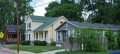 | Buena Vista Historic District | 0.1 miles | 1980 |
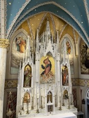 | Church of the Assumption | 0.2 miles | 1977 |
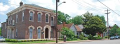 | Germantown Historic District | 0.3 miles | 1979 |
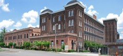 | Tennesse Manufacturing Company | 0.3 miles | 1999 |
| Clark Memorial Methodist Church Complex | 0.5 miles | 2024 | |
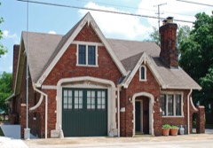 | Fire Hall No. 1 | 0.5 miles | 2008 |
| National Archives record | The nomination case file for reference 79002427 in Record Group 79. |
| Wikipedia article | Community-written account of this property, licensed CC BY-SA. |
| Davidson County | All 204 listed properties in this county. |