 Block
From the record
One of 216 National Register listings published here for Shelby County · listed in 1982 · category: District.
Sources: the National Register database, National Park Service
Listed on the National Register of Historic Places in 1982.
One of 216 National Register listings published here for Shelby County · listed in 1982 · category: District.
Sources: the National Register database, National Park Service
Regional context, not property-specific evidence. The federal wildfire occurrence database lists 7 fires within 5 miles of Arlington Historic District between 1999 and 2014, burning about 52 acres in total. None started naturally. None was recorded as arson. Distance is straight-line from the map coordinates, so a fire counted here may appear on a neighbouring settlement's page as well.
| Reported cause | Fires |
|---|---|
| Debris and open burning | 7 |
The most recent of them, most recent first, with the day each was reported and the service that recorded it.
| Date | Cause | Size | Reported by | Name on the report |
|---|---|---|---|---|
| 7 September 1999 | Debris and open burning | 6.0 acres | Tennessee Division of Forestry | not named |
| 24 August 2007 | Debris and open burning | 22 acres | Tennessee Division of Forestry | GRIMES & 196 FIRE |
| 26 March 1999 | Debris and open burning | 5.0 acres | Tennessee Division of Forestry | not named |
| 20 March 2014 | Debris and open burning | 7.0 acres | Tennessee Division of Forestry | CENTER POINT |
| 5 February 1999 | Debris and open burning | 3.0 acres | Tennessee Division of Forestry | not named |
| 25 February 1999 | Debris and open burning | 7.0 acres | Tennessee Division of Forestry | not named |
| 31 January 2006 | Debris and open burning | 2.0 acres | Tennessee Division of Forestry | not named |
Regional context, not property-specific evidence. The federal mineral resources record lists 1 working within 5 miles of Arlington Historic District: 1 producer. All of them still produce. What was taken out: Sand and Gravel, Construction. Distance is straight-line from the map coordinates, so a quarry counted here may appear on a neighbouring settlement's page as well.
| Where | Site | Commodity | Status | Recorded |
|---|---|---|---|---|
| Van Road Pit | Sand and Gravel, Construction | Producer |
Regional context, not property-specific evidence. The National Weather Service names Arlington, the town this property stands in, in 30 storm reports between 1993 and 2020: 16 thunderstorm wind, 5 hail, 5 flash flood, 2 lightning. The reports record 1 death. Each account below is quoted exactly as the forecast office filed it, from the NOAA Storm Events Database, and each date opens the federal record of that event.
| When | Event | Place named | Harm | What the report says |
|---|---|---|---|---|
| September 2004 | Lightning | Arlington | 1 killed | A man was killed by a lightning strike while hunting in a field. |
| May 2010 | Flood | Arlington | $50,000,000 | Flash flooding transitioned into a flood event across Northern Shelby County as a result of up to 16 inches of rain. The Loosahatchie River rose rapidly spilling over its banks flooding numerous homes and businesses from Millington to Arlington. Many roads were underwater as well. The river crested at a record level in Arlington on May 2nd. |
| June 2016 | Flash Flood | Arlington | $1,500,000 | Exit 25 ramp on Interstate 40 had 6 to 10 inches of water flowing across impeding traffic. Flooding of deep water also occurred on Hays Road in Arlington forcing a road closure and on Arlington Road at the Arlington Self Storage Business.||In addition, the Broadcast media also reported several residential roads across Arlington were flooded as well as Arlington Trace Subdivision, Airline Road, Douglas Road and Fire Station 71. |
| April 2011 | Flash Flood | Arlington | $20,000 | Heavy rain produced flash flooding across much of north and eastern portions of Shelby County. The intersection of Pisgah Road and Houston Levee Road in Cordova was covered by six to eight inches of water. Jenkins Road and Macon Road was flooded in Cordova as well. In addition, the intersection of Airline Road and Highway 70 in Arlington was closed due to flood waters. North of Collierville, Highway 205 South and Raleigh-LaGrange Road was flooded. In Millington, roads near Raleigh-Millington Road were flooded. One car was stranded in flood waters. |
| July 2004 | Thunderstorm Wind | Arlington | $15,000 | Two barns had their roofs blown off. Several large trees were knocked down. Some of the trees were 3 to 4 feet in diameter. |
| July 2002 | Thunderstorm Wind | Arlington | $10,000 | Several trees were knocked down. One tree fell on a house. |
| August 2005 | Thunderstorm Wind | Arlington | $5,000 | Two large trees were blown over. |
| August 2003 | Thunderstorm Wind | Arlington | $5,000 | A few trees were knocked down. |
| November 2002 | Thunderstorm Wind | Arlington | $5,000 | Some trees were blown down. |
| December 2002 | Thunderstorm Wind | Arlington | $5,000 | Some power lines were knocked down. |
| March 1998 | Thunderstorm Wind | Arlington | $5,000 | Some telephone poles and power lines were blown down. |
| June 1994 | Thunderstorm Wind | Arlington | $5,000 | Several airplanes were flipped over at the Arlington Airport. |
| June 2018 | Thunderstorm Wind | Arlington | $3,000 | Trees down at Pleasant Ridge and Osborntown Roads. |
| May 2004 | Lightning | Arlington | $1,000 | One structure was damaged by a fire started by lightning. |
| May 1998 | Thunderstorm Wind | Arlington | $1,000 | Several trees were knocked down. |
| February 1993 | Thunderstorm Wind | Arlington | $500 | Some trees were knocked down along Interstate 40. |
| September 2004 | Hail | Arlington | $10 | no account filed |
| May 2020 | Thunderstorm Wind | Arlington | - | Numerous trees down around Arlington. Some homes had shingles removed. Power lines down across Airline Road. |
| February 2015 | Flood | Arlington | - | Heavy rain combined with melting snow and sleet to produce flooding in Northern Shelby County. Arlington-Millington Road was closed due to flooding. |
| June 2015 | Thunderstorm Wind | Arlington | - | Straight line winds ripped a drain gutter off a home in Arlington. |
| June 2012 | Thunderstorm Wind | Arlington | - | Straight line winds knocked a tree on to a house in Arlington. |
| April 2010 | Thunderstorm Wind | Arlington | - | Straight line winds blew a large tree down on a house on Brown Street in Arlington. |
| April 2010 | Hail | Arlington | - | Golf ball size hail fell in Arlington. |
| May 2010 | Hail | Arlington | - | Golf ball size hail fell at Highway 70 and Airline Road. |
| July 2009 | Flash Flood | Arlington | - | Heavy rain produced flash flooding in Arlington. Hayes Road had eight inches of water covering the road. |
| June 2009 | Thunderstorm Wind | Arlington | - | Straight line winds blew large trees down in Arlington. Power lines were also knocked down causing power outages. |
| December 2009 | Flash Flood | Arlington | - | Heavy rain produce flash flooding around the Northern and Eastern portions of Shelby County. Numerous roads were closed as a result including Brunswick Road, the intersection of Walnut Grove Road and Rock Creek, the intersection of Humphrey and Houston Levee Roads, and Macon Road east of Pisgah. |
| July 2007 | Flash Flood | Arlington | - | Heavy rain fell 3 miles southwest of Arlington and produced flash flooding. Water covered Highway 70 in several locations. |
| April 2015 | Hail | Arlington | - | no account filed |
| April 2011 | Hail | Arlington | - | no account filed |
No historic map-sheet match is published for this property yet. That does not mean no map exists. This record needs a coordinate-quality review before it can be joined to a sheet boundary. Browse the county's mapped places while that work is pending.
Other National Register properties close enough to walk or drive between, ordered by distance from this one. Both positions come from the same geocoding pass that matched these properties to their map sheets.
| Photograph | Property | Distance | Listed |
|---|---|---|---|
| Wells School | 3.9 miles | 1995 | |
 | Davies Manor | 7.1 miles | 1975 |
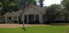 | Squire's Rest | 7.9 miles | 2007 |
| Barretville Bank and Trust Company Building | 8.0 miles | 2019 |
| National Archives record | The nomination case file for reference 82004038 in Record Group 79. |
| Shelby County | All 216 listed properties in this county. |