 Block
From the record
One of 2 National Register listings published here for McNairy County · listed in 1983 · category: Building.
Sources: the National Register database, National Park Service · the Wikipedia article
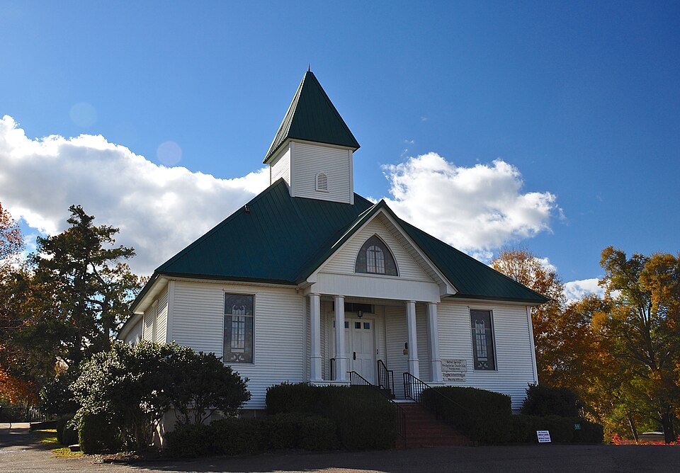
Listed on the National Register of Historic Places in 1983.
One of 2 National Register listings published here for McNairy County · listed in 1983 · category: Building.
Sources: the National Register database, National Park Service · the Wikipedia article
Regional context, not property-specific evidence. The federal wildfire occurrence database lists 165 fires within 5 miles of Bethel Springs Presbyterian Church between 1997 and 2020, burning about 798 acres in total. None started naturally. 38 were recorded as arson. Distance is straight-line from the map coordinates, so a fire counted here may appear on a neighbouring settlement's page as well.
| Reported cause | Fires |
|---|---|
| Debris and open burning | 98 |
| Arson/incendiarism | 38 |
| Equipment and vehicle use | 12 |
| Missing data/not specified/undetermined | 10 |
| Other causes | 3 |
| Power generation/transmission/distribution | 2 |
| Misuse of fire by a minor | 1 |
| Smoking | 1 |
The most recent of them, most recent first, with the day each was reported and the service that recorded it.
| Date | Cause | Size | Reported by | Name on the report |
|---|---|---|---|---|
| 6 September 2018 | Debris and open burning | 2.5 acres | Tennessee Division of Forestry | MOOSE LODGE RD |
| 5 September 2000 | Debris and open burning | 10 acres | Tennessee Division of Forestry | not named |
| 4 September 1999 | Debris and open burning | 1.0 acres | Tennessee Division of Forestry | not named |
| 4 September 1999 | Debris and open burning | 3.0 acres | Tennessee Division of Forestry | not named |
| 29 September 2010 | Debris and open burning | 5.0 acres | Tennessee Division of Forestry | SARDIE HENERY 2 |
| 25 September 1999 | Debris and open burning | 1.0 acres | Tennessee Division of Forestry | not named |
| 22 September 2015 | Debris and open burning | under an acre | Tennessee Division of Forestry | LIMON GUAGE |
| 15 September 1999 | Debris and open burning | 6.0 acres | Tennessee Division of Forestry | not named |
Regional context, not property-specific evidence. The federal mineral resources record lists 4 workings within 5 miles of Bethel Springs Presbyterian Church: 2 occurrences, 1 prospect, 1 past producer. None of them still produces. What was taken out: Clay, Ball Clay. Distance is straight-line from the map coordinates, so a quarry counted here may appear on a neighbouring settlement's page as well.
| Where | Site | Commodity | Status | Recorded |
|---|---|---|---|---|
| Roney Pit | Ball Clay | Past Producer | ||
| J.F. Basham Farm Prospect | Clay | Prospect | ||
| Selmer Prospect | Clay | Occurrence | ||
| West Selmer Prospect | Clay | Occurrence |
No historic map-sheet match is published for this property yet. That does not mean no map exists. This record needs a coordinate-quality review before it can be joined to a sheet boundary. Browse the county's mapped places while that work is pending.
| National Archives record | The nomination case file for reference 83003054 in Record Group 79. |
| Wikipedia article | Community-written account of this property, licensed CC BY-SA. |
| McNairy County | All 2 listed properties in this county. |