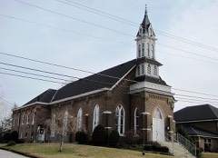
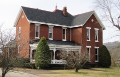
| May 2024 | Thunderstorm Wind | South Carthage | $500,000 | A NWS storm survey team found straight line wind damage in and around Carthage with maximum winds estimated up to 75 mph. Several trees were snapped and uprooted along Lebanon Highway west of Carthage. In the town, downed trees were found along Jefferson Avenue, Myers Terrance Road, Carmack Avenue, and Colonial Avenue. Nearby cars were also damaged by falling trees. These straight line winds also blew a steeple off of North Carthage Baptist Church. Damages are a rough estimate. |
| May 2024 | Thunderstorm Wind | South Carthage | $250,000 | A NWS storm survey team found straight line wind damage in and around Carthage with maximum winds estimated up to 75 mph. Several trees were snapped and uprooted along Lebanon Highway west of Carthage. In the town, downed trees were found along Jefferson Avenue, Myers Terrance Road, Carmack Avenue, and Colonial Avenue. Nearby cars were also damaged by falling trees. These straight line winds also blew a steeple off of North Carthage Baptist Church. Damages are a rough estimate. |
| August 2010 | Thunderstorm Wind | Carthage | $125,000 | Trees were reported down county wide. A roof was reported off a carport at 120 Homepage Road in Brush Creek. Barns were also damaged in Chest Mound. Amount of barns that were damaged and the type of damage to each barn was unknown.||Newspapers reported that downed tree and tree limbs knocked power out to several homes in Gordonsville and the surrounding areas. |
| May 2024 | Thunderstorm Wind | South Carthage | $100,000 | Straight-line winds snapped and uprooted numerous trees along Cullum Street. One of these uprooted trees caused structural damage to a house. Damages are a rough estimate. |
| May 2024 | Thunderstorm Wind | South Carthage | $50,000 | A NWS storm survey team found straight line wind damage in and around Carthage with maximum winds estimated up to 75 mph. Several trees were snapped and uprooted along Lebanon Highway west of Carthage. In the town, downed trees were found along Jefferson Avenue, Myers Terrance Road, Carmack Avenue, and Colonial Avenue. Nearby cars were also damaged by falling trees. These straight line winds also blew a steeple off of North Carthage Baptist Church. Damages are a rough estimate. |
| May 2024 | Thunderstorm Wind | South Carthage | $50,000 | A NWS storm survey team found straight line wind damage in and around Carthage with maximum winds estimated up to 75 mph. Several trees were snapped and uprooted along Lebanon Highway west of Carthage. In the town, downed trees were found along Jefferson Avenue, Myers Terrance Road, Carmack Avenue, and Colonial Avenue. Nearby cars were also damaged by falling trees. These straight line winds also blew a steeple off of North Carthage Baptist Church. Damages are a rough estimate. |
| March 1997 | Tornado (F1) | Carthage | $50,000 | no account filed |
| July 2012 | Thunderstorm Wind | Carthage | $25,000 | Several trees and power lines were downed across the county. |
| August 2010 | Thunderstorm Wind | Carthage | $25,000 | Trees and power lines were downed in Carthage. |
| June 2009 | Thunderstorm Wind | South Carthage | $25,000 | Several trees were downed in the Carthage area. |
| May 2013 | Thunderstorm Wind | Carthage | $20,000 | A report was received via 911 dispatch of trees down across Smith county. |
| December 2021 | Tornado (EF0) | South Carthage | $15,000 | This EF-0 tornado touched down on Bright Avenue in South Carthage and moved northeast along the east side of Carthage uprooting several small trees and snapping large tree limbs on Upper Ferry Road, McGinness Avenue, Hillcrest Drive, Skyline Drive, Ridgeway Drive, and Cumberland Mine Road. The tornado then crossed the Horseshoe Bend of the Cumberland River blowing down several trees, then moved across McClures Bend of the Cumberland River and caused tree damage and moderate roof damage to a structure on McClures Bend Lane. The tornado continued east, crossing Sullivan Bend and the Cumberland River yet again before lifting on Waynick Road in Jackson County where it caused minor tree damage. Total path length of this tornado was 7.35 miles. |
| April 2022 | Thunderstorm Wind | Carthage | $10,000 | Trees were blown down across Smith County. |
| January 2020 | Thunderstorm Wind | Carthage | $10,000 | A garage was destroyed on Horseshoe Bend Road with debris blown into the roadways. |
| August 2018 | Thunderstorm Wind | South Carthage | $10,000 | A Twitter tSpotter report and photo showed the steeple was blown off the First Baptist Church in Carthage. |
| February 2014 | Thunderstorm Wind | Carthage | $10,000 | Trees and power lines were blown down across the county with numerous power outages. |
| January 2013 | Thunderstorm Wind | Carthage | $10,000 | Numerous trees were blown down across the county. |
| February 2012 | Thunderstorm Wind | Carthage | $10,000 | Windows were blown out of buildings in downtown Carthage. Several trees were blown down in the city with one crushing a vehicle. |
| April 2011 | Thunderstorm Wind | South Carthage | $10,000 | Several trees were blown down in Carthage on Jefferson Avenue East. |
| July 1998 | Thunderstorm Wind | Carthage | $10,000 | Newspaper account of numerous trees were blown down in Carthage. Part of a roof was blown off a factory on Industrial Dr. |
| June 2019 | Thunderstorm Wind | Carthage | $5,000 | Trees and power lines were blown down across Smith County. |
| June 2016 | Thunderstorm Wind | Carthage | $5,000 | Detached carport flipped and destroyed. |
| July 2016 | Thunderstorm Wind | Carthage | $5,000 | Several trees, tree limbs, and power lines down across Smith County with multiple power outages. |
| April 2014 | Thunderstorm Wind | South Carthage | $5,000 | A tree was blown down onto a van at the Smith County Bus Garage on Upper Ferry Road in Carthage. |
| May 2013 | Thunderstorm Wind | Carthage | $5,000 | A trained spotter reported multiple trees down across the city of Carthage. |
| June 2016 | Thunderstorm Wind | Carthage | $3,000 | A few trees were blown down in Carthage. |
| May 2016 | Thunderstorm Wind | South Carthage | $2,000 | Power lines were blown down along Highway 70 west of Carthage. |
| July 2016 | Thunderstorm Wind | Carthage | $2,000 | Trees were reportedly blown down in Carthage. |
| May 1995 | Thunderstorm Wind | Carthage | $2,000 | A few trees were blown down. |
| April 2016 | Thunderstorm Wind | South Carthage | $1,000 | A #tSpotter Twitter report indicated a tree was blown down in Carthage on Jefferson Avenue. |
| May 2016 | Thunderstorm Wind | South Carthage | $1,000 | A tSpotter Twitter report indicated a tree was blown down in the Eastland Heights area of Carthage. |
| December 2013 | Thunderstorm Wind | Carthage | $1,000 | A sign was blown out at a Sonic Drive-In in Carthage. |
| November 2004 | Flash Flood | Carthage | $1,000 | Spotter reported the intersection of Hihgway 85 and Turkey Creek Road was flooded. Ditches and culverts were spilling water onto roads around the county. |
| January 1999 | Thunderstorm Wind | Carthage | $1,000 | High winds pulled a section of a white picket fence from the ground on Flat Rock Rd. Trees were blown down. |
| September 2001 | Thunderstorm Wind | South Carthage | $500 | A few trees were down along Old Lebanon Rd., McCall St., and Hailey Ave. A sassafras tree fell on a kennel and outdoor furniture near a home. No animals were injured. |
| March 2025 | Hail | South Carthage | - | Estimated 1 inch hail was reported from a severe thunderstorm in South Carthage. |
| February 2021 | Flash Flood | South Carthage | - | Social media reports indicated rushing flood waters covered several roadways in Carthage. |
| February 2020 | Flood | South Carthage | - | Main street was partially blocked due to flooding. |
| February 2019 | Heavy Rain | Carthage | - | A COOP observer in Carthage measured a 24 hour rain total of 3.80 inches. |
| April 2017 | Hail | Carthage | - | Dime to nickel hail size reported in Carthage. |
| April 2017 | Hail | Carthage | - | Facebook photo showed quarter size hail in Carthage. |
| June 2016 | Flood | South Carthage | - | Minor flooding was reported on Old State Highway 53 in South Carthage. |
| August 2013 | Hail | Carthage | - | Quarter size hail was reported in Carthage. |
| August 2013 | Heavy Rain | South Carthage | - | A two-day rainfall total of 4.90 inches was measured at CoCoRaHS station Carthage 2.8 WSW. |
| June 2011 | Hail | Carthage | - | Trained spotter reported quarter size hail. |
| September 2006 | Thunderstorm Wind | Carthage | - | A few trees were down. |
| May 2005 | Hail | Carthage | - | Law enforcement reported half-dollar size hail. |
| April 2002 | Hail | Carthage | - | Dime size hail reported. Hail was covering the ground. |
| May 2001 | Hail | Carthage | - | Dime size hail reported. |
| June 2001 | Thunderstorm Wind | Carthage | - | Tree down on Highway 53. |
| January 2000 | Thunderstorm Wind | South Carthage | - | Several trees were down. |
| January 2000 | Thunderstorm Wind | Carthage | - | Trees were blown down. |
| November 2000 | Thunderstorm Wind | Carthage | - | Sheriff reported building damage to a local market on State Highway 53, about 4 miles south of Carthage. Numerous trees were down countywide. |
| May 1998 | Thunderstorm Wind | Carthage | - | Sheriff's office reported trees were blown down acounty wide, especially about 10 miles east of Carthage on U.S. Highway 70. |
| July 2018 | Hail | Carthage | - | no account filed |
| April 2017 | Hail | Carthage | - | no account filed |
| April 2015 | Hail | Carthage | - | no account filed |
| March 2012 | Hail | South Carthage | - | no account filed |
| April 2012 | Hail | Carthage | - | no account filed |
| April 2011 | Thunderstorm Wind | Carthage | - | no account filed |
 Block