 Block
From the record
11 National Register listings published here.
Sources: the National Register database, National Park Service
45 topographic sheets cover 38 settlements here, and 11 properties are on the National Register of Historic Places.
11 National Register listings published here.
Sources: the National Register database, National Park Service
Every property in this county listed on the National Register of Historic Places, with the year it was listed and the federal nomination document.
| Photograph | Property | Type | Listed | Reference |
|---|---|---|---|---|
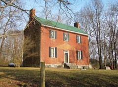 | James Bradley House | building | 1978 | 78002637 |
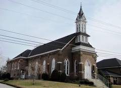 | Carthage United Methodist Church | building | 1985 | 85001487 |
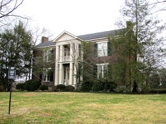 | Cullum Mansion | building | 1983 | 83003068 |
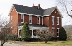 | Davis-Hull House | building | 1983 | 83003069 |
| Dixon Springs District | district | 1975 | 75001788 | |
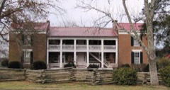 | Dixona | building | 1973 | 73001832 |
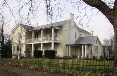 | Fite-Williams-Ligon House | building | 2003 | 03000663 |
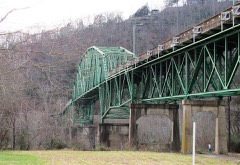 | Cordell Hull Bridge | structure | 2009 | 09000951 |
| Rome Ferry | site | 1986 | 86003477 | |
 | Smith County Courthouse | building | 1979 | 79002483 |
Every wildfire the federal occurrence database records inside this county: 80 of them, burning about 1,056 acres. 1 started naturally and 38 were recorded as arson. Each settlement page carries the fires within five miles of it.
| Reported cause | Fires |
|---|---|
| Arson/incendiarism | 38 |
| Debris and open burning | 27 |
| Missing data/not specified/undetermined | 6 |
| Equipment and vehicle use | 4 |
| Smoking | 3 |
| Natural | 1 |
| Misuse of fire by a minor | 1 |
The five largest, by the area the report gives. 6 of them were set deliberately.
| Date | Cause | Size | Reported by | Name on the report |
|---|---|---|---|---|
| 24 November 1998 | Natural | 153 acres | Tennessee Division of Forestry | not named |
| 23 November 2016 | Arson/incendiarism | 101 acres | Tennessee Division of Forestry | DIFFICULT FIRE |
| 25 February 1998 | Arson/incendiarism | 73 acres | Tennessee Division of Forestry | not named |
| 3 November 2000 | Arson/incendiarism | 65 acres | Tennessee Division of Forestry | not named |
| 12 November 2005 | Debris and open burning | 60 acres | Tennessee Division of Forestry | not named |
| 25 January 2005 | Arson/incendiarism | 48 acres | Tennessee Division of Forestry | not named |
| 15 March 2000 | Arson/incendiarism | 40 acres | Tennessee Division of Forestry | not named |
| 1 February 1998 | Arson/incendiarism | 36 acres | Tennessee Division of Forestry | not named |
Every settlement page carries the fires within five miles of it - see the settlement index below.
The NOAA Storm Events Database holds 268 reports for this county, causing no deaths, 23 injuries and about $13,453,600 in recorded property damage. Each settlement page carries the reports that name it.
| Kind of event | Reports |
|---|---|
| Thunderstorm Wind | 174 |
| Hail | 43 |
| Flash Flood | 25 |
| Tornado | 15 |
| Flood | 6 |
| Heavy Rain | 5 |
The most serious of them, by death, then injury, then recorded damage. The accounts are quoted exactly as the forecast office filed them.
| When | Event | Place named | Harm | What the report says |
|---|---|---|---|---|
| February 2008 | Thunderstorm Wind | Flat Rock | 11 hurt, $5,000 | Trees and power lines were down around the county. |TEMA reported 11 injuries around the county. |
| January 1997 | Tornado (F2) | Brush Creek | 6 hurt, $1,000,000 | no account filed |
| March 1955 | Tornado (F1) | not stated | 3 hurt, $25,000 | no account filed |
| April 1970 | Tornado (F1) | not stated | 2 hurt, $25,000 | no account filed |
| March 1952 | Tornado (F1) | not stated | 1 hurt, $25,000 | no account filed |
| March 2020 | Tornado (EF1) | Grant | $5,000,000 | An historic, long-track, strong EF-3 tornado began in western Davidson County then tracked eastward for over 60 miles through Wilson County into Smith County before lifting, causing 5 deaths and 220 injuries. This tornado touched down west of River Road Pike then moved eastward across Bells Bend, destroying a barn and blowing down numerous trees. The tornado strengthened significantly and widened to 0.65 miles wide as it crossed the Cumberland River into the John C. Tune Airport area, causing strong EF-2 damage to numerous planes, hangers, warehouses, and other buildings from Cockrill Bend Way to Briley Parkway. Around $200 million in damage was reported at John Tune Airport alone. Continuing eastward, the tornado caused severe damage to the Tennessee State Prison and blew down numerous high-tension transmission towers as it again crossed the Cumberland River into North Nashville, with up to EF-2 damage to farm facilities at Tennessee State University and dozens of homes between I-40 and Buchanan Street. EF-2 damage continued across the Germantown neighborhood just 1/2 mile north of downtown Nashville with several damaged and destroyed apartment complexes, homes, and businesses. The tornado intensified further as it tracked through East Nashville, with EF-3 damage to businesses and other buildings in the Five Points area and EF-2 damage to homes in the Lockeland Springs and Barclay Drive neighborhoods. Two people were killed in Five Points after leaving a bar and going outside as the tornado struck. After crossing the Cumberland River yet again, the tornado weakened as it moved northeast through the Donelson Hills and Lincoya Hills neighborhoods of Donelson, but strengthened again to a strong EF-3 in the Standford Estates area where several homes were leveled. The tornado weakened slightly but continued to cause EF-2 damage to homes and businesses as it turned southeast and passed through Hermitage into Wilson County. ||Dozens of homes continued to sustain up to EF-2 damage as the tornado moved across the Chandler Road and Triple Crown Parkway neighborhoods of Mount Juliet. Turning more to the northeast, the tornado strenghtened to strong EF-3 and leveled numerous homes in the Catalpa Drive and Clearview Drive neighborhoods, with one elderly couple killed on Catalpa Drive at Dogwood Drive. Crossing Mount Juliet Road, the tornado severely damaged West Wilson Middle School and Stoner Creek Elementary School, both of which will have to be torn down and rebuilt. The tornado reached its peak intensity of high-end EF-3 and peak size of 0.9 miles wide as it moved across Golden Bear Parkway and along Eastgate Blvd, leveling several large warehouses and killing a security guard at the CEVA warehouse on Athletes Way North. Crossing Highway 109 into Lebanon, the tornado weakened to EF-2 but continued damaging dozens of homes and businesses as it moved through southern sections of the city. Further to the east, buildings on both sides of I-40 in Tuckers Crossroads received up to EF-2 damage before the tornado turned southeast and crossed into Smith County. Weakening and shrinking in size, the tornado caused EF-1 damage to numerous homes and businesses in Grant, New Middleton, and just south of Gordonsville. The tornado finally lifted east of Highway 141 and north of Judkins Lane after a continuous 60.13 miles on the ground. |
| May 2016 | Flash Flood | Rome | $2,000,000 | Major flash flooding affected northern Smith County, especially the Dixon Springs and Riddleton areas. Numerous primary and secondary roads along with private driveways and bridges were flooded and closed or even washed out, including Highway 25, Bowmans Branch Lane, Wilburn Hollow Road, and Young Branch Road. One car reportedly was washed away into a creek off Highway 25 in Riddleton. Several homes were also flooded in these same areas. The Smith County Highway Superintendent stated that it would take at least 8 weeks to repair all the flood damage to the road network across the county. At least 2 water rescues from homes were conducted on Wilburn Hollow Road. |
| May 2010 | Flood | Dixon Spgs | $1,600,000 | On State Highway 53 near Chesnut Mound, hillside gave way due to the heavy rain and blocked off one half of the highway. Details on amount of damage to this highway were unkown. Also, numerous homes, numerous businesses, numerous non comercial buildings, along with several county, state, and federal roads across the county received damage due to the flood. |
| August 2010 | Flash Flood | Kempville | $1,000,000 | Sherriffs office reported several roads in the northeast portion of Smith County with water over the roads, resulting in them being closed.| |Newspapers reported that a section of the roadway was washed out on Dog Branch Road. A large crack on Hartsville Pike developed in the Halls Hill community resulting in closure of the road. Heavy rainfall washed rocks onto State Highway 25 near the Carthage city limits which county's department of transportation had to clear off the road to make it passible again.||Newspapers also reported that Defeated Creek rose to within inches of flooding three mobile homes in the Difficult community. The water rose to the back of the mobile homes which sit along Difficult Road. One family in the 400 block of Difficult Road had to be removed from their home by rescue personnel. Water got inside the Pleasant Shade Grocery and Restaurant. On S.P. McClanahan Road, a PT Cruiser was washed downstream by the heavy rainfall. |
| May 2024 | Thunderstorm Wind | South Carthage | $500,000 | A NWS storm survey team found straight line wind damage in and around Carthage with maximum winds estimated up to 75 mph. Several trees were snapped and uprooted along Lebanon Highway west of Carthage. In the town, downed trees were found along Jefferson Avenue, Myers Terrance Road, Carmack Avenue, and Colonial Avenue. Nearby cars were also damaged by falling trees. These straight line winds also blew a steeple off of North Carthage Baptist Church. Damages are a rough estimate. |
| December 2015 | Tornado (EF2) | Lancaster Hill | $300,000 | This EF2 tornado touched down on Helton Creek just southwest of Dry Branch Road. At this location, the path width was narrow at 50-75 yards wide but snapped numerous trees and did some minor roof damage to a home. The tornado continued to the east-northeast snapping large trees and doing minor roof damage to a home on Corley Road. As the tornado crossed over TN Highway 264 and Smith Fork Creek it widened to 250 yards. It was here where it produced the greatest damage. The roof and two exterior walls were removed, along with its carport and 2 covered porches. Based on the exterior walls only being toe-nailed in place, it was decided that the maximum wind speed would be reduced slightly to a maximum of 125 mph. The tornado continued east-northeast destroying a cinder block garage and causing moderate roof damage to a log cabin home on Maynard Hollow Lane. At the end of the path, the tornado snapped numerous trees in Lancaster where the path width had narrowed to 100 yards. No damage was found beyond Lancaster.||This is the first tornado on record to occur in both DeKalb County and Smith County in the month of December. |
| May 2024 | Thunderstorm Wind | South Carthage | $250,000 | A NWS storm survey team found straight line wind damage in and around Carthage with maximum winds estimated up to 75 mph. Several trees were snapped and uprooted along Lebanon Highway west of Carthage. In the town, downed trees were found along Jefferson Avenue, Myers Terrance Road, Carmack Avenue, and Colonial Avenue. Nearby cars were also damaged by falling trees. These straight line winds also blew a steeple off of North Carthage Baptist Church. Damages are a rough estimate. |
| August 2010 | Thunderstorm Wind | Carthage | $125,000 | Trees were reported down county wide. A roof was reported off a carport at 120 Homepage Road in Brush Creek. Barns were also damaged in Chest Mound. Amount of barns that were damaged and the type of damage to each barn was unknown.||Newspapers reported that downed tree and tree limbs knocked power out to several homes in Gordonsville and the surrounding areas. |
| May 2024 | Thunderstorm Wind | South Carthage | $100,000 | Straight-line winds snapped and uprooted numerous trees along Cullum Street. One of these uprooted trees caused structural damage to a house. Damages are a rough estimate. |
| January 1999 | Flash Flood | Countywide | $100,000 | Many roads were flooded around the county. It would cost $100,000 to repair the county roads. |
| December 2016 | Thunderstorm Wind | Dixon Spgs | $75,000 | Significant wind damage was reported across northern Smith County. A roof was ripped off a barn on Hiwassee Road. In Dixon Springs, a playhouse was destroyed, a house had minor siding damage, and several trees were blown down. In Riddleton on Wilburn Hollow Road, a barn was blown down, a garage was heavily damaged, windows were blown out of a house, and numerous trees were blown down. |
| May 2020 | Thunderstorm Wind | Dixon Spgs | $73,600 | Numerous trees and power lines were blown down across Smith County. Some of the worst damage was in Dixon Springs, where photos showed dozens of trees blown down and buildings with roof and exterior damage. |
| May 2024 | Thunderstorm Wind | Flat Rock | $50,000 | A NWS storm survey team found straight line wind damage in and around Carthage with maximum winds estimated up to 75 mph. Several trees were snapped and uprooted along Lebanon Highway west of Carthage. In the town, downed trees were found along Jefferson Avenue, Myers Terrance Road, Carmack Avenue, and Colonial Avenue. Nearby cars were also damaged by falling trees. These straight line winds also blew a steeple off of North Carthage Baptist Church. Damages are a rough estimate. |
| May 2024 | Thunderstorm Wind | South Carthage | $50,000 | A NWS storm survey team found straight line wind damage in and around Carthage with maximum winds estimated up to 75 mph. Several trees were snapped and uprooted along Lebanon Highway west of Carthage. In the town, downed trees were found along Jefferson Avenue, Myers Terrance Road, Carmack Avenue, and Colonial Avenue. Nearby cars were also damaged by falling trees. These straight line winds also blew a steeple off of North Carthage Baptist Church. Damages are a rough estimate. |
| May 2024 | Thunderstorm Wind | Rock City | $50,000 | Straight-line winds resulted in downed trees and powerlines in the Dickson Springs area west of Carthage. Damages are a rough estimate. |
| May 2024 | Thunderstorm Wind | South Carthage | $50,000 | A NWS storm survey team found straight line wind damage in and around Carthage with maximum winds estimated up to 75 mph. Several trees were snapped and uprooted along Lebanon Highway west of Carthage. In the town, downed trees were found along Jefferson Avenue, Myers Terrance Road, Carmack Avenue, and Colonial Avenue. Nearby cars were also damaged by falling trees. These straight line winds also blew a steeple off of North Carthage Baptist Church. Damages are a rough estimate. |
| May 2017 | Tornado (EF0) | Rome | $50,000 | A weak EF-0 Tornado touched down in far western Smith County just east of the Wilson/Smith County line on Mitchell Lane. Damage was mostly confined to dozens of trees snapped or uprooted along the 2.5 mile path. Two barns were also uplifted and destroyed off Hiwassee Road in western Smith County. Based on newly available high resolution Google Earth satellite imagery in July 2019, the path of this tornado was extended slightly to the southwest, giving a total path length of 2.45 miles. |
| March 2010 | Heavy Rain | Caney Fork | $50,000 | As reported by the Tennessee Highway Patrol, Jessie C. Brewer, 69, of Rockwood, Tennessee, died after his 1994 Ford ASP hydroplaned and ended up running in front of a tractor trailer truck. Brewer was headed west on Interstate 40 at the 263 mile marker in Smith County, when he lost control of the car on rain slick Interstate 40. Brewer's car hydroplaned, ran off the right shoulder, and struck the guardrail, then slid back to the left across both lanes of traffic, struck the guardrail, then slid back to the left across both lanes of traffic again, struck the guardrail on that side again, and then ran back into the traffic lanes and into the path of a tractor trailer truck, which struck Brewer's vehicle in the left side. The driver of the tractor trailer truck was not injured. Any damage associated with the car and the tractor trailer truck was unknown. Actual depth of water on the road was also unknown. |
| September 2009 | Flood | Dixon Spgs | $50,000 | Roads became flooded in the Difficult and Kempville areas. In Brush Creek, the county's rescue squad was dispatched to help rescue a woman and her six-month old child that had to be evacuated from their home. Water damage to home was unknown. Several additional roads across the county were also flooded. Several fields near small creeks were also flooded across the county. |
| July 1999 | Flash Flood | Countywide | $50,000 | Heavy rainfall early Friday morning dumped 3 to 7 inches of rain in a short period of time and resulted in flash flooding in several locations. One of the hardest hit areas was South Carthage. A mobile home on Hogan's Creek Road in South Carthage was swept off its foundation at a distance of 10 yards. It was lodged against trees and vehicles which were sitting in the yard. Most of the damage around the county was to roads where tile bridges and paving were washed up. Most of the residential damage though occurred on Hogan's Creek.Another mobile home, a double-wide, received severe damage to its underpinning. Flood waters entered the garage of another resident. 4 vehicles were washed downstream or submerged. One family on Wilkie Circle in the Brush Creek community had to be evacuated because of rising waters on Hickman Creek. The water circled the home but did not enter it. Water seeped inside a trailer on Dale Lane on Plunkett's Creek Circle. Water also flooded a work shop on Bob More Lane. A truck from R&R Auto Sales was swept several yards down the road into a creek. Many roads in Smith county were barricaded due to high water. Tile bridges were washed out at the New Middleton community namely at Dry Fork Road, and also on Plunkett's Creek Road and Dog Branch Road near Difficult. |
| March 1997 | Tornado (F1) | Carthage | $50,000 | no account filed |
| March 2017 | Tornado (EF1) | Sykes | $40,000 | A NWS storm survey along with high resolution Google Earth satellite imagery confirmed an EF1 tornado touched down in far southern Smith County southwest of the town of Hickman just north of Potter Road. The tornado completely destroyed a 1930s-era home being used as a storage building to the west of Kyle Hollow Lane, with contents blown up to 150 yards away. Numerous trees were also snapped and uprooted around the building and a nearby mobile home sustained minor exterior damage. Three homes on Jenkins Hill Road just west of Hill Road suffered minor to moderate roof damage and two nearby outbuildings were destroyed. A nearby barn was destroyed and another barn suffered roof damage. On Highway 264 at Jenkins Hall Road, a large barn was completely destroyed with debris blown over 200 yards away to the north, and another barn suffered minor roof damage. TDOT also reported Highway 264 was blocked by trees blown down across the roadways. Farther to the east, dozens of trees were snapped and uprooted in the hills and valleys around Nabors Hollow Lane, and one home received considerable roof damage before the tornado lifted. Special thanks to Smith County Emergency Management and @SmithCountyWx for their assistance with this storm survey. |
| January 2013 | Thunderstorm Wind | Riddleton | $40,000 | A large portion of the roof was blown off a local country store called the Stagecoach in Dixon Springs. A small storage barn also collapsed. Numerous trees were also blown down with minor roof damage to some homes. |
| March 2017 | Thunderstorm Wind | Lancaster Hill | $25,000 | A NWS Storm Survey along with high resolution Google Earth satellite imagery indicates a nearly 5 mile long by 1/3 mile wide microburst caused significant wind damage in the Lancaster area of Smith County. Several trees were snapped or uprooted from Hackett Valley Road eastward across Highway 141 to Lancaster, with TDOT reporting that fallen trees blocked Highway 141. A mobile home on Nixon Valley Road had the porch and one third of the roof blown off, and a nearby barn lost about half its roof. Debris from the barn blown over 200 yards into forests to the northeast. Dozens of trees were also snapped and uprooted in swaths on hillsides and hilltops from Seabowisha Lane just north of Lancaster eastward to east of Moss Bend Lane. |
| July 2012 | Thunderstorm Wind | Carthage | $25,000 | Several trees and power lines were downed across the county. |
| August 2010 | Thunderstorm Wind | Carthage | $25,000 | Trees and power lines were downed in Carthage. |
| June 2009 | Thunderstorm Wind | South Carthage | $25,000 | Several trees were downed in the Carthage area. |
| November 2017 | Thunderstorm Wind | Brush Creek | $20,000 | A strong 1/2 mile wide by 4.7 mile long microburst struck areas from around 1.2 miles northeast of Brush Creek to 0.6 miles southeast of Hickman. Several trees were blown down south of Dry Fork Road and north of Hall Road, and a mobile home suffered roof damage on Cedarwood Lane. More trees were blown down near and along Leland Lane and Winfree Road, and an outbuilding was destroyed just north of the intersection of Winfree Road at Sykes Road. The worst damage occurred on Sykes Road where two homes suffered significant roof damage, a large equipment shed was completely destroyed, two barns had minor roof damage, an outbuilding was destroyed, and many trees were blown down. Debris from the destroyed barn was blown over 500 yards to the northeast. More trees were blown down on Raccoon Branch Lane and Highway 264, and a barn had minor roof damage just south of Hickman. Winds were estimated up to 85 mph. |
| June 2013 | Thunderstorm Wind | Monoville | $20,000 | Numerous trees and power lines were blown down across the northern part of Smith County, especially in the Pleasant Shade, Turkey Creek, and Defeated communities where widespread power outages were reported. Trees were blown down and blocked Highway 80 south of Pleasant Shade and also on Turkey Creek Road. A tree was blown down onto a house on Harris Hollow Road in Defeated. |
| May 2013 | Thunderstorm Wind | Carthage | $20,000 | A report was received via 911 dispatch of trees down across Smith county. |
| July 1998 | Flash Flood | West Central Portion | $20,000 | At the intersection of Old Highway 53 and Highway 70N between Rock City and Rome, the roads were closed due to high water. Newspaper accounts tell of homes being evacuated and roads closed at Rome and Rock City. Raging waters from Plunkett's Creek and Rawl's Creek combined to flood Plunkett's Creek Circle, located off Highway 70 in the Rock City community. A mobile home and Plunkett's Creek Baptist Church were flooded. |
| June 1998 | Thunderstorm Wind | Pleasant Shade | $20,000 | The Carthage Courier reported several large trees were uprooted. One tree fell on a car shed, damaging 2 vehicles. |
| December 2021 | Tornado (EF0) | South Carthage | $15,000 | This EF-0 tornado touched down on Bright Avenue in South Carthage and moved northeast along the east side of Carthage uprooting several small trees and snapping large tree limbs on Upper Ferry Road, McGinness Avenue, Hillcrest Drive, Skyline Drive, Ridgeway Drive, and Cumberland Mine Road. The tornado then crossed the Horseshoe Bend of the Cumberland River blowing down several trees, then moved across McClures Bend of the Cumberland River and caused tree damage and moderate roof damage to a structure on McClures Bend Lane. The tornado continued east, crossing Sullivan Bend and the Cumberland River yet again before lifting on Waynick Road in Jackson County where it caused minor tree damage. Total path length of this tornado was 7.35 miles. |
| May 2016 | Thunderstorm Wind | Riddleton | $15,000 | The tSpotter Twitter coordinator for Smith County took several photos indicating a 1 mile wide microburst struck the Murrah Road area south of Beasley Bend Road in Riddleton. One home at 48 Murrah Road suffered significant loss of shingles and siding, and a tree fell onto a neighboring home. Several mainly small trees were also blown down in a NNW to SSE direction. Winds were estimated up to 65 mph. |
| October 2012 | Tornado (EF1) | Grant | $15,000 | A low end EF1 tornado touched down just north of Interstate 40 in the Grant community before ending near Highway 141. Several trees were blown down on Dawson Road. Dozens of large trees were snapped and uprooted on a farm located south of S.P. McClanahan Road. Homeowners estimated some of the trees to be over 200 years old. More trees were blown down with skirting damage to a mobile home along S.P. McClanahan Road was damaged and several more trees were uprooted. A few more trees were blown down before the tornado lifted west of Highway 141. Max winds were estimated to be 90 mph.||This was the first tornado on record to occur in the month of October in Smith County. |
| April 2022 | Thunderstorm Wind | Carthage | $10,000 | Trees were blown down across Smith County. |
| December 2021 | Thunderstorm Wind | Pleasant Shade | $10,000 | A Facebook report indicated a shop was destroyed and trees and power lines were blown down on Toe Town Road in Pleasant Shade. |
| March 2020 | Thunderstorm Wind | Lancaster Hill | $10,000 | A 4 mile long swath of straight-line wind damage affected eastern Smith County in the Club Springs area from Stewarts Bend Lane eastward across I-40, Kirby Lane, Club Springs Road, and Opposum Valley Lane. Several trees were snapped or uprooted and a few outbuildings suffered roof damage. Winds were estimated up to 75 mph. |
| January 2020 | Thunderstorm Wind | Carthage | $10,000 | A garage was destroyed on Horseshoe Bend Road with debris blown into the roadways. |
| April 2020 | Tornado (EF0) | Grant | $10,000 | This tornado quickly developed and strengthened to EF-1 intensity along Bell Road in far eastern Wilson County where several trees were downed and roof and siding damage occurred to a two story house. The tornado traveled northeast and hit another house on Bluebird Road causing roof damage. Nearly the entire tree line along the driveway to this house was shredded with tree limbs and debris covering the ground. The tornado then crossed Interstate 40 where an 18-wheeler was flipped on its side causing a traffic accident where 3 injuries were reported. Additional damage was observed on North Commerce Road and Dawson Lane where additional trees were damaged. Crossing into Smith County, the tornado caused minor damage to a few roofs, trees, and a trampoline in a neighborhood along Winding Hills Lane at Colby Lane. Further to the northeast, minor tree damage was once again observed on Opossum Hollow Road and an outbuilding was destroyed. On Grant Highway, several buildings were damaged at the Grant Cedar Mill, which also sustained damage from the EF-3 Nashville/Mount Juliet/Lebanon Tornado on March 3, 2020. From there, the tornado path became very difficult to determine as it crossed the wide damage path from the March 3rd EF-3 tornado into an area with no public roadways, and is estimated to have ended east of Grant Highway where some damaged trees could be seen. However, the tornado path may be extended eastward in the future once high resolution satellite imagery is available. The combined tornado path across Wilson and Smith Counties was estimated to be 3.81 miles. |
| September 2019 | Thunderstorm Wind | Defeated | $10,000 | Numerous trees were blown down and one camper was overturned at the Defeated Creek Campground eastward to Lakeside Drive. |
| August 2018 | Thunderstorm Wind | South Carthage | $10,000 | A Twitter tSpotter report and photo showed the steeple was blown off the First Baptist Church in Carthage. |
| March 2017 | Tornado (EF0) | Brush Creek | $10,000 | An NWS Storm Survey along with Google Earth high resolution satellite data and radar data determined a high end EF-1 tornado touched down in Wilson County just north of Highway 70 (Sparta Pike) in far western Watertown, then curved northeast and east across the northern fringes of the town. One home suffered considerable roof damage at 7077 Sparta Pike and a carport was destroyed at a neighboring home. Another mobile home had most of its metal roof blown off on Linwood Road and several trees were blown down on both sides of the roadway. The tornado intensified as it crossed New Town Road where 2 homes suffered roof damage and dozens of trees were snapped or uprooted in all directions. Another home had roof damage on Parkenson Road where many more trees were snapped and uprooted. The most severe damage occurred along South Commerce Road, where one home suffered considerable roof and siding damage, and the attached garage was knocked off the slab foundation and collapsed. However, the garage was not properly attached to the foundation. An adjacent barn was completely destroyed with debris blown over 200 yards to the southeast. Another barn further south on South Commerce Road was heavily damaged, and the wastewater plant across the road received minor damage. East of South Commerce Road, two wooden TVA high transmission power poles were snapped. A home sustained minor roof damage and a greenhouse was destroyed on the west side of Holmes Gap Road, while another home suffered heavy roof damage and an outbuilding was destroyed on the east side of the roadway. The tornado then weakened as it continued eastward, but still continued to blow down dozens of trees. An outbuilding suffered minor damage south of Hudson Road, and a large outbuilding was destroyed farther east at 850 Haley Road. Numerous more trees continued to be blown down across rural forests and fields to the east before the tornado crossed into Smith County.||In Smith County, the tornado caused EF-0 damage as it crossed Holmes Gap Road around 2 miles southwest of Brush Creek. Two old barns sustained damage on the west side of the roadway, while another barn on the east side was destroyed. Numerous tree were also blown down in the area. The tornado continued to blow down trees in forests to the north of Switchboard Road before dissipating into a large downburst that affected areas south of Brush Creek. |
| December 2016 | Thunderstorm Wind | Tanglewood | $10,000 | Tspotter reported a tree was blown down across Highway 70. A car drove into the tree and wrecked. |
| December 2016 | Thunderstorm Wind | Difficult | $10,000 | Several trees were blown down, sheet metal torn off a house, and a shed knocked over on Dog Branch Road in Pleasant Shade. |
| July 2016 | Flash Flood | Pleasant Shade | $10,000 | Flash flooding affected portions of northern Smith County per Facebook and tSpotter Twitter reports. Several roads were flooded and closed in Pleasant Shade, while Bowmans Branch Lane in Riddleton was flooded with one bridge partially washed out. |
| July 2016 | Thunderstorm Wind | Riddleton | $10,000 | A tSpotter Twitter report indicated a garage under construction collapsed in Riddleton. |
| February 2014 | Thunderstorm Wind | Carthage | $10,000 | Trees and power lines were blown down across the county with numerous power outages. |
| August 2014 | Thunderstorm Wind | Brush Creek | $10,000 | A large downburst that struck the Alexandria area in northwest De Kalb County also blew down several trees and power lines in far southwestern Smith County south of Brush Creek. |
| January 2013 | Thunderstorm Wind | Carthage | $10,000 | Numerous trees were blown down across the county. |
| January 2013 | Thunderstorm Wind | Gordonsville | $10,000 | Several trees were blown down around Gordonsville. |
| February 2012 | Thunderstorm Wind | Carthage | $10,000 | Windows were blown out of buildings in downtown Carthage. Several trees were blown down in the city with one crushing a vehicle. |
| April 2011 | Thunderstorm Wind | South Carthage | $10,000 | Several trees were blown down in Carthage on Jefferson Avenue East. |
| March 2010 | Hail | Gordonsville | $10,000 | One inch hail was reported in Carthage. Newspaper also reported that hail rained down across much of the county, and it was so intense, it piled up on roadways and on roofs of houses and buildings, forming a coating of ice in many areas of the county. The hail was so thick at times, that some motorist temporarily pulled off the roadways until the ice eventually turned into rain. Predominately, hail fell for generally 10 to 15 minutes before changing over to all rain. There were no widespread reports of damage to vehicles, homes, etc., resulting from the hail storm. Even though roadways were iced-over in some areas, there were no reports of wrecks involving serious injuries. |
| July 2010 | Thunderstorm Wind | Elmwood | $10,000 | Power lines and trees were downed along U.S. Highway 70 in Elmwood. |
The Survey's mineral resources record lists 44 workings inside this county. 13 still produce and 31 are closed or unrecorded. Each settlement page carries the workings within five miles of it.
| Commodity | Workings |
|---|---|
| Zinc | 20 |
| Fluorine-Fluorite | 6 |
| Stone, Crushed/Broken | 4 |
| Barium-Barite | 3 |
| Limestone, Dimension | 3 |
| Dolomite | 3 |
| Fluorine-Fluorite, Lead, Barium-Barite | 2 |
| Lead, Fluorine-Fluorite, Barium-Barite | 2 |
| Limestone, General | 2 |
| Uranium | 2 |
| Oil Shale | 2 |
| Cadmium | 2 |
| Fluorine-Fluorite, Barium-Barite, Lead, Zinc | 1 |
| Calcium, Barium-Barite | 1 |
The least common of them first, because a county's hundredth gravel pit says nothing its first ten did not.
| Where | Site | Commodity | Status | Recorded |
|---|---|---|---|---|
| Boatman Mine | Fluorine-Fluorite, Calcium, Barium-Barite | Past Producer | 1895 | |
| Boatman Mine | Fluorine-Fluorite, Barium-Barite, Calcium | Past Producer | ||
| Carthage Stone Co. Quarry | Stone, Crushed/Broken, Limestone, General | Producer | Limestone | |
| Central Tennessee Zinc District | Zinc, Fluorine-Fluorite, Barium-Barite, Lead | Producer | 1969, 1975 | |
| Elmwood Zinc Mine No. 2 Shaft | Zinc, Lead, Barium-Barite, Fluorine-Fluorite | Producer | Stratabound | |
| Gordonsville Concentrator | Zinc, Lead | Plant | ||
| Gordonsville-Elmwood | Germanium, Zinc, Limestone, General, Stone, Crushed/Broken | Producer | 1967, 1975 | |
| Gordonsville-Elmwood Mine | Zinc, Stone, Fluorine-Fluorite, Lead, Barium-Barite | Producer | Barite, Galena, Sphalerite | |
| Outcrop Sample For Uranium | Uranium, Oil Shale | Occurrence | ||
| Outcrop Sample For Uranium | Oil Shale, Uranium | Occurrence | ||
| Terry | Lead, Zinc, Fluorine-Fluorite, Barium-Barite | Prospect | ||
| Terry Prospect | Fluorine-Fluorite, Barium-Barite, Lead, Zinc | Occurrence | 1910 | |
| Carthage Mine | Limestone, General | Producer | ||
| Cumberland Mine | Zinc, Cadmium, Dolomite | Producer | 1965 | |
| Elmwood Zinc Mine #3 Shaft | Zinc, Lead, Fluorine-Fluorite, Barium-Barite | Producer | Stratabound | |
| Elmwood Zinc Mine #4 Shaft | Zinc, Fluorine-Fluorite, Lead, Barium-Barite | Producer | Stratabound | |
| Elmwood Zinc Mine Incline | Zinc, Lead, Fluorine-Fluorite, Barium-Barite | Producer | Stratabound | |
| Outcrop Sample For Uranium | Uranium, Oil Shale | Occurrence | ||
| Outcrop Sample For Uranium | Uranium, Oil Shale | Occurrence | ||
| Rome Quarry | Limestone, General | Past Producer | Sedimentary | |
| Stonewall | Zinc, Cadmium, Dolomite | Past Producer | 1977 | |
| Carthage Property | Zinc, Dolomite | Prospect | 1965 | |
| Congo Bottom Prospect | Barium-Barite | Occurrence | Barite | |
| Congo Bottom Prospect | Barium-Barite | Prospect | ||
| H.W. Hudson Prospect | Fluorine-Fluorite, Barium-Barite | Prospect | ||
| Limestone Quarry | Limestone, Dimension | Past Producer | ||
| Limestone Quarry | Limestone, Dimension | Past Producer | ||
| Limestone Quarry | Limestone, Dimension | Past Producer | ||
| Coleman-Wright Quarry | Stone, Crushed/Broken | Past Producer | ||
| Rome Quarry | Stone, Crushed/Broken | Past Producer | ||
| Smith County Highway Department Quarry | Stone, Crushed/Broken | Producer | Limestone | |
| Smith County Highway Dept. Quarry | Stone, Crushed/Broken | Past Producer | ||
| John Fitzpatrick Prospect | Fluorine-Fluorite | Occurrence | Fluorite | |
| John Fitzpatrick Prospect | Fluorine-Fluorite | Occurrence | ||
| Cowin and Company Gordinsville Mine | Zinc | Past Producer | ||
| Deep Well-Sphalerite Occurrence | Zinc | Occurrence | Sphalerite | |
| Deep Well-Sphalerite Occurrence | Zinc | Occurrence | ||
| Elmwood Mill | Zinc | Plant | ||
| Elmwood Mine No. 2 Production Shaft | Zinc | Past Producer | ||
| Elmwood Mine No. 3 Production Shaft | Zinc | Past Producer | ||
| Elmwood Mine Slope Entry | Zinc | Past Producer | ||
| Jersey Miniere Gordonsville Project | Zinc | Past Producer | ||
| Jersey Miniere South Carthage Mine | Zinc | Past Producer | ||
| Sulfur Creek | Zinc | Prospect |
Named settlements recorded in the Geographic Names Information System, each with the topographic sheets covering it. Villages, hamlets and abandoned places alike. Each is shown with the nearest named watercourse or landform and the survey quadrangle it falls on.
District 5 · 38563 · On Hickman Creek · Gordonsville quadrangle
11 sheets, 1928 to 1982
District 8 · 38560 · Near Sumac Hollow · Buffalo Valley quadrangle
11 sheets, 1928 to 1982
District 8 · 38560 · Near Beller Hollow · Buffalo Valley quadrangle
11 sheets, 1928 to 1982
District 1 · 37030 · On West Branch Buffalo Creek · Granville quadrangle
11 sheets, 1932 to 1982
District 5 · 38563 · On Hickman Creek · Gordonsville quadrangle
11 sheets, 1928 to 1982
District 8 · 38569 · On Smith Fork Creek · Buffalo Valley quadrangle
11 sheets, 1928 to 1982
District 5 · 38567 · Near Cowan Hollow · Gordonsville quadrangle
11 sheets, 1928 to 1982
District 8 · 38560 · Near Grisham Hollow · Granville quadrangle
11 sheets, 1932 to 1982
No longer a settlement
District 3 · 38563 · On Denny Branch · New Middleton quadrangle
10 sheets, 1942 to 1994
District 3 · 38563 · On Denny Branch · Gordonsville quadrangle
11 sheets, 1928 to 1982
District 1 · 37145 · On Boston Branch · Pleasant Shade quadrangle
10 sheets, 1932 to 1982
District 8 · 38569 · On Smith Fork Creek · Buffalo Valley quadrangle
11 sheets, 1928 to 1982
District 3 · 38563 · Near Tomahawk Knob · New Middleton quadrangle
10 sheets, 1942 to 1994
District 8 · 38560 · Near Jonesboro Hollow · Granville quadrangle
11 sheets, 1932 to 1982
No longer a settlement
The vanished settlements of Smith County: the places named above that are no longer on the map.