 Block
From the record
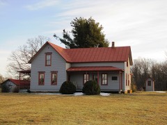
One of 12 National Register listings published here for Fentress County · listed in 1984 · category: Building · built in 1898.
Sources: the National Register database, National Park Service
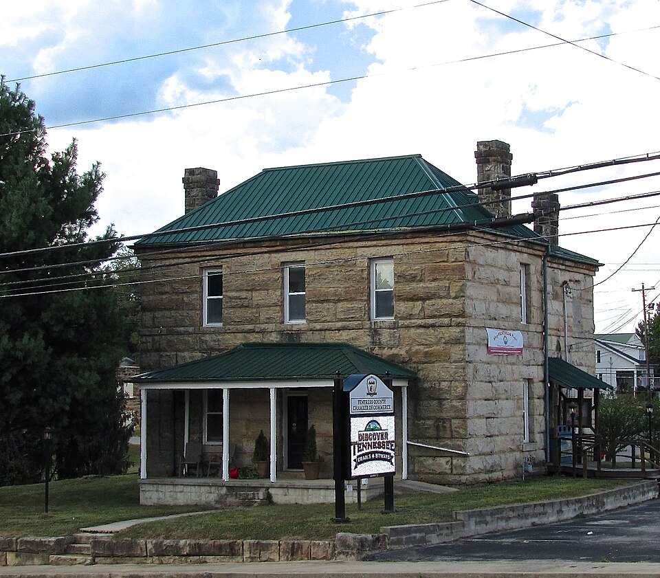
Built in 1898. Listed on the National Register of Historic Places in 1984.
One of 12 National Register listings published here for Fentress County · listed in 1984 · category: Building · built in 1898.
Sources: the National Register database, National Park Service
Regional context, not property-specific evidence. The federal wildfire occurrence database lists 62 fires within 5 miles of Old Fentress County Jail between 1997 and 2020, burning about 568 acres in total. None started naturally. 24 were recorded as arson. Distance is straight-line from the map coordinates, so a fire counted here may appear on a neighbouring settlement's page as well.
| Reported cause | Fires |
|---|---|
| Debris and open burning | 32 |
| Arson/incendiarism | 24 |
| Missing data/not specified/undetermined | 2 |
| Recreation and ceremony | 1 |
| Misuse of fire by a minor | 1 |
| Power generation/transmission/distribution | 1 |
| Other causes | 1 |
The most recent of them, most recent first, with the day each was reported and the service that recorded it.
| Date | Cause | Size | Reported by | Name on the report |
|---|---|---|---|---|
| 23 September 1998 | Arson/incendiarism | 40 acres | Tennessee Division of Forestry | not named |
| 23 September 1998 | Missing data/not specified/undetermined | under an acre | Tennessee Division of Forestry | not named |
| 19 September 1997 | Arson/incendiarism | under an acre | Tennessee Division of Forestry | not named |
| 18 September 1998 | Debris and open burning | under an acre | Tennessee Division of Forestry | not named |
| 6 August 1999 | Arson/incendiarism | 6.5 acres | Tennessee Division of Forestry | not named |
| 29 August 1998 | Debris and open burning | 6.0 acres | Tennessee Division of Forestry | not named |
| 22 August 2001 | Arson/incendiarism | 1.5 acres | Tennessee Division of Forestry | not named |
| 3 June 2000 | Arson/incendiarism | under an acre | Tennessee Division of Forestry | not named |
Regional context, not property-specific evidence. The federal mineral resources record lists 10 workings within 5 miles of Old Fentress County Jail: 5 occurrences, 2 producers, 2 prospects, 1 past producer. 2 still produce. What was taken out: Strontium, Stone, Crushed/Broken, Sand and Gravel, Construction. Distance is straight-line from the map coordinates, so a quarry counted here may appear on a neighbouring settlement's page as well.
| Where | Site | Commodity | Status | Recorded |
|---|---|---|---|---|
| Fentress Co. Highway Dept. Quarry | Sand and Gravel, Construction | Past Producer | Sedimentary | |
| Fentress Co. Highway Dept. Quarry | Stone, Crushed/Broken | Producer | ||
| Fentress County Hwy. Dept. Quarry Pit No. 404 | Stone, Crushed/Broken | Producer | Limestone | |
| Buffalo Cove Quarry | Strontium | Prospect | ||
| Gernt Heirs Property #1 | Strontium | Occurrence | ||
| Gernt Heirs Property #2 | Strontium | Occurrence | ||
| Gordon Stephens Property #1 | Strontium | Occurrence | ||
| Gordon Stephens Property #2 | Strontium | Occurrence | ||
| Joe Young Property | Strontium | Occurrence | ||
| Joe Young Prospect | Strontium | Prospect |
Regional context, not property-specific evidence. The National Weather Service names Jamestown, the town this property stands in, in 93 storm reports between 1993 and 2026: 48 thunderstorm wind, 26 hail, 8 flash flood, 4 lightning. The reports record 1 death and 1 injury. Each account below is quoted exactly as the forecast office filed it, from the NOAA Storm Events Database, and each date opens the federal record of that event.
| When | Event | Place named | Harm | What the report says |
|---|---|---|---|---|
| August 2005 | Lightning | Jamestown | 1 killed, 1 hurt | A husband and wife were mule riding. A thunderstorm developed so they took cover underneath a 200 foot tree. The lightning struck the tree, went down through the tree, hit the ground and hit a 67-year-old female standing underneath the tree. The lightning bolt killed the 2 mules and injured her husband. |
| May 2009 | Tornado (EF1) | Jamestown | $150,000 | EF1 Tornado, with a maximum estimated wind speed of 100 mph, started in the Tom Price Road Area of Jamestown and resulted in the destruction of one mobile home and numerous trees down across houses. A couple of buildings had their roofs blown off just north northeast of Allardt. Newspaper also reported that trees were downed on Government Pond Road, Country Club Road, and Baseline Road, which appeared to be|the hardest hit area, with several large trees being uprooted and most of the siding on an outbuilding at the Joe Pennycuff residence being blown off. There was another|report of a funnel cloud near the White Oak and Hensley Road area. Power outages occurred across several areas of the county due to trees being blown down on power lines. |
| March 1996 | Tornado (F0) | East Jamestown | $150,000 | no account filed |
| March 2021 | Flash Flood | Jamestown | $76,250 | Several roads were flooded in Jamestown and across Fentress County. |
| May 2020 | Thunderstorm Wind | Jamestown | $68,960 | Numerous trees and power lines were blown down across Fentress County. |
| May 2009 | Lightning | Jamestown | $50,000 | County's Emergency 911 center located at the Fentress County Jail sustained a direct lightning hit, temporarily knocking out telephone service and causing damage. |
| January 2008 | Thunderstorm Wind | Jamestown | $50,000 | Numerous trees and power lines were down over western Fentress County and in Jamestown. Some of these trees fell on houses and cars. Power was out in Jamestown. |
| May 2012 | Thunderstorm Wind | Jamestown | $35,000 | Some trees were downed across the county resulting in power outages. |
| May 2024 | Thunderstorm Wind | Jamestown | $25,000 | Severe thunderstorm winds downed numerous trees and power poles in Jamestown. Damages are a rough estimate. |
| July 2022 | Thunderstorm Wind | Jamestown | $25,000 | More than 100 trees and some power poles were blown down across Fentress County. Several buildings suffered minor structural damage. |
| April 2011 | Thunderstorm Wind | Jamestown | $25,000 | Trees and power lines were downed 12 miles west of Jamestown. Trees and power lines were downed in Jamestown. Another tree was downed 3 miles west of Jamestown. |
| June 2009 | Thunderstorm Wind | Jamestown | $25,000 | Small trees were reported down county wide. |
| April 2009 | Thunderstorm Wind | Jamestown | $25,000 | Numerous trees were reported down in the southern part of the county. |
| July 2014 | Thunderstorm Wind | Jamestown | $20,000 | A tree fell onto a house and car on Old Allardt Road just southeast of Jamestown. |
| April 2012 | Thunderstorm Wind | Jamestown | $20,000 | Numerous trees and power lines were blown down throughout Fentress County with all schools closed for the day due to power outages. |
| June 1997 | Thunderstorm Wind | Jamestown | $17,000 | no account filed |
| June 2024 | Thunderstorm Wind | Jamestown | $15,000 | An awning was blown off a gas station in Jamestown. Damages are a rough estimate. |
| June 1998 | Thunderstorm Wind | Jamestown | $15,000 | no account filed |
| March 2026 | Thunderstorm Wind | Jamestown | $10,000 | Severe thunderstorm winds downed a large tree on a home near Highway 52 and Highway 127. Damages are a rough estimate. |
| July 2014 | Thunderstorm Wind | Jamestown | $10,000 | Most of Fentress County without power. Numerous trees were reported blocking roadways across the county. |
| May 2011 | Thunderstorm Wind | Jamestown | $10,000 | Several trees and power lines were downed. |
| May 2011 | Thunderstorm Wind | Jamestown | $10,000 | Several trees were reported downed in Jamestown. |
| September 2010 | Thunderstorm Wind | East Jamestown | $10,000 | Trees were downed in the northeastern corner of the county, including State Highway 154 northeast of Jamestown. |
| May 2005 | Thunderstorm Wind | Jamestown | $10,000 | Law enforcement reported trees and power lines were down. Many trees were down on houses. |
| December 2000 | Thunderstorm Wind | Jamestown | $10,000 | Newspaper article reported strong thunderstorm winds damaged a barn and took the roof off an adjoining shed. Also, a portion of the fence was destroyed by flying debris from the barn. This occurred at the John Tallent farm, located east of Jamestown Airport. |
| January 1999 | Thunderstorm Wind | Jamestown | $10,000 | Barn was blown down. Several trees were blown down, including 2 trees down on homes. |
| June 2019 | Thunderstorm Wind | Jamestown | $5,000 | Tree damage and power outages were reported throughout Fentress County. |
| June 2017 | Lightning | Jamestown | $5,000 | A small outbuilding was struck by lightning, and the resulting fire burned the structure to the ground. |
| July 2014 | Thunderstorm Wind | Jamestown | $5,000 | A tree was reported down with power outages at West Briar Avenue. |
| January 2013 | Thunderstorm Wind | Jamestown | $5,000 | A few trees were downed across the county. |
| November 2010 | Flash Flood | Jamestown | $5,000 | Flooding was reported on Old Allardt Road next to the bridge. |
| May 2010 | Thunderstorm Wind | Jamestown | $5,000 | Fentress EMA reported several large trees were blown down near Jamestown. |
| February 1993 | Thunderstorm Wind | Jamestown | $5,000 | A few trees and power lines were knocked down. |
| December 2021 | Thunderstorm Wind | Jamestown | $3,000 | A Facebook report indicated trees and power lines were blown down in the Ridgetop Acres area of Jamestown. |
| December 2019 | Flood | Jamestown | $3,000 | High water covered parts of McGhee Road. Heavy rain also caused several trees to fall across the road. |
| April 2018 | Thunderstorm Wind | Jamestown | $3,000 | Several trees were blown down in Jamestown. |
| June 2016 | Thunderstorm Wind | Jamestown | $3,000 | A few trees were blown down in the Jamestown area. |
| April 2012 | Thunderstorm Wind | Jamestown | $3,000 | A tree was uprooted at Hamilton Field Road and Gouldstown Road breaking a main water line. |
| May 2008 | Thunderstorm Wind | Jamestown | $3,000 | Trees were down on Highway 52 about 5 miles west of Jamestown. |
| July 2018 | Thunderstorm Wind | Jamestown | $2,000 | Minor roof damage occurred to a house in Jamestown just off Highway 52 East. |
| May 2015 | Thunderstorm Wind | East Jamestown | $2,000 | Part of the roof of an old body shop was blown off at Highway 154 and Crockett Cemetery Road. |
| January 2000 | Thunderstorm Wind | Jamestown | $2,000 | Multiple trees down and went through a house. |
| June 1995 | Thunderstorm Wind | Jamestown | $2,000 | A couple of trees were blown down. |
| June 2007 | Thunderstorm Wind | Jamestown | $1,000 | Trees and power lines were down just west of Jamestown on Highway 52. |
| June 2006 | Flash Flood | Jamestown | $1,000 | Road flooded out. |
| September 2006 | Lightning | Jamestown | $1,000 | Lightning struck near the home of Kirby Kennedy on Coon Hunters Rd. The lightning traveled more than 60 feet, creating a ditch up to 2 feet wide and over a foot deep, before it made contact with a swing set in the yard, jumped from one swing set to the other, and continued another 50-plus feet, making a smaller ditch before knocking off part of a gutter downspout on the house. The only visible damage to the house was a small hole which the surge blew out one of the foundation blocks. |
| May 1995 | Hail | Jamestown | $100 | no account filed |
| August 2021 | Flood | Jamestown | - | A few areas of street flooding occurred in Jamestown. The public reported receiving 2.23 inches of rain in about 30 minutes. |
| July 2015 | Hail | Jamestown | - | Quarter size hail was reported in downtown Jamestown. |
| August 2014 | Flash Flood | Jamestown | - | Heavy rain resulted in flooding along Alf Threet Road and Taylor Place Road south of Jamestown with water flowing across the roadways. |
| August 2014 | Flood | Jamestown | - | McGhee Street and Memory Garden Road in Jamestown were flooded but still passable. |
| July 2014 | Hail | Jamestown | - | Quarter sized hail was reported by a trained spotter in Jamestown. |
| April 2012 | Hail | Jamestown | - | A trained spotter reported golf ball size hail in Jamestown. |
| April 2012 | Hail | Jamestown | - | A trained spotter reported half dollar size hail and power outages 2 miles south of Jamestown. |
| March 2011 | Hail | Jamestown | - | Quarter sized hail was reported by a spotter near Jamestown. |
| May 2009 | Hail | Jamestown | - | One inch hail was reported. |
| May 2009 | Hail | Jamestown | - | Quarter size hail was reported near Jamestown. |
| May 2009 | Hail | Jamestown | - | Golf ball size hail was reported in Jamestown. |
| April 2006 | Hail | Jamestown | - | Quarter size hail reported. |
| April 2006 | Thunderstorm Wind | Jamestown | - | Spotter measured a wind gust up to 70 mph. Also, 2 trees were blown down. |
No historic map-sheet match is published for this property yet. That does not mean no map exists. This record needs a coordinate-quality review before it can be joined to a sheet boundary. Browse the county's mapped places while that work is pending.
Other National Register properties close enough to walk or drive between, ordered by distance from this one. Both positions come from the same geocoding pass that matched these properties to their map sheets.
| Photograph | Property | Distance | Listed |
|---|---|---|---|
 | Alvin C. York Agricultural Institute Historic District | 1.2 miles | 1991 |
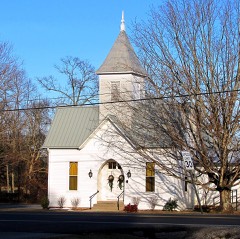 | Allardt Presbyterian Church | 4.2 miles | 1991 |
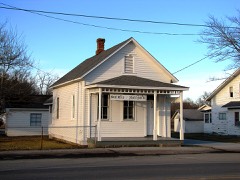 | Gernt Office | 4.2 miles | 1991 |
| Youngs Historic District | 4.3 miles | 1991 | |
| Allardt Historic District | 4.6 miles | 1991 | |
 | Bruno Gernt House | 4.8 miles | 1987 |
| National Archives record | The nomination case file for reference 84003536 in Record Group 79. |
| Fentress County | All 12 listed properties in this county. |