 Block
From the record
12 National Register listings published here, 1 of them a National Historic Landmark.
Sources: the county history on the Internet Archive · the National Register database, National Park Service
80 topographic sheets cover 43 settlements here, and 12 properties are on the National Register of Historic Places.
12 National Register listings published here, 1 of them a National Historic Landmark.
Sources: the county history on the Internet Archive · the National Register database, National Park Service
Every property in this county listed on the National Register of Historic Places, with the year it was listed and the federal nomination document.
| Photograph | Property | Type | Listed | Reference |
|---|---|---|---|---|
| Allardt Historic District | district | 1991 | 91001593 | |
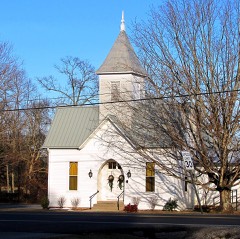 | Allardt Presbyterian Church | building | 1991 | 91000818 |
| James Beaty General Merchandise Store | building | 2013 | 13000947 | |
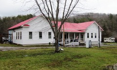 | Davidson School | building | 1993 | 92001739 |
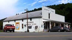 | Forbus Historic District | district | 1991 | 91000821 |
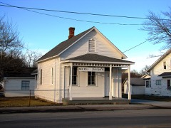 | Gernt Office | building | 1991 | 91000819 |
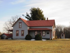 | Bruno Gernt House | building | 1987 | 87000391 |
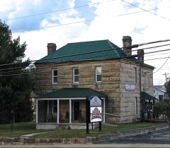 | Old Fentress County Jail | building | 1984 | 84003536 |
| Sergeant York Historic Area | district | 1973 | 73001763 | |
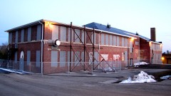 | Alvin C. York Agricultural Institute Historic District | district | 1991 | 91001378 |
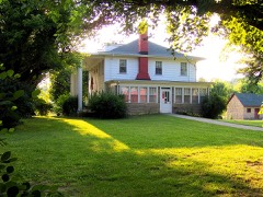 | Alvin Cullom York Farm | district | 1976 | 76001773 |
| Youngs Historic District | district | 1991 | 91000820 |
Every wildfire the federal occurrence database records inside this county: 336 of them, burning about 16,481 acres. 1 started naturally and 168 were recorded as arson. Each settlement page carries the fires within five miles of it.
| Reported cause | Fires |
|---|---|
| Arson/incendiarism | 168 |
| Debris and open burning | 112 |
| Missing data/not specified/undetermined | 33 |
| Recreation and ceremony | 7 |
| Equipment and vehicle use | 5 |
| Power generation/transmission/distribution | 4 |
| Misuse of fire by a minor | 3 |
| Smoking | 2 |
| Natural | 1 |
| Other causes | 1 |
The five largest, by the area the report gives. Every one of them was set deliberately.
| Date | Cause | Size | Reported by | Name on the report |
|---|---|---|---|---|
| 3 November 2000 | Arson/incendiarism | 3,398 acres | Big South Fork National River and Recreation Area | DARROW RDG |
| 1 November 2000 | Arson/incendiarism | 2,925 acres | Tennessee Division of Forestry | not named |
| 1 November 2000 | Arson/incendiarism | 1,088 acres | Big South Fork National River and Recreation Area | CAMPBRANCH |
| 27 November 2012 | Arson/incendiarism | 960 acres | Tennessee Division of Forestry | GERNT STABLES |
| 1 November 2000 | Arson/incendiarism | 787 acres | Tennessee Division of Forestry | not named |
| 30 March 2006 | Arson/incendiarism | 631 acres | Tennessee Division of Forestry | GATEWOOD FORD ROAD |
| 30 March 2006 | Arson/incendiarism | 364 acres | Tennessee Division of Forestry | GATEWOOD FORD ROAD |
| 7 April 2013 | Arson/incendiarism | 340 acres | Tennessee Division of Forestry | STEPHENS LOOP |
Every settlement page carries the fires within five miles of it - see the settlement index below.
The NOAA Storm Events Database holds 299 reports for this county, causing 9 deaths, 163 injuries and about $11,766,910 in recorded property damage. Each settlement page carries the reports that name it.
| Kind of event | Reports |
|---|---|
| Thunderstorm Wind | 167 |
| Hail | 59 |
| Flash Flood | 29 |
| Tornado | 20 |
| Lightning | 11 |
| Flood | 9 |
| Heavy Rain | 3 |
| Funnel Cloud | 1 |
The most serious of them, by death, then injury, then recorded damage. The accounts are quoted exactly as the forecast office filed them.
| When | Event | Place named | Harm | What the report says |
|---|---|---|---|---|
| April 1974 | Tornado (F4) | not stated | 7 killed, 150 hurt, $2,500,000 | no account filed |
| July 2005 | Lightning | Allardt | 1 killed, 3 hurt, $10,000 | Mr. Terry Binion, a 38-year-old Hartsville resident, was struck and killed by lightning while riding a horse at the East Fork Stables in Allardt. He was riding with his wife, son, and 2 friends. The lightning bolt struck a tree, then bounced off the tree hitting the man and hitting his 2 friends, Kelly Overton and Kyle Deering. Mr. Binion and his horse died at the scene. Mrs. Binion, Overton and Deering were treated and released from Jamestown Regional Medical Center. Overton's horse also died. The damage on the tree by the lightning was about 2 inches wide and 20 feet down. |
| August 2005 | Lightning | Jamestown | 1 killed, 1 hurt | A husband and wife were mule riding. A thunderstorm developed so they took cover underneath a 200 foot tree. The lightning struck the tree, went down through the tree, hit the ground and hit a 67-year-old female standing underneath the tree. The lightning bolt killed the 2 mules and injured her husband. |
| May 1972 | Tornado (F2) | not stated | 3 hurt, $25,000 | no account filed |
| November 1957 | Tornado (F2) | not stated | 2 hurt, $25,000 | no account filed |
| February 1956 | Tornado (F1) | not stated | 2 hurt, $25,000 | no account filed |
| July 2009 | Thunderstorm Wind | Pall Mall | 1 hurt, $1,000 | Tree fell on a car which resulted in a woman getting injured. Extent of injuries to woman unknown. |
| March 1991 | Thunderstorm Wind | not stated | 1 hurt | no account filed |
| August 2010 | Flood | Pine Haven | $5,000,000 | South Main Street was covered in about a foot of water near York High School. A tree was also reported down on State Highway 52 West.||Newspapers reported that considerable flooding occurred in some areas of the county, causing considerable damage to several roads, including the complete washout of West Cave Road, State Highway 154, at the intersection at the intersection of State Highway 52 west of Jamestown. The heavy rainfall was also responsible for washing out a water line on Glenobey Road.||All this damage was the result of more than 5 inches of rain falling in less than 4 hours in some parts of the county. |
| February 2025 | Tornado (EF2) | Highland Jct | $1,000,000 | This tornado touched down northwest of Clarkrange along Baldwin Gulf Road in Fentress County where it caused roofing damage to a residence. The tornado traveled east-southeast and crossed Lowe Point Road, Old Bean Shed Road, and S York Highway, snapping trees along its path. The tornado continued its east-southeast track towards the Fentress and Morgan County border, and once it crossed Ernest Hall Road, it destroyed a chicken barn. The tornado then crossed into Morgan County at Brodio Road. Damage found in Fentress County was rated EF-1 tornado damage with maximum estimated winds of 95 mph, but the tornado strengthened to EF-2 after crossing into Morgan County. Damages are a rough estimate. |
| June 2023 | Tornado (EF1) | Jamestown Arpt | $500,000 | This EF-1 tornado touched down south of the Jamestown Municipal Airport near Highway 127 and traveled over 11 miles toward the east-northeast before lifting near Charley Hull Loop Road. The tornado uprooted and snapped hundreds of trees along the path. Over a dozen outbuildings and barns were completely destroyed, and several houses sustained roof and window damage. Local residents captured the tornado on video. High resolution satellite imagery was very helpful in determining the path of this tornado. No injuries or fatalities were reported. Damages are a rough estimate. |
| June 2009 | Lightning | Stockton | $200,000 | Lightning strike destroyed an Oil Tank. One of the tanks exploded and flew 300 feet from its original location. Newspaper reported that this one tank broke off a crossmember of a utility pole and severed power and utility lines before coming to rest across the road from its original position. There was only a small amount of oil in the bottom of the tanks, which helped keep a fire that had also broken out due to the lightning strike from spreading to three other tanks in the same area. |
| June 2023 | Tornado (EF1) | Banner Spgs | $150,000 | This low end EF-1 tornado touched down west of the intersection of Bicknell Road and Leamon Hall Road and traveled toward the east-northeast before lifting west of Larue Lane. Dozens of trees were uprooted and snapped, causing damage to two homes and a few outbuildings. High resolution satellite imagery was very helpful in determining the path of this tornado. No injuries or fatalities were reported. Damages are a rough estimate. |
| May 2009 | Tornado (EF1) | Jamestown | $150,000 | EF1 Tornado, with a maximum estimated wind speed of 100 mph, started in the Tom Price Road Area of Jamestown and resulted in the destruction of one mobile home and numerous trees down across houses. A couple of buildings had their roofs blown off just north northeast of Allardt. Newspaper also reported that trees were downed on Government Pond Road, Country Club Road, and Baseline Road, which appeared to be|the hardest hit area, with several large trees being uprooted and most of the siding on an outbuilding at the Joe Pennycuff residence being blown off. There was another|report of a funnel cloud near the White Oak and Hensley Road area. Power outages occurred across several areas of the county due to trees being blown down on power lines. |
| March 1996 | Tornado (F0) | East Jamestown | $150,000 | no account filed |
| July 2023 | Flash Flood | Riverton | $100,000 | Heavy rain started early in the morning in the Jamestown area, and training thunderstorms through the afternoon hours produced five to eight inches of rain which resulted in significant flash flooding. According to the emergency manager and several other sources, numerous roads were flooded and washed out due to the flooding. Some of these roads included Manson Road, Tollie Lane, and Riverton Road in the Manson community where two small bridges also reportedly had water flowing over them. Highway 52 at Riverton Road was washed out and impassable. Boatland Road and Mill Creek Road were also washed out with a car swept away along Mill Creek Road. Glenobey Road and David Road were also flooded and closed. No reports of injuries or fatalities were received. Damages are a rough estimate. |
| March 2021 | Flash Flood | Jamestown | $76,250 | Several roads were flooded in Jamestown and across Fentress County. |
| May 2024 | Thunderstorm Wind | Sharp Place | $75,000 | NWS Damage Assessment found large swaths of trees down in northeastern Pickett County, primarily along Pickett Park Highway northeast of Jamestown. These trees also brought down large stretches of powerlines. |
| May 2020 | Thunderstorm Wind | Jamestown | $68,960 | Numerous trees and power lines were blown down across Fentress County. |
| July 2023 | Flash Flood | Clarkrange | $50,000 | Heavy rain began in the Clarkrange area early in the morning and continued into the afternoon hours, producing an estimated five to eight inches of rain. This produced significant flash flooding in the area with the emergency manager and several other sources reporting that numerous roads were flooded and washed out. These included Highway 127 and Highway 62 as well as Franklin Loop north of Clarkrange. A CoCoRaHS observer northeast of Clarkrange near Roslin Road measured 6.11 inches of rain. No injuries or fatalities were reported, and damages are a rough estimate. |
| July 2015 | Tornado (EF1) | Riverton | $50,000 | A tornado moved southeast out of far southern Pickett County into western Fentress County and strengthened to EF1 intensity. One home on Riverton Road suffered moderate roof and siding damage, and a nearby mobile home had minor roof damage. Numerous trees and power lines were blown down on Riverton Road and Highway 52 with both roadways blocked and closed. More trees were snapped and uprooted on Manson Road and Boatland Road before the tornado lifted around 6 miles southwest of Jamestown. Maximum winds were estimated at 95 mph. |
| July 2012 | Thunderstorm Wind | Grimsley | $50,000 | Dannys Discount Store in Grimsley had its roof blown off, trees and power lines were downed county wide, with one tree on house on Stockton Road and Mt. Helen Road. |
| February 2009 | Tornado (EF1) | Camp Ground | $50,000 | The initial touchdown was near the intersection of Little Hurricane Trail and Highway 62. The damage path from the tornado continued for approximately 1/2 of a mile to the northeast.| |Dozen of pine trees, and a few hardwood trees, were snapped or uprooted. One residence had a small portion of roof peeled back. Two trees fell on automobiles and another fell on and heavily damaged an outbuilding. |
| February 2009 | Thunderstorm Wind | Camp Ground | $50,000 | Thirty to fifty trees were downed off Highway 62 Little Hurricane Trail. Man was pinned in car by tree and transported to hospital. Condition of man unkown. |
| May 2009 | Lightning | Jamestown | $50,000 | County's Emergency 911 center located at the Fentress County Jail sustained a direct lightning hit, temporarily knocking out telephone service and causing damage. |
| January 2008 | Thunderstorm Wind | Jamestown | $50,000 | Numerous trees and power lines were down over western Fentress County and in Jamestown. Some of these trees fell on houses and cars. Power was out in Jamestown. |
| February 2009 | Thunderstorm Wind | Highland Jct | $40,000 | Significant damage to an abandoned car wash in Clarkrange. Roof was detached. Power lines were also downed along Highway 62. |
| May 2012 | Thunderstorm Wind | Jamestown | $35,000 | Some trees were downed across the county resulting in power outages. |
| July 2012 | Thunderstorm Wind | Allardt | $30,000 | Roof damage to a furniture store occurred and several trees were downed in Allardt. |
| April 2011 | Thunderstorm Wind | Pine Haven | $30,000 | Metal building was destroyed at the York Agricultural Institute and power lines were also downed on State Highway 52. Specific details concerning the type of metal building that was destroyed were unknown. |
| April 2011 | Thunderstorm Wind | Camp Ground | $30,000 | Just off of State Highway 62 between Clarkrange and Monterey, about 3/4 mile east of the Putnam County line, several trees were snapped off, uprooted, or twisted. Minor structural damage also occurred. Specific details concerning what type of structure sustained damage and associated costs were unkown. |
| March 2025 | Thunderstorm Wind | Pine Haven | $25,000 | Severe thunderstorm winds downed several trees and caused minor structural damage on the north side of Jamestown near Fairgrounds Road. Damages are a rough estimate. |
| February 2025 | Hail | Clarkrange | $25,000 | A few houses just north of Clarkrange received hail the evening of February 6th. A few minutes of hail was reported, leading to roofs being damaged as well as some vehicle damage. One resident reported hail of nickel to quarter size. |
| May 2024 | Thunderstorm Wind | Jamestown | $25,000 | Severe thunderstorm winds downed numerous trees and power poles in Jamestown. Damages are a rough estimate. |
| May 2024 | Thunderstorm Wind | Allardt | $25,000 | Facebook user reported several trees down on Memory Creek Road in Allardt with one tree falling onto a house. Damages are a rough estimate. |
| July 2022 | Thunderstorm Wind | Jamestown | $25,000 | More than 100 trees and some power poles were blown down across Fentress County. Several buildings suffered minor structural damage. |
| April 2011 | Thunderstorm Wind | Jamestown | $25,000 | Trees and power lines were downed 12 miles west of Jamestown. Trees and power lines were downed in Jamestown. Another tree was downed 3 miles west of Jamestown. |
| November 2010 | Flash Flood | Wilder | $25,000 | A rock slide was reported along Highway 85 at Wilder. Several back roads were also closed across Fentress County. |
| January 2010 | Flash Flood | Pall Mall | $25,000 | Local radio station reported flooded roadways at various locations across the county. |
| July 2010 | Lightning | Allardt | $25,000 | House fire was started by a lightning strike which resulted in minor damage to a home in Allardt. Extent of minor damage was unkown. |
| May 2010 | Flood | Allardt | $25,000 | State Highway 296 was closed due to high water. |
| June 2009 | Thunderstorm Wind | Stockton | $25,000 | Several trees were blown down in the Mt. Helen area. |
| June 2009 | Thunderstorm Wind | Jamestown | $25,000 | Small trees were reported down county wide. |
| June 2009 | Thunderstorm Wind | Pine Haven | $25,000 | Small trees were reported down county wide. |
| April 2009 | Thunderstorm Wind | Jamestown | $25,000 | Numerous trees were reported down in the southern part of the county. |
| May 1984 | Tornado (F1) | not stated | $25,000 | no account filed |
| April 1974 | Tornado (F2) | not stated | $25,000 | no account filed |
| April 1965 | Tornado (F2) | not stated | $25,000 | no account filed |
| July 2011 | Lightning | Allardt | $22,000 | The fire alarm and PA System at Allardt Elementary School was struck by lightning causing major damage to this system. |
| August 2023 | Thunderstorm Wind | Clarkrange | $20,000 | Severe thunderstorm winds downed powerlines along Martha Washington Road in Clarkrange and downed a tree on top of a car. No injuries were reported. Damages are a rough estimate. |
| June 2019 | Tornado (EF1) | Armathwaite | $20,000 | An EF-1 tornado touched down in the Armathwaite community west of Brannon Lane and moved east across Stockton Road, Mt Helen Road, HM Brooks Road, Chestnut Ridge Road, and Sam Smith Road before lifting. A few barns and outbuildings were damaged and hundreds of large trees were snapped and uprooted along the path, with the worst damage along Sam Smith Road where a home narrowly missed being crushed by numerous trees. The tornado path may have been longer to the east but that area is not accessible by roads. |
| July 2014 | Thunderstorm Wind | Jamestown | $20,000 | A tree fell onto a house and car on Old Allardt Road just southeast of Jamestown. |
| February 2012 | Thunderstorm Wind | Banner Spgs | $20,000 | An NWS Storm Survey found a strong microburst with maximum wind speeds up to 85 mph struck areas east of Grimsley. Dozens of trees were snapped or uprooted and several power poles and lines were blown down along a 2 mile path from south of the Banner Springs Road and Press Beaty Road intersection eastward to Pierce Road. One tree fell on a house on Georgee Road causing major damage to the roof and garage. Another tree toppled onto and damaged a vehicle on Press Beaty Road, and a tree also fell onto and destroyed an outbuilding on Pierce Road. |
| April 2012 | Thunderstorm Wind | Jamestown | $20,000 | Numerous trees and power lines were blown down throughout Fentress County with all schools closed for the day due to power outages. |
| January 2008 | Thunderstorm Wind | Allardt | $20,000 | Porch was destroyed to a home and shingles were blown off the roof.|One such incident was at the Flea-N-Tique building on Highway 127 South. The front porch was ripped off and blown about 300 feet. |
| March 1997 | Hail | Countywide | $20,000 | no account filed |
| June 1997 | Thunderstorm Wind | Jamestown | $17,000 | no account filed |
| June 2024 | Thunderstorm Wind | Jamestown | $15,000 | An awning was blown off a gas station in Jamestown. Damages are a rough estimate. |
| June 2023 | Thunderstorm Wind | Allardt | $15,000 | Severe thunderstorm winds associated with a tornadic storm snapped power poles and downed trees north of Allardt. Damages are estimated. |
| June 2019 | Thunderstorm Wind | Allardt | $15,000 | A tree fell on a house causing significant damage. |
The Survey's mineral resources record lists 19 workings inside this county. 5 still produce and 14 are closed or unrecorded. Each settlement page carries the workings within five miles of it.
| Commodity | Workings |
|---|---|
| Strontium | 8 |
| Stone, Crushed/Broken | 3 |
| Zinc | 3 |
| Barium-Barite | 2 |
| Sand and Gravel, Construction | 2 |
| Stone, Crushed/Broken, Limestone, General | 1 |
| Dolomite | 1 |
The least common of them first, because a county's hundredth gravel pit says nothing its first ten did not.
| Where | Site | Commodity | Status | Recorded |
|---|---|---|---|---|
| Frogge & Williams Limestone Co. Quarry | Stone, Crushed/Broken, Limestone, General | Producer | Limestone | |
| Pall Mall | Zinc, Dolomite | Past Producer | Underground | |
| Fentress Co. Highway Dept. Quarry | Sand and Gravel, Construction | Past Producer | Sedimentary | |
| Fentress County Sand Quarry | Sand and Gravel, Construction | Producer | ||
| Pall Mall Mine | Barium-Barite | Past Producer | 1933 | |
| Pall Mall Mine | Barium-Barite | Past Producer | ||
| Deep Well-Sphalerite Occurrence | Zinc | Occurrence | Sphalerite | |
| Deep Well-Sphalerite Occurrence | Zinc | Occurrence | ||
| Fentress Co. Highway Dept. Quarry | Stone, Crushed/Broken | Producer | ||
| Fentress County Hwy. Dept. Quarry Pit No. 404 | Stone, Crushed/Broken | Producer | Limestone | |
| Wright Quarry | Stone, Crushed/Broken | Producer | ||
| Buffalo Cove Quarry | Strontium | Prospect | ||
| Gernt Heirs Property #1 | Strontium | Occurrence | ||
| Gernt Heirs Property #2 | Strontium | Occurrence | ||
| Gordon Stephens Property #1 | Strontium | Occurrence | ||
| Gordon Stephens Property #2 | Strontium | Occurrence | ||
| Joe Young Property | Strontium | Occurrence | ||
| Joe Young Prospect | Strontium | Prospect | ||
| Richard Beatty Property | Strontium | Occurrence |
One book written about this county, cut here where the book itself is cut, at its printed chapters: 3 chapters in all. Every chapter is public domain, machine-read from the scan and reproduced complete. A chapter already given under one of the county's towns is not repeated in this list.
| Chapter | Length |
|---|---|
| Chapter 5: Mark Twain's Description of Jamestown and the Surroundings | 1,506 words |
| Chapter 22: Jim Crockett | 557 words |
| Chapter 24 | 20,589 words in 2 parts |
Named settlements recorded in the Geographic Names Information System, each with the topographic sheets covering it. Villages, hamlets and abandoned places alike. Each is shown with the nearest named watercourse or landform and the survey quadrangle it falls on.
District 5 · 38504 · On Lovely Spring Branch · Burrville quadrangle
16 sheets, 1895 to 1979
District 4 · 38556 · On Laurel Branch · Jones Knob quadrangle
16 sheets, 1895 to 1979
District 5 · 38556 · On Davis Branch · Burrville quadrangle
16 sheets, 1895 to 1979
No longer a settlement
District 3 · 38556 · On Crooked Creek · Jamestown quadrangle
16 sheets, 1895 to 1979
District 5 · 38556 · On Mineral Springs Branch · Stockton quadrangle
18 sheets, 1895 to 1979
District 4 · 38556 · On Laurel Branch · Grimsley quadrangle
16 sheets, 1895 to 1979
No longer a settlement
District 5 · 38504 · On West Fork Joe Branch · Honey Creek quadrangle
19 sheets, 1895 to 2000
District 5 · 38556 · Near Campbell Mountain · Jamestown quadrangle
16 sheets, 1895 to 1979
District 2 · 38577 · Near Wright Mountain · Jamestown quadrangle
16 sheets, 1895 to 1979
District 4 · 37726 · On Shoal Creek · Grimsley quadrangle
16 sheets, 1895 to 1979
No longer a settlement
The vanished settlements of Fentress County: the places named above that are no longer on the map.