BlockBefore
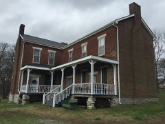
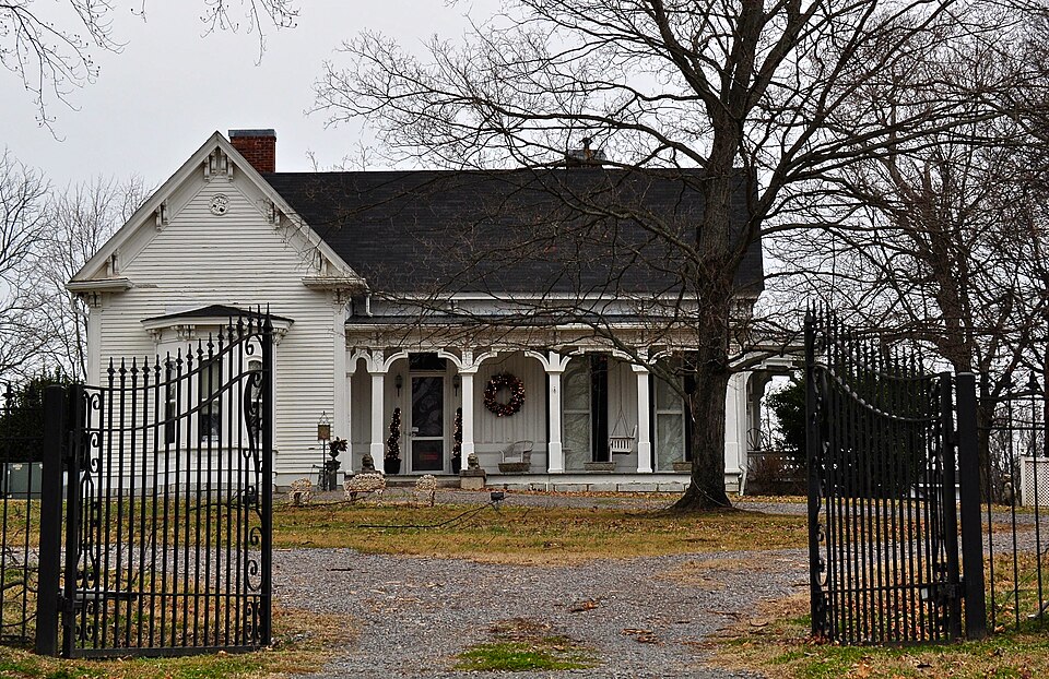
Photograph of Parks Place
Photograph by Skye Marthaler, CC BY-SA 3.0. Via Wikimedia Commons.

Parks Place

Listed on the National Register of Historic Places in 1984.

From the record

“Parks Place is an Italianate-style house in College Grove, Tennessee that was listed on the National Register of Historic Places in 1984. It has also been known as the William Felix Webb House.”

Wikipedia article Parks Place, CC BY-SA 4.0.

One of 135 National Register listings published here for Williamson County · listed in 1984 · category: Building.

Sources: the Wikipedia article · the National Register database, National Park Service

The listing

  • What is counted as historic. The nomination lists 3 buildingss as contributing to the listing.
  • Address. Cox Rd., College Grove, 37046
  • When was it listed? September 1984
  • Category. building
  • District. District 5
  • Architectural style. Renaissance Revival architecture
  • National Register reference number. 84003753 - assigned by the National Park Service when the property was listed.

Storms near this property

9 since 2005

Regional context, not property-specific evidence. The National Weather Service names College Grove, the town this property stands in, in 9 storm reports between 2005 and 2023: 5 thunderstorm wind, 2 hail, 1 tornado, 1 flash flood. No death or injury is recorded in these reports. Each account below is quoted exactly as the forecast office filed it, from the NOAA Storm Events Database, and each date opens the federal record of that event.

WhenEvent Place namedHarm What the report says
January 2013Tornado (EF0)College Grove$80,000An EF0 tornado touched down west of Horton Highway around 3 miles west of Eagleville. Farm buildings on the west side of Horton Highway were damaged with one outbuilding destroyed. Several trees were also snapped or uprooted. The tornado then crossed Horton Highway into Rutherford County.
March 2017Thunderstorm WindCollege Grove$3,000A tSpotter Twitter photo showed an old barn was destroyed near College Grove.
April 2017Thunderstorm WindCollege Grove$2,000A friend of a NWS employee reported trees were blown down in the College Grove area.
February 2014Thunderstorm WindCollege Grove$2,000A trained spotter reported trees blown down on Horton Highway near College Grove.
June 2023Thunderstorm WindCollege Grove$1,000A #tspotter on Twitter reported a snapped oak tree near Arno-Allisona Road and Giles Hill Road near Eagleville. Damages are estimated for the tree.
July 2020Flash FloodCollege Grove-Many yards were submerged with flood waters over roadways at Highway 31A at Harper Street and Drumright Road near College Grove Elementary in College Grove.
August 2019HailCollege Grove-Facebook photos showed quarter size hail fell in College Grove.
May 2005Thunderstorm WindCollege Grove-WKRN-TV channel 2 reported tree down at College Grove.
March 2021HailCollege Grove-no account filed

Every storm recorded in Williamson County

Map coverage status

No historic map-sheet match is published for this property yet. That does not mean no map exists. This record needs a coordinate-quality review before it can be joined to a sheet boundary. Browse the county's mapped places while that work is pending.

Listed places nearby

6 within 8 miles

Other National Register properties close enough to walk or drive between, ordered by distance from this one. Both positions come from the same geocoding pass that matched these properties to their map sheets.

Photograph PropertyDistance Listed
James Webb House0.3 miles1988
Joseph Scales House0.7 miles1988
James Scales House0.8 miles1988
Newton Jordan House1.4 miles1988
College Grove Methodist Church1.9 miles1988
Bank of College Grove, The2.0 miles1988

Sources for this property

National Archives recordThe nomination case file for reference 84003753 in Record Group 79.
Wikipedia articleCommunity-written account of this property, licensed CC BY-SA.
Williamson CountyAll 135 listed properties in this county.

Provenance

  • Listing record. National Park Service National Register of Historic Places, listed-properties dataset, current to 2026-05-22.
  • Map join. Address geocoded through the United States Census geocoder, then tested against the published boundary of every sheet in the USGS Historical Topographic Map Collection.
  • How this page is made. Listing fields come from federal records; map-sheet coverage is a labelled coordinate-to-boundary calculation, not a source-field claim.
  • Storms. NOAA National Centers for Environmental Information, Storm Events Database https://www.ncei.noaa.gov/stormevents/ A work of the United States government, no copyright under 17 U.S.C. 105. Narratives are quoted verbatim from the National Weather Service report and are not edited or summarised.