 Block
From the record
One of 33 National Register listings published here for Bedford County · listed in 1985 · category: District.
Sources: the National Register database, National Park Service
Listed on the National Register of Historic Places in 1985.
One of 33 National Register listings published here for Bedford County · listed in 1985 · category: District.
Sources: the National Register database, National Park Service
Regional context, not property-specific evidence. The federal wildfire occurrence database lists 48 fires within 5 miles of Normandy Historic District between 1998 and 2019, burning about 286 acres in total. None started naturally. 11 were recorded as arson. Distance is straight-line from the map coordinates, so a fire counted here may appear on a neighbouring settlement's page as well.
| Reported cause | Fires |
|---|---|
| Debris and open burning | 24 |
| Arson/incendiarism | 11 |
| Equipment and vehicle use | 4 |
| Power generation/transmission/distribution | 2 |
| Missing data/not specified/undetermined | 2 |
| Railroad operations and maintenance | 1 |
| Fireworks | 1 |
| Recreation and ceremony | 1 |
| Smoking | 1 |
| Other causes | 1 |
The most recent of them, most recent first, with the day each was reported and the service that recorded it.
| Date | Cause | Size | Reported by | Name on the report |
|---|---|---|---|---|
| 4 September 1999 | Arson/incendiarism | 5.0 acres | Tennessee Division of Forestry | not named |
| 29 September 2007 | Equipment and vehicle use | under an acre | Tennessee Division of Forestry | SMITH |
| 23 September 2019 | Debris and open burning | under an acre | Tennessee Division of Forestry | LOCKWOOD FIRE |
| 23 September 1998 | Arson/incendiarism | under an acre | Tennessee Division of Forestry | not named |
| 25 August 1999 | Arson/incendiarism | 12 acres | Tennessee Division of Forestry | not named |
| 28 July 2000 | Debris and open burning | 3.0 acres | Tennessee Division of Forestry | not named |
| 16 May 2000 | Arson/incendiarism | under an acre | Tennessee Division of Forestry | not named |
| 9 April 2014 | Power generation/transmission/distribution | 20 acres | Tennessee Division of Forestry | SANDERS |
Regional context, not property-specific evidence. The federal mineral resources record lists 2 workings within 5 miles of Normandy Historic District: 2 occurrences. None of them still produces. What was taken out: Uranium, Oil Shale, Uranium, Oil Shale. Distance is straight-line from the map coordinates, so a quarry counted here may appear on a neighbouring settlement's page as well.
| Where | Site | Commodity | Status | Recorded |
|---|---|---|---|---|
| Outcrop Sample For Uranium | Uranium, Oil Shale | Occurrence | ||
| Outcrop Sample For Uranium | Uranium, Oil Shale | Occurrence |
Regional context, not property-specific evidence. The National Weather Service names Normandy, the town this property stands in, in 15 storm reports between 1997 and 2024: 8 thunderstorm wind, 3 hail, 3 flash flood, 1 tornado. No death or injury is recorded in these reports. Each account below is quoted exactly as the forecast office filed it, from the NOAA Storm Events Database, and each date opens the federal record of that event.
| When | Event | Place named | Harm | What the report says |
|---|---|---|---|---|
| July 2023 | Flash Flood | Normandy | $25,000 | Heavy rain in the Normandy area resulted in flash flooding along Rowesville Road. One person had to be rescued from their vehicle which got trapped in the flood waters. No injuries were reported. Damages are a rough estimate. |
| April 2011 | Tornado (EF1) | Normandy | $25,000 | An EF1 tornado with maximum winds 90 to 100 mph touched down around 615 am in extreme southeast Bedford County. Damage was centered along Magnolia Lane and Winding Way Road. The damage path in Bedford and Coffee counties was approximately 1 mile long. Maximum path width was 75 yds. Hundreds of trees were snapped along the path. |
| September 2021 | Flash Flood | Normandy | $15,000 | A house was reportedly flooded with vehicles floating down the creek in the 500 block of Carr Creek Road. |
| May 2024 | Thunderstorm Wind | Normandy | $10,000 | Severe thunderstorm winds downed trees on Normandy Road and along Highway 269 in Normandy. Damages are a rough estimate. |
| August 2012 | Thunderstorm Wind | Normandy | $5,000 | Several trees were blown down in Normandy. |
| May 1997 | Thunderstorm Wind | Normandy | $5,000 | Sheriff's office reported many power lines down. |
| July 2013 | Thunderstorm Wind | Normandy | $1,000 | A tree was reported down on Highway 41A at Shipman Creek Road. |
| October 2022 | Thunderstorm Wind | Normandy | - | A tSpotter report received via Twitter showed downed trees in the 300 Block of Normandy Road in Normandy. |
| August 2019 | Thunderstorm Wind | Normandy | - | A wind gust of 60 mph was estimated 1 mile north of Normandy. |
| May 2003 | Flash Flood | Normandy | - | Major flooding was occurring around the city with several roads closed. Boats were used to rescue people stranded in their vehicles due to high water on Hurricane Grove Road, off U.S. Highway 231 North and Gregory Mill Road, near U.S. Highway 41A. Bedford County schools were closed Tuesday May 6 because of the high water problems. |
| August 2002 | Thunderstorm Wind | Normandy | - | SKYWARN Spotter reported trees were blown down. |
| February 2000 | Hail | Normandy | - | Quartter size hail covered the ground with a depth of 3 inches. |
| January 2000 | Thunderstorm Wind | Normandy | - | Highway department reported 3 trees were blown down. |
| July 1997 | Hail | Normandy | - | Local law enforcement reorted dime size hail. |
| March 2011 | Hail | Normandy | - | no account filed |
No historic map-sheet match is published for this property yet. That does not mean no map exists. This record needs a coordinate-quality review before it can be joined to a sheet boundary. Browse the county's mapped places while that work is pending.
Other National Register properties close enough to walk or drive between, ordered by distance from this one. Both positions come from the same geocoding pass that matched these properties to their map sheets.
| Photograph | Property | Distance | Listed |
|---|---|---|---|
 | Absalom Lowe Landis House | 3.6 miles | 1987 |
| Thompson Creek Rural Historic District | 3.8 miles | 2019 | |
| Shofners' Lutheran Church and Cemetery | 4.0 miles | 1998 | |
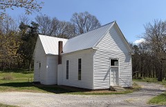 | Raus School | 5.6 miles | 2012 |
| John Green Sims House | 6.0 miles | 1987 | |
| Valley Home | 6.2 miles | 1989 |
| National Archives record | The nomination case file for reference 85002786 in Record Group 79. |
| Bedford County | All 33 listed properties in this county. |