 Block
From the record
One of 11 National Register listings published here for Smith County · listed in 1986 · category: Site.
Sources: the National Register database, National Park Service
Listed on the National Register of Historic Places in 1986.
One of 11 National Register listings published here for Smith County · listed in 1986 · category: Site.
Sources: the National Register database, National Park Service
Regional context, not property-specific evidence. The federal wildfire occurrence database lists 8 fires within 5 miles of Rome Ferry between 1999 and 2010, burning about 36 acres in total. None started naturally. 4 were recorded as arson. Distance is straight-line from the map coordinates, so a fire counted here may appear on a neighbouring settlement's page as well.
| Reported cause | Fires |
|---|---|
| Arson/incendiarism | 4 |
| Debris and open burning | 3 |
| Missing data/not specified/undetermined | 1 |
The most recent of them, most recent first, with the day each was reported and the service that recorded it.
| Date | Cause | Size | Reported by | Name on the report |
|---|---|---|---|---|
| 13 August 2002 | Debris and open burning | under an acre | Tennessee Division of Forestry | not named |
| 6 April 2005 | Arson/incendiarism | 13 acres | Tennessee Division of Forestry | not named |
| 26 March 2001 | Arson/incendiarism | 10 acres | Tennessee Division of Forestry | not named |
| 20 March 2010 | Missing data/not specified/undetermined | 4.0 acres | Tennessee Division of Forestry | SCUDDER |
| 15 March 2000 | Arson/incendiarism | under an acre | Tennessee Division of Forestry | not named |
| 9 December 2006 | Debris and open burning | 1.5 acres | Tennessee Division of Forestry | not named |
| 20 December 2006 | Arson/incendiarism | 7.0 acres | Tennessee Division of Forestry | not named |
| 10 December 1999 | Debris and open burning | under an acre | Tennessee Division of Forestry | not named |
Regional context, not property-specific evidence. The federal mineral resources record lists 8 workings within 5 miles of Rome Ferry: 4 past producers, 2 occurrences, 2 prospects. None of them still produces. What was taken out: Zinc, Fluorine-Fluorite, Limestone, General, Stone, Crushed/Broken. Distance is straight-line from the map coordinates, so a quarry counted here may appear on a neighbouring settlement's page as well.
| Where | Site | Commodity | Status | Recorded |
|---|---|---|---|---|
| Boatman Mine | Fluorine-Fluorite, Calcium, Barium-Barite | Past Producer | 1895 | |
| Boatman Mine | Fluorine-Fluorite, Barium-Barite, Calcium | Past Producer | ||
| H.W. Hudson Prospect | Fluorine-Fluorite, Barium-Barite | Prospect | ||
| Rome Quarry | Limestone, General | Past Producer | Sedimentary | |
| Rome Quarry | Stone, Crushed/Broken | Past Producer | ||
| Deep Well-Sphalerite Occurrence | Zinc | Occurrence | Sphalerite | |
| Deep Well-Sphalerite Occurrence | Zinc | Occurrence | ||
| Sulfur Creek | Zinc | Prospect |
Regional context, not property-specific evidence. The National Weather Service names Rome, the town this property stands in, in 11 storm reports between 2001 and 2024: 8 thunderstorm wind, 2 flash flood, 1 tornado. No death or injury is recorded in these reports. Each account below is quoted exactly as the forecast office filed it, from the NOAA Storm Events Database, and each date opens the federal record of that event.
| When | Event | Place named | Harm | What the report says |
|---|---|---|---|---|
| May 2016 | Flash Flood | Rome | $2,000,000 | Major flash flooding affected northern Smith County, especially the Dixon Springs and Riddleton areas. Numerous primary and secondary roads along with private driveways and bridges were flooded and closed or even washed out, including Highway 25, Bowmans Branch Lane, Wilburn Hollow Road, and Young Branch Road. One car reportedly was washed away into a creek off Highway 25 in Riddleton. Several homes were also flooded in these same areas. The Smith County Highway Superintendent stated that it would take at least 8 weeks to repair all the flood damage to the road network across the county. At least 2 water rescues from homes were conducted on Wilburn Hollow Road. |
| May 2017 | Tornado (EF0) | Rome | $50,000 | A weak EF-0 Tornado touched down in far western Smith County just east of the Wilson/Smith County line on Mitchell Lane. Damage was mostly confined to dozens of trees snapped or uprooted along the 2.5 mile path. Two barns were also uplifted and destroyed off Hiwassee Road in western Smith County. Based on newly available high resolution Google Earth satellite imagery in July 2019, the path of this tornado was extended slightly to the southwest, giving a total path length of 2.45 miles. |
| May 2017 | Thunderstorm Wind | Rome | $9,000 | Nine trees were blown down near Hiwassee Road and Cedar Knob Lane in association with the rear flank downdraft of the EF-0 tornado to the north. |
| June 2016 | Thunderstorm Wind | Rome | $5,000 | A tSpotter Twitter coordinator reported a large grain bin was toppled over. |
| July 2016 | Thunderstorm Wind | Rome | $3,000 | Trees were reportedly blown down on Hiawasee Road. |
| July 2016 | Thunderstorm Wind | Rome | $3,000 | Trees were blown down in Rome. |
| July 2024 | Thunderstorm Wind | Rome | $1,000 | Severe thunderstorm winds downed a tree along Highway 70 in Rome. Damages are a rough estimate. |
| July 2017 | Thunderstorm Wind | Rome | $1,000 | A tSpotter Twitter report indicated a large tree was blown down across Highway 70 in Rome. |
| January 2008 | Thunderstorm Wind | Rome | $1,000 | Trees and power lines were down around the county. |
| February 2019 | Flash Flood | Rome | - | A Twitter tSpotter report indicated Highway 70 between Hiwassee Road and the Dollar General store in the Rome community was flooded and closed. |
| February 2001 | Thunderstorm Wind | Rome | - | A large hackberry tree fell across Blevins Road, in Rome, blocking traffic. There were other reports of isolated trees or tree limbs down in Smith county. Some mailboxes were blown over at Flat Rock Road, and the top of a tree was on Hiwassee Road. These roads are located in the northwest section of the county. |
No historic map-sheet match is published for this property yet. That does not mean no map exists. This record needs a coordinate-quality review before it can be joined to a sheet boundary. Browse the county's mapped places while that work is pending.
Other National Register properties close enough to walk or drive between, ordered by distance from this one. Both positions come from the same geocoding pass that matched these properties to their map sheets.
| Photograph | Property | Distance | Listed |
|---|---|---|---|
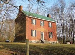 | James Bradley House | 5.7 miles | 1978 |
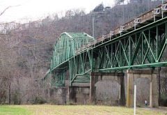 | Cordell Hull Bridge | 6.4 miles | 2009 |
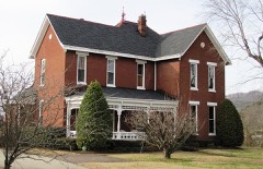 | Davis-Hull House | 6.6 miles | 1983 |
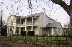 | Fite-Williams-Ligon House | 6.6 miles | 2003 |
 | Smith County Courthouse | 6.6 miles | 1979 |
| Cordell Hull Bridge | 6.7 miles | 2009 |
| National Archives record | The nomination case file for reference 86003477 in Record Group 79. |
| Smith County | All 11 listed properties in this county. |