 Block
From the record
One of 50 National Register listings published here for Rutherford County · listed in 1990 · category: District.
Sources: the National Register database, National Park Service
Listed on the National Register of Historic Places in 1990.
One of 50 National Register listings published here for Rutherford County · listed in 1990 · category: District.
Sources: the National Register database, National Park Service
Regional context, not property-specific evidence. The federal wildfire occurrence database lists 13 fires within 5 miles of Walter Hill Hydroelectric Station between 1998 and 2014, burning about 194 acres in total. None started naturally. 3 were recorded as arson. Distance is straight-line from the map coordinates, so a fire counted here may appear on a neighbouring settlement's page as well.
| Reported cause | Fires |
|---|---|
| Debris and open burning | 4 |
| Arson/incendiarism | 3 |
| Missing data/not specified/undetermined | 3 |
| Smoking | 1 |
| Misuse of fire by a minor | 1 |
| Equipment and vehicle use | 1 |
The most recent of them, most recent first, with the day each was reported and the service that recorded it.
| Date | Cause | Size | Reported by | Name on the report |
|---|---|---|---|---|
| 4 September 2002 | Equipment and vehicle use | 2.0 acres | Tennessee Division of Forestry | not named |
| 11 September 1998 | Debris and open burning | 4.5 acres | Tennessee Division of Forestry | not named |
| 1 September 1998 | Missing data/not specified/undetermined | under an acre | Tennessee Division of Forestry | not named |
| 24 August 2007 | Missing data/not specified/undetermined | 5.0 acres | Tennessee Division of Forestry | 840 EXIT 47 BURNOVER |
| 19 August 2007 | Arson/incendiarism | 23 acres | Tennessee Division of Forestry | I840 EXIT 57 |
| 17 August 2007 | Smoking | 22 acres | Tennessee Division of Forestry | 840 EXIT 62 |
| 16 April 2014 | Missing data/not specified/undetermined | 54 acres | Natchez Trace Parkway | STRI-NORTHERN FIELD |
| 28 March 2013 | Arson/incendiarism | under an acre | Stones River National Battlefield | ARTILLERY |
Regional context, not property-specific evidence. The federal mineral resources record lists 2 workings within 5 miles of Walter Hill Hydroelectric Station: 1 occurrence, 1 plant. 1 still produces. What was taken out: Fluorine-Fluorite, Barium-Barite, Lead, Zinc, Stone, Crushed/Broken. Distance is straight-line from the map coordinates, so a quarry counted here may appear on a neighbouring settlement's page as well.
| Where | Site | Commodity | Status | Recorded |
|---|---|---|---|---|
| Bell-Orren Prospect | Fluorine-Fluorite, Barium-Barite, Lead, Zinc | Occurrence | 1900 | |
| Young's Mill | Stone, Crushed/Broken | Plant |
Regional context, not property-specific evidence. The National Weather Service names Murfreesboro, the town this property stands in, in 188 storm reports between 1993 and 2026: 110 thunderstorm wind, 61 hail, 8 flash flood, 4 tornado. The reports record 53 injuries. Each account below is quoted exactly as the forecast office filed it, from the NOAA Storm Events Database, and each date opens the federal record of that event.
| When | Event | Place named | Harm | What the report says |
|---|---|---|---|---|
| April 2002 | Tornado (F3) | Murfreesboro | 31 hurt, $2,300,000 | 31 people were injured. Most of them were treated and released from the hospital. 6 people had to be hospitalized, and one person was seriously injured and had to be Life-Flighted to Vanderbilt hospital. 7 mobile homes were destroyed, and one mobile home had major damage and another mobile home had minor damage. 5 residences were destroyed, 10 residences had major damage and 36 residences had minor damage. 2 horse banrs were destroyed, and 6 horses/and or cattle were killed. The tornado touched down on W. Gum Road, just west of I-24. Interstate 24 was littered with tree limbs and debris at one point. The tornado lifted up around Mankin-McKnight Rd. This storm complex moved into Cannon county and produced another tornado near Bradyville.Damage assessment in Rutherford county by the Emergency Management Agency was placed at 2.3 million dollars. |
| January 1997 | Tornado (F4) | Murfreesboro | 18 hurt, $4,700,000 | This was one of those extraordinary cases where the National Weather Service had a 41 minute lead time on a tornado warning . The F4 tornado struck the Southridge Subdivision, near Barfield, TN, at 503 PM. The tornado caused 18 injuries and 4.7 million dollars in property damages. One person had to be hospitalized overnight. The last time an F4 tornado struck Middle Tennessee was on May 18, 1995. The path length of the tornado was 6.5 miles with its intensity reaching F4 and its maximum width of 300 yards.44 homes were destroyed and 47 other homes were damaged in the Barfield area. There was also damage to a Middle School, Food Lion Supermarket and to the Chalet Apartments.The tornado first touched down on Yeargan Road, about 6 miles southwest of Murfreesboro, with an intensity of F1 and path width of 100 yards. At this location, a sheet metal roof was peeled back off a barn and a couple of trees were broken off. Also close by, a trailer was lifted off its foundation and overturned. Several trees were uprooted in the area. The tornado proceeded northeast and increased to F2 intensity with a width of 300 yards. As it struck the community of Barfield, an entire roof was lifted off a house, several homes were partially destroyed, and a barn was totally destroyed. The tornado crossed the West Fork of the Stones River and struck the Southridge Subdivision. At this time the tornado increased to a maximum intensity of F4 with its width remaining at 300 yards. About half a dozen homes were totally destroyed. The tornado then struck a large apartment complex just west of U.S. Hwy 231 on the south side of Murfreesboro. The tornado produced some structural damage and extensive roof damage as it weakened to F1 intensity and its width decreased to 150 yards. The tornado then crossed U.S. Hwy 231 and the Indian Wells Golf Course. Large trees were uprooted and structural damage occurred to several businesses as it approached I-24. The tornado continued moving to the northeast across I-24 snapping and uprooting trees as it narrowed to 50 yards wide. On the southeast side of Murfreesboro near the intersection of Elam Road and U.S. Hwy 41, and near Brandyville Road and East Rutherford Boulevard, the tornado uprooted numerous trees and damaged the roofs of several homes. It was at this point the track of the tornado ended as it lifted back into the clouds. Newspaper accounts told stories of people going to a basement, or an interior room of a house such as a bathroom or closet for safety. The low casualties from this tornado indicated all the preparedness activities of the National Weather Service for many years certainly paid off. |
| February 1997 | Lightning | Murfreesboro | 2 hurt, $100,000 | no account filed |
| May 2009 | Thunderstorm Wind | Murfreesboro | 1 hurt, $10,000 | The pavilion at the New Vision Baptist Church was blown down resulting in one minor injury. Newspaper also reported that about 50 Middle Tennessee Electric Membership Corporation customers lose power temporarily. |
| April 2006 | Hail | Murfreesboro | 1 hurt | no account filed |
| March 2009 | Tornado (EF1) | Murfreesboro | $4,410,000 | The tornado touchdown near Scott Street and caused some damage to businesses there, and continued across broad street where it caused significant damage to shops in the Jackson Heights Mall, especially a bank and a movie theater, were several people experienced minor injuries. Several vechiles in the parking lot were also damaged. The tornado also caused major damage to the Boys and Girls Club located on Jones Boulevard. Numerous trees and power lines along with minor structural damage was observed to homes north of Lokey Avenue, and there was some structural damage to businesses on Memorial Boulevard near Clark Boulevard. Maximum winds were estimated at 90 mph. |
| May 2020 | Thunderstorm Wind | Murfreesboro | $1,010,000 | Numerous trees and power lines were blown down across Rutherford County with widespread power outages. |
| July 2024 | Tornado (EF0) | Murfreesboro | $750,000 | A small, weak EF-0 tornado moved through Murfreesboro, also impacting Middle Tennessee State University. Main damage was large tree branches down with some trees uprooted. Minor structural damage was noted at the stadium, including some siding material off of one of the buildings and some gate and fencing damage. The tornado began just east of Memorial Boulevard, continued east-southeast towards Middle Tennessee State University, and ended southeast of campus on Copper Hollow Drive. Maximum winds were estimated to be 75 mph. Damages are a rough estimate. |
| July 2024 | Thunderstorm Wind | Murfreesboro | $750,000 | A swath of intense damaging winds up to 80 mph occurred across central Murfreesboro from around the Stones River to downtown. Damage consisted of many trees down or uprooted, many branches snapped off, and some structural damage, primarily due to trees or branches falling. There was some minor roof damage to a few buildings, including metal peeled up at a business and some shingles lost on a few houses. Damages are a rough estimate. |
| April 2001 | Thunderstorm Wind | Murfreesboro | $500,000 | High winds toppled the steel radio tower for WGNS-AM radio station. The tower was built in 1946 and was 328 feet tall. The tower was Murfreesboro tallest structure. Damage to the tower was estimated between $250K to $500K. |
| April 2011 | Thunderstorm Wind | Murfreesboro | $75,000 | Over one hundred trees were downed near Trotter Lane in Murfreesboro. Roads in this area were also partially blocked. Some roof damage to homes and several outbuildings were even destroyed. |
| May 1998 | Thunderstorm Wind | Murfreesboro | $50,000 | Strong winds caught the edge of the gym's metal roof, rolled it up and left it dangling at St. Rose of Lima Catholic Church. The report was relayed to the NWS by a radio station. Newspaper accounts mention trees fell on a house on Spring Street, also on 2 trucks and on a boat on Sherrill Blvd., also on a car on Elrod St., and a tree fell on a house on Beck Ct. Trees and power lines were knocked down countywide. |
| May 2006 | Lightning | Murfreesboro | $30,000 | Lightning struck a condo located on Northfield Boulevard in Murfreesboro, off Memorial Blvd. The lightning set fire to 3 units in the condo. A lady's cat died of smoke inhalation. There were no injuries. |
| April 2011 | Thunderstorm Wind | Murfreesboro | $25,000 | Debris, in the form of fence parts, awnings and trees were along Memorial Drive near Murfreesboro Airport. Also, structural damage occurred to a Taco Bell restaurant in this area. Specific details concerning type of structural damage and associated cost to the Taco Bell restaurant were unknown. |
| April 2011 | Thunderstorm Wind | Murfreesboro | $25,000 | Damage occurred in the Jamison Place Subdivision. This included shingles coming of several homes, the top of many trees being broken off, and several fences being blown down. |
| March 2009 | Thunderstorm Wind | Murfreesboro | $25,000 | Roof damage, signs down, and other damage to businesses reported on Memorial Drive. |
| September 2000 | Lightning | Murfreesboro | $25,000 | The Rutherford county communications center on Old Salem Road lost all radio, telephone lines and its 911 call board after taking a lightning strike. Dispatchers were forced to move into the EMS Director's mobile unit in the parking lot. |
| June 2011 | Thunderstorm Wind | Murfreesboro | $20,000 | Murfreesboro Daily News Journal reported two large trees were blown down onto a house at 223 E. Lytle Street, with one tree damaging the porch and another falling on a car. |
| April 2009 | Thunderstorm Wind | Murfreesboro | $20,000 | Cannon Community Church, at 209 Old Murfreesboro Road, had the south side of the roof blown off of its building and into the parking lot in front of the building blocking the road. |
| December 2025 | Thunderstorm Wind | Murfreesboro | $15,000 | Several trees were reported down in the Murfreesboro area with some blocking roads. Multiple instances of trees falling onto homes were reported, causing structural damage. Damages are a rough estimate. |
| June 2013 | Thunderstorm Wind | Murfreesboro | $15,000 | Numerous trees and power lines were blown down across Murfreesboro. |
| July 2012 | Thunderstorm Wind | Murfreesboro | $15,000 | Several trees and power lines were downed across eastern portions of the county. |
| May 1996 | Thunderstorm Wind | Murfreesboro | $15,000 | no account filed |
| July 2024 | Thunderstorm Wind | Murfreesboro | $10,000 | Severe thunderstorm winds downed trees in Murfreesboro, causing power outages. Damages are a rough estimate. |
| June 2016 | Thunderstorm Wind | Murfreesboro | $10,000 | Numerous reports of trees and power lines down across Rutherford County. |
| April 2011 | Thunderstorm Wind | Murfreesboro | $10,000 | A couple trees were blown down Murfreesboro. |
| April 2011 | Thunderstorm Wind | Murfreesboro | $10,000 | A tree was blown down onto a house at Ewing Blvd and a tree was also blown down onto a car along North Walnut Street. Specific details concerning type of damage to the house and car along with any associated damge costs to both were unknown. |
| April 2011 | Thunderstorm Wind | Murfreesboro | $10,000 | A large tree was downed on Kingwood Drive. Large limbs from other trees and power lines were also downed as well. |
| August 2005 | Thunderstorm Wind | Murfreesboro | $10,000 | Trees were down. Newspaper article stated that a tree fell on a car. Also, a Quizno's Subs sign fell and struck an SUV on Thompson Lane in Murfreesboro. |
| May 1997 | Thunderstorm Wind | Murfreesboro | $10,000 | Strong thundertstorm winds blew off part of a roof at the Elk's Lodge in Murfreesboro. |
| July 1995 | Thunderstorm Wind | Murfreesboro | $10,000 | Numerous trees and power lines were knocked down. |
| March 2009 | Thunderstorm Wind | Murfreesboro | $6,000 | Several trees were downed near downtown Murfreesboro. |
| April 2022 | Thunderstorm Wind | Murfreesboro | $5,000 | Trees and power lines were blown down in downtown Murfreesboro, including a tree that fell onto a house on East Vine Street. |
| June 2019 | Thunderstorm Wind | Murfreesboro | $5,000 | Numerous trees reported down across the county. |
| March 2017 | Thunderstorm Wind | Murfreesboro | $5,000 | Multiple trees were blown down across Murfreesboro. |
| March 2017 | Thunderstorm Wind | Murfreesboro | $5,000 | Photos and video showed a tractor trailer was blown over on top of a car on Highway 231 near I-24. |
| March 2016 | Thunderstorm Wind | Murfreesboro | $5,000 | A tSpotter report from Twitter indicated a tree was blown down onto a home on North Cove Drive in Murfreesboro. |
| June 2016 | Thunderstorm Wind | Murfreesboro | $5,000 | Tree fell and damaged roof and side of a house in Murfreesboro. |
| April 2015 | Thunderstorm Wind | Murfreesboro | $5,000 | A large tree fell on a house in Murfreesboro. |
| July 2012 | Thunderstorm Wind | Murfreesboro | $5,000 | Several trees were downed. |
| June 2011 | Thunderstorm Wind | Murfreesboro | $5,000 | Trees blown down across much of northwestern Rutherford County. |
| June 2010 | Thunderstorm Wind | Murfreesboro | $5,000 | A large tree was blown over onto two parked vehicles. No injuries were reported. Details on any damage to the two parked vehicles were unkown. |
| August 2000 | Lightning | Murfreesboro | $5,000 | Lightning struck and caused a fire at Joe's Body Shop and Painting on South Church Street. |
| July 1995 | Thunderstorm Wind | Murfreesboro | $5,000 | A few trees and power lines were blown down. |
| August 1993 | Thunderstorm Wind | Murfreesboro | $5,000 | Some power lines were knocked down. A few homes in the southern part of town lost part of their roofs. |
| June 2015 | Thunderstorm Wind | Murfreesboro | $4,000 | Trees and power lines were blown down on Mercury Blvd in Murfreesboro. |
| April 2022 | Thunderstorm Wind | Murfreesboro | $3,000 | Report from mPing: trees uprooted or snapped; roof blown off. |
| June 2022 | Thunderstorm Wind | Murfreesboro | $3,000 | Three large trees were blown down. |
| June 2019 | Thunderstorm Wind | Murfreesboro | $3,000 | Large trees were blown down on Medical Center Parkway. |
| March 2017 | Thunderstorm Wind | Murfreesboro | $3,000 | Tspotter Twitter reports indicated multiple trees were blown down in East Murfreesboro. |
| March 2017 | Thunderstorm Wind | Murfreesboro | $3,000 | Several trees were snapped near the World Outreach Church on Highway 99. |
| March 2017 | Thunderstorm Wind | Murfreesboro | $3,000 | Three power poles were snapped on Barfield Road. |
| June 2015 | Thunderstorm Wind | Murfreesboro | $3,000 | Tree was blown down onto a house on Maple Street near the square. |
| June 2007 | Thunderstorm Wind | Murfreesboro | $3,000 | A cluster of thunderstorms intensified and entered southern Rutherford County. The thunderstorms blew down tress on Midland Rd. A tree fell on Mimi's Silks, Gifts and Flowers, and knocked the top off a chimney. Mimi's Silks, Gifts and Flowers is located on 4346 Midland Rd. |
| June 2024 | Thunderstorm Wind | Murfreesboro | $2,000 | A downed powerline was reported on Broad Street and Medical Center Parkway in Murfreesboro. Damages are a rough estimate. |
| February 2020 | Thunderstorm Wind | Murfreesboro | $2,000 | Trees were blown down that blocked Barfield Road. |
| June 2019 | Thunderstorm Wind | Murfreesboro | $2,000 | Trees were blown down on Medical Center Parkway in front of Firehouse Subs. |
| July 2016 | Thunderstorm Wind | Murfreesboro | $2,000 | A tree fell and crushed a carport in Murfreesboro. |
| October 2007 | Thunderstorm Wind | Murfreesboro | $2,000 | Trees and power lines down at 4900 Poplar Wood Road at 1105 PM CST. |
| December 2004 | Thunderstorm Wind | Murfreesboro | $2,000 | Report of shingles and some siding ripped away from home. |
No historic map-sheet match is published for this property yet. That does not mean no map exists. This record needs a coordinate-quality review before it can be joined to a sheet boundary. Browse the county's mapped places while that work is pending.
Other National Register properties close enough to walk or drive between, ordered by distance from this one. Both positions come from the same geocoding pass that matched these properties to their map sheets.
| Photograph | Property | Distance | Listed |
|---|---|---|---|
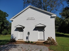 | Providence Primitive Baptist Church | 0.4 miles | 2000 |
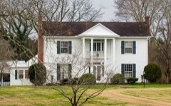 | Searcy-Matthews-Tarpley Farm | 0.9 miles | 2011 |
 | Thomas C. Black House | 1.2 miles | 1996 |
| Murfreesboro Veterans Administration Hospital Historic District | 1.2 miles | 2012 | |
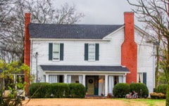 | Riverside Farm | 1.7 miles | 2006 |
| Benjamine Rucker House | 3.0 miles | 1991 |
| National Archives record | The nomination case file for reference 90001660 in Record Group 79. |
| Rutherford County | All 50 listed properties in this county. |