 Block
From the record
One of 13 National Register listings published here for Lawrence County · listed in 1992 · category: District.
Sources: the National Register database, National Park Service
Listed on the National Register of Historic Places in 1992.
One of 13 National Register listings published here for Lawrence County · listed in 1992 · category: District.
Sources: the National Register database, National Park Service
Regional context, not property-specific evidence. The federal wildfire occurrence database lists 181 fires within 5 miles of Lawrenceburg Commercial Historic District between 1997 and 2019, burning about 388 acres in total. None started naturally. 26 were recorded as arson. Distance is straight-line from the map coordinates, so a fire counted here may appear on a neighbouring settlement's page as well.
| Reported cause | Fires |
|---|---|
| Debris and open burning | 94 |
| Arson/incendiarism | 26 |
| Equipment and vehicle use | 20 |
| Missing data/not specified/undetermined | 12 |
| Misuse of fire by a minor | 9 |
| Smoking | 7 |
| Fireworks | 6 |
| Recreation and ceremony | 2 |
| Other causes | 2 |
| Railroad operations and maintenance | 2 |
| Power generation/transmission/distribution | 1 |
The most recent of them, most recent first, with the day each was reported and the service that recorded it.
| Date | Cause | Size | Reported by | Name on the report |
|---|---|---|---|---|
| 6 September 2010 | Debris and open burning | under an acre | Tennessee Division of Forestry | ROSENBROCK |
| 6 September 1999 | Debris and open burning | under an acre | Tennessee Division of Forestry | not named |
| 5 September 1999 | Arson/incendiarism | 2.0 acres | Tennessee Division of Forestry | not named |
| 30 September 1999 | Missing data/not specified/undetermined | 5.0 acres | Tennessee Division of Forestry | not named |
| 27 September 2019 | Equipment and vehicle use | 2.0 acres | Tennessee Division of Forestry | CORN STUBBLE FIRE |
| 27 September 2001 | Debris and open burning | under an acre | Tennessee Division of Forestry | not named |
| 25 September 1999 | Arson/incendiarism | under an acre | Tennessee Division of Forestry | not named |
| 25 September 1999 | Arson/incendiarism | under an acre | Tennessee Division of Forestry | not named |
Regional context, not property-specific evidence. The federal mineral resources record lists 2 workings within 5 miles of Lawrenceburg Commercial Historic District: 2 producers. All of them still produce. What was taken out: Stone, Crushed/Broken, Limestone, General, Stone, Crushed/Broken. Distance is straight-line from the map coordinates, so a quarry counted here may appear on a neighbouring settlement's page as well.
| Where | Site | Commodity | Status | Recorded |
|---|---|---|---|---|
| Lawrence County Quarry and Mill | Stone, Crushed/Broken | Producer | ||
| Lawrenceburg Materials | Stone, Crushed/Broken, Limestone, General | Producer | Limestone |
Regional context, not property-specific evidence. The National Weather Service names Lawrenceburg, the town this property stands in, in 192 storm reports between 1993 and 2025: 95 thunderstorm wind, 54 hail, 24 flash flood, 8 flood. The reports record 2 deaths and 44 injuries. Each account below is quoted exactly as the forecast office filed it, from the NOAA Storm Events Database, and each date opens the federal record of that event.
| When | Event | Place named | Harm | What the report says |
|---|---|---|---|---|
| July 1998 | Flash Flood | Lawrenceburg | 2 killed, 20 hurt, $4,000,000 | Synoptic conditions near the surface and aloft, set the stage for serious flooding problems in Lawrenceburg. A strong cut off low, located west of Lawrenceburg, caused a series of thunderstorms to train or move across Lawrence county. These thunderstorms contained very heavy rains. Precipitable water values were in excess of 2 inches that evening. There was a strong 850 mb moisture convergence field, along with 300 mb divergence, and also Lawrence county was in the right rear quadrant of the jet stream. Nashville Doppler Radar estimated about 8 inches of rain at Lawrenceburg Monday night and early Tuesday morning. 4 inches of rain fell in about an hour at one point Monday night. The Lawrenceburg Filtration Plant received 8.76 inches in a 24 hour period ending 7 AM CDT Tuesday, July 14. The Filtration Plant is a cooperative observer site for Lawrenceburg. Numerous roads were closed due to high water. There were 2 people killed and 20 injured. A 63 year old female was swept away in her car just east of David Crockett State Park on U.S. Highway 64 West bridge. The other fatality, a 74 year old male, was swept away in his car on U.S. Highway 43 bridge near the railroad trestle. The report of the fatalities was received at 1035 PM CDT from the emergency management office. 122 homes were damaged or destroyed, 13 mobile homes and several small bridges were swept away. 100 people had to be evacuated from their homes. 18 businesses sustained water damage. One home had 29 inches of water in it. The water and sewage plant was left inoperable, and residents had no water or bath facilities. Bottled water was distributed. Portable toilets were set up around town. Life was starting to return to normal on Saturday, July 18. |
| July 2002 | Lightning | Lawrenceburg | 18 hurt | Lightning killed 9 cattle when they took shelter under a pecan tree. |
| May 2001 | Thunderstorm Wind | Lawrenceburg | 2 hurt | Trees were down on U.S. Highway 64 and just east of the Natchez Trace Parkway in Lawrence county.A tree fell on the hood of a car, and threw 2 adults in the front seat into the windshield. The 2 were transported to a Lawrenceburg hospital. A child sitting in a child restraint device in the back seat was not injured. |
| August 1998 | Flash Flood | Lawrenceburg | 1 hurt, $20,000 | Lawrence county 911 center reported several roads blocked off in Lawrenceburg and in the northern part of the county due to high water. There were 2 accidents on U.S. Highway 64 west of town that was attributed to the flash flooding. One accident did result in one injury. |
| May 1999 | Thunderstorm Wind | Lawrenceburg | 1 hurt, $10,000 | Vehicle blown off road in downtown Lawrenceburg. Driver had arm broken. |
| May 2011 | Lightning | Lawrenceburg | 1 hurt | A county EMS employee was struck by lightning. Specific details concerning final condition of the employee who was struck, what type of injuries were received, and any associated medical cost were unknown. |
| May 2000 | Lightning | Lawrenceburg | 1 hurt | Lightning struck a person at a radio station. |
| May 2020 | Thunderstorm Wind | Lawrenceburg | $180,000 | Numerous trees and power lines were blown down across Lawrence County with several outbuildings and barns damaged. |
| August 2023 | Thunderstorm Wind | Lawrenceburg | $150,000 | A possible microburst caused damage in Lawrenceburg. The metal roofing of the Davy Crockett Motel along East Gaines Street was peeled back while multiple powerlines in the area where also downed. Numerous trees were also downed in Lawrenceburg, mostly north of the public square around Liberty Avenue. One of these trees fell onto a home. This damage resulted in 1,878 customers without power. No injuries reported. Damages are a rough estimate. |
| October 2004 | Flash Flood | Lawrenceburg | $100,000 | Urban street flooding was occurring. At 212 AM CST water was getting into homes in Lawrenceburg. A newspaper story said water rescues were made by the Swift Water Rescue Team, including one at Galbreath Subdivision, Jackson Street, Kathy Drive, Weakley Creek Road and Maple Avenue in Lawrenceburg. Other rescues were done on Prosser Road. 2 people were rescued at St. Joseph on U.S. Highway 64, as their car was swept 15 to 20 feet off the side of the roadway. As much as 5 inches of rain fell in 2 hours, and in some places 6 inches were reported. A water main bursted near Lawrenceburg, in the Stud Horse Canyon area just off Highway 64. The water main burst made matters worse. Water pressure became low to many businesses and residences. Schools were closed Tuesday and Wednesday, October 19th and 20th. Some roads in Lawrence County were completely washed out. |
| May 1999 | Thunderstorm Wind | Lawrenceburg | $97,000 | Spotter reported trees and power lines down 1 mile south of U.S. Highway 64 and S.R. 241. TEMA reported main expense was to restore utility service. |
| February 2009 | Thunderstorm Wind | Lawrenceburg | $40,000 | A roof was blown of a home with numerous trees down in the vicinity. |
| May 2006 | Thunderstorm Wind | Lawrenceburg | $35,000 | Tree was blown down on a mobil home. Newspaper story estimated damage to be around $35,000. |
| May 2025 | Thunderstorm Wind | Lawrenceburg | $25,000 | Severe thunderstorm winds downed a tree onto a home on Lawrence Street in Lawrenceburg. Damages are a rough estimate. |
| April 2025 | Thunderstorm Wind | Lawrenceburg | $25,000 | Severe thunderstorm winds downed trees and powerlines in Lawrenceburg. One of these trees reportedly fell on a home. Damages are a rough estimate. |
| June 2009 | Thunderstorm Wind | Lawrenceburg | $25,000 | Multiple trees were reported down just west of Lawrenceburg. |
| October 2009 | Thunderstorm Wind | Lawrenceburg | $25,000 | Several trees were downed county wide, including around Lawrenceburg and near the Lawrence/Maury County Line. |
| June 2023 | Thunderstorm Wind | Lawrenceburg | $20,000 | Severe thunderstorm winds downed a tree onto a house in Lawrenceburg and also downed power lines. Damages are a rough estimate. |
| May 2022 | Thunderstorm Wind | Lawrenceburg | $20,000 | Tennessee Valley Weather reported several trees, tree limbs, power lines and power poles were blown down across Lawrence County resulting in scattered power outages. This included a few trees blown down in Lawrenceburg. |
| October 2010 | Thunderstorm Wind | Lawrenceburg | $20,000 | A tree fell on top of a resident's car and a power line was also downed at the 200 block of Nixon Avenue in Lawrenceburg. The car, a 2000 Nissan Maxima, sustained extensive damage, was inoperable, and was towed away from this road. |
| July 2002 | Lightning | Lawrenceburg | $18,000 | Lightning killed 9 cattle when they took shelter under a pecan tree. |
| June 2011 | Thunderstorm Wind | Lawrenceburg | $15,000 | A roof was blown off a home in Lawrenceburg and trees were blown down in and around the city. |
| June 2006 | Thunderstorm Wind | Lawrenceburg | $15,000 | Shingles off a roof. A tree fell on a car (2003 Ford Escape). |
| May 2025 | Thunderstorm Wind | Lawrenceburg | $10,000 | Severe thunderstorm winds downed a tree onto a van in Lawrenceburg, trapping its occupants inside. Damages are a rough estimate. |
| May 2022 | Thunderstorm Wind | Lawrenceburg | $10,000 | Trees and power lines were blown down with power outages in Lawrenceburg. The roof of the gymnasium at Lawrence County High School was damaged causing water damage inside the building. |
| December 2021 | Thunderstorm Wind | Lawrenceburg | $10,000 | Several trees were blown down across Lawrence County. A CWOP home weather station in Lawrenceburg measured a wind gust of 54 mph. |
| June 2018 | Thunderstorm Wind | Lawrenceburg | $10,000 | Numerous trees, power lines, and business signs were blown down across Lawrenceburg with widespread power outages. |
| May 2011 | Thunderstorm Wind | Lawrenceburg | $10,000 | A few power poles were reported downed just east of Lawrenceburg. |
| June 2011 | Thunderstorm Wind | Lawrenceburg | $10,000 | Trees were blown down and some buildings suffered roof damage across the western portion of Lawrence County. |
| April 1998 | Thunderstorm Wind | Lawrenceburg | $10,000 | Some structural damage to a building. |
| July 2015 | Thunderstorm Wind | Lawrenceburg | $6,000 | A few trees were blown down across Lawrence County including on Bealer Road, Dugout Road, and Winfall Road. |
| May 2025 | Thunderstorm Wind | Lawrenceburg | $5,000 | Severe thunderstorm winds downed trees at Stephens Street and Buffalo Road in Lawrenceburg. Damages are a rough estimate. |
| July 2025 | Thunderstorm Wind | Lawrenceburg | $5,000 | Several trees were downed in the Lawrenceburg area, including one that fell on a car along 4th Street. Damages are a rough estimate. |
| July 2023 | Thunderstorm Wind | Lawrenceburg | $5,000 | A thunderstorm caused a tree to fall onto some powerlines along 3rd Street in Lawrenceburg. Damages are a rough estimate. |
| May 2022 | Thunderstorm Wind | Lawrenceburg | $5,000 | Large tree branches and power lines were blown down on Parkes Street at Lafayette Avenue in Lawrenceburg resulting in some power outages. |
| December 2021 | Flood | Lawrenceburg | $5,000 | Several low water crossings and other low lying areas reportedly seeing flooding across Lawrence County, including North Military Ave about 1.5 miles north of downtown Lawrenceburg, Henryville Road at Oaks Road where one vehicle was stranded, and Gwinn Road in Ethridge. |
| May 2021 | Thunderstorm Wind | Lawrenceburg | $5,000 | Numerous trees and power lines were blown down across Lawrence County. Approximately 1013 customers were without power. |
| December 2019 | Thunderstorm Wind | Lawrenceburg | $5,000 | An outbuilding was blown into the road on North Military Avenue in Lawrenceburg. |
| May 2018 | Thunderstorm Wind | Lawrenceburg | $5,000 | Several trees were blown down across Lawrenceburg, with most trees and some power lines downed in David Crockett State Park. |
| July 2017 | Thunderstorm Wind | Lawrenceburg | $5,000 | Lawrence County Emergency Management reported a microburst caused wind damage across northern Lawrenceburg. The roof was blown off a building on May Street and a power pole was snapped on Massey Avenue. Several trees were also blown down. |
| July 2017 | Flood | Lawrenceburg | $5,000 | Lawrence County Emergency Management reported street flooding on Old Military Avenue at Weekly Creek Road, Geri Street, and 1st Avenue at 8th Street in Lawrenceburg. Two vehicles slid off roads and became partially submerged. |
| May 2017 | Thunderstorm Wind | Lawrenceburg | $5,000 | A tree fell on a power line on First Street, power lines were blown down near Rotary Park, and a power line was blown down resulting in a fire starting in a tree on Admiral Circle in Lawrenceburg. |
| December 2016 | Thunderstorm Wind | Lawrenceburg | $5,000 | Trees were blown down on power lines along Mahr Avenue. |
| March 2013 | Lightning | Lawrenceburg | $5,000 | Lightning struck in the area of the school's science and vocational buildings around 10 a.m. Smoke was reported in part of the buildings, but firefighters said no fire was detected. Some electronic equipment was damaged, including the fire alarm system.|No injuries were reported, and students returned to classes within an hour of being evacuated. |
| June 2011 | Thunderstorm Wind | Lawrenceburg | $5,000 | Trees were blown down with power outages in Lawrenceburg. |
| May 2011 | Thunderstorm Wind | Lawrenceburg | $5,000 | State Route 20 in northern part of county was temporarily closed as a large tree fell on a power line, blocking the road. |
| April 2010 | Thunderstorm Wind | Lawrenceburg | $5,000 | One tree was reported down in Lawrenceburg which fell on a car...trapping a person inside. Estimated wind gust was around 50 mph. |
| April 2009 | Flash Flood | Lawrenceburg | $5,000 | Flooding was reported on U.S. Highway 64. |
| October 2007 | Thunderstorm Wind | Lawrenceburg | $5,000 | A fourteen inch diameter tree was blown down onto a house. |
| May 1999 | Thunderstorm Wind | Lawrenceburg | $5,000 | Wind damage to trailer home. |
| May 1999 | Thunderstorm Wind | Lawrenceburg | $5,000 | Roof was blown off a house. |
| September 1993 | Thunderstorm Wind | Lawrenceburg | $5,000 | Numerous trees were blown down. A few trees fell on some homes and damaged a few cars. |
| December 2021 | Thunderstorm Wind | Lawrenceburg | $3,000 | Lawrence County Emergency Management reported 155 hours were without power in Lawrenceburg due to tree limbs down on power lines. |
| June 2019 | Thunderstorm Wind | Lawrenceburg | $3,000 | Trees were blown down across Lawrenceburg. |
| December 2013 | Thunderstorm Wind | Lawrenceburg | $3,000 | A tree was blown down on a home in downtown Lawrenceburg on 5th Street. |
| June 2007 | Thunderstorm Wind | Lawrenceburg | $3,000 | Trees were blown down in the city from Highway 242 on the west side to Bobby Brewer Park on the east side. Most tree damage was along Debus Street and Hoover Street. Light poles were blown down at Bobby Brewer Park. |
| June 2023 | Thunderstorm Wind | Lawrenceburg | $2,000 | The Lawrence County emergency manager reported that severe thunderstorm winds downed a power line onto a vehicle at Ada and Palmer Road in Lawrenceburg. No injuries were reported. Damages are a rough estimate. |
| August 2023 | Thunderstorm Wind | Lawrenceburg | $2,000 | Severe thunderstorm winds downed a tree limb onto a powerline at 1st Avenue and Gaines Street in Lawrenceburg. Damages are a rough estimate. |
| October 2014 | Thunderstorm Wind | Lawrenceburg | $2,000 | Trees were blown down on Guard Drive in Lawrenceburg. |
| January 2013 | Thunderstorm Wind | Lawrenceburg | $2,000 | A tree was downed across U.S. Highway 43. |
No historic map-sheet match is published for this property yet. That does not mean no map exists. This record needs a coordinate-quality review before it can be joined to a sheet boundary. Browse the county's mapped places while that work is pending.
Other National Register properties close enough to walk or drive between, ordered by distance from this one. Both positions come from the same geocoding pass that matched these properties to their map sheets.
| Photograph | Property | Distance | Listed |
|---|---|---|---|
 | Crockett Theater | under 500 feet | 1997 |
 | Garrett House | under 500 feet | 2009 |
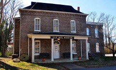 | Lawrence County Jail | 0.2 miles | 1976 |
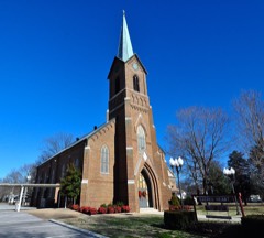 | Sacred Heart of Jesus Church | 0.3 miles | 1984 |
| Lawrenceburg No. 1 Hydroelectric Station | 1.6 miles | 1990 | |
| Lawrenceburg No. 2 Hydroelectric Station | 2.4 miles | 1990 |
| National Archives record | The nomination case file for reference 92000346 in Record Group 79. |
| Lawrence County | All 13 listed properties in this county. |