 Block
From the record
One of 24 National Register listings published here for Wilson County · listed in 1993 · category: Site.
Sources: the National Register database, National Park Service · the Wikipedia article
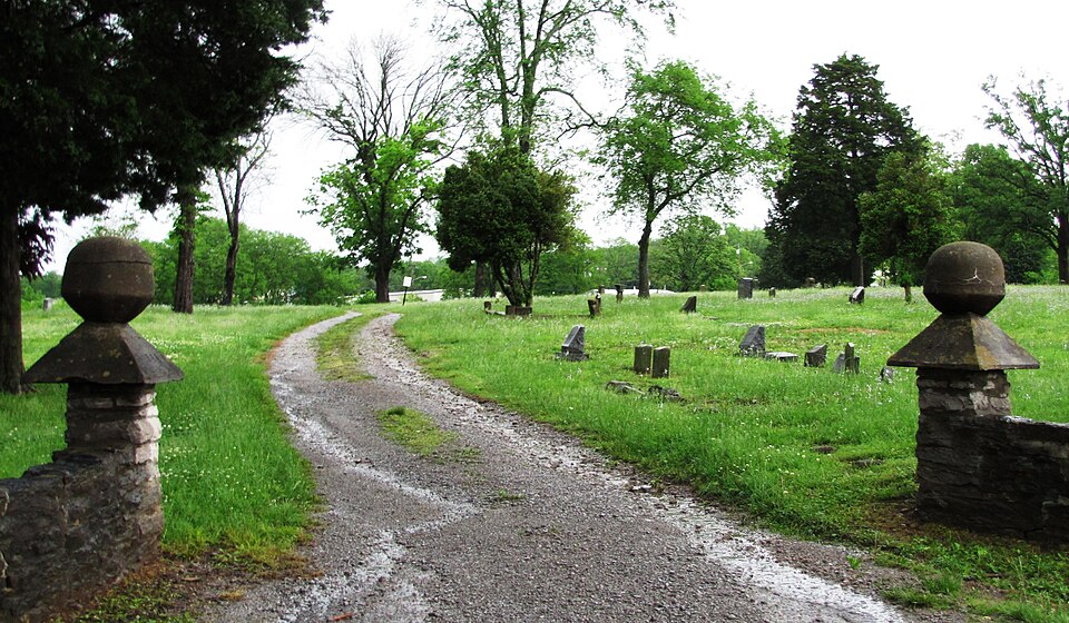
Listed on the National Register of Historic Places in 1993.
One of 24 National Register listings published here for Wilson County · listed in 1993 · category: Site.
Sources: the National Register database, National Park Service · the Wikipedia article
Regional context, not property-specific evidence. The federal wildfire occurrence database lists 8 fires within 5 miles of Rest Hill Cemetery between 1997 and 2016, burning about 80 acres in total. None started naturally. None was recorded as arson. Distance is straight-line from the map coordinates, so a fire counted here may appear on a neighbouring settlement's page as well.
| Reported cause | Fires |
|---|---|
| Debris and open burning | 5 |
| Misuse of fire by a minor | 3 |
The most recent of them, most recent first, with the day each was reported and the service that recorded it.
| Date | Cause | Size | Reported by | Name on the report |
|---|---|---|---|---|
| 19 September 1997 | Misuse of fire by a minor | 2.0 acres | Tennessee Division of Forestry | not named |
| 12 September 2007 | Debris and open burning | under an acre | Tennessee Division of Forestry | SPRING CREEK RD |
| 17 August 2007 | Debris and open burning | 9.0 acres | Tennessee Division of Forestry | BLUEBIRD ROAD BREAKOVER |
| 16 August 2007 | Debris and open burning | 57 acres | Tennessee Division of Forestry | BLUEBIRD ROAD |
| 27 March 2007 | Debris and open burning | 3.8 acres | Tennessee Division of Forestry | POPLAR HILL ROAD |
| 24 March 2007 | Misuse of fire by a minor | under an acre | Tennessee Division of Forestry | CARTHAGE HWY |
| 23 November 2016 | Misuse of fire by a minor | 4.0 acres | Tennessee Division of Forestry | HARTSVILLE PK FIRE #1 |
| 18 October 2010 | Debris and open burning | 3.3 acres | Tennessee Division of Forestry | 855 WALNUT GROVE RD |
Regional context, not property-specific evidence. The federal mineral resources record lists 4 workings within 5 miles of Rest Hill Cemetery: 2 producers, 1 past producer, 1 occurrence. 2 still produce. What was taken out: Stone, Crushed/Broken, Stone, Crushed/Broken, Limestone, General, Clay. Distance is straight-line from the map coordinates, so a quarry counted here may appear on a neighbouring settlement's page as well.
| Where | Site | Commodity | Status | Recorded |
|---|---|---|---|---|
| Lebanon Quarry - Plant #2 | Stone, Crushed/Broken, Limestone, General | Producer | Limestone | |
| Van Dyke School Prospect | Clay | Occurrence | ||
| Lebanon Quarry - Plant #2 | Stone, Crushed/Broken | Producer | ||
| Quarry | Stone, Crushed/Broken | Past Producer |
Regional context, not property-specific evidence. The National Weather Service names Lebanon, the town this property stands in, in 172 storm reports between 1995 and 2026: 111 thunderstorm wind, 34 hail, 19 flash flood, 4 lightning. The reports record 8 injuries. Each account below is quoted exactly as the forecast office filed it, from the NOAA Storm Events Database, and each date opens the federal record of that event.
| When | Event | Place named | Harm | What the report says |
|---|---|---|---|---|
| May 2003 | Thunderstorm Wind | Lebanon | 7 hurt | Spotter reported trailer overturned and a vehicle flipped over from strong thunderstorm winds. 7 people were injured. About 200 trees were blown down on a nearby 100 acre farm located on Patton Hollow Rd.It was a quarter mile of destruction with several century old cedar trees ripped up out of the ground. |
| October 2004 | Thunderstorm Wind | Lebanon | 1 hurt, $5,000 | Two mobile home trailers and a guard shack were blown over near Nashville Superspeedway off of U.S. Highway 231. The guard was treated and released from U.M.C. |
| May 2023 | Thunderstorm Wind | Lebanon | $2,000,000 | A suspected microburst in Lebanon caused significant wind damage with multiple downed trees and power lines across the city. Along Oak Street, numerous downed trees were reported with damages to vehicles. Also along Oak Street, a tree at a residential house fell, clipping the corner of the house before falling onto a car detailing building and a car. Along Darlenes Way, a screened-in back porch was demolished while the tin roof of an outbuilding was blown off. A garage door was destroyed while another residence reported ceiling and drywall damage. Finally, at Lebanon City Hall, two marble monuments weighing 3,500 to 4,500 pounds were tipped over. Damages are a rough estimate. |
| May 2024 | Flash Flood | Lebanon | $500,000 | Heavy rain caused flash flooding in Lebanon with property flooding reported along Lovers Lane in northeast Lebanon. Damages are a rough estimate. |
| May 2020 | Thunderstorm Wind | Lebanon | $437,730 | Numerous trees and power lines were blown down in Lebanon and across much of the rest of Wilson County with widespread power outages. |
| June 1996 | Tornado (F1) | Lebanon | $150,000 | no account filed |
| May 2009 | Lightning | Lebanon | $75,000 | About 6,000 customers were without power when a lightning strike struck equipment at a power station in Lebannon. |
| April 2006 | Thunderstorm Wind | Lebanon | $70,000 | Winds estimated to be around 70 mph blew down a press box on the west end of a football field at Lebanon High School. The press box was blown off its supports and into the aluminum bleachers. The press box was only 2 years old and was 115 feet long. The damage to the press box and bleachers was $55,000. Also, the scoreboard at Cumberland University was bent over due to strong winds estimated at 60 mph. 3 mobile homes had a tree blown down on top of each in a smalll mobile home park on the south side of Webster Street, which is located off North Cumberland Road in the northern part of Lebanon. |
| July 2018 | Lightning | Lebanon | $60,000 | Wilson County EMA reported a barn was struck by lightning and destroyed by fire at 1701 Hartsville Pike. The barn was a total loss with damage estimated at $60,000. |
| June 2010 | Thunderstorm Wind | Lebanon | $35,000 | Multiple large trees and limbs were blown down or snapped. Pieces of siding were torn off of 2 homes. |
| April 2026 | Thunderstorm Wind | Lebanon | $25,000 | Severe thunderstorm winds caused numerous downed trees and powerlines, which caused about 3,000 customers to lose power in Wilson County. Damages are a rough estimate. |
| May 2017 | Thunderstorm Wind | Lebanon | $25,000 | Wilson County Emergency Management reported 31 trees and power lines were blown down in and around Lebanon with several roadways blocked. Roads with trees down included 90 Chaparral Drive, Castle Heights Avenue, Spring Street, Hartsville Pike, Baddour Parkway, 740 Sanders Avenue, Hatton Road, Trousdale Ferry Pike, and Forrest Avenue. A tree was also blown down onto a house at 710 Park Ave. |
| July 2012 | Thunderstorm Wind | Lebanon | $25,000 | A tree fell on a house at 424 Oakdale Drive. Power lines were downed along Hartsville Pike. A tree was also downed on Coles Ferry Pike partially blocking the road. |
| June 2009 | Thunderstorm Wind | Lebanon | $25,000 | Several large trees were reported down in Lebanon. |
| July 2015 | Tornado (EF0) | Lebanon | $20,000 | An EF0 tornado down along Sparta Pike at Peyton Road then moved northeast across the Wilson County Fairgrounds before lifting northeast of Bluebird Road. A few outdoor sheds at a business on the west side of Sparta Pike were damaged and another was blown northeast across Peyton Road and destroyed. A power pole was also snapped and power lines blown down on Peyton Road. Several trees were blown down and an information booth was destroyed at the Wilson County Fairgrounds. More trees were blown down on Bluebird Road with one falling onto and crushing a pickup truck. Emergency management personnel took video of the tornado as it passed through the Fairgrounds. Maximum winds were estimated at 75 mph. |
| July 2008 | Lightning | Lebanon | $20,000 | A lightning strike destroyed the communications system, phone system, computers and cameras at the sheriff's office and other Wilson County buildings. The Nave funeral home lost its carport to the lightning. |
| March 2006 | Thunderstorm Wind | Lebanon | $20,000 | A garage was heavily damaged. Several trees were blown down. |
| May 2024 | Thunderstorm Wind | Lebanon | $15,000 | Severe thunderstorm winds downed several trees along South Cumberland Street in Lebanon. Damages are a rough estimate. |
| July 2023 | Thunderstorm Wind | Lebanon | $15,000 | Severe thunderstorm winds downed numerous trees and powerlines across Lebanon. Damages are a rough estimate. |
| June 2019 | Thunderstorm Wind | Lebanon | $15,000 | Trees and power lines were blown down across Wilson County with several roadways blocked, including Cooks Road, Coles Ferry Pike, Carthage highway, East Market Street, John Hagar Road, Old Rome Pike, Trousdale Ferry Pike, Hickory Ridge Road, Goshen Road, and Old Shannon Road. A vehicle drove into a fallen tree at 209 Blair Lane resulting in minor injuries to the occupants. |
| July 2016 | Thunderstorm Wind | Lebanon | $15,000 | Dozens of trees and power lines were blown down all across Wilson County with many roads blocked, including Smith Road, Faulkner Lane, Benders Ferry Road at Davis Corner Road, Curd Road, Central Pike, Lake Forest Drive at Saundersville Ferry Road, Old Rome Pike, Carthage Highway, Bluebird Road, and Lakeshore Drive. |
| April 2026 | Thunderstorm Wind | Lebanon | $10,000 | Severe thunderstorm winds downed utility poles between Hartmann Drive and Hunters Village Drive in Lebanon. Damages are a rough estimate. |
| April 2026 | Thunderstorm Wind | Lebanon | $10,000 | Severe thunderstorm winds caused sporadic damage across portions of Lebanon, including downed trees and utility lines. Damages are a rough estimate. |
| June 2016 | Thunderstorm Wind | Lebanon | $10,000 | A large part of the roof was blown off Sam Houston Elementary School. The roof was under construction. |
| June 2016 | Thunderstorm Wind | Lebanon | $10,000 | The roof was blown off the new city animal control building on Sparta Pike. |
| June 2016 | Thunderstorm Wind | Lebanon | $10,000 | Numerous reports of trees and power lines down throughout Wilson County. |
| July 2005 | Lightning | Lebanon | $10,000 | Lightning struck the Linda Hackett Realty office at 321 W. Main St. in Lebanon around 11 AM CST. The lightning damaged the computer and phone sysytems in the office, heating and air conditioning system, and a small television. Wiring was also damaged in the electrical room. The business had to be closed for the rest of the day. Damage was estimated to be in the thousands of dollars. |
| May 2003 | Thunderstorm Wind | Lebanon | $10,000 | Public reported a tree blown down on a mobile home. |
| July 1997 | Thunderstorm Wind | Lebanon | $10,000 | Middle Tennesse Electric Company reported power lines were down in eastern Wilson county along Shop Springs Road and Trousdale Ferry Road. |
| May 1995 | Thunderstorm Wind | Lebanon | $7,000 | Several trees were blown down. |
| April 2026 | Thunderstorm Wind | Lebanon | $5,000 | Severe thunderstorm winds caused shingles to be blown off a house as well as caused fencing damage on Hunters Village Drive in Lebanon. Damages are a rough estimate. |
| April 2022 | Thunderstorm Wind | Lebanon | $5,000 | Trees and power lines were blown down in Lebanon. Trained spotter measured a wind gust of 70 mph. |
| July 2020 | Thunderstorm Wind | Lebanon | $5,000 | Several trees were blown down and roofs blown off outbuildings around the Peyton Road and Bluebird Road area. |
| July 2018 | Thunderstorm Wind | Lebanon | $5,000 | A tree fell onto a jeep in Lebanon. |
| November 2017 | Thunderstorm Wind | Lebanon | $5,000 | A tree was blown down onto a car at 413 South Maple Street in Lebanon. |
| May 2016 | Thunderstorm Wind | Lebanon | $5,000 | Several trees and power lines were blown down in and around Lebanon with one tree blown down onto a house on Hartsville Pike. |
| July 2016 | Thunderstorm Wind | Lebanon | $5,000 | A tree was down on a house and power lines were blown down on Hill Street. |
| July 2016 | Thunderstorm Wind | Lebanon | $5,000 | A tree was blown down onto a house on Park Avenue in Lebanon. |
| August 2012 | Thunderstorm Wind | Lebanon | $5,000 | Trees were blown down in Lebanon. |
| July 2004 | Thunderstorm Wind | Lebanon | $5,000 | Telephone poles and trees were snapped. Tree fell on a house. Newspaper story said that as many as 500 trees were blown around the county down during the storm according to Sheriff Ashe. |
| August 1997 | Thunderstorm Wind | Lebanon | $5,000 | A tree was blown down across a road on Hickory Ridge Road. Also, power lines and trees were down near Burchett Ford dealership. |
| July 1995 | Thunderstorm Wind | Lebanon | $5,000 | Several trees and power poles were blown down. |
| May 1995 | Thunderstorm Wind | Lebanon | $5,000 | Several trees and a light pole were knocked down. |
| April 2022 | Thunderstorm Wind | Lebanon | $3,000 | Report from mPing: Trees uprooted or snapped; roof blown off. |
| August 2018 | Thunderstorm Wind | Lebanon | $3,000 | A few trees were blown down in Lebanon. |
| June 2014 | Thunderstorm Wind | Lebanon | $3,000 | A tree was blown down onto power lines on Bluebird Road just east of the Wilson County Fairgrounds. |
| December 2013 | Thunderstorm Wind | Lebanon | $3,000 | Trees were blown down at Hartsville Pike and Vance Lane. |
| December 2013 | Thunderstorm Wind | Lebanon | $3,000 | Trees and power lines were blown down on West Forrest Avenue. |
| April 2007 | Thunderstorm Wind | Lebanon | $3,000 | Tree was blown down on a house located at 320 Mann Rd. |
| August 2019 | Thunderstorm Wind | Lebanon | $2,000 | A tree and power lines were blown down into the road at 727 Rome Pike. |
| April 2018 | Thunderstorm Wind | Lebanon | $2,000 | Wilson County Emergency Management and social media photos showed several trees were blown down across Lebanon. One tree was down across the road at 705 Vincent-Case Avenue at Castle Heights Avenue, and another tree was down across the road at Hill Street at North Tarver Avenue. |
| September 2016 | Thunderstorm Wind | Lebanon | $2,000 | A tree and power line were blown down at High Street and Highland Court in Lebanon. |
| July 2016 | Thunderstorm Wind | Lebanon | $2,000 | Trees were blown down near the railroad tracks in Lebanon. |
| April 2015 | Thunderstorm Wind | Lebanon | $2,000 | Trees were blown down along Highway 231 around 1 mile north of Lebanon. |
| November 2015 | Thunderstorm Wind | Lebanon | $2,000 | A tSpotter report via Twitter indicated trees were blown down and blocked the road at Hartsville Pike and Vance Lane. |
| April 2004 | Thunderstorm Wind | Lebanon | $2,000 | Park Ranger at Cedars of Lebanon State Park reported numerous trees down and some property damage near the State Park. A storage building was turned over and roofing material was ripped off a roof of a house on Zachary Road according to a news clipping from the "Lebanon Democrat". |
| June 1995 | Thunderstorm Wind | Lebanon | $2,000 | A couple of trees were blown down. |
| July 1995 | Thunderstorm Wind | Lebanon | $2,000 | One utility pole was knocked down. |
| June 2009 | Thunderstorm Wind | Lebanon | $1,500 | Large tree was downed on Oak Hill Circle in Lebanon. |
| July 2018 | Thunderstorm Wind | Lebanon | $1,000 | A tree was blown down into the roadway at 1200 Africa Road. |
No historic map-sheet match is published for this property yet. That does not mean no map exists. This record needs a coordinate-quality review before it can be joined to a sheet boundary. Browse the county's mapped places while that work is pending.
Other National Register properties close enough to walk or drive between, ordered by distance from this one. Both positions come from the same geocoding pass that matched these properties to their map sheets.
| Photograph | Property | Distance | Listed |
|---|---|---|---|
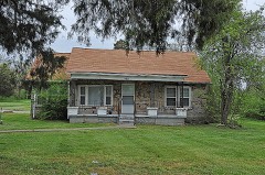 | Harry Bailey House | under 500 feet | 2000 |
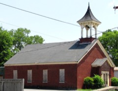 | Pickett Chapel Methodist Church | 1.0 miles | 1977 |
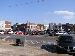 | Lebanon Commercial Historic District | 1.2 miles | 1999 |
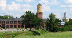 | Lebanon Woolen Mills | 1.3 miles | 2007 |
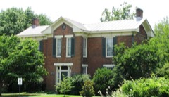 | Fite-Fessenden House | 1.4 miles | 1985 |
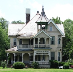 | I. W. P. Buchanan House | 1.7 miles | 1979 |
| National Archives record | The nomination case file for reference 93000212 in Record Group 79. |
| Wikipedia article | Community-written account of this property, licensed CC BY-SA. |
| Wilson County | All 24 listed properties in this county. |