 Block
BlockFrom the record
18 National Register listings published here.
Sources: the National Register database, National Park Service
69 topographic sheets cover 43 settlements here, and 18 properties are on the National Register of Historic Places.
18 National Register listings published here.
Sources: the National Register database, National Park Service
Every property in this county listed on the National Register of Historic Places, with the year it was listed and the federal nomination document.
| Photograph | Property | Type | Listed | Reference |
|---|---|---|---|---|
| J. T. Baker Farmstead | building | 1992 | 92000138 | |
 | Farmers National Bank | building | 1984 | 84001871 |
 | Gebhardt Bakery | building | 1984 | 84001873 |
| Grimes Garage | building | 1984 | 84001875 | |
| Grimes House | building | 1984 | 84001877 | |
 | Hill County Courthouse | building | 1971 | 71000939 |
 | Hill County Jail | building | 1981 | 81000631 |
| Hillsboro Cotton Mills | building | 1984 | 84001878 | |
| Hillsboro Residential Historic District | district | 1984 | 84001879 | |
 | Missouri-Kansas-Texas Company Railroad Station | building | 1979 | 79002978 |
 | Nolan River Bridge 303-A of the Gulf, Colorado and Santa Fe Railway | structure | 2012 | 12001001 |
 | Old Rock Saloon | building | 1984 | 84001881 |
| Sturgis National Bank | building | 1984 | 84001889 | |
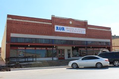 | Tarlton Building | building | 1984 | 84001892 |
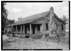 | Joe E. Turner House | building | 1977 | 77001452 |
 | U.S. Post Office | building | 1984 | 84001894 |
 | Western Union Building | building | 1984 | 84001896 |
Drawn when these were printed as single large sheets: the town seen from the air, and the county divided into its farms with every owner named. Each opens the original at the Library of Congress.

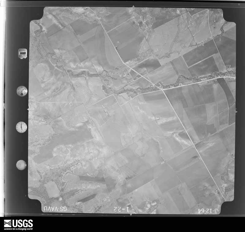
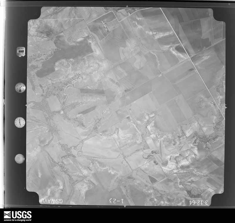
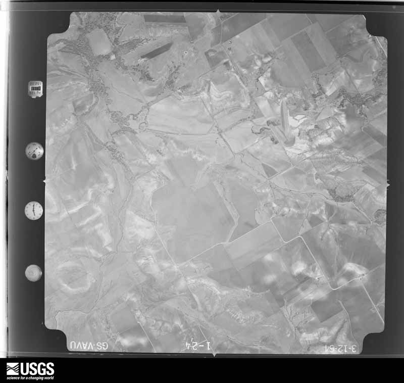
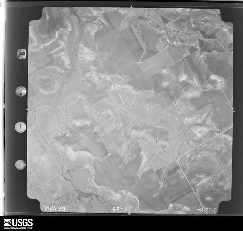
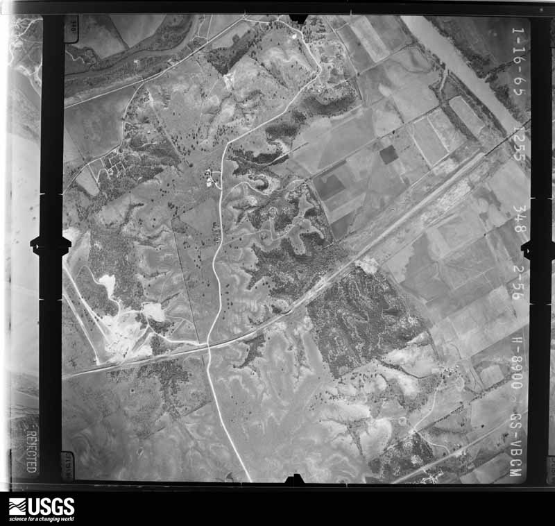
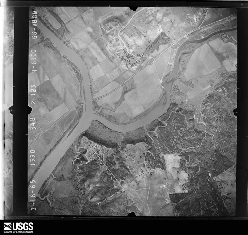
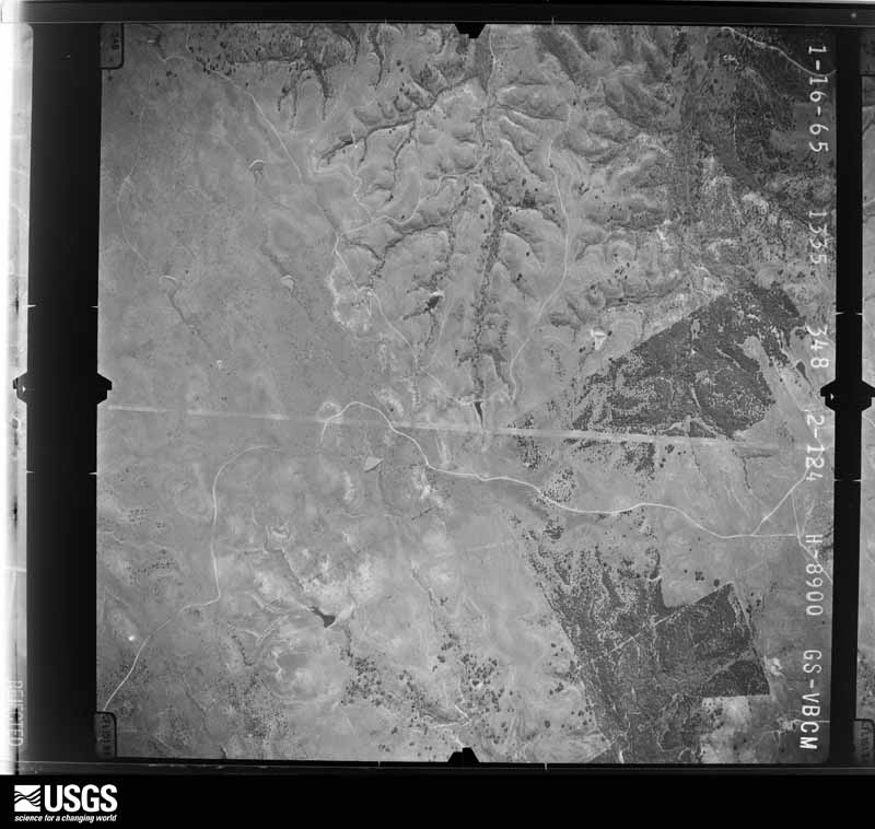
Flown by the U.S. Geological Survey between 1937 and 1989, the Aerial Photo Single Frames collection is the definitive mid-century view of the land: fields, roads and rivers as the camera saw them. The Survey holds 1,476 frames inside the rectangle that bounds this county; the 43 frames below were taken over the county itself, chosen across the decades of flights (at most four a year from that rectangle), so one flight cannot crowd out the rest. The full set is free to browse and download at EarthExplorer under the dataset Aerial Photo Single Frames.




































The thermometers that kept this county's weather, and the gages that measured the flow of its streams, as the federal records hold them. The extremes below are measured values from those records, not estimates.
Who lived here in 1950, one enumeration district at a time, as the Census Bureau described each district. Each row opens its official National Archives result, with Population Schedules and ED Maps available there.
Every wildfire the federal occurrence database records inside this county: 2,306 of them, burning about 24,304 acres. 22 started naturally and 101 were recorded as arson. Each settlement page carries the fires within five miles of it.
| Reported cause | Fires |
|---|---|
| Debris and open burning | 920 |
| Missing data/not specified/undetermined | 808 |
| Equipment and vehicle use | 332 |
| Arson/incendiarism | 101 |
| Power generation/transmission/distribution | 52 |
| Smoking | 39 |
| Natural | 22 |
| Recreation and ceremony | 13 |
| Railroad operations and maintenance | 8 |
| Misuse of fire by a minor | 6 |
| Other causes | 5 |
The five largest, by the area the report gives. None of them was recorded as arson.
| Date | Cause | Size | Reported by | Name on the report |
|---|---|---|---|---|
| 9 September 2011 | Missing data/not specified/undetermined | 1,500 acres | Texas A & M Forest Service | WHITNEY DAM |
| 24 June 2018 | Missing data/not specified/undetermined | 1,100 acres | Texas A & M Forest Service | 192 CR4319 |
| 7 September 2019 | Debris and open burning | 1,100 acres | Texas A & M Forest Service | FM 934 GRASS FIRE |
| 24 June 2018 | Equipment and vehicle use | 1,000 acres | Texas A & M Forest Service | HAYCUTTER FIRE |
| 31 January 2017 | Debris and open burning | 800 acres | Texas A & M Forest Service | FM 933 |
| 8 September 2011 | Natural | 580 acres | Texas A & M Forest Service | DAM FIRE |
| 7 September 2019 | Debris and open burning | 500 acres | Texas A & M Forest Service | 150 |
| 22 August 2005 | Missing data/not specified/undetermined | 500 acres | Texas A & M Forest Service | CENTRAL TX - 18 |
Every settlement page carries the fires within five miles of it - see the settlement index below.
The NOAA Storm Events Database holds 596 reports for this county, causing 13 deaths, 175 injuries and about $14,470,110 in recorded property damage. Each settlement page carries the reports that name it.
| Kind of event | Reports |
|---|---|
| Hail | 310 |
| Thunderstorm Wind | 159 |
| Tornado | 61 |
| Flash Flood | 54 |
| Flood | 8 |
| Lightning | 3 |
| Heavy Rain | 1 |
The most serious of them, by death, then injury, then recorded damage. The accounts are quoted exactly as the forecast office filed them.
| When | Event | Place named | Harm | What the report says |
|---|---|---|---|---|
| March 1973 | Tornado (F4) | not stated | 6 killed, 75 hurt | no account filed |
| March 1959 | Tornado (F4) | not stated | 6 killed, 31 hurt, $25,000 | no account filed |
| May 1971 | Tornado (F3) | not stated | 1 killed, 49 hurt | no account filed |
| May 1957 | Tornado (F3) | not stated | 4 hurt, $250,000 | no account filed |
| December 1987 | Thunderstorm Wind | not stated | 4 hurt | no account filed |
| June 1998 | Thunderstorm Wind | Hubbard | 3 hurt, $50,000 | Thunderstorm winds took the roof from a house and blew a metal awning onto two cars. Three people were injured by flying glass. Thunderstorm winds also damaged buildings and downed trees. |
| January 2017 | Tornado (EF1) | Lake Whitney | 2 hurt, $290,000 | A National Weather Service storm survey crew found evidence of a tornado which began in Bosque County northwest of Laguna Park, and ended in Hill County. In Bosque County, the tornado produced EF-0 damage, with damage to trees. In Hill County, approximately 80 homes had some damage, mostly shingle damage on roofs. However, about 10 manufactured homes suffered major damage, with roof and window damage. One older home lost most of its roof and walls, after a tree fell on the home. |
| April 1986 | Tornado (F1) | not stated | 2 hurt, $250,000 | no account filed |
| March 1972 | Tornado (F2) | not stated | 2 hurt, $250,000 | no account filed |
| April 1990 | Thunderstorm Wind | not stated | 2 hurt | no account filed |
| April 1990 | Thunderstorm Wind | not stated | 1 hurt | no account filed |
| May 1981 | Tornado (F3) | not stated | $2,500,000 | no account filed |
| May 1976 | Tornado (F4) | not stated | $2,500,000 | no account filed |
| September 2010 | Flash Flood | Blum | $1,000,000 | Several county roads and Farm-to-Market roads were impassible or closed due to high water. Swift water rescues were conducted in Whitney after two apartment complexes were flooded. There were at least 17 high water rescues conducted across the county. At least 40 homes suffered damage due to flood waters, and county roads across the county experienced significant damage. |
| March 2000 | Hail | Hillsboro | $1,000,000 | Hail and high wind did extensive damage over northern Hill county from Blum to Hillsboro. This is the same storm that struck Somervell county. The wind unroofed barns, uprooted trees, and damaged homes and buildings. Large hail broke windows and dented vehicles. Three 18-wheelers were blown over while trying to wait out the storm on the side of I-35 just north of Hillsboro. Wind driven hail broke or cracked over 200 windows in Hillsboro, some in the recently reconstructed historic court house. Water subsequently damage carpet and floors. Some hail stones in Hillsboro were as large as baseballs. Approximately 17,000 acres of wheat were ruined. The newspaper quoted this as the worst hail storm in Hillsboro since the 1980s. |
| April 2012 | Hail | Itasca | $700,000 | Tennis ball sized hail fell in Itasca. The local newspaper reported that cars, houses, and buildings were damaged from the large hail. The hail that fell across the county also damaged the wheat crop. |
| December 2006 | Tornado (F2) | Blum | $500,000 | The National Weather Service in Fort Worth conducted a damage survey and found that a tornado developed west of FM 933 and south of CR 1145. Tree damage was noted as the tornado crossed FM 933 and FM 67 one mile southeast of Blum. The tornado apparently increased in size and intensity after crossing FM 67. A large grain silo was toppled over on CR 1137, roughly 1.5 miles northeast of Blum. Extensive tree and power pole damage was also noted. The path width was over a quarter of a mile at this time. As the tornado crossed County Roads 1136 and 1133, widespread tree damage was noted, as was structural damage to roofs and windows. The tornado then moved across FM 2488 just south of the Johnson County line, where a well-engineered home lost portions of roof decking and a large barn was destroyed. Portions of the barn's metal skin were carried over a mile to the north-northeast. The tornado then crossed into Johnson County. |
| June 2003 | Lightning | Hillsboro | $500,000 | A lightning started fire destroyed a church. |
| June 2010 | Flash Flood | Birome | $400,000 | Numerous reports of flash flooding were reported in the southeastern portions of the county. A vehicle was overtaken with water on Farm-to-Market Road 308 near the town of Bynum. Additional water was reported over Farm-to-Market Road 308 between the towns of Penelope and Birome and near Malone. There was also water over County Road 2114 west of Penelope and a bridge was washed out, stranding four motorists along NW 3150 Road, northeast of Dawson. Water was reported in homes between Hillsboro and Brandon. |
| May 2021 | Tornado (EF2) | Brazlime | $350,000 | The tornado formed in extreme northern Hill County, NW of the Blum community, near the intersection of Texas Highway 174 and Hill County Road 1106. The tornado traveled across open country for approximately 3.4 miles. Scattered tree and powerline damage of EF-0 intensity was noted along the length of this path. Near the end of the tornado's lifespan, it struck a brick-clad frame home, removing most of the roof and part of the walls of the structure. The tornado's peak intensity of EF-2, with estimated wind speeds of 130 mph, was inferred from the damage to this structure. Some other trees and outbuildings sustained EF-0 to EF-1 damage near this home. The tornado dissipated several hundred yards beyond the point where the tornado impacted the frame home. |
| October 1985 | Tornado (F2) | not stated | $250,000 | no account filed |
| May 1968 | Tornado (F2) | not stated | $250,000 | no account filed |
| April 2024 | Flash Flood | Hillsboro | $200,000 | Broadcast media showed video of water covering residential roads in Hillsboro and water approximately 1-2 feet deep up to home foundations. The exact location of the impacted homes is uncertain. |
| October 2007 | Thunderstorm Wind | Hillsboro | $200,000 | Extensive damage occurred with numerous trees blown down and shingles were blown off roofs. Several trees fell on houses and vehicles. A large plate glass window was shattered at a residence, and garage doors and business signs were damaged. Twelve vehicles at a car dealership lost all their windows, and another ten vehicles were damaged by flying debris. |
| May 2024 | Hail | Mayfield | $100,000 | Report from mPING: Softball (4.50 in.). |
| June 2023 | Hail | Whitney | $100,000 | A trained spotter reported two-inch diameter hail in Whitney, TX. |
| June 2023 | Thunderstorm Wind | Whitney | $100,000 | Amateur radio reported that a tree was blown down onto a house in Whitney. |
| October 2015 | Flash Flood | Hubbard | $100,000 | Major street flooding was reported in Hubbard after several inches of rain fell in a short amount of time. Highway 171 between Hubbard and Coolidge was closed due to water over the road. The rain, often heavy at times, continued for over 24 hours and approximately 15-20 inches or more of rain fell in the area. |
| October 2015 | Flash Flood | Mertens | $100,000 | Several roads were closed in southern Hill County. |
| November 1996 | Thunderstorm Wind | Hubbard | $100,000 | no account filed |
| April 2015 | Thunderstorm Wind | Mayfield | $90,000 | A manufactured home on CR 1458 was destroyed by thunderstorm winds. |
| May 2024 | Hail | Osceola | $75,000 | Broadcast media sent photo of 3 to 3.5 inch hail in the Itasca area. |
| June 2012 | Lightning | Hillsboro | $68,610 | Lightning struck the Hill County Law Enforcement Center damaging much of the electrical equipment at the building. The cost to repair all the damaged equipment was quoted around $68,605. |
| April 2024 | Tornado (EF1) | Birome | $60,000 | The same supercell produced another brief tornado, based on eye witness accounts, on either side of FM 339 southwest of Penelope. The tornado formed in the field just east of the road, hitting a residence and dissipating soon afterwards. Two houses were damaged: One had metal panels peeled off the roof, and the home shifted off its cinder blocks about 8 inches. Winds got in the garage of the uninhabited second house and lifted the roof off, then it collapsed back on the house and the walls buckled. The tornado lifted just east of the property. Maximum estimated winds were 105 mph. |
| April 2010 | Thunderstorm Wind | Penelope | $60,000 | Numerous trees and power poles were reported down in the southeast corner of Hill County from Penelope to Hubbard. Several trees were also reported down along 171 south of Hubbard. Some of the downed trees blocked county roads. In Hubbard, a large glass window at a business was blown out, a few tree limbs fell on cars causing damage, and some sheet metal was wrapped around a utility pole. |
| February 2009 | Thunderstorm Wind | Huron | $60,000 | Significant damage occured at a Youth Retreat near Huron. Numerous outbuildings were damaged or destroyed. The main building suffered significant roof damage, the support columns for the porch were dislodged or removed, and a metal canopy next to the building was destroyed. Several trees lost large limbs and two trees were uprooted. Debris from the retreat was scattered up to a half mile away. A NWS survey confirmed straight line winds or a microburst was responsible for the damage. |
| May 2007 | Thunderstorm Wind | Blum | $60,000 | Hundreds of trees were damaged or blown down across Northern Hill county. Windows were blown out on the west side of a school in Blum and temporary repair structures on a field house were blown away at Itasca High School. Two truck rigs were blown over on Interstate 35W. |
| November 2024 | Thunderstorm Wind | Lake Whitney | $50,000 | A large metal barn was destroyed on the south side of Lake Whitney. A nearby metal building was also damaged with the garage doors pushed in and part of a metal carport tossed into the next yard. |
| April 2024 | Tornado (EF1) | Abbott | $50,000 | A tornado occurred near Abbott, first developing on the west side of I-35W and CR 2341 where trees were damaged and uprooted. A semi-tractor trailer was rolled over on the interstate. The tornado moved northeast causing tree damage until it reached CR 3106 where it caused minor damage to a few homes. The tornado dissipated after crossing CR 3106 again, north of CR 3145. Maximum estimated winds were 95 mph. |
| October 2018 | Tornado (EF1) | Chat | $50,000 | The survey team determined a second tornado occurred on the east side of I-35, a little over 3.5 miles southeast of downtown Hillsboro. Tornado damage was first seen at the end of HCR 3267 where a few trees were damaged and one home lost its roof deck. Then, this tornado produced damage consistent with an EF1 wind speed of 100 mph on HCR 3267 where one home lost a substantial portion of the roof, deck, walls and windows. The tornado destroyed a small storage shed, and it also damaged a RV trailer and small boat. The RV and the boat were picked up and tossed a few yards from their original location. |
| April 2015 | Thunderstorm Wind | Woodbury | $50,000 | The emergency manager reported extensive damage to several barns and numerous trees in Woodbury. |
| April 2015 | Thunderstorm Wind | Blum | $50,000 | The emergency manager reported extensive thunderstorm wind damage in Blum. A storm chaser reported large tree limbs were snapped off along FM 933 north of Blum. |
| April 2015 | Thunderstorm Wind | Itasca | $50,000 | The emergency manager reported thunderstorm wind damage to roofs and businesses in Itasca. One person was injured by a falling tree. |
| February 2009 | Thunderstorm Wind | Hillsboro | $50,000 | Multiple units in a mobile home park east of Hillsboro suffered damage and numerous tree limbs were broken off. |
| August 2009 | Thunderstorm Wind | Hillsboro | $50,000 | A 14 inch diameter tree was knocked down at the city manager's residence in Hillsboro, and another large tree fell onto a truck causing minor damage. In addition, roofs were blown off several barns in western parts of Hillsboro. Power lines and 4 to 5 inch diameter tree limbs were knocked down throughout the city. |
| March 2004 | Thunderstorm Wind | Hillsboro | $50,000 | An 18 wheeler was blown over on Interstate 35 in the south part of town, a mobile home south of town was destroyed, a barn was unroofed west of Hillsboro, and 4 buildings were damaged at the Prairie ValleyPresbyterian Camp about 15 miles southwest of Hillsboro. |
| November 1994 | Thunderstorm Wind | Itasca | $50,000 | A house was unroofed and several mobile homes were blown over. |
| April 2014 | Hail | Itasca | $40,000 | Trained spotters reported ping pong ball sized hail in Itasca. |
| March 2007 | Flash Flood | Itasca | $40,000 | Many streets in Itasca and Hillsboro were closed due to flooding. Five homes and three bridges were damaged by the floodwaters, and eight high water rescues were required. |
| June 2007 | Flash Flood | Abbott | $40,000 | Interstate 35 at exit 366 near Abbott was under water, and a bridge on CR 2415 south west of Peoria was washed away. Street flooding was also reported in Hillsboro. |
| October 2001 | Tornado (F1) | Abbott | $40,000 | A tornado touched down 2 miles northwest of Birome and moved east northeast 0.7 of a mile before dissipating. The damage path was mostly across open country, but heavy damage occurred to a mobile home and a barn. |
| April 2011 | Hail | Itasca | $35,000 | The COOP Observer in Itasca reported hail stones up to 3.5 inches in diameter. |
| April 2008 | Thunderstorm Wind | Covington | $35,000 | Damage was reported to roofs and outbuildings. Barns were also blown down. |
| April 2015 | Thunderstorm Wind | Itasca | $30,000 | A tractor-trailer was overturned on Interstate 35W between mile markers 7 & 8. |
| April 2008 | Flash Flood | Vaughan | $30,000 | Cars stalled on FM 1713 and CR 1212 north of Whitney. Water was reported over Highway 22 in Peoria. Water was also reported over several other county and farm roads. Flood waters washed away road base in some cases. |
| June 2006 | Thunderstorm Wind | Hillsboro | $30,000 | The awning and marquee of the historic Texas Theater on Waco Street was torn off. Support cables for the awning were also pulled from the wall. |
| April 1999 | Thunderstorm Wind | Hillsboro | $25,000 | Thunderstorm winds damaged two barns, destroyed a carport, blew two trucks off the road, and caused damage to a house. |
| April 2011 | Hail | Itasca | $25,000 | no account filed |
| January 1996 | Thunderstorm Wind | Lake Whitney | $25,000 | no account filed |
| May 1981 | Tornado (F2) | not stated | $25,000 | no account filed |
The Survey's mineral resources record lists 4 workings inside this county. All of them still produce. Each settlement page carries the workings within five miles of it.
| Commodity | Workings |
|---|---|
| Limestone, General | 2 |
| Calcium | 1 |
| Stone, Crushed/Broken | 1 |
The least common of them first, because a county's hundredth gravel pit says nothing its first ten did not.
| Where | Site | Commodity | Status | Recorded |
|---|---|---|---|---|
| Arnold Pit | Stone, Crushed/Broken | Producer | ||
| Blum Quarry and Plant | Calcium | Producer | ||
| Oalstrom Pit | Limestone, General | Producer | ||
| Unnamed Quarry | Limestone, General | Producer | Sedimentary |
Named settlements recorded in the Geographic Names Information System, each with the topographic sheets covering it. Villages, hamlets and abandoned places alike. Each is shown with the nearest named watercourse or landform and the survey quadrangle it falls on.
Whitney census division · 76622 · On Dead Horse Creek · Aquilla quadrangle
15 sheets, 1892 to 1985
Malone-Penelope census division · 76673 · On Mesquite Creek · Penelope quadrangle
7 sheets, 1954 to 1985
Blum census division · 76636 · Near Brushy Knob · Covington quadrangle
17 sheets, 1891 to 1985
Hillsboro census division · 76645 · On Pecan Creek · Hillsboro West quadrangle
15 sheets, 1891 to 1985
Whitney census division · 76622 · On Tener Creek · Smiths Bend quadrangle
16 sheets, 1892 to 1985
Hillsboro census division · 76645 · On Parker Creek · Hillsboro West quadrangle
15 sheets, 1891 to 1985
Whitney census division · 76622 · On Snake Creek · Smiths Bend quadrangle
16 sheets, 1892 to 1985
Hillsboro census division · 76645 · On Rocky Branch · Peoria quadrangle
14 sheets, 1892 to 1985
Hillsboro census division · 76645 · On Little Hackberry Creek · Abbott quadrangle
14 sheets, 1892 to 1985
Hillsboro census division · 76645 · On Cottonwood Creek · Hillsboro West quadrangle
15 sheets, 1891 to 1985
Whitney census division · 76692 · On Towash Creek · Whitney quadrangle
16 sheets, 1892 to 1985