 Block
BlockFrom the record
1 National Register listing published here.
Sources: the National Register database, National Park Service
27 topographic sheets cover 10 settlements here, and 1 property is on the National Register of Historic Places.
1 National Register listing published here.
Sources: the National Register database, National Park Service
Every property in this county listed on the National Register of Historic Places, with the year it was listed and the federal nomination document.
| Photograph | Property | Type | Listed | Reference |
|---|---|---|---|---|
 | Old Morris County Courthouse | building | 1979 | 79002997 |
Drawn when these were printed as single large sheets: the town seen from the air, and the county divided into its farms with every owner named. Each opens the original at the Library of Congress.

Selected from the Digital Public Library of America's 3 image records catalogued for this county. Every one shown here carries a public-domain status or a licence that permits reuse on a site that carries advertising; non-commercial, share-alike and restricted images are excluded. The selection is spread across the county's towns (at most eight per town), so no single institution's bulk upload crowds out the rest. Each opens the holding library's record, and the complete set at the Digital Public Library of America is one click away.

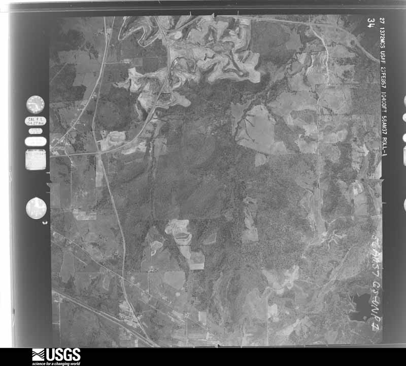
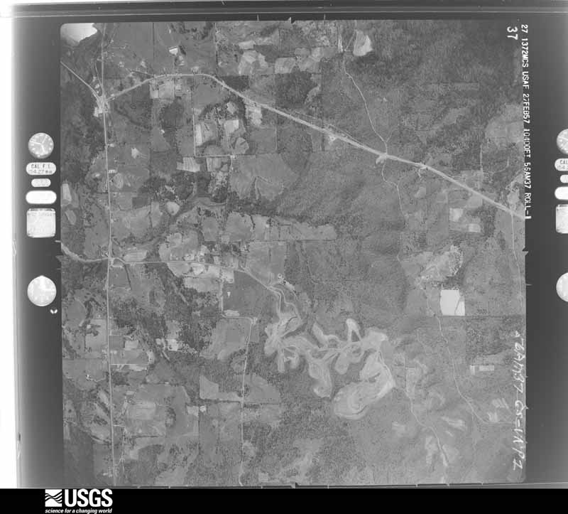
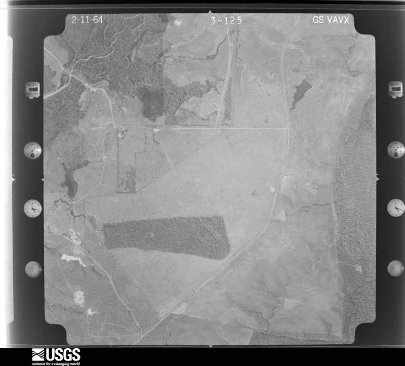
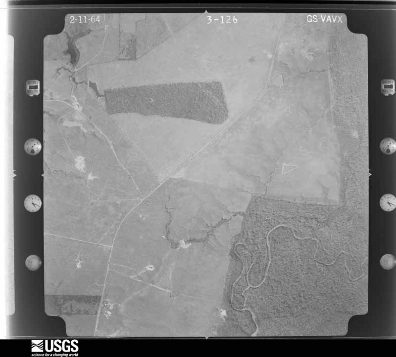
Flown by the U.S. Geological Survey between 1937 and 1989, the Aerial Photo Single Frames collection is the definitive mid-century view of the land: fields, roads and rivers as the camera saw them. The Survey holds 397 frames inside the rectangle that bounds this county; the 26 frames below were taken over the county itself, chosen across the decades of flights (at most four a year from that rectangle), so one flight cannot crowd out the rest. The full set is free to browse and download at EarthExplorer under the dataset Aerial Photo Single Frames.






















The thermometers that kept this county's weather, and the gages that measured the flow of its streams, as the federal records hold them. The extremes below are measured values from those records, not estimates.
Who lived here in 1950, one enumeration district at a time, as the Census Bureau described each district. Each row opens its official National Archives result, with Population Schedules and ED Maps available there.
Every wildfire the federal occurrence database records inside this county: 536 of them, burning about 5,456 acres. 23 started naturally and 76 were recorded as arson. Each settlement page carries the fires within five miles of it.
| Reported cause | Fires |
|---|---|
| Debris and open burning | 297 |
| Arson/incendiarism | 76 |
| Missing data/not specified/undetermined | 60 |
| Equipment and vehicle use | 30 |
| Power generation/transmission/distribution | 26 |
| Natural | 23 |
| Smoking | 8 |
| Recreation and ceremony | 7 |
| Railroad operations and maintenance | 5 |
| Misuse of fire by a minor | 3 |
| Fireworks | 1 |
The five largest, by the area the report gives. One of them was set deliberately.
| Date | Cause | Size | Reported by | Name on the report |
|---|---|---|---|---|
| 9 February 2015 | Missing data/not specified/undetermined | 250 acres | Oklahoma Division of Forestry | CAVANAL FIRE |
| 31 July 1998 | Equipment and vehicle use | 225 acres | Texas A & M Forest Service | not named |
| 31 July 1998 | Missing data/not specified/undetermined | 175 acres | Texas A & M Forest Service | not named |
| 6 March 2010 | Debris and open burning | 154 acres | Texas A & M Forest Service | LINDEN - 025 |
| 29 August 2000 | Arson/incendiarism | 150 acres | Texas A & M Forest Service | LINDEN - 314 |
| 27 December 1999 | Debris and open burning | 140 acres | Texas A & M Forest Service | not named |
| 25 April 2005 | Debris and open burning | 115 acres | Texas A & M Forest Service | LINDEN - 107 |
| 26 August 2005 | Natural | 97 acres | Texas A & M Forest Service | LINDEN - 312 |
Every settlement page carries the fires within five miles of it - see the settlement index below.
The NOAA Storm Events Database holds 234 reports for this county, causing 1 death, 8 injuries and about $7,430,750 in recorded property damage. Each settlement page carries the reports that name it.
| Kind of event | Reports |
|---|---|
| Thunderstorm Wind | 110 |
| Hail | 88 |
| Tornado | 17 |
| Flash Flood | 13 |
| Funnel Cloud | 4 |
| Lightning | 2 |
The most serious of them, by death, then injury, then recorded damage. The accounts are quoted exactly as the forecast office filed them.
| When | Event | Place named | Harm | What the report says |
|---|---|---|---|---|
| November 2022 | Tornado (EF3) | Cason | 1 killed, 8 hurt, $5,000,000 | The supercell thunderstorm which produced a brief and weak tornado in eastern Camp County then went on to produce a stronger and longer-lasting tornado from southwestern Morris County and into northwestern Cass County. This EF-3 tornado with estimated maximum winds of 155 mph initially started along FM-144 south of the Cason community and very quickly became quite destructive, producing EF-3 damage to a home, and EF-2 damage to multiple structures before tracking northeast to Texas Highway 11. A few mobile homes were destroyed near the start of the tornado which resulted in several injuries. The tornado continued to track northeast from Texas Highway 11 to Highway 49, doing mostly EF-1 damage for 3 miles before reaching Highway 49. As the tornado crossed Highway 49, two nearby homes were completely destroyed and largely swept from their foundations and at least one injury resulted. This damage was only rated EF-2 because of the pier and beam foundation construction of both homes did not anchor the structures well to the intense wind loading. Behind the homes, some isolated tree debarking was observed with a swath of EF-3 damage with maximum winds of 140 mph. The tornado continued to the northeast, completely destroying a mobile home along CR-3201, where one fatality associated with this tornado occurred. The tornado continued to advance northeastward, doing mainly EF-1 damage to trees and some structures before knocking over and destroying a few large electrical transmission lines near the intersection of CR-3211 and CR-3209. EF-2 level winds at 125 mph were estimated to have caused this structural damage. Finally, the tornado continued on another several miles to the northeast across U.S. Highway 259 before crossing into northwestern Cass County. |
| June 1997 | Thunderstorm Wind | Daingerfield | $850,000 | Winds reported by Storm Spotters. Roofs were torn from homes and businesses with numerous pines were snapped and fell onto homes and power lines. So many power lines were topped that power outages lasted for several weeks in many areas. Power companies from Dallas-Ft. Worth, Texas and Texarkana, AR were called in to help with the repairs. |
| April 2025 | Tornado (EF2) | Lone Star | $750,000 | A EF-2 tornado with estimated maximum winds near 120 mph touched down along Sand Crossing Road/CR 4428 just north of Big Cypress Bayou, downing tree limbs and snapping a couple of softwood tree trunks. The tornado moved northeast, crossing CR 2225 and moved along or just west of CR 2223 on the western shore of Ellison Creek Reservoir. A large amount of tree damage consisting of snaps and uproots were observed. The tornado then strengthened to EF-2 intensity when it damaged three homes northeast of CR 2236. The most significant structural damage was to a house that had its garage door buckled, allowing the tornadic winds inside the home, which uplifted and removed most of the roof on the back of the house. Roof removal/collapse was also noted on a couple of boat docks in this vicinity. The tornado crossed Ellison Creek Reservoir and caused widespread tree damage at a church camp on the eastern shore between Camp Circle and Lacewood Drive. There was a concentrated area of dozens of very large pine trees that were snapped at a very consistent height. Six cars were rolled and thrown approximately 100 yards from a nearby church building into this area of concentrated tree damage. Approximately 120 people were in the building where the vehicles were parked. They received the Tornado Warning several minutes before the tornado struck and were able to take cover in a safe place. The tornado then moved northeast into a neighborhood and uprooted and snapped numerous trees. Dozens of homes sustained minor to major damage due to parts of trees or entire trees falling on them. The tornado crossed Highway 259, uprooted more trees, and caused minor roof damage to a home along Bunt Drive. It then crossed Forrest Hill Road and caused more tree damage along FM 3421 west of CR 2113. While the survey team was unable to locate additional damage due to limited road access, NDVI differencing of high-resolution imagery indicated that the tornado continued northeast and damaged more trees before lifting in a wooded area south of Ore Road and west of CR 2113. |
| January 1995 | Hail | Daingerfield | $300,000 | Large hail damaged over 282 homes, businesses and automobiles in southern Morris County resulting in hundreds of thousands of dollars in damage. |
| April 2008 | Thunderstorm Wind | Naples | $150,000 | Several trees and powerlines were downed throughout the county. Damaging wind gusts downed one of the oldest trees in Naples, Texas to fall and cause extensive damage to one of the oldest in town. Other trees were reported down at the intersection of Hwy 338 and FM 161 along with others in the Omaha area as well. Wind also leveled the outfield fence at the Pewitt baseball field and uprooted the pole vault pit at the football field. |
| October 1993 | Thunderstorm Wind | Naples | $50,000 | Extensive roof damage was reported across town. Some trees were also blown down. |
| May 2008 | Thunderstorm Wind | Daingerfield | $40,000 | Strong and damaging wind gusts downed trees south of town. One tree fell onto a carport and roof of a home south of town near Hwy 259. |
| July 2017 | Lightning | Veals | $30,000 | Lightning struck a cluster of trees at Daingerfield State Park from a thunderstorm that moved near the park. At least five trees showed signs of lightning damage, with the strike causing the main underground water and sewer lines to explode. It also blew the phone box off of the pump station and smoked all of the outlets in the Big Pine Bathhouse. Pieces of the concrete sidewalk blew at several joints leading to the bathhouse. The extent of this damage caused the closure of the park until repairs could be made. |
| September 2007 | Thunderstorm Wind | Naples | $30,000 | Damaging wind gusts took the top out of some trees near a home. The storm also demolished a barn and utility building and blew some shingles off the roof of the home. |
| April 2000 | Tornado (F2) | Omaha | $28,000 | This tornado developed in a high precipitation supercell as it moved eastward across the county. Numerous large pine and oak trees were snapped and broken. Several barns were damaged but the tornado stayed mostly across rural farmland and forests. This tornado is a continuation of the Titus County, TX tornado. |
| March 2025 | Tornado (EF1) | Cason | $25,000 | This EF1 tornado with estimated maximum winds near 88 mph developed within a QLCS and began along Farm-to-Market Road 144 just north of Highway 49 in extreme eastern Morris County. The tornado moved east northeast across Hunt Road/County Road 1235, Green Street Road/County Road 1233, and County Road 3208, uprooting numerous trees and breaking large branches. The tornado continued northeast crossing Wilson Road, Kelly Road, Foster Road, and Old Daingerfield Road before moving across U.S. Highway 259 north of Rocky Branch. More tree limbs were downed as the tornado crossed County Road 4212, Highway 338, and Daniels Chapel Road. The tornado uprooted more softwood trees before lifting on Daniels Chapel Road just east of its intersection with Leeves Road and just west of the Morris/Cass County line. Just east of there, a significant number of large pine trees were uprooted at a property at the intersection of Daniels Chapel Road and FM Road 161. However, the damage pattern of these uproots was consistent with straight-line wind damage and not a tornado. The tornado had a maximum width of 735 yards and tracked nearly 9 miles. |
| January 1975 | Tornado (F2) | not stated | $25,000 | no account filed |
| April 1954 | Tornado (F3) | not stated | $25,000 | no account filed |
| May 2012 | Thunderstorm Wind | Dangerfield | $20,000 | A large tree fell on a house in Daingerfield, Texas. Numerous other trees were downed along Hwy. 259. |
| April 2011 | Thunderstorm Wind | Lone Star | $20,000 | The National Weather Service conducted a storm survey in the southern portion of Morris County, Tx. and determined that the damage was consistent with severe thunderstorm wind gusts near 80 mph. Damage was very sporadic and a tornado track could not be found. Damage consisted of nearly the entire roof of a local feed store removed along Holt Road north of Black Mountain Road. Other small trees were downed along Black Mountain Road just west of Hwy. 259. Minor shingle damage was also observed to a business just west of Hwy. 259. |
| July 1998 | Thunderstorm Wind | Daingerfield | $15,000 | Numerous trees and powerlines down. |
| April 2000 | Tornado (F2) | Daingerfield | $12,000 | Numerous large pine and oak trees snapped and broken. A roof was partially removed from a brick house and a chain link fence wrapped in a pine tree about 50 feet up. This was one of several tornadoes which occurred. This tornado continued into Cass County, TX. |
| April 2009 | Tornado (EF1) | Veals | $10,000 | This storm developed about 100 yards inside the Morris County line, very near the Cass County line, about 5 miles northwest of Hughes Springs. This tornado first touched down just west of County Line Road near FM 130 in eastern Morris County, continuing east across CR 2865, before lifting near FM 250 north of FM 130. Numerous trees were uprooted and snapped, with power lines downed as well. This tornado was rated an EF1, with winds of around 90 mph. |
| July 2008 | Lightning | Lone Star | $10,000 | Lightning struck a storage house near Lone Star, setting the tank on fire. No injuries were reported. |
| July 2007 | Flash Flood | Omaha | $8,000 | One foot of water across US 67 at 144 north. A car was stranded in high water with occupants needing to be rescued under a railroad bridge at the intersection of US 67 and US 259. |
| April 1995 | Thunderstorm Wind | Daingerfield | $5,000 | Trees and power lines were blown down between Daingerfield and Jenkins. |
| August 1994 | Thunderstorm Wind | Omaha | $5,000 | Trees were blown down along a 1/4 mile stretch of Highway 144. |
| August 1994 | Thunderstorm Wind | Daingerfield | $5,000 | Trees were blown down by high winds. |
| August 1994 | Thunderstorm Wind | Omaha | $5,000 | A barn was damaged, and trees were blown down by high winds. |
| November 1994 | Thunderstorm Wind | Daingerfield | $5,000 | Trees were blown down by high winds. During the evening hours, a line of strong thunderstorms had moved into the western parts of North Central Texas. Just after 830 pm a bow-echo developed on the south end of the line in Southern Comanche County and began accelerating rapidly to the northeast, sometimes reaching speeds of 70 miles an hour. During the next several hours a series of bow echos produced wind damage from Hamilton County northeastward across Bosque, Johnson, Ellis, Dallas, Collin, Rockwall, Hunt, and Delta Counties. |
| November 1973 | Tornado (F2) | not stated | $2,500 | no account filed |
| August 1964 | Tornado (F0) | not stated | $2,500 | no account filed |
| October 2010 | Tornado (EF0) | Omaha | $1,000 | This was a continuation of the tornado that first touched down in extreme eastern Titus County. This EF0 tornado touched down along Hwy. 67 and County Road 3325. Two large trees were snapped along the north side of the highway and other small limbs were downed. The tornado continued northeast, crossing County Road 3314 in Morris County knocking down numerous mid sized and large limbs before lifting north of County Road 3314. Maximum winds were estimated between 65 and 70 mph. A fence sustained minor damage from on of the large trees which fell near Hwy. 67. |
| November 2005 | Thunderstorm Wind | Naples | $1,000 | A storage building was blown off its blocks and suffered minor damage. |
| January 1993 | Thunderstorm Wind | not stated | $500 | Trees were blown down across the county. |
| April 1957 | Tornado (F2) | not stated | $250 | no account filed |
| March 2026 | Hail | Dangerfield | - | Quarter size hail reported in Daingerfield. |
| March 2025 | Thunderstorm Wind | Cason | - | Tree downed on a vehicle in Cason. |
| March 2025 | Thunderstorm Wind | Ore | - | Report from Mping. |
| April 2024 | Thunderstorm Wind | Rocky Branch | - | Numerous trees downed in and around the Rocky Branch community with vehicles stalled on roadways because of all the downed trees blocking lanes. |
| June 2023 | Hail | Ore | - | Quarter size hail reported in Lone Star. |
| June 2023 | Hail | Naples | - | Quarter size hail reported at a gas station in Naples. |
| June 2023 | Hail | Omaha | - | Ping pong ball size hail reported via social media in Omaha. |
| June 2023 | Hail | Naples | - | Hen egg size hail reported in Naples. |
| June 2023 | Thunderstorm Wind | Lone Star | - | Trees downed on a couple of homes in Lone Star. |
| June 2023 | Thunderstorm Wind | Naples | - | Trees downed along Pace Street in Naples. |
| October 2023 | Flash Flood | Omaha | - | Roadway flooded at the intersection of Spur 284 and FM 114 in Omaha. |
| April 2022 | Thunderstorm Wind | Lone Star | - | Trees were downed in Lone Star. |
| April 2022 | Thunderstorm Wind | Omaha | - | Trees and power lines were downed in Omaha. |
| April 2022 | Thunderstorm Wind | Omaha | - | A tree was blown down on County Road 3304. |
| March 2022 | Tornado (EF2) | Lone Star | - | This is a continuation of the Upshur/Marion County EF-2 tornado. This tornado, which remained an EF-1 with estimated maximum winds near 110 mph from far Western Marion County, snapped numerous trees in far Southeast Morris County along and east of Morris County Cutoff Road/County Road 2307, before entering Southwestern Cass County. |
| July 2022 | Hail | Lone Star | - | Nickel sized hail reported in Lone Star. |
| April 2021 | Hail | Naples | - | Golf ball size hail fell at Pewitt High School east of Omaha. |
| May 2021 | Hail | Veals | - | Quarter to half dollar size hail fell a few miles northeast of Daingerfield. |
| May 2021 | Hail | Veals | - | Half dollar to ping pong ball size hail fell from a second severe thunderstorm about a few miles northeast of Daingerfield. |
| May 2020 | Thunderstorm Wind | Daingerfield | - | A tree was blown onto power lines on County Road 1127. |
| May 2020 | Thunderstorm Wind | Cason | - | A tree was blown down onto FM 144 just north of Highway 49. |
| April 2020 | Funnel Cloud | Cason | - | A wall cloud was observed several miles northwest of Daingerfield. |
| April 2020 | Thunderstorm Wind | Omaha | - | A tree was blown down onto a home on Joyner Street. Multiple power outages were reported in Omaha. |
| April 2020 | Thunderstorm Wind | Omaha | - | Numerous trees were blown down over roadways across the northern half of Morris County. |
| June 2020 | Hail | Jenkins | - | Quarter size hail fell near the Jenkins community north of Lone Star. |
| April 2019 | Hail | Dangerfield | - | Nickel size hail fell just northeast of Daingerfield. |
| April 2019 | Hail | Lone Star | - | Quarter size hail fell in Lone Star. Report via Facebook. |
| October 2019 | Thunderstorm Wind | Omaha | - | Trees were blown down near Omaha. |
| June 2019 | Thunderstorm Wind | Lone Star | - | A large tree was blown down off of Highway 729 south of Lone Star near the Marion County line. Power was out in several areas across Morris County. |
The Survey's mineral resources record lists 9 workings inside this county. 1 still produces and 8 are closed or unrecorded. Each settlement page carries the workings within five miles of it.
| Commodity | Workings |
|---|---|
| Iron | 7 |
| Iron, Sand and Gravel, Construction | 1 |
| Water, Free | 1 |
| Clay | 1 |
The least common of them first, because a county's hundredth gravel pit says nothing its first ten did not.
| Where | Site | Commodity | Status | Recorded |
|---|---|---|---|---|
| Daingerfield Deposit | Iron, Sand and Gravel, Construction | Occurrence | Goethite, Hematite | |
| Lone Star Deposits | Iron, Water, Free | Past Producer | 1830, 1855 | |
| Unknown | Clay | Past Producer | ||
| Lone Star Steel Black Mountain Mine | Iron | Past Producer | ||
| Lone Star Steel Daingerfield Mine | Iron | Past Producer | ||
| Lone Star Steel Limonite Pits | Iron | Past Producer | ||
| Lone Star Steel Main Pits | Iron | Past Producer | ||
| Lone Star Steel Plant | Iron | Producer | ||
| Veals Switch Mine | Iron | Past Producer | Goethite, Hematite, Siderite |
Named settlements recorded in the Geographic Names Information System, each with the topographic sheets covering it. Villages, hamlets and abandoned places alike. Each is shown with the nearest named watercourse or landform and the survey quadrangle it falls on.