 Block
BlockFrom the record
4 National Register listings published here.
Sources: the National Register database, National Park Service
55 topographic sheets cover 63 settlements here, and 4 properties are on the National Register of Historic Places.
4 National Register listings published here.
Sources: the National Register database, National Park Service
Every property in this county listed on the National Register of Historic Places, with the year it was listed and the federal nomination document.
| Photograph | Property | Type | Listed | Reference |
|---|---|---|---|---|
| Concord School | building | 2024 | 100010801 | |
 | Elias and Mattie Crim House | building | 2005 | 05000892 |
 | Henderson Commercial Historic District | district | 1995 | 95000219 |
| Monte Verdi Plantation | building | 2014 | 14000104 |
Drawn when these were printed as single large sheets: the town seen from the air, and the county divided into its farms with every owner named. Each opens the original at the Library of Congress.

Selected from the Digital Public Library of America's 1 image records catalogued for this county. Every one shown here carries a public-domain status or a licence that permits reuse on a site that carries advertising; non-commercial, share-alike and restricted images are excluded. The selection is spread across the county's towns (at most eight per town), so no single institution's bulk upload crowds out the rest. Each opens the holding library's record, and the complete set at the Digital Public Library of America is one click away.

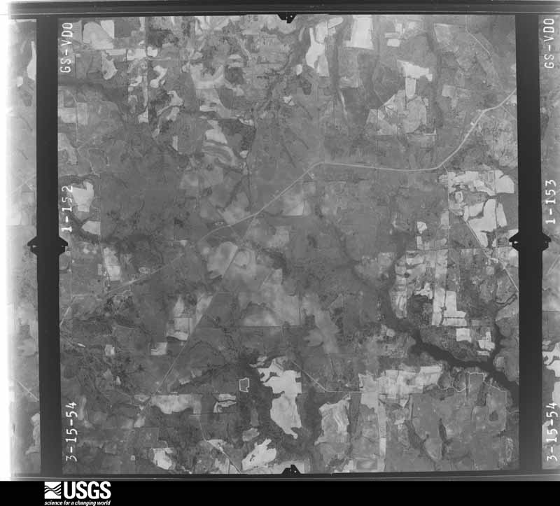
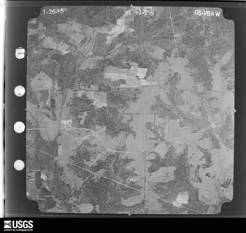
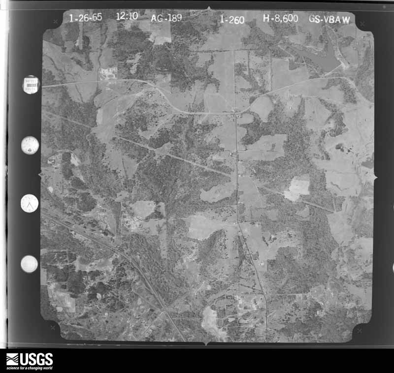
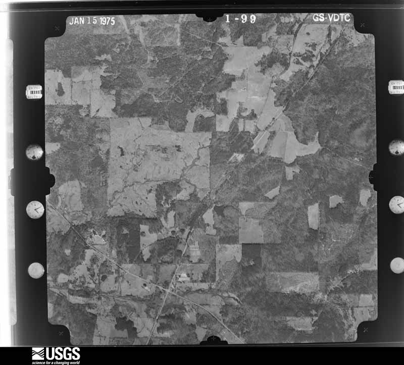
Flown by the U.S. Geological Survey between 1937 and 1989, the Aerial Photo Single Frames collection is the definitive mid-century view of the land: fields, roads and rivers as the camera saw them. The Survey holds 1,286 frames inside the rectangle that bounds this county; the 48 frames below were taken over the county itself, chosen across the decades of flights (at most four a year from that rectangle), so one flight cannot crowd out the rest. The full set is free to browse and download at EarthExplorer under the dataset Aerial Photo Single Frames.












































The thermometers that kept this county's weather, and the gages that measured the flow of its streams, as the federal records hold them. The extremes below are measured values from those records, not estimates.
Who lived here in 1950, one enumeration district at a time, as the Census Bureau described each district. Each row opens its official National Archives result, with Population Schedules and ED Maps available there.
Every wildfire the federal occurrence database records inside this county: 3,353 of them, burning about 25,518 acres. 120 started naturally and 146 were recorded as arson. Each settlement page carries the fires within five miles of it.
| Reported cause | Fires |
|---|---|
| Debris and open burning | 1690 |
| Missing data/not specified/undetermined | 865 |
| Equipment and vehicle use | 196 |
| Power generation/transmission/distribution | 193 |
| Arson/incendiarism | 146 |
| Natural | 120 |
| Smoking | 51 |
| Misuse of fire by a minor | 33 |
| Recreation and ceremony | 25 |
| Railroad operations and maintenance | 20 |
| Fireworks | 12 |
| Other causes | 1 |
| Firearms and explosives use | 1 |
The five largest, by the area the report gives. One of them was set deliberately.
| Date | Cause | Size | Reported by | Name on the report |
|---|---|---|---|---|
| 30 August 2011 | Power generation/transmission/distribution | 1,672 acres | Texas A & M Forest Service | JOHNSON CREEK FIRE |
| 1 April 1996 | Recreation and ceremony | 1,500 acres | Texas A & M Forest Service | not named |
| 23 March 1996 | Missing data/not specified/undetermined | 450 acres | Texas A & M Forest Service | not named |
| 24 February 1996 | Arson/incendiarism | 430 acres | Texas A & M Forest Service | not named |
| 18 August 2011 | Power generation/transmission/distribution | 415 acres | Texas A & M Forest Service | BOWLES CREEK FIRE |
| 5 September 2011 | Power generation/transmission/distribution | 400 acres | Texas A & M Forest Service | HENDERSON - 505 |
| 6 September 2011 | Missing data/not specified/undetermined | 398 acres | Texas A & M Forest Service | HENDERSON - 514 |
| 7 September 2011 | Missing data/not specified/undetermined | 390 acres | Texas A & M Forest Service | PRICE FIRE |
Every settlement page carries the fires within five miles of it - see the settlement index below.
The NOAA Storm Events Database holds 784 reports for this county, causing 3 deaths, 16 injuries and about $17,655,500 in recorded property damage. Each settlement page carries the reports that name it.
| Kind of event | Reports |
|---|---|
| Thunderstorm Wind | 396 |
| Hail | 243 |
| Tornado | 71 |
| Flash Flood | 57 |
| Lightning | 11 |
| Flood | 4 |
| Funnel Cloud | 2 |
The most serious of them, by death, then injury, then recorded damage. The accounts are quoted exactly as the forecast office filed them.
| When | Event | Place named | Harm | What the report says |
|---|---|---|---|---|
| November 1994 | Thunderstorm Wind | Henderson | 1 killed, 2 hurt, $50,000 | A 3-week old child was killed and two persons sustained minor injuries when a mobile home was rolled by high winds and heavily damaged. Roofs were partially blown off two houses and a barn was damaged. Damage was estimated at over $25,000. M01M |
| April 1986 | Thunderstorm Wind | not stated | 1 killed | no account filed |
| April 1986 | Thunderstorm Wind | not stated | 1 killed | no account filed |
| April 2003 | Tornado (F2) | Tatum | 6 hurt, $2,300,000 | A supercell storm moved across the northeast part of the county. About 20 wood frame and mobile homes were damaged. Six (6) mobile homes were totally destroyed. Numerous trees were twisted, broken and uprooted. This tornado remained in Rusk County. |
| April 1958 | Tornado (F2) | not stated | 4 hurt, $250,000 | no account filed |
| January 1974 | Tornado (F1) | not stated | 1 hurt, $250,000 | no account filed |
| May 2022 | Tornado (EF2) | Henderson | 1 hurt, $100,000 | An EF-2 tornado with estimated maximum winds of 115 mph developed just west of County Road 222 on the east side of Henderson and continued northeast for just over eight miles, uprooting and snapping thousands of trees and causing damage to some structures. The tornado was at its widest and strongest crossing County Road 262, FM 1251 East, County Road 324, and County Road 327 where extensive snapping of pine and hardwood trees warranted an estimated peak wind speed of 115 mph, a low EF-2 rating on the Enhanced Fujita Scale. The one injury occurred along County Road 262 where a male outside was struck by a falling tree. Several residences received various levels of roof damage, mostly due to falling trees. The tornado weakened as it lifted west of Martin Lake, with the same storm spawning another tornado just to the east near Martin Lake. |
| January 2012 | Tornado (EF1) | Mt Enterprise | 1 hurt, $100,000 | The National Weather Service conducted a storm survey in Rusk County in the town of Mt. Enterprise and found evidence of an EF1 tornado. The tornado first touched down southwest of town along CR 3207 south of Gatlin Cemetery Road where several large trees were snapped and uprooted. One large tree fell onto a house causing significant roof damage. The tornado continued east northeast paralleling Henderson Street where a carport was torn off of a house with some of the debris striking and injuring a person standing outside the home. Several other trees were snapped an uprooted along Henderson Street and CR 3204. The tornado crossed HWY 259 where a portion of a roof was blown off a small retail building and across the street into the parking lot of a gas station and fast food restaurant. The tornado continued east northeast along Angelina street uprooting and snapping trees as well as blowing shingles off of houses. The tornado crossed HWY 84 west of CR 3198 and lifted just west of CR 3195. Maximum winds are estimated at 85-95 mph. |
| August 2020 | Lightning | Henderson | 1 hurt | A 54 year old male groundskeeper was struck by lightning near a shed at the Henderson Country Club in Henderson. The lightning entered his head and came out through his left hand and leg. The victim suffered only minor injuries, and was released from the hospital the next day. |
| April 2003 | Tornado (F3) | New Salem | $9,000,000 | A supercell thunderstorm moved northeast across Rusk County. Numerous wood frame and mobile homes were damaged with several homes totally destroyed. A few barns were damaged as well. One power substation was severely damaged. Numerous large Pine, Oak, and Pecan trees were twisted, broken and uprooted. This tornado moved into Rusk County from Cherokee County, TX. |
| March 2022 | Tornado (EF2) | Glenfawn | $1,000,000 | This is a continuation of the Northwest Nacogdoches County EF-2 tornado. The tornado maintained its high end EF-1/low end EF-2 intensity as it moved through Southern and Eastern Rusk County, with estimated maximum winds near 125 mph. Upon departing FM 225 just inside the Southern Rusk County line, the tornado tracked northeast and crossed County Roads 3238 and 3227 before reaching Highway 84. Numerous trees were snapped and uprooted along the tornado's path through Highway 84, with the tornado tearing down a large metal electrical transmission tower off of County Road 3206 northeast of the Sulphur Springs community, while also ripping the roof off of a nearby single family home. The tornado continued northeast snapping and uprooting additional trees, while also damaging the roofs off of several homes as it crossed County Road 3167, FM 2496, County Roads 3155 and 3146. As the tornado crossed Highway 259 and County Road 317, it damaged or destroyed several metal buildings, while also destroying a single-wide mobile home. The tornado also destroyed another single-wide mobile home on FM 95 in the Minden community, while also significantly damaging a nearby single family home. The tornado then crossed FM 1798 and County Road 3125, snapping and uprooting additional trees before crossing FM 840. Here, several metal buildings were destroyed, with damage to roofs and walls on a couple of homes. The tornado crossed County Road 366 before finally lifting just east of County Road 364 about 10 miles east-southeast of Henderson. ||In Rusk County, around 50 structures were damaged. The total path length of this tornado from Southern Cherokee, Northwest Nacogdoches, and through Southern and Eastern Rusk Counties was 37.57 miles. |
| May 2017 | Tornado (EF2) | Caledonia | $500,000 | This is a continuation of the Nacogdoches County EF-2 tornado that initially touched down just southwest of Garrison along Highway 59. Additional EF-2 damage, with estimated winds of 115-120 mph occurred in the extreme southeast corner of Rusk County along Highway 59, where the tornado tore through a chicken farm, destroying one chicken coop and killing all chickens, while also damaging 5 other coops. Several homes sustained roof damage from snapped or uprooted trees, and at least 20 outbuildings were damaged or destroyed. The tornado also snapped several power poles in this area and continued northeast along Highway 59 into Northwest Shelby County. |
| March 2008 | Tornado (EF1) | New London | $500,000 | An EF1 tornado touched down near the community of New London, Texas. Numerous trees and powerlines were downed and a building was damaged near the intersection of county road 108 and farm to market road 850. Damage was also witnessed to a home, a metal building and dozen of trees along Dill Road. Additional damage was noted along U.S. 259, 4 miles south of Kilgore, Texas where the tornado downed several trees and a metal building suffered damage. |
| March 2001 | Tornado (F1) | Tatum | $300,000 | This tornado continued into Panola County, Texas. A tornado developed on the southern most cell of a squall line as it moved eastward across the county. Six homes lost numerous shingle patches while one home lost part of its roof. Two churches suffered roof damage. Numerous snapped, broken or felled trees. |
| May 2015 | Tornado (EF2) | Price | $250,000 | National Weather Service Storm Survey Team determined that damage in Rusk County was consistent with that of a tornado. An EF2 tornado touched down approximately 9 miles west southwest of Henderson, Texas in Rusk County and traveled in a east northeast direction before lifting approximately 10 miles east northeast of Henderson, Texas. Numerous trees were snapped and or uprooted along its path. Several powerpoles were snapped as well. Several homes in and around Henderson suffered minor to moderate damage mostly from fallen trees. |
| October 2009 | Thunderstorm Wind | Henderson | $250,000 | Strong winds downed trees throughout the county. One tree fell on top of a home in the 700 block of Slaydon Street. Several metal buildings at the Lowe's Hardware Store on US Hwy. 79 South were destroyed and scattered across a vacant lot. Another large tree fell on a home on Shawnee Trail with trees on a home in the 800 block of South Main Street. Trees were also downed on the carport of a residence on FM 3135. |
| April 1991 | Tornado (F2) | not stated | $250,000 | no account filed |
| November 1961 | Tornado (F3) | not stated | $250,000 | no account filed |
| May 2008 | Tornado (EF1) | Pleasant Grove | $200,000 | An EF1 tornado with winds of 105 to 110 mph occurred in Rusk County from 930 am to 940 am CDT on Wednesday, May 14th, 2008. The tornado touched down approximately 500 yards west of County Road 1798 where a manufactured home was completely destroyed. The hope appears to have been destroyed when the winds swept under the home...lifted it off its foundation and slammed it into the ground thereby causing the entire structure to fail. The winds then scattered the debris and home contents up to three miles northeast of the home. Numerous trees were snapped and uprooted along County Road 4183. A large barn was collapsed on the west side of County Road 4182 and a shed was destroyed by a fallen tree on the east side of County Road 4182. The tornado then crossed FM 839 snapping trees and knocking down power lines. Trees were snapped and uprooted along County Road 461 including one tree that fell on an outbuilding causing severe damage. The tornado lifted several hundred yards east of County Road 461. |
| May 2022 | Tornado (EF1) | Minden | $175,000 | An EF-1 tornado with estimated maximum winds of 110 mph first touched down near Highway 259, causing damage at the Whispering Pines RV Park. This damage consisted of numerous trees being uprooted or snapped along with the complete destruction of a towable RV trailer. In addition, a food truck was tossed around 50 feet along with a number of canopies being tossed up to 500 feet. The tornado tracked to the east northeast and crossed County Road 3145 and uprooted/snapped numerous trees, before crossing FM 95 South toward County Road 3153, leaving behind a trail of uprooted and snapped trees. The tornado lifted near County Road 3144, with a path length of just over 3 miles. |
| March 2021 | Tornado (EF1) | Sulphur Spgs | $160,000 | An EF1 tornado with estimated maximum winds around 110 mph touched down about 1 mile west of Mount Enterprise where it uprooted trees in an open field southwest of town. The tornado then tracked northeast into the Mount Enterprise where it caused shingle damage on several single family homes. One home had its roof mostly removed near the intersection of Highway 84 and West 5th Street, while also damaging a church steeple as it crossed Highway 84. Multiple trees were snapped and uprooted and additional homes suffered shingle damage as the tornado tore through the northeast side of Mount Enterprise. The tornado continued northeast as it crossed County Roads 3195 and 3185, before moving into a heavily wooded area east of County Road 3122 in extreme Southeast Rusk County, snapping and uprooting numerous trees, before crossing over into Southwest Panola County and intensifying into an EF2 tornado just southwest of Lake Murvaul. |
| December 2017 | Tornado (EF2) | New Salem | $125,000 | An EF-2 tornado was maximum estimated winds near 115 mph touched down across a heavily wooded areas just south of FM 4251 northeast of Reklaw, where it snapped and uprooted numerous trees. This tornado destroyed a nearby cabin adjacent to a pond where it was lifted off its pier and beam foundation and moved it about 15 yards into a heavily wooded area. A fiberglass fishing boat was lofted and unable to be found. The tornado continued east across a heavily wooded area before crossing County Road 4234 where numerous trees were snapped and uprooted. This tornado lifted after crossing County Road 4232 southwest of the Laneville community. |
| November 2015 | Thunderstorm Wind | Caledonia | $100,000 | An NWS Storm Survey team concluded that the damage northwest of the Garrison, Texas community was consistent with that of straight line wind gusts. Three chicken houses were heavily damaged or destroyed on FM 95 at CR. 3257. Also, a culvert was lifted out of a ditch and destroyed. |
| July 2006 | Lightning | Mt Enterprise | $100,000 | Lightning struck an abandoned home in the town of Laneville resulting in a fire. |
| January 2020 | Tornado (EF1) | Glenfawn | $80,000 | An EF-1 tornado with estimated maximum winds near 110 mph touched down along Highway 84 near the intersection of County Road 4234 west of Mount Enterprise, snapping and uprooting a few trees. The tornado continued eastward roughly along Highway 84, intensifying and snapping numerous trees in the Reagan Branch bottom, just west of the Farm to Market Road 225 intersection. It continued east-northeast snapping and uprooting trees as it crossed County Roads 3223, 3226, and 3206. Several farm outbuildings were tossed and completely destroyed along County Road 3206, with two residences sustaining roof damage, before the tornado lifted just northeast of the intersection of County Road 3206 and 3166. |
| August 1998 | Thunderstorm Wind | Turnertown | $80,000 | Two mobile homes destroyed by fallen trees. |
| May 2015 | Flash Flood | Trukton | $75,000 | Several street were flooded, closed and/or washed out across Rusk County, Texas. |
| February 2011 | Tornado (EF1) | Kurth Lake | $60,000 | A brick home had half of its roof torn off. A neighboring home had its roof damage from debris from the first home. A shed and chicken coop was completely destroyed. Numerous trees were snapped and or uprooted along the path which started along CR 2126 and crossed FM 782 before lifting. Maximum winds were 90-100 mph. |
| June 1998 | Thunderstorm Wind | Henderson | $55,000 | no account filed |
| January 2020 | Thunderstorm Wind | Kilgore | $50,000 | Damaging straight line winds estimated up to 100 mph partially ripped the roof off of a metal outbuilding and a nearby trailer was tipped over off of Texas 101 Spur and Woodlawn Street. Damage was found again along Meadowgreen Drive and Idylwood Drive just inside the Southern Gregg County side of Kilgore, where approximately 8 single family homes and 2 apartment buildings had partial roof damage. In addition, trees were snapped and uprooted in this area as well. |
| May 2017 | Thunderstorm Wind | Henderson | $50,000 | Numerous trees were downed across much of Rusk County from damaging straight line wind gusts. One large tree fell on a home on the 3600 Block of FM 3310 south of Henderson. |
| August 2013 | Thunderstorm Wind | Sexton City | $50,000 | A tree was uprooted and fell on a home off State Highway 323. There were no injuries reported. |
| May 2008 | Tornado (EF1) | Henderson | $50,000 | An EF1 tornado occurred northeast of Henderson, Texas along Hwy 43. A 24 by 24 foot foot metal building was completely destroyed and minor damage occurred to a house owned by the owner of a construction company. Numerous trees were snapped and uprooted along the path which ended 5.5 miles east along FM 1251. A hay barn was partially destroyed and several trees were uprooted and snapped around a home along FM 1251 in the Church Hill community. The path was 100 yards wide at its widest point. The tornado lifted before reaching CR 328 in Rusk County. |
| May 1994 | Thunderstorm Wind | Reklaw | $50,000 | Numerous trees were blown down by thunderstorm winds. |
| October 1993 | Thunderstorm Wind | New London | $50,000 | Numerous trees were blown down by thunderstorm winds, some of which fell upon power lines. |
| November 1993 | Thunderstorm Wind | New London | $50,000 | Numerous trees were blown down by thunderstorm winds, some of which fell upon power lines. |
| November 1996 | Thunderstorm Wind | New London | $50,000 | no account filed |
| May 2015 | Lightning | Henderson | $30,000 | A lightning strike resulted in a structural fire in Henderson, Texas. |
| February 2013 | Tornado (EF1) | Laneville | $30,000 | The National Weather Service conducted a storm survey and determined that an EF1 tornado first touched down 6 miles northwest of Mount Enterprise, Texas. Damage consisted of a travel trailer which was overturned and a roof torn off of a metal barn along County Road 3168. In addition, trees were snapped along with large branches downed along County Road 3156. |
| September 2007 | Thunderstorm Wind | Price | $30,000 | A 8x14 storage building was destroyed and an 18 inch diameter tree was blown onto a house in the community of Price. |
| May 1999 | Thunderstorm Wind | Henderson | $30,000 | Winds blew the roof off a building in Henderson Square. |
| October 2025 | Tornado (EF1) | Kilgore | $25,000 | The is a continuation of the Southern Gregg County EF-1 tornado. This tornado remained EF-1 in strength with estimated maximum winds near 94 mph as it exited Harris Street Park in Kilgore, and entered a residential area when it crossed Florence and Monroe Streets. Most of the damage in this area consisted of snapped and uprooted trees which damaged a few homes. Other homes sustained minor shingle loss. The tornado generally followed Monroe Street while crossing Martin, South, and Simmons Streets before lifting near the intersection of Hunter Street and Broadway Blvd. |
| June 2019 | Lightning | Henderson | $25,000 | Lightning struck a home along Highway 79 East, starting a fire in the attic. |
| April 2017 | Tornado (EF1) | Overton | $25,000 | This is a continuation of the EF-0 tornado from eastern Smith County that touched down just west of the Overton city limits. This tornado intensified to an EF-1 as it crossed into the Overton community in Western Rusk County, with maximum estimated winds between 95-105 mph. Several trees were snapped and uprooted with some minor shingle damage occurring to one home. The most concentrated damage was found near the Overton School complex and in the adjacent cemetery along Farm to Market Road 850 before lifting along County Road 128. |
| January 1999 | Thunderstorm Wind | Henderson | $25,000 | Twelve large trees down. One uprooted tree fell on a house at FM3135 and Hwy 79. |
| April 1991 | Tornado (F2) | not stated | $25,000 | no account filed |
| April 1991 | Tornado (F1) | not stated | $25,000 | no account filed |
| July 1975 | Tornado (F1) | not stated | $25,000 | no account filed |
| March 1970 | Tornado (F3) | not stated | $25,000 | no account filed |
| December 1968 | Tornado (F1) | not stated | $25,000 | no account filed |
| April 1959 | Tornado (F1) | not stated | $25,000 | no account filed |
| July 1954 | Tornado (F3) | not stated | $25,000 | no account filed |
| February 1953 | Tornado | not stated | $25,000 | no account filed |
| April 2018 | Lightning | Pone | $20,000 | Lightning struck a tank battery on County Road 401 near FM 839, catching it on fire. |
| May 2012 | Thunderstorm Wind | Henderson | $20,000 | Numerous large trees were downed in and around Henderson, Texas. Local Emergency Manager reported that a tree fell on a house in town, along with numerous other roadways being blocked by fallen trees. Hwy. 42 and FM. 1249 were hit the worst. |
| June 2004 | Thunderstorm Wind | Henderson | $20,000 | A downburst toppled several trees which damaged two homes and a pickup truck. Damage path was 2 miles long and one half mile wide. |
| March 1998 | Thunderstorm Wind | Tatum | $20,000 | Several trees fell across Hwy 43. An 18 wheeler ran into the trees and two cars piled into the back of the 18 wheeler. |
| May 2017 | Tornado (EF1) | Minden | $15,000 | An EF-1 tornado with maximum estimated winds between 100-110 mph touched down along Farm to Market Road 1798 East just east of Farm to Market Road 95. This tornado appeared to be skimming the treetops until it touched down along County Road 3125 South, snapping and uprooting trees. Another area of more focused damage was along County Road 363 South and County Road 364 South, where several more trees were snapped or uprooted. At least two of these trees fell on a house and outbuilding, causing moderate damage. The tornado lifted shortly beyond County Road 364 South. |
| January 1999 | Thunderstorm Wind | Kilgore | $12,000 | Roof damage. |
| April 2018 | Lightning | Henderson | $10,000 | Lightning struck a home at the 500 block of South Van Buren Street, which split a large limb from a tree and landed/damaged the chimney of the home. |
The Survey's mineral resources record lists 17 workings inside this county. 15 still produce and 2 are closed or unrecorded. Each settlement page carries the workings within five miles of it.
| Commodity | Workings |
|---|---|
| Kaolin | 7 |
| Fire Clay (Refractory), Kaolin | 4 |
| Kaolin, Fire Clay (Refractory) | 3 |
| Clay | 3 |
The least common of them first, because a county's hundredth gravel pit says nothing its first ten did not.
| Where | Site | Commodity | Status | Recorded |
|---|---|---|---|---|
| Henderson Brick Plant & Pit | Clay | Producer | ||
| Lewis Pit | Kaolin, Fire Clay (Refractory) | Producer | Sedimentary | |
| Major Brick Sales Co Pit 1 | Clay | Past Producer | ||
| Major Brick Sales Co Pit 2 | Clay | Unknown | ||
| Unnamed Pit | Kaolin, Fire Clay (Refractory) | Producer | Sedimentary | |
| Unnamed Pit | Kaolin, Fire Clay (Refractory) | Producer | Sedimentary | |
| Anderson Pit | Fire Clay (Refractory), Kaolin | Producer | Sedimentary | |
| Burkett Pit | Fire Clay (Refractory), Kaolin | Producer | Sedimentary | |
| Plastic Pits | Fire Clay (Refractory), Kaolin | Producer | Sedimentary | |
| Wylie Pit | Fire Clay (Refractory), Kaolin | Producer | Sedimentary | |
| Henderson Clay Products Anderson | Kaolin | Producer | ||
| Henderson Clay Products Burkett Pit | Kaolin | Producer | ||
| Henderson Clay Products Lewis Pit | Kaolin | Producer | ||
| Henderson Clay Products Pit | Kaolin | Producer | ||
| Henderson Clay Products Plant | Kaolin | Producer | ||
| Henderson Clay Products Plastic Pit | Kaolin | Producer | ||
| Henderson Clay Products Wylie Pit | Kaolin | Producer |
Named settlements recorded in the Geographic Names Information System, each with the topographic sheets covering it. Villages, hamlets and abandoned places alike. Each is shown with the nearest named watercourse or landform and the survey quadrangle it falls on.
Laneville census division · 75667 · On Anadarko Creek · New Salem quadrangle
11 sheets, 1943 to 1992
Mount Enterprise census division · 75946 · On North Branch Caney Creek · Caledonia quadrangle
11 sheets, 1953 to 1992
Price-Turnertown census division · 75654 · On Daniel Branch · Gum Springs quadrangle
13 sheets, 1935 to 1986
Pinehill census division · 75681 · On Welch Springs Branch · Minden quadrangle
12 sheets, 1956 to 1986
Mount Enterprise census division · 75946 · On Sandy Branch · Caledonia quadrangle
11 sheets, 1953 to 1992
Tatum census division · 75652 · On Lee Creek · Elderville quadrangle
16 sheets, 1956 to 1986
Henderson census division · 75652 · On Dry Creek · Kilgore SE quadrangle
15 sheets, 1936 to 1986
Henderson census division · 75652 · On Flanigan Branch · Henderson quadrangle
14 sheets, 1935 to 1986
Henderson census division · 75652 · On Dogwood Creek · Kilgore SE quadrangle
15 sheets, 1936 to 1986
No longer a settlement
Laneville census division · 75784 · On Wheelus Branch · New Salem quadrangle
11 sheets, 1943 to 1992
Laneville census division · 75667 · On Mush Creek · Laneville quadrangle
11 sheets, 1943 to 1992
Laneville census division · 75654 · On Gin Branch · Gum Springs quadrangle
13 sheets, 1935 to 1986
Price-Turnertown census division · 75654 · Gum Springs quadrangle
13 sheets, 1935 to 1986
Henderson census division · 75652 · On Dutch Creek · Henderson quadrangle
14 sheets, 1935 to 1986
Overton census division · 75684 · On Davis Creek · Kilgore SE quadrangle
15 sheets, 1936 to 1986
Henderson census division · 75652 · On Cooper Creek · Price quadrangle
13 sheets, 1935 to 1986
Kilgore census division · 75662 · On Star Creek · Kilgore SW quadrangle
15 sheets, 1936 to 1986
Laneville census division · 75667 · On Irwin Branch · Laneville quadrangle
11 sheets, 1943 to 1992
Mount Enterprise census division · 75946 · On Hodge Branch · Caledonia quadrangle
11 sheets, 1953 to 1992
Laneville census division · 75667 · On Camp Branch · Gum Springs quadrangle
13 sheets, 1935 to 1986
Kilgore census division · 75662 · On Tiawichi Creek · Elderville quadrangle
16 sheets, 1956 to 1986
Mount Enterprise census division · 75681 · On Gatlin Branch · Mount Enterprise quadrangle
11 sheets, 1953 to 1992
Laneville census division · 75654 · On Compton Branch · New Salem quadrangle
11 sheets, 1943 to 1992
Pinehill census division · 75654 · On Buckner Branch · Long Branch quadrangle
12 sheets, 1956 to 1986
Kilgore census division · 75684 · On Davis Creek · Kilgore SE quadrangle
15 sheets, 1936 to 1986
Overton census division · 75684 · On Davis Creek · Kilgore SE quadrangle
15 sheets, 1936 to 1986
Laneville census division · 75667 · On Ashby Creek · Gum Springs quadrangle
13 sheets, 1935 to 1986
Price-Turnertown census division · 75654 · On Horton Creek · Price quadrangle
13 sheets, 1935 to 1986
Kilgore census division · 75662 · On Little Rabbit Creek · Kilgore SW quadrangle
15 sheets, 1936 to 1986
Price-Turnertown census division · 75654 · Gum Springs quadrangle
13 sheets, 1935 to 1986
Laneville census division · 75760 · On Wooten Creek · Laneville quadrangle
11 sheets, 1943 to 1992
Laneville census division · 75760 · On Johnson Branch · Laneville quadrangle
11 sheets, 1943 to 1992
Laneville census division · 75760 · On Johnson Branch · Cushing quadrangle
11 sheets, 1943 to 1992
The vanished settlements of Rusk County: the places named above that are no longer on the map.