 Block
BlockAlice, Texas
8 topographic sheets cover this place, the earliest surveyed in 1920 and the latest in 1985. It stands in the Alice census division. It lies in ZIP code area 78332. The Survey maps it on the Alice North quadrangle. 17,891 people lived here at the 2020 count. It stands 202 feet above sea level.
Research this city
Population over time
2 figuresAlice fell from 19,104 to 17,891 between 2010 and 2020. These are the recorded population figures Wikidata holds for this place, reached through the Geographic Names Information System number this page is keyed on rather than by name, so they belong to this place and not to another of the same name. Most are census counts, but not all are: an early figure may be a founding or settlement estimate, and an estimate published within five years of a census is left out. The change column is computed, and is left blank where more than 20 years separate a figure from the one before it, because a gap that long is not a change between two counts.
| Year | People | Change |
|---|---|---|
| 2010 | 19,104 | |
| 2020 | 17,891 | -1,213 (-6%) |
Topographic sheets covering this place
4 surveys from 8 printed sheetsMatched by testing this settlement's coordinate against the published boundary of every sheet in the United States Geological Survey's historical collection. Each opens the scanned sheet at the Survey.
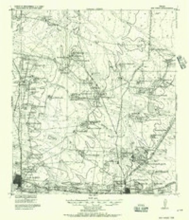
- 1920 USGS San Diego quadrangle1:62500
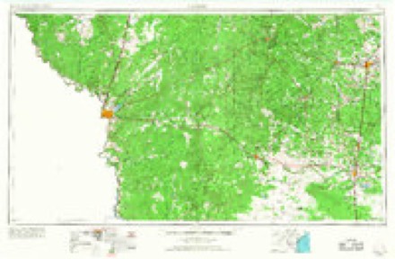
- 1956 USGS Laredo quadrangle1:250000, 3 printings
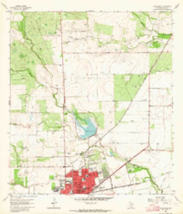
- 1963 USGS Alice North quadrangle1:24000, 2 printings
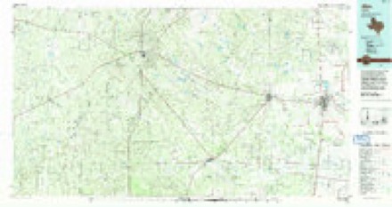
- 1985 USGS Alice quadrangle1:100000, 2 printings
Fires near this place
188 since 2008Regional context, not property-specific evidence. The federal wildfire occurrence database lists 188 fires within 5 miles of Alice between 2008 and 2017, burning about 1,423 acres in total. 2 started naturally. 2 were recorded as arson. Distance is straight-line from the map coordinates, so a fire counted here may appear on a neighbouring settlement's page as well.
| Reported cause | Fires |
|---|---|
| Missing data/not specified/undetermined | 164 |
| Debris and open burning | 13 |
| Power generation/transmission/distribution | 3 |
| Natural | 2 |
| Equipment and vehicle use | 2 |
| Arson/incendiarism | 2 |
| Misuse of fire by a minor | 2 |
The most recent of them, most recent first, with the day each was reported and the service that recorded it.
| Date | Cause | Size | Reported by | Name on the report |
|---|---|---|---|---|
| 8 September 2012 | Missing data/not specified/undetermined | under an acre | Texas A & M Forest Service | 1599 C.R. 115 FIRE. |
| 5 September 2015 | Missing data/not specified/undetermined | 10 acres | Texas A & M Forest Service | 244 C.R. 172 FIRE |
| 3 September 2011 | Missing data/not specified/undetermined | 100 acres | Texas A & M Forest Service | 625 C,R, 137 FIRE. |
| 27 September 2012 | Missing data/not specified/undetermined | under an acre | Texas A & M Forest Service | 1814 E.MAIN ST./BOX 228 FIRE |
| 24 September 2015 | Missing data/not specified/undetermined | 2.0 acres | Texas A & M Forest Service | 112 C.R. 3084 FIRE |
| 23 September 2011 | Missing data/not specified/undetermined | under an acre | Texas A & M Forest Service | 118 COUNTY ROAD 140 FIRE, |
| 2 September 2012 | Missing data/not specified/undetermined | under an acre | Texas A & M Forest Service | 1400 MORNINGSIDE DR. FIRE |
| 17 September 2009 | Missing data/not specified/undetermined | 1.0 acres | Texas A & M Forest Service | 1000 LUERA ST. |
Settlements close enough to share some of these fires:
Storms near this place
60 of 83 shownRegional context, not property-specific evidence. The National Weather Service names Alice in 83 storm reports between 1993 and 2025: 53 thunderstorm wind, 14 hail, 7 tornado, 6 flash flood. The reports record 4 injuries. Each account below is quoted exactly as the forecast office filed it, from the NOAA Storm Events Database, and each date opens the federal record of that event.
| When | Event | Place named | Harm | What the report says |
|---|---|---|---|---|
| May 2025 | Thunderstorm Wind | Alice | 4 hurt | Multiple leaned power poles and 2 semi trucks blown over. Numerous injuries across the area, mostly to individuals inside vehicles that either flipped or got into accidents. |
| May 2014 | Tornado (EF1) | Alice | $1,600,000 | An EF1 tornado touched down on the southeast side of the city of Alice just south of the intersection of Highway 359 and Stadium Road. The tornado traveled 2.3 miles and lifted just north of the intersection of County Road 1352 and County Road 382. This tornado produced shingle damage to the roof tops of several homes, lifted the roof deck off of several homes, and snapped a dozen power poles at their mid-point. The tornado destroyed a metal building and a portable building, broke overhead doors, blew out the siding of several metal buildings, and downed numerous trees. |
| May 2014 | Hail | Alice | $500,000 | Baseball sized hail occurred in the east-central portion of the city of Alice. |
| March 2013 | Hail | Alice | $250,000 | NWS storm survey concluded quarter to golf ball sized hail occurred on the north side of the city of Alice. |
| May 2014 | Hail | Alice | $100,000 | Quarter to half dollar sized hail occurred on the south side of Alice. Power was out on the south side of town also. |
| July 2005 | Tornado (F1) | Alice | $100,000 | A NWS storm survey concluded a tornado, in the outer rainbands of Hurricane Emily, formed approximately 8 miles north of Alice, near the intersection of CR-120 and CR-124 in the community of Tecolote. The tornado tracked northwest for 0.9 miles producing F1 damage. Several homes were damaged along this path and one mobile home was completely destroyed. Many trees were snapped and uprooted. The tornado continued northwest, skipping across open rural country for another 9 miles, producing F0 damage to trees and vegetation, before moving into Duval County. |
| May 2021 | Thunderstorm Wind | Alice | $50,000 | Numerous broken tree branches were observed around Alice with most damage concentrated along Schley and Rankin Avenues. There were at least four observed downed power lines within this neighborhood as well as damage to a car port and loss of roofing materials at a local bingo hall. Farther east of this location, a 53 MPH wind gust was reported at the Alice airport at 00:54 AM LST. |
| May 2014 | Thunderstorm Wind | Alice | $50,000 | Large trees were blown down in the central part of the city of Alice. |
| May 2021 | Thunderstorm Wind | Alice | $25,000 | Numerous areas of damage were reported near Alice, including power poles down and damage to homes in the Rancho Alegre area. |
| May 2021 | Thunderstorm Wind | Alice | $25,000 | Broadcast media reported thunderstorm winds damaging a home and blowing away a storage unit behind the property. Downed powerlines were reported near the property. |
| May 2025 | Thunderstorm Wind | Alice | $24,000 | Report of two tractor trailers flipped over on Hwy 281 and FM 1554. |
| May 2005 | Thunderstorm Wind | Alice | $20,000 | Wind gust to 64 mph measured by ALI ASOS. Several trees were uprooted across the city. The Alamo Lumber Co. in Alice suffered straight-line winds damage, which included a large shed being destroyed along with fence and lumber material being destroyed. Over 2000 Alice customers lost power during the storm. |
| July 2023 | Flood | Alice | $10,000 | Water rescue occurred on County Road 170 north of County Road 116. Water was over the road from flooded Muerto Creek due to heavy rainfall earlier in the day. |
| May 2007 | Flash Flood | Alice | $10,000 | Several county roads in and round Alice were closed due to flooding. Alice city officials reported that some residents were evacuated for minor flooding near low lying creeks, mainly over the northeast portion of the city. Water was reported in several business around town.| |
| April 2022 | Thunderstorm Wind | Alice | $5,000 | A back patio roof was blown off in Alice. |
| April 1994 | Thunderstorm Wind | Alice | $5,000 | The Alice Airport reported a wind gust to 48 knots. |
| May 2025 | Thunderstorm Wind | Alice | - | Metal Building System (MBS). Inward or outward collapse of overhead doors. |
| May 2025 | Thunderstorm Wind | Alice | - | Four snapped power poles/electrical transmission lines. Broken wood cross members. |
| May 2025 | Thunderstorm Wind | Alice | - | Small hardwood tree limbs broken (up to 1 inch diameter). |
| May 2025 | Thunderstorm Wind | Alice | - | Large hardwood tree branches broken (1-3 inch diameter). |
| May 2025 | Thunderstorm Wind | Alice | - | Roof blown off of a horse barn and several large trees down. Report received via phone call. |
| May 2025 | Thunderstorm Wind | Alice | - | Small Retail Building [Fast Food Restaurants] (SRB). Uplift of roof decking; significant loss of roof covering (>20%). |
| May 2025 | Thunderstorm Wind | Alice | - | Many uprooted trees and downed power poles. |
| May 2025 | Thunderstorm Wind | Alice | - | Base of pole failed. Free-Standing Light Poles, Luminary Poles, Flag Poles (FSP). Bent pole. |
| May 2025 | Thunderstorm Wind | Alice | - | Metal Building System (MBS). Column anchorage failed. |
| May 2025 | Thunderstorm Wind | Alice | - | Public reported 75 mph winds; Also reported pea-sized hail. |
| May 2025 | Thunderstorm Wind | Alice | - | RV flipped at this location. Metal Building System (MBS). Inward or outward collapse of overhead doors. |
| May 2025 | Thunderstorm Wind | Alice | - | Metal Building System (MBS). Column anchorage failed. |
| May 2025 | Thunderstorm Wind | Alice | - | Most poles snapped near the base with a couple snapped about 6 feet off the ground. |
| May 2025 | Thunderstorm Wind | Alice | - | Large hardwood tree branches broken (1-3 inch diameter). |
| May 2025 | Thunderstorm Wind | Alice | - | Hardwood tree trucks snapped. |
| May 2025 | Thunderstorm Wind | Alice | - | Reports received through EM of a barn demolished on FM 1554. |
| May 2025 | Thunderstorm Wind | Alice | - | Reports of downed power lines and trees throughout the city of Alice. |
| May 2025 | Thunderstorm Wind | Alice | - | ASOS station KALI Alice measured 89 mph gusts. Peak wind time report differs from the actual passage of strong winds, so time on this report is estimated on radar. |
| May 2025 | Thunderstorm Wind | Alice | - | Blowing debris helped push over the power pole. |
| May 2025 | Thunderstorm Wind | Alice | - | Small limbs broken (up to 1 inch diameter) of hardwood trees. |
| May 2025 | Thunderstorm Wind | Alice | - | Tree on left is uprooted with several other snapped large branches nearby. Softwood trees. |
| May 2025 | Thunderstorm Wind | Alice | - | Numerous large tree branches on property also snapped and destruction of several small outbuildings. One- or Two-Family Residences (FR12). Loss of roof covering material (<20%), gutters and/or awning; loss of vinyl or metal siding. |
| May 2025 | Thunderstorm Wind | Alice | - | Large hardwood tree branches broken (1-3 inch diameter). |
| May 2025 | Thunderstorm Wind | Alice | - | Numerous large hardwood tree branches (1-3 inch diameter) down including a palm tree uprooted. |
| June 2024 | Flood | Alice | - | Several roads closed around Alice, such as the Johnson St Overpass, Edith and Industrial, 5th and Main, and 1100-1600 Block of Main. |
| July 2023 | Flash Flood | Alice | - | Report received through Facebook of 6 inches of rainfall caused flooding of roads near San Diego. |
| April 2022 | Thunderstorm Wind | Alice | - | Picture received from public of large tree branch broken. Report of 3.5 inches of rain occurred with this storm, also. |
| May 2021 | Thunderstorm Wind | Alice | - | A spotter reported the awning over pumps at a gas station was moving. |
| April 2019 | Thunderstorm Wind | Alice | - | Large tree limbs were blown down south of Alice. |
| March 2018 | Hail | Alice | - | Pictures relayed through social media of quarter sized hail in Alice. |
| March 2016 | Thunderstorm Wind | Alice | - | Alice International Airport ASOS measured a gust to 64 mph. |
| April 2015 | Funnel Cloud | Alice | - | Public reported a funnel cloud just north of the WalMart in Alice on the northeast side of town. |
| April 2009 | Hail | Alice | - | Nickle sized hail reported in Alice. A 52 mph wind gust was reported one minute later at the Alice ASOS. |
| September 2007 | Flash Flood | Alice | - | Sheriff dispatcher reported stalled vehicles in the city limits of Alice in high water.| |
| May 2006 | Flash Flood | Alice | - | San Diego Street flooded in Alice and barricaded. |
| July 2006 | Flash Flood | Alice | - | 2 to 3 inches of rainfall fell over the Alice area during a one hour period, resulting in Highway 44 at Flournoy Rd. (FM 1931) closed due to high water. Minor street flooding was observed elsewhere throughout the city.The Alice ASOS recorded 2.67 inches, and a COOP observer in Alice recorded 3.80 inches on the day. |
| February 2003 | Thunderstorm Wind | Alice | - | Power lines blown down on Highway 359 just north of FM 3376. |
| May 2002 | Thunderstorm Wind | Alice | - | Trees and power lines down all across Alice. |
| May 2001 | Thunderstorm Wind | Alice | - | Several large trees blown over with law enforcement signs downed. Damage to an officers home due to tree falling on roof. |
| May 2001 | Thunderstorm Wind | Alice | - | Several trees and power lines downed by thunderstorm wind. |
| May 2001 | Thunderstorm Wind | Alice | - | Tree limbs blown over by thunderstorm wind gusts between midnight and 115 am CDT. |
| August 2001 | Thunderstorm Wind | Alice | - | Roof Damage to several homes |
| August 2001 | Thunderstorm Wind | Alice | - | 2 mi SW of Alice. Tree was knocked onto roof of house. |
| March 2000 | Flash Flood | Alice | - | Excessive runoff from heavy rainfall closed roads within Alice city limits. |
Nearest settlements
The eight closest, with where each one stands in the county. Distances are straight-line, computed from the Geographic Names Information System coordinates.
| Map | Place | Distance | Sheets |
|---|---|---|---|
| North Hilltop Addition Colonia | 0.3 miles | 7 | |
| East Buena Vista Addition Colonia | 0.5 miles | 7 | |
| Sanchez Addition Colonia | 1.2 miles | 7 | |
| Guerra Estate Addition Colonia | 1.3 miles | 7 | |
| Guerra Addition Colonia | 1.4 miles | 7 | |
| Holshouser Number 2 Colonia | 1.4 miles | 7 | |
| La Jolla Addition Colonia | 1.4 miles | 7 | |
| Hawks Addition Colonia | 1.5 miles | 7 |
Elsewhere
Matched on this settlement's Geographic Names Information System number rather than its name, so it cannot be a different place of the same name in another state.
| Wikipedia article on Alice | An encyclopaedic summary. Its text is share-alike, so it is linked here rather than copied. |
| Wikidata item Q981528 | The structured record the population and elevation above come from. Public domain (CC0). |
Provenance
This settlement is recorded in the Geographic Names Information System as feature 1329361. The sheet list is computed by point-in-boundary test against the United States Geological Survey's historical topographic inventory. Both are works of the United States government and carry no copyright under 17 U.S.C. 105.
Wildfire. Short, Karen C. 2022. Spatial wildfire occurrence data for the United States, 1992-2020 [FPA_FOD_20221014]. 6th Edition. Fort Collins, CO: Forest Service Research Data Archive. https://doi.org/10.2737/RDS-2013-0009.6 Collected with United States Government funding and usable without additional permissions or fees.
Storms. NOAA National Centers for Environmental Information, Storm Events Database https://www.ncei.noaa.gov/stormevents/ A work of the United States government, no copyright under 17 U.S.C. 105. Narratives are quoted verbatim from the National Weather Service report and are not edited or summarised.