 Block
BlockBalmorhea, Texas
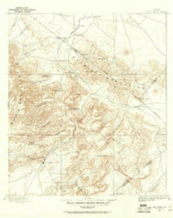
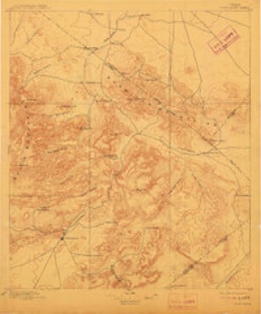
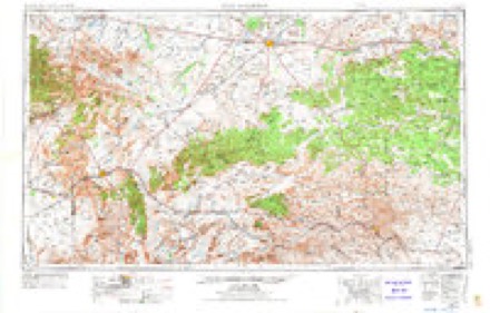
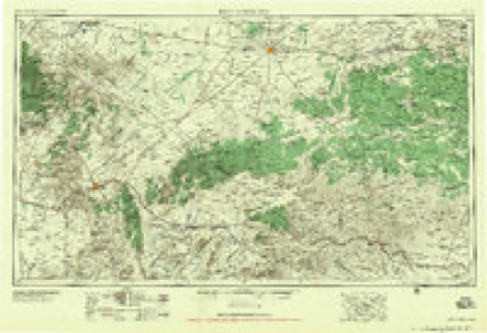
12 topographic sheets cover this place, the earliest surveyed in 1894 and the latest in 1985. It stands in the Balmorhea census division. It lies in ZIP code area 79718. The Survey maps it on the Balmorhea quadrangle. 408 people lived here at the 2020 count. It stands 3,196 feet above sea level.
Population over time
2 figuresBalmorhea fell from 479 to 408 between 2010 and 2020. These are the recorded population figures Wikidata holds for this place, reached through the Geographic Names Information System number this page is keyed on rather than by name, so they belong to this place and not to another of the same name. Most are census counts, but not all are: an early figure may be a founding or settlement estimate, and an estimate published within five years of a census is left out. The change column is computed, and is left blank where more than 20 years separate a figure from the one before it, because a gap that long is not a change between two counts.
| Year | People | Change |
|---|---|---|
| 2010 | 479 | |
| 2020 | 408 | -71 (-15%) |
Topographic sheets covering this place
7 surveys from 12 printed sheetsMatched by testing this settlement's coordinate against the published boundary of every sheet in the United States Geological Survey's historical collection. Each opens the scanned sheet at the Survey.
- 1894 USGS Fort Davis quadrangle1:125000
- 1897 USGS Fort Davis quadrangle1:125000, 3 printings
- 1954 USGS Fort Stockton quadrangle1:250000, 3 printings
- 1958 USGS Fort Stockton quadrangle1:250000
- 1973 USGS Fort Stockton quadrangle1:250000
- 1980 USGS Balmorhea quadrangle1:24000
- 1985 USGS Fort Davis quadrangle1:100000, 2 printings
Fires near this place
1 since 2020Regional context, not property-specific evidence. The federal wildfire occurrence database lists 1 fire within 5 miles of Balmorhea in 2020, burning about 14 acres in total. None started naturally. None was recorded as arson. Distance is straight-line from the map coordinates, so a fire counted here may appear on a neighbouring settlement's page as well.
| Reported cause | Fires |
|---|---|
| Missing data/not specified/undetermined | 1 |
The most recent of them, most recent first, with the day each was reported and the service that recorded it.
| Date | Cause | Size | Reported by | Name on the report |
|---|---|---|---|---|
| 9 June 2020 | Missing data/not specified/undetermined | 14 acres | Texas A & M Forest Service | COTTONWOOD |
Settlements close enough to share some of these fires:
Storms near this place
34 since 1993Regional context, not property-specific evidence. The National Weather Service names Balmorhea in 34 storm reports between 1993 and 2024: 21 hail, 6 flash flood, 4 thunderstorm wind, 3 tornado. No death or injury is recorded in these reports. Each account below is quoted exactly as the forecast office filed it, from the NOAA Storm Events Database, and each date opens the federal record of that event.
| When | Event | Place named | Harm | What the report says |
|---|---|---|---|---|
| June 2022 | Flash Flood | Balmorhea | $8,000 | Heavy rain fell across Reeves County and resulted in flash flooding near Balmorhea. There was a high water rescue. A person in a pickup drove through a low water crossing south of Balmorhea Lake. The pickup and driver were washed 1000 feet downstream. The cost of damage is a very rough estimate. |
| April 2014 | Thunderstorm Wind | Balmorhea | $5,000 | A thunderstorm moved across Reeves County and produced wind damage in Balmorhea. There were reports of damage to trees and sheds as well as power outages. The cost of damage is a rough estimate. |
| May 1994 | Hail | Balmorhea | $5,000 | The public reported quarter- to golf ball-size hail in Balmorhea from 1536 CST to 1556 CST. |
| May 1994 | Hail | Balmorhea | $5,000 | The public reported quarter- to golf ball-size hail in Balmorhea from 1536 CST to 1556 CST. |
| June 2014 | Thunderstorm Wind | Balmorhea | $2,000 | A thunderstorm moved across Reeves County and produced wind damage in Balmorhea. There was a large tree down at El Paso Street and State Highway 17. The tree was blocking Highway 17. The cost of damage is a rough estimate. |
| September 2014 | Flash Flood | Balmorhea | $500 | Heavy rain fell across Reeves County and produced flash flooding near Balmorhea. Portions of State Highway 17 near Balmorhea were closed due to flooding. The amount of damage is unknown so the cost of damage is a very rough estimate. |
| May 2024 | Hail | Balmorhea | - | Lots of small hail, some of the hail may be slightly larger. |
| June 2023 | Hail | Balmorhea | - | Ping pong ball-sized hail was observed along I-10 near Balmorhea. |
| June 2023 | Hail | Balmorhea | - | Two-inch diameter hail was observed on the south side of Balmorhea. |
| March 2020 | Tornado (EFU) | Balmorhea | - | A thunderstorm in Reeves County produced a tornado about eight miles west of Mentone. A National Weather Service survey team was unable to locate damage directly caused by the tornado due to poor road networks. Photos provided by the public and emergency management suggested that the tornado was significant, however due to a lack of damage indicators, the survey team was unable to determine a path and intensity. Thus, the tornado was rated an EF-U. It was estimated that the tornado traveled roughly 12 miles before lifting from storm spotter reports and radar signatures. The tornado started in Reeves County and moved east into Loving County. It lifted before reaching Highway 302 and moved just north of Mentone. |
| May 2015 | Hail | Balmorhea | - | A thunderstorm moved across Reeves County and produced nickel sized hail east of Balmorhea between mile markers 212 and 214 on Interstate 10. |
| May 2015 | Hail | Balmorhea | - | A thunderstorm moved across Reeves County and produced golf ball sized hail 4 miles north of the US 285/302 intersection along US 285. |
| April 2012 | Hail | Balmorhea | - | A thunderstorm moved over Reeves County and produced one inch hail in Balmorhea. The hail was reported to be an inch deep, and it lasted for ten minutes. |
| April 2007 | Hail | Balmorhea | - | Nickel size hail fell in a swath along Texas Highway 17 from the Jeff Davis/Reeves County line to Toyahvale. |
| May 2007 | Flash Flood | Balmorhea | - | Flooding occurred over both lanes of I-10 between mile markers 185 and 186 at the Reeves/Jeff Davis County line. |
| June 2005 | Hail | Balmorhea | - | Quarter size hail was reported five miles north of Interstate 10 along Texas Route 17. |
| June 2005 | Hail | Balmorhea | - | The first of two severe storms to affect Balmorhea during the early morning hours of the 3rd struck at midnight CST. This storm produced quarter size hail in town, and resulted in no damage. |
| June 2005 | Hail | Balmorhea | - | Quarter size hail was reported again by local law enforcement officials in Balmorhea at 00:45 CST. Damage did not result from either of the severe storms to strike Balmorhea during the late evening of the 2nd and the early morning of the 3rd. |
| April 2004 | Hail | Balmorhea | - | Golfball to baseball size hail fell in Balmorhea and also along Farm to Market Road 1450 east of Pecos.Hail was still covering FM 1450 at 915 pm that evening. |
| April 2004 | Flash Flood | Balmorhea | - | Flooding was reported along Farm to Market Road 2903 between Toyah and Balmorhea, making the road impassable. Farm to Market Road 869 and State Highway 17 were also closed due to flooding. |
| April 2004 | Tornado (F0) | Balmorhea | - | A tornado was observed by a Texas Department of Public Safety trooper moving east at ten mph. The tornado moved over rural areas with no damage noted. |
| June 2004 | Hail | Balmorhea | - | The Reeves County Emergency Manager and the public reported intermittent large hail ranging in size from dimes to golfballs along Interstate 10 from near the Reeves/Jeff Davis County Line to the Interstate 10 and Interstate 20 split. |
| September 2002 | Tornado (F0) | Balmorhea | - | A truck driver traveling on Interstate 10 in western Reeves County reported and photographed a tornado. The tornado was located just north of the interstate...a few miles east of the Interstate 10 and Interstate 20 junction. |
| June 1999 | Flash Flood | Balmorhea | - | Rain from a series of storms added to cause minor flooding in Balmorhea. |
| May 1994 | Hail | Balmorhea | - | The public reported quarter- to golf ball-size hail in Balmorhea from 1536 CST to 1556 CST. |
| August 1993 | Thunderstorm Wind | Balmorhea | - | A Skywarn spotter reported winds of 60 mph or greater in extreme southern Reeves County. |
| May 2023 | Hail | Balmorhea | - | no account filed |
| May 2015 | Hail | Balmorhea | - | no account filed |
| April 2012 | Hail | Balmorhea | - | no account filed |
| April 2012 | Hail | Balmorhea | - | no account filed |
| June 2007 | Hail | Balmorhea | - | no account filed |
| July 2002 | Thunderstorm Wind | Balmorhea | - | no account filed |
| August 1996 | Flash Flood | Balmorhea | - | no account filed |
| August 1996 | Hail | Balmorhea | - | no account filed |
Nearest settlements
The eight closest, with where each one stands in the county. Distances are straight-line, computed from the Geographic Names Information System coordinates.
| Map | Place | Distance | Sheets |
|---|---|---|---|
| Pueblo Vitoria | 2.1 miles | 12 | |
| Toyahvale | 3.6 miles | 12 | |
| Saragosa | 5.2 miles | 9 | |
| Cuatro Caminos | 11.9 miles | 12 | |
| Verhalen | 12.7 miles | 9 | |
| Collier | 15.3 miles | 9 | |
| Hoban | 17.0 miles | 9 | |
| Gozar | 18.6 miles | 8 |
Elsewhere
Matched on this settlement's Geographic Names Information System number rather than its name, so it cannot be a different place of the same name in another state.
| Wikipedia article on Balmorhea | An encyclopaedic summary. Its text is share-alike, so it is linked here rather than copied. |
| Wikidata item Q980320 | The structured record the population and elevation above come from. Public domain (CC0). |
Provenance
This settlement is recorded in the Geographic Names Information System as feature 1351473. The sheet list is computed by point-in-boundary test against the United States Geological Survey's historical topographic inventory. Both are works of the United States government and carry no copyright under 17 U.S.C. 105.
Wildfire. Short, Karen C. 2022. Spatial wildfire occurrence data for the United States, 1992-2020 [FPA_FOD_20221014]. 6th Edition. Fort Collins, CO: Forest Service Research Data Archive. https://doi.org/10.2737/RDS-2013-0009.6 Collected with United States Government funding and usable without additional permissions or fees.
Storms. NOAA National Centers for Environmental Information, Storm Events Database https://www.ncei.noaa.gov/stormevents/ A work of the United States government, no copyright under 17 U.S.C. 105. Narratives are quoted verbatim from the National Weather Service report and are not edited or summarised.