 Block
BlockBartonville, Texas
11 topographic sheets cover this place, the earliest surveyed in 1954 and the latest in 1991. It stands in the Justin-Roanoke census division. It lies in ZIP code area 76226. The Survey maps it on the Argyle quadrangle. 1,725 people lived here at the 2020 count. It stands 640 feet above sea level.
Population over time
2 figuresBartonville grew from 1,469 to 1,725 between 2010 and 2020. These are the recorded population figures Wikidata holds for this place, reached through the Geographic Names Information System number this page is keyed on rather than by name, so they belong to this place and not to another of the same name. Most are census counts, but not all are: an early figure may be a founding or settlement estimate, and an estimate published within five years of a census is left out. The change column is computed, and is left blank where more than 20 years separate a figure from the one before it, because a gap that long is not a change between two counts.
| Year | People | Change |
|---|---|---|
| 2010 | 1,469 | |
| 2020 | 1,725 | +256 (+17%) |
Topographic sheets covering this place
5 surveys from 11 printed sheetsMatched by testing this settlement's coordinate against the published boundary of every sheet in the United States Geological Survey's historical collection. Each opens the scanned sheet at the Survey.
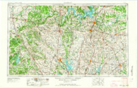
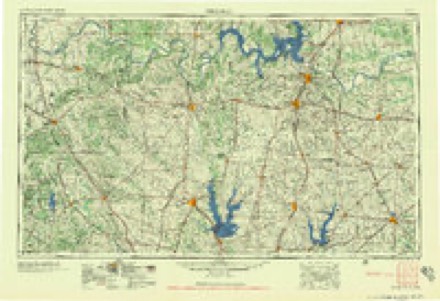
- 1954 USGS Sherman quadrangle1:250000, 2 printings
- 1958 USGS Sherman quadrangle1:250000
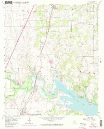
- 1960 USGS Argyle quadrangle1:24000, 5 printings
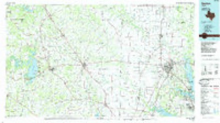
- 1985 USGS Denton quadrangle1:100000
- 1991 USGS Denton quadrangle1:100000, 2 printings
Fires near this place
136 since 2005Regional context, not property-specific evidence. The federal wildfire occurrence database lists 136 fires within 5 miles of Bartonville between 2005 and 2018, burning about 786 acres in total. None started naturally. 9 were recorded as arson. Distance is straight-line from the map coordinates, so a fire counted here may appear on a neighbouring settlement's page as well.
| Reported cause | Fires |
|---|---|
| Debris and open burning | 58 |
| Missing data/not specified/undetermined | 46 |
| Arson/incendiarism | 9 |
| Smoking | 9 |
| Equipment and vehicle use | 8 |
| Railroad operations and maintenance | 4 |
| Misuse of fire by a minor | 2 |
The most recent of them, most recent first, with the day each was reported and the service that recorded it.
| Date | Cause | Size | Reported by | Name on the report |
|---|---|---|---|---|
| 16 September 2009 | Debris and open burning | 1.0 acres | Texas A & M Forest Service | HAWKS RD |
| 5 August 2006 | Arson/incendiarism | 40 acres | Texas A & M Forest Service | MARSHALL CREEK- 172 |
| 23 August 2014 | Debris and open burning | under an acre | Texas A & M Forest Service | 9100 TEASLEY |
| 20 August 2009 | Debris and open burning | 1.0 acres | Texas A & M Forest Service | JERNIGAN |
| 2 August 2010 | Debris and open burning | under an acre | Texas A & M Forest Service | 2221 SHUMARD |
| 12 August 2013 | Equipment and vehicle use | under an acre | Texas A & M Forest Service | GRASS FIRE |
| 5 July 2013 | Arson/incendiarism | under an acre | Texas A & M Forest Service | GRASS FIRE |
| 5 July 2013 | Arson/incendiarism | under an acre | Texas A & M Forest Service | GRASS FIRE |
Settlements close enough to share some of these fires:
Storms near this place
40 since 1996Regional context, not property-specific evidence. The National Weather Service names Bartonville in 40 storm reports between 1996 and 2025: 24 hail, 6 lightning, 5 flash flood, 3 thunderstorm wind. No death or injury is recorded in these reports. Each account below is quoted exactly as the forecast office filed it, from the NOAA Storm Events Database, and each date opens the federal record of that event.
| When | Event | Place named | Harm | What the report says |
|---|---|---|---|---|
| June 2023 | Hail | Bartonville | $10,000,000 | A social media photo indicated 4.25 inch diameter hail near the intersection of Cross Timbers Rd and Shiloh Rd in Flower Mound. Damage to roofs and vehicles was reported across Flower Mound from the large hail. |
| March 2024 | Hail | Bartonville | $5,000,000 | Emergency manager reported baseball sized hail (measured) in Lantana. |
| March 2024 | Hail | Bartonville | $5,000,000 | Reports of 2-3+ inch hail in Double Oak. |
| June 2023 | Hail | Bartonville | $750,000 | A trained spotter reported hail of 3.5 inches in diameter in Bartonville. |
| March 2017 | Hail | Bartonville | $500,000 | Amateur radio reported baseball sized hail in the city of Lantana. |
| June 2020 | Lightning | Bartonville | $250,000 | A local newspaper reported a home in the 3500 block of Gallop Court in Flower Mound was destroyed by fire caused by a lightning strike. |
| June 2011 | Hail | Bartonville | $250,000 | A large amount of hail up to the size of golfballs fell in the Lantana community which is located near Bartonville. The hail broke numerous windows in cars and homes, dented wood siding and cars, and damaged roofs. |
| May 2024 | Thunderstorm Wind | Bartonville | $200,000 | Public reported a measured wind gust of 86 mph west of Double Oak. |
| June 2020 | Lightning | Bartonville | $150,000 | A local newspaper reported a house in the 1500 block of Haverford Lane in Lantana was lost to a fire caused by lightning. |
| May 2013 | Lightning | Bartonville | $110,000 | The Denton County Fire marshal reported a house in the 9300 block of Blanco Drive caught fire after lightning struck the roof. The house was severely damaged, causing the home to be temporarily uninhabitable. Due to the fire, the roof is completely gone and the first floor suffered water damage. The siding of a neighboring house was damaged by the heat of the fire. |
| June 2020 | Lightning | Bartonville | $100,000 | A local newspaper reported a house in the 8500 block of Canyon Crossing in Lantana was damaged by a fire caused by lightning. |
| April 2007 | Tornado (EF1) | Bartonville | $100,000 | This tornado touched down in Flower Mound, near Bolo Lane just north of Lake Grapevine. Significant tree damage occurred in this area, and a house lost part of it's roof. The damage continued about a half mile east-northeast to Couer Du Lac Lane where the tornado caused substantial roof damage to two homes. Trees, fences, and a horse barn were also damaged in this area. Sporadic tree damage continued east-northeast almost a mile. Here, another subdivision suffered roof damage. Wind speeds were estimated to be 80-85 MPH. |
| June 2020 | Lightning | Bartonville | $50,000 | A local newspaper reported a house in the 500 block of Wolf Run in Bartonville was damaged by a fire caused by lightning. |
| June 2020 | Flash Flood | Bartonville | $45,000 | Emergency management reported one vehicle stuck in high water and another swept off of the road in the city of Double Oak, TX. |
| June 2020 | Flood | Bartonville | $25,000 | Three flooded locations were reported in Flower Mound: Bridlewood at W. Windsor, Hwy 377 at 1171, and Lusk Lane near Kings Road. On Lusk Lane, at least one car was pushed to the side of the road and the driver was stranded. The water over the bridge was about 1 foot deep. |
| May 2025 | Lightning | Bartonville | $15,000 | A house was struck by lightning on St Andrew Drive in Highland Village. |
| June 2011 | Hail | Bartonville | $15,000 | Quarter sized hail was reported on Double Oak. Windows were broken in homes by the large amount of hail. |
| June 2011 | Thunderstorm Wind | Bartonville | $15,000 | Trees and large tree limbs in Double Oak were knocked down by severe thunderstorm winds. |
| September 2018 | Flash Flood | Bartonville | $10,000 | Emergency management reported flash flooding ongoing on Bridlewood Blvd. Also, stranded vehicles were reported near the intersection of FM 407 and Chin Chapel Rd, as well as Lusk Lane at Shiloh Rd in the city of Flower Mound TX. |
| May 2013 | Hail | Bartonville | $10,000 | Trained spotters reported ping pong ball sized hail in Flower Mound. |
| May 2024 | Hail | Bartonville | $8,000 | Public reported ping pong to golf ball hail just west of Double Oak. |
| November 2015 | Flash Flood | Bartonville | $8,000 | A person had to be rescued from their vehicle in the 1500 block of Old Alton Road after they drove into high water. The location was likely flooded from a nearby creek. |
| April 2015 | Flash Flood | Bartonville | $1,000 | Flooding was reported over southbound Bridlewood at W. Windsor in Flower Mound. At least a foot of water was present across this roadway. |
| May 2024 | Hail | Bartonville | - | Report from mPING: Quarter (1.00 in.). |
| May 2024 | Hail | Bartonville | - | Report from mPING: Quarter (1.00 in.). |
| May 2024 | Hail | Bartonville | - | Report from mPING: Quarter (1.00 in.). |
| May 2024 | Hail | Bartonville | - | Report from mPING: Dime (0.75 in.). |
| March 2022 | Hail | Bartonville | - | Amateur radio reported dime sized hail in Bartonville, TX. |
| April 2021 | Hail | Bartonville | - | Ping pong ball size hail was reported one mile north of Downtown Flower Mound. |
| April 2021 | Hail | Bartonville | - | Half dollar size hail was reported one mile south of Bartonville. |
| June 2019 | Thunderstorm Wind | Bartonville | - | A trained spotter estimated wind gusts to 60 MPH, along with reporting trees down, approximately 1 mile west-southwest of the city of Double Oak, TX. |
| April 2018 | Hail | Bartonville | - | A public report indicated nickel sized hail approximately 1 mile south-southwest of the city of Copper Canyon, TX. |
| September 2018 | Flash Flood | Bartonville | - | Emergency management reported that high water was surrounding homes near Rippy Rd and Bayberry Street in the city of Flower Mound, TX. |
| April 2011 | Hail | Bartonville | - | Quarter sized hail fell 2 miles northeast of Flower Mound. |
| May 2024 | Hail | Bartonville | - | no account filed |
| March 2021 | Hail | Bartonville | - | no account filed |
| May 2001 | Hail | Bartonville | - | no account filed |
| May 2001 | Hail | Bartonville | - | no account filed |
| March 2000 | Hail | Bartonville | - | no account filed |
| April 1996 | Hail | Bartonville | - | no account filed |
Nearest settlements
The eight closest, with where each one stands in the county. Distances are straight-line, computed from the Geographic Names Information System coordinates.
| Map | Place | Distance | Sheets |
|---|---|---|---|
| Double Oak | 1.2 miles | 12 | |
| Lantana | 1.3 miles | 12 | |
| Copper Canyon | 2.4 miles | 12 | |
| Argyle | 4.3 miles | 11 | |
| Flower Mound | 4.4 miles | 12 | |
| Hidden Hill | 4.6 miles | 12 | |
| Highland Village | 4.7 miles | 12 | |
| Harbor Grove | 5.1 miles | 12 |
Elsewhere
Matched on this settlement's Geographic Names Information System number rather than its name, so it cannot be a different place of the same name in another state.
| Wikipedia article on Bartonville | An encyclopaedic summary. Its text is share-alike, so it is linked here rather than copied. |
| Wikidata item Q809565 | The structured record the population and elevation above come from. Public domain (CC0). |
Provenance
This settlement is recorded in the Geographic Names Information System as feature 1377974. The sheet list is computed by point-in-boundary test against the United States Geological Survey's historical topographic inventory. Both are works of the United States government and carry no copyright under 17 U.S.C. 105.
Wildfire. Short, Karen C. 2022. Spatial wildfire occurrence data for the United States, 1992-2020 [FPA_FOD_20221014]. 6th Edition. Fort Collins, CO: Forest Service Research Data Archive. https://doi.org/10.2737/RDS-2013-0009.6 Collected with United States Government funding and usable without additional permissions or fees.
Storms. NOAA National Centers for Environmental Information, Storm Events Database https://www.ncei.noaa.gov/stormevents/ A work of the United States government, no copyright under 17 U.S.C. 105. Narratives are quoted verbatim from the National Weather Service report and are not edited or summarised.