 Block
BlockCorinth, Texas
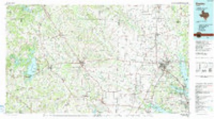
11 topographic sheets cover this place, the earliest surveyed in 1954 and the latest in 1991. It stands in the Lewisville-Flower Mound census division. It lies in ZIP code area 76210. The Survey maps it on the Denton East quadrangle. 22,634 people lived here at the 2020 count. It stands 607 feet above sea level.
Population over time
2 figuresCorinth grew from 19,935 to 22,634 between 2010 and 2020. These are the recorded population figures Wikidata holds for this place, reached through the Geographic Names Information System number this page is keyed on rather than by name, so they belong to this place and not to another of the same name. Most are census counts, but not all are: an early figure may be a founding or settlement estimate, and an estimate published within five years of a census is left out. The change column is computed, and is left blank where more than 20 years separate a figure from the one before it, because a gap that long is not a change between two counts.
| Year | People | Change |
|---|---|---|
| 2010 | 19,935 | |
| 2020 | 22,634 | +2,699 (+14%) |
Topographic sheets covering this place
5 surveys from 11 printed sheetsMatched by testing this settlement's coordinate against the published boundary of every sheet in the United States Geological Survey's historical collection. Each opens the scanned sheet at the Survey.
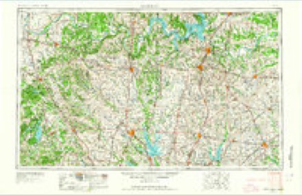
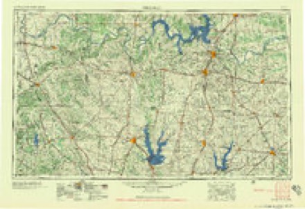
- 1954 USGS Sherman quadrangle1:250000, 2 printings
- 1958 USGS Sherman quadrangle1:250000
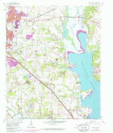
- 1960 USGS Denton East quadrangle1:24000, 5 printings
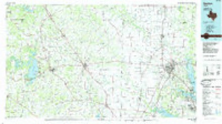
- 1985 USGS Denton quadrangle1:100000
- 1991 USGS Denton quadrangle1:100000, 2 printings
Fires near this place
51 since 2005Regional context, not property-specific evidence. The federal wildfire occurrence database lists 51 fires within 5 miles of Corinth between 2005 and 2018, burning about 333 acres in total. None started naturally. 2 were recorded as arson. Distance is straight-line from the map coordinates, so a fire counted here may appear on a neighbouring settlement's page as well.
| Reported cause | Fires |
|---|---|
| Missing data/not specified/undetermined | 25 |
| Debris and open burning | 18 |
| Smoking | 2 |
| Equipment and vehicle use | 2 |
| Arson/incendiarism | 2 |
| Power generation/transmission/distribution | 1 |
| Recreation and ceremony | 1 |
The most recent of them, most recent first, with the day each was reported and the service that recorded it.
| Date | Cause | Size | Reported by | Name on the report |
|---|---|---|---|---|
| 16 September 2014 | Debris and open burning | under an acre | Texas A & M Forest Service | LONG ROAD |
| 23 August 2014 | Debris and open burning | under an acre | Texas A & M Forest Service | 9100 TEASLEY |
| 16 August 2010 | Equipment and vehicle use | 2.0 acres | Texas A & M Forest Service | SWISHER ROAD FIRE |
| 6 July 2014 | Debris and open burning | under an acre | Texas A & M Forest Service | 2400 JAMES STREET |
| 30 July 2011 | Missing data/not specified/undetermined | under an acre | Texas A & M Forest Service | BRAZOS @ POST OAK |
| 25 July 2011 | Arson/incendiarism | under an acre | Texas A & M Forest Service | INDIAN LAKE |
| 11 July 2017 | Equipment and vehicle use | 1.0 acres | Texas A & M Forest Service | N/A |
| 10 July 2014 | Debris and open burning | under an acre | Texas A & M Forest Service | 2525 BRINKER |
Settlements close enough to share some of these fires:
Storms near this place
47 since 1998Regional context, not property-specific evidence. The National Weather Service names Corinth in 47 storm reports between 1998 and 2025: 21 hail, 19 thunderstorm wind, 5 flash flood, 1 flood. No death or injury is recorded in these reports. Each account below is quoted exactly as the forecast office filed it, from the NOAA Storm Events Database, and each date opens the federal record of that event.
| When | Event | Place named | Harm | What the report says |
|---|---|---|---|---|
| June 2008 | Thunderstorm Wind | Corinth | $1,000,000 | A microburst likely flipped a dock over at Lakeview Marina, which caused five anchored boats to sink. Two other boats were under debris. One dock was destroyed while several others were damaged. At least one large tree was uprooted about 200 yards away from the dock. Other large trees were split in half, huge limbs were broken off, and dozens of fences were downed throughout Lake Dallas, Hickory Creek, Corinth, and Shady Shores. |
| April 2016 | Hail | Corinth | $500,000 | A public report indicated baseball sized hail approximately one mile north of Corinth, TX. |
| November 2015 | Tornado (EF1) | Corinth | $500,000 | A National Weather Service storm survey team found evidence of a narrow, yet long tornado in the Hickory Creek and Corinth areas of Denton County. As the tornado began near the Steeplechase North subdivision, several homes suffered minor roof damage as well as garage door damage. A car wash suffered heavy damage to the east side of the business along the path. As the tornado began to dissipate, a hotel and several other signs were damaged before the tornado moved over Lake Lewisville. The Swisher Cemetery was also damaged. Large cedar trees were split and headstones were damaged at the cemetery. |
| March 2017 | Hail | Corinth | $100,000 | An amateur radio report indicated 4.25 inch diameter hail approximately 2 miles north of Corinth, TX. |
| May 2015 | Flash Flood | Corinth | $100,000 | Rain continued to fall in Denton County on Saturday, May 30th, lake levels rose and flood waters entered homes on Lewisville Lake and closed numerous roads around the county. The county emergency manager told the newspaper homes are flooding in areas all around Lewisville Lake, including Shady Shores on Shady Shores Road, in Oak Shores and The Colony, and in Frisco off Lebanon Road. |
| May 2009 | Flash Flood | Corinth | $100,000 | The Hickory Creek Mobile Home community was flooded by Bryant Branch Creek that runs through the community. The water depth ranged from knee deep to 5 feet deep in some locations and entered several homes. One couple had to evacuate their home after it was deemed unsafe to live in when it started shifting from the flood waters. |
| March 2017 | Hail | Corinth | $50,000 | Amateur radio reported baseball sized hail in the city of Corinth. |
| March 2017 | Hail | Corinth | $50,000 | A social media report indicated hail up to tennis-ball sized near the city of Corinth, TX. |
| April 2011 | Thunderstorm Wind | Corinth | $40,000 | A FAA wind sensor in Corinth reported a 69 MPH wind gust. |
| August 2010 | Thunderstorm Wind | Corinth | $25,000 | More than 30 homes in the Oakmost subdivision of Corinth were damaged when a downburst hit the area. The only information regarding the damage was limited to a shed imploding on Andover Street, a brick wall fell over, and several chimneys were damaged. |
| September 2018 | Flash Flood | Corinth | $10,000 | Emergency management reported stranded cars on Old Alton Road and water rescues on Cooper Canyon Road near the city of Argyle, TX. |
| August 2010 | Thunderstorm Wind | Corinth | $10,000 | In the Post Oak/Meadowview area of Corinth, trees up to 14 in diameter were knocked down by downburst winds. The roof of a mobile home was also peeled back. |
| November 2015 | Thunderstorm Wind | Corinth | $8,000 | Denton County Sheriff's Department reported wind and building damage near Corinth, TX. |
| June 2009 | Thunderstorm Wind | Corinth | $8,000 | A 74 mph wind gust was measured near I-35E and State School Road in Denton. |
| June 2011 | Thunderstorm Wind | Corinth | $7,000 | Two to three foot diameter trees were uprooted in Corinth and shingles were blown off roofs. |
| May 2013 | Hail | Corinth | $5,000 | Denton County Emergency Management office reported golf ball sized hail in Corinth. |
| August 2003 | Thunderstorm Wind | Corinth | $5,000 | Trees and fences were blown down by high winds. |
| May 2025 | Thunderstorm Wind | Corinth | $4,000 | Law enforcement reported numerous trees and tree limbs blown down across Denton. |
| July 2009 | Hail | Corinth | $4,000 | Golfball size hail fell 1 mile east-southeast of the intersection at Teasley Ln and Robinson Rd. |
| April 2011 | Thunderstorm Wind | Corinth | $3,000 | An estimated wind gust of 60 mph was reported near Corinth. |
| May 2011 | Thunderstorm Wind | Corinth | $3,000 | Sixty to seventy MPH winds were estimated in Corinth. |
| August 2002 | Thunderstorm Wind | Corinth | $3,000 | Power lines were blown down by high winds. |
| June 2019 | Thunderstorm Wind | Corinth | $2,000 | Emergency management reported a wind gust of 64 MPH at North Central Texas College, Corinth, TX campus. |
| July 2019 | Thunderstorm Wind | Corinth | $2,000 | A weather station measured a wind gust of 77 MPH at North Central Texas College in the city of Corinth, TX; however, school personnel estimated the winds were probably 65-70 mph. Several 2-3 limbs were reported down but no other damage was reported. |
| May 2009 | Flash Flood | Corinth | $1,000 | The access road along Interstate 35E in the Corinth and Lake Dallas area had water over the road. |
| July 2019 | Thunderstorm Wind | Corinth | $500 | Scattered tree damage was reported in the Hickory Creek/River Oaks subdivision located in Denton. Large tree branches were snapped off. |
| June 2025 | Hail | Corinth | - | Report from mPING: Quarter (1.00 in.). |
| June 2025 | Hail | Corinth | - | Report from mPING: Quarter (1.00 in.). |
| May 2024 | Hail | Corinth | - | Report from mPING: Dime (0.75 in.). |
| March 2022 | Hail | Corinth | - | A public report indicated quarter sized hail near Corinth, TX. |
| May 2020 | Hail | Corinth | - | An MPING report indicated quarter sized hail approximately 2 miles northwest of the city of Shady Shores, TX. |
| April 2018 | Hail | Corinth | - | A public report indicated nickel sized hail approximately 2 miles west-southwest of the city of Corinth, TX. |
| April 2018 | Hail | Corinth | - | Broadcast media reported nickel-sized hail in the city of Corinth, TX. |
| September 2018 | Flash Flood | Corinth | - | A social media report indicated that Interstate 35E was shut down near the intersection of State School Rd due to high water. |
| April 2016 | Hail | Corinth | - | A trained spotter reported quarter-sized hail in Corinth, TX. |
| May 2011 | Hail | Corinth | - | Quarter sized hail fell at Shady Shores Dr and Interstate 35-E southeast of Denton. |
| May 2011 | Hail | Corinth | - | Hail up to the size of quarters fell at Mayhill Road and I-35E in southeast Denton. |
| May 2011 | Hail | Corinth | - | Half dollar sized hail was reported near the intersection of Robinson and Teasley, approximately 2 miles west of Corinth. |
| May 2009 | Flood | Corinth | - | Ongoing flooding continued into the night from heavy rainfall over the county during the evening hours. Hickory Creek Mobile Community continued to be affected by several feet of water from flooding on Bryant Branch Creek. |
| May 1998 | Thunderstorm Wind | Corinth | - | Thunderstorm winds caused a gas station canopy to collapse. Thunderstorm winds also damaged roofs and blew down signs, trees, fences, and powerlines. No dollar estimate of damage was provided. |
| May 1998 | Thunderstorm Wind | Corinth | - | Thunderstorm winds blew a large tree onto a house in Shady Shores. No dollar estimate of damage was provided. |
| June 1998 | Thunderstorm Wind | Corinth | - | Wind damage was reported at a mobile home park. No dollar estimate of damage was reported. |
| May 2024 | Hail | Corinth | - | no account filed |
| April 2011 | Hail | Corinth | - | no account filed |
| May 2007 | Hail | Corinth | - | no account filed |
| June 2007 | Thunderstorm Wind | Corinth | - | no account filed |
| April 1999 | Hail | Corinth | - | no account filed |
Nearest settlements
The eight closest, with where each one stands in the county. Distances are straight-line, computed from the Geographic Names Information System coordinates.
| Map | Place | Distance | Sheets |
|---|---|---|---|
| Shady Shores | 2.0 miles | 11 | |
| Hickory Creek | 2.5 miles | 12 | |
| Hidden Hill | 2.9 miles | 12 | |
| Harbor Grove | 3.0 miles | 12 | |
| Lake Dallas | 3.2 miles | 12 | |
| Carter | 3.2 miles | 11 | |
| Mayhill | 3.6 miles | 11 | |
| Camp Dallas | 4.1 miles | 10 |
Elsewhere
Matched on this settlement's Geographic Names Information System number rather than its name, so it cannot be a different place of the same name in another state.
| Wikipedia article on Corinth | An encyclopaedic summary. Its text is share-alike, so it is linked here rather than copied. |
| Wikidata item Q974334 | The structured record the population and elevation above come from. Public domain (CC0). |
Provenance
This settlement is recorded in the Geographic Names Information System as feature 1333356. The sheet list is computed by point-in-boundary test against the United States Geological Survey's historical topographic inventory. Both are works of the United States government and carry no copyright under 17 U.S.C. 105.
Wildfire. Short, Karen C. 2022. Spatial wildfire occurrence data for the United States, 1992-2020 [FPA_FOD_20221014]. 6th Edition. Fort Collins, CO: Forest Service Research Data Archive. https://doi.org/10.2737/RDS-2013-0009.6 Collected with United States Government funding and usable without additional permissions or fees.
Storms. NOAA National Centers for Environmental Information, Storm Events Database https://www.ncei.noaa.gov/stormevents/ A work of the United States government, no copyright under 17 U.S.C. 105. Narratives are quoted verbatim from the National Weather Service report and are not edited or summarised.