 Block
BlockBig Spring, Texas
11 topographic sheets cover this place, the earliest surveyed in 1942 and the latest in 1986. It stands in the Big Spring census division. It lies in ZIP code area 79720. The Survey maps it on the Big Spring North quadrangle. 26,144 people lived here at the 2020 count. It stands 2,441 feet above sea level.
Research this city
On record in Big Spring
Buildings and businesses the archive holds for this place. Each opens its own page, with the source record it came from.
On the National Register 6 records
 Big Spring Hospitallisted 2023
 Big Spring Veterans Administration Hospitallisted 2022
 Potton-Hayden Houselisted 1975
 Settles Hotellisted 2013
- Big Spring Downtown Historic Districtlisted 2024
- Petroleum Buildinglisted 2021
Population over time
3 figuresBig Spring grew from 25,233 to 26,144 between 2000 and 2020. These are the recorded population figures Wikidata holds for this place, reached through the Geographic Names Information System number this page is keyed on rather than by name, so they belong to this place and not to another of the same name. Most are census counts, but not all are: an early figure may be a founding or settlement estimate, and an estimate published within five years of a census is left out. The change column is computed, and is left blank where more than 20 years separate a figure from the one before it, because a gap that long is not a change between two counts.
| Year | People | Change |
|---|---|---|
| 2000 | 25,233 | |
| 2010 | 27,282 | +2,049 (+8%) |
| 2020 | 26,144 | -1,138 (-4%) |
Topographic sheets covering this place
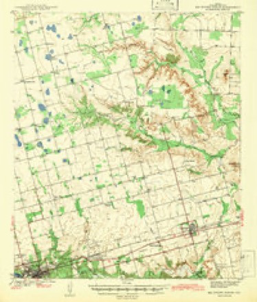
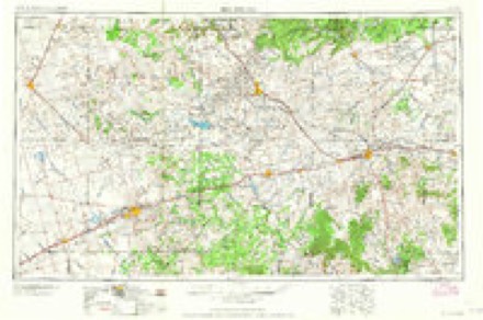
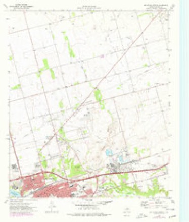
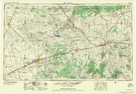
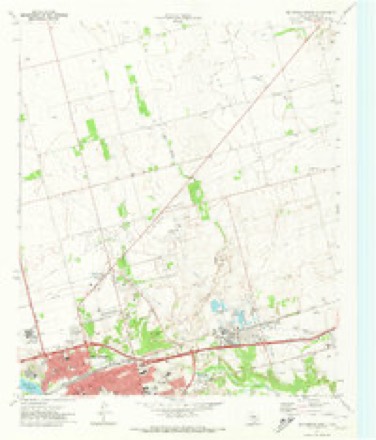
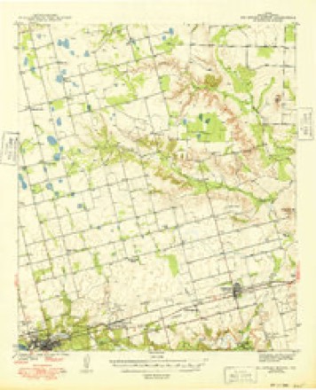
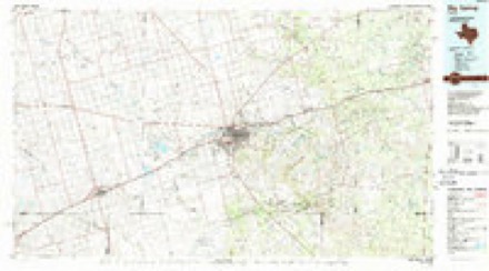
7 surveys from 11 printed sheetsMatched by testing this settlement's coordinate against the published boundary of every sheet in the United States Geological Survey's historical collection. Each opens the scanned sheet at the Survey.
- 1942 USGS Big Spring North quadrangle1:62500
- 1954 USGS Big Spring quadrangle1:250000, 4 printings
- 1954 USGS Big Spring North quadrangle1:24000
- 1958 USGS Big Spring quadrangle1:250000
- 1965 USGS Big Spring North quadrangle1:24000
- 1971 USGS Big Spring North quadrangle1:62500
- 1986 USGS Big Spring quadrangle1:100000, 2 printings
Fires near this place
320 since 2005Regional context, not property-specific evidence. The federal wildfire occurrence database lists 320 fires within 5 miles of Big Spring between 2005 and 2020, burning about 13,423 acres in total. 2 started naturally. 11 were recorded as arson. Distance is straight-line from the map coordinates, so a fire counted here may appear on a neighbouring settlement's page as well.
| Reported cause | Fires |
|---|---|
| Missing data/not specified/undetermined | 138 |
| Power generation/transmission/distribution | 55 |
| Debris and open burning | 54 |
| Equipment and vehicle use | 37 |
| Arson/incendiarism | 11 |
| Smoking | 10 |
| Railroad operations and maintenance | 7 |
| Misuse of fire by a minor | 5 |
| Natural | 2 |
| Recreation and ceremony | 1 |
The most recent of them, most recent first, with the day each was reported and the service that recorded it.
| Date | Cause | Size | Reported by | Name on the report |
|---|---|---|---|---|
| 7 September 2015 | Missing data/not specified/undetermined | under an acre | Texas A & M Forest Service | CR 21 AND 176 |
| 6 September 2020 | Debris and open burning | 1.0 acres | Texas A & M Forest Service | 206 SIMER ROAD |
| 3 September 2013 | Arson/incendiarism | 1.0 acres | Texas A & M Forest Service | 2407 N BIRDWELL |
| 27 September 2020 | Missing data/not specified/undetermined | 2.0 acres | Texas A & M Forest Service | 1200 BLK N FM 700 |
| 24 September 2019 | Power generation/transmission/distribution | 15 acres | Texas A & M Forest Service | OVERTON & 461 |
| 24 September 2019 | Equipment and vehicle use | 2.0 acres | Texas A & M Forest Service | 87 & DRIVER RD |
| 24 September 2013 | Missing data/not specified/undetermined | under an acre | Texas A & M Forest Service | MM 181-182 I-20 |
| 23 September 2011 | Missing data/not specified/undetermined | under an acre | Texas A & M Forest Service | EAST OF SHELL STATION |
Settlements close enough to share some of these fires:
Mines and quarries near this place
3 within 5 milesRegional context, not property-specific evidence. The federal mineral resources record lists 3 workings within 5 miles of Big Spring: 2 producers, 1 unknown. 2 still produce. What was taken out: Limestone, General, Stone, Crushed/Broken, Stone, Crushed/Broken, Limestone, General. Distance is straight-line from the map coordinates, so a quarry counted here may appear on a neighbouring settlement's page as well.
| Where | Site | Commodity | Status | Recorded |
|---|---|---|---|---|
| Big Rough Sand and Gravel Fisher Qy | Stone, Crushed/Broken | Unknown | ||
| Fisher Quarry | Limestone, General, Stone, Crushed/Broken | Producer | Limestone | |
| Tubbs Pit | Limestone, General | Producer |
Storms near this place
60 of 228 shownRegional context, not property-specific evidence. The National Weather Service names Big Spring in 228 storm reports between 1993 and 2025: 132 hail, 45 thunderstorm wind, 45 flash flood, 2 heavy rain. The reports record 48 injuries. Each account below is quoted exactly as the forecast office filed it, from the NOAA Storm Events Database, and each date opens the federal record of that event.
| When | Event | Place named | Harm | What the report says |
|---|---|---|---|---|
| May 1996 | Hail | Big Spring | 48 hurt, $30,000,000 | no account filed |
| April 1995 | Hail | Big Spring | $20,000,000 | no account filed |
| June 2025 | Thunderstorm Wind | Big Spring | $1,000,000 | Numerous reports were received of wind-driven hail damage across Big Spring. West facing windows and walls of homes were damaged. Car windows were broken. Multiple power poles were snapped. At least some small metal outbuilldings and awnings were damaged. Wind speeds are estimated to have been between 80-100 mph. The time of occurrence is estimated from radar. The total cost of damages is also estimated. |
| April 2001 | Hail | Big Spring | $500,000 | A severe thunderstorm moved across the eastern portions of the city of Big Spring, producing golfball to baseball size hail and 40-50 mph winds over approximately a one mile stretch of land. It is estimated that 400 cars sustained hail damage. |
| May 1993 | Hail | Big Spring | $500,000 | A supercell thunderstorm produced golf ball to baseball-size hail in the city of Big Spring. Many buildings and automobiles suffered damage. Other thunderstorms which followed contained very heavy rainfall which led to flash flooding across western Howard County. The floodwaters damaged a railroad track, resulting in the derailment of four engines and two freight cars. Two railroad crewmen were injured. An automobile was swept off of a road northwest of Big Spring, but the occupant was rescued unharmed. |
| September 2004 | Heavy Rain | Big Spring | $100,000 | Heavy rainfall caused ponding of water on many driving surfaces near Big Spring. A semi-truck hydroplaned off of Interstate 20 on the north side of the city. A second semi-truck lost control and jack-knifed when the driver tried to avoid a collision with emergency workers responding to the first incident. |
| May 2016 | Tornado (EF3) | Big Spring | $75,000 | A thunderstorm moved across Howard County and produced a tornado near Big Spring. Eyewitness reports from storm chasers and spotters in the area indicate that the tornado began at 6:13 pm CDT just south of Texas State Highway 176, approximately 10 miles west of Big Spring. The tornado then moved southeastward over open fields, bounded by Natural Dam Lake to its west and Wilkinson Road just to its east. The tornado continued on this southeast track along Salt Lake, eventually crossing Interstate 20 at approximately 6:32 pm CDT. ||South of Interstate 20, the tornado exhibited erratic movement, being described by chasers and spotters as being nearly stationary in a field. Examination of radar imagery showed the primary storm circulation moved slowly southeastward to approximately half a mile northwest of the intersection of Lintner Road and Rockhouse Road by 6:37 pm CDT, before turning eastward. The tornado continued to move east, with the southern periphery of the tornado affecting Home #1. The tornado then began to move northeastward, crossing nearly directly over Home #2 around 6:40 pm CDT. A slight east northeast turn allowed for only the tornado's northern periphery to affect Home #3 along Cauble Road around 6:42 pm CDT.||The tornado moved southward along or near Cauble Road. The tornado continued its erratic behavior, moving southwestward and re-entering the same field as previous around 6:48 pm CDT. The tornado then turned west-northwestward, eventually becoming quasi-stationary just east of the Home #1 between 6:52 pm and 6:54 pm CDT, before moving westward, just north of Home #1. Residents at home #1 described how long the tornado lasted and felt the tornado had impacted them twice. The tornado dissipated approximately 1.5 miles west of Home #1 around 7 pm CDT.||The damage assessment team looked at several different indicators to determine tornado intensity. At Home #2, which likely was the closest and strongest structure to the tornado during the most intense portion of the tornado's life cycle, the entire roof was destroyed and exterior walls on this well-constructed residence were partially collapsed. This damage indicator suggests an EF-3 intensity with wind speeds estimated at 140-160 mph. In the adjacent field east of Home #2, a 640 type pump jack was blown over. The assessment team also looked at tree damage at Home #2. Both softwood and hardwood trees were viewed on the property. Damage to these large trees was indicative of high end EF-2 to low end EF-3 damage.||Home #1 and Home #3 experienced tornado damage indicative of EF-2 damage. In the examples shown, large sections of the roof were removed, but with the walls still standing. At Home #3, there were power poles that were snapped approximately five feet off the ground. Wind speeds at this residence are estimated at 115 to 125 mph. At Home #1, trees were uprooted. Wind speeds are estimated at this location of 105 to 115 mph. The cost of damage from this tornado is a very rough estimate. |
| May 2025 | Flash Flood | Big Spring | $70,000 | Big Spring Fire Department reported a couple water rescues from vehicles at low water crossings and water in an apartment building in Big Spring. The time of occurrence is estimated from radar. The location is also approximate, as is the cost of damages. |
| May 2016 | Thunderstorm Wind | Big Spring | $50,000 | A thunderstorm moved across Howard County and produced wind damage near and in the City of Big Spring. There were 10,000 people without power across Howard County. There were reports of roofs blown off of houses, power lines down, and trampolines blown away. The cost of damage is a very rough estimate. |
| September 2003 | Flash Flood | Big Spring | $50,000 | Flash flooding in the city streets of Big Spring resulted in a dangerous situation for motorists. Local authorities reported "numerous" vehicles stalled in up to three feet of flowing water in city streets. Rescue workers removed several people from vehicles which were submerged up to the windshields in the flood waters. No injuries were reported. |
| August 2000 | Thunderstorm Wind | Big Spring | $50,000 | A thunderstorm moved through Big Spring Sunday night tearing the roofs off a day care center and four apartment buildings. Rain caused flooding damage in the unroofed apartments. There were also reports of trees blown down in town. |
| June 2002 | Thunderstorm Wind | Big Spring | $30,000 | Spotters reported a semi truck blown over on Interstate 20. |
| May 2000 | Thunderstorm Wind | Big Spring | $30,000 | Tractor trailer blown over, roofs torn off, trees down, windows broken, storage building damaged, and dog pens destroyed. |
| June 2004 | Flash Flood | Big Spring | $20,000 | Extensive flash flooding was reported in the vicinity of Big Spring during the evening hours. A vehicle was washed off of a city street at 18:45 CST. The occupants were rescued by fire department personnel. Spotters reported several vehicles stalled in high flood waters along Farm to Market Road 700 at 19:40 CST. A foot of flowing water covered portions of U.S. Highway 87 near the intersection of Todd Road. In addition, an elderly man was stranded for several hours by flood waters covering Farm to Market Road 33 south of Big Spring near the Howard/Glasscock County line. |
| September 2004 | Flash Flood | Big Spring | $20,000 | The Big Spring Police Department barricaded several city streets due to flowing flood waters that resulted from flash flooding. The most significant flooding was reported in the city's northwest side. At 18:43 CST a motorist was stranded in flood waters at the 1400th block of Sixth Street. Northwest Second and Benton Streets also were closed. |
| May 2014 | Thunderstorm Wind | Big Spring | $19,000 | A thunderstorm moved across Howard County and produced wind damage near Big Spring. There was a three mile long stretch of Centerpoint Road between Big Spring and Coahoma where there were 31 power poles snapped. The cost of damage is a rough estimate. |
| April 2016 | Thunderstorm Wind | Big Spring | $15,000 | A thunderstorm moved across Howard County and produced wind damage in Big Spring. A travel trailer was blown over from thunderstorm wind gusts of 80 mph between 6:00 and 6:15 pm CDT. The cost of damage is a very rough estimate. |
| July 2004 | Flash Flood | Big Spring | $15,000 | Flash flooding conditions developed rapidly in Big Spring. At 00:45 CST the Big Spring Police Department reported over one foot of water flowing over the Interstate 20 service road. Numerous other city streets also were closed due to flash flooding, including Parkway and Alamesa Streets east of Sixth Street.At 02:13 CST a vehicle was swept off of U.S. Highway 87 north of Big Spring. Fire Department Personnel rescued the driver and no injuries resulted. |
| May 2003 | Flash Flood | Big Spring | $15,000 | The Big Spring Police Department and storm spotters reported several main city streets in Big Spring under water due to flash flooding. Water was reported to be a few feet deep on the Interstate 20 service roads with several cars stalled. No injuries were reported. |
| August 2004 | Thunderstorm Wind | Big Spring | $15,000 | no account filed |
| July 2012 | Thunderstorm Wind | Big Spring | $13,000 | A thunderstorm moved over Howard County and produced 70 mph wind gusts for ten minutes. These winds flattened a barn in Big Spring. The cost of damage to the barn is an estimate. |
| January 2010 | Thunderstorm Wind | Big Spring | $12,000 | The public reported a barn was destroyed, a trampoline was blown into another yard, and several utility poles were snapped due to wind gusts associated with the storm. |
| April 2003 | Thunderstorm Wind | Big Spring | $12,000 | Two trees were blown down by severe thunderstorm winds and caused damage to electrical transformers. In addition, a roof was blown off of a portable building at the school. |
| June 2025 | Thunderstorm Wind | Big Spring | $10,000 | Multiple reports were received from the public that most west-facing windows were broken at Hotel Settles in Big Spring due to damaging wind-driven hail. The time of occurrence is estimated from radar. The cost of damages and the maximum wind gust are also estimated. |
| June 2005 | Thunderstorm Wind | Big Spring | $10,000 | Storm spotters reported that thunderstorm wind gusts blew down power poles along U.S. Highway 87 near the intersection of County Road 4500 north of Big Spring. |
| June 1997 | Thunderstorm Wind | Big Spring | $10,000 | As the line of storms moved eastward, the events began to change from hail events to wind events. In the city of Big Spring 65 mph winds were reported with large tree limbs broken and light aircraft at the airport overturned. |
| May 2013 | Thunderstorm Wind | Big Spring | $8,000 | A thunderstorm moved over Howard County and produced a 70 mph wind gust five miles northeast of Big Spring. Large power poles were snapped as a result of this wind. The cost of damage is a rough estimate. |
| June 2013 | Thunderstorm Wind | Big Spring | $8,000 | A thunderstorm moved over Howard County and produced wind damage five miles northeast of Big Spring. The north side of a barn was destroyed. Based on the damage, the wind gusts were estimated to be around 70 mph. The cost of damage is a rough estimate. |
| May 2010 | Flash Flood | Big Spring | $8,000 | At 1520 pm CST, the Howard County Emergency Manager reported flash flooding in and around Big Spring, TX. Fifty-five gallon drums were floating down roadways and several motorists were stranded in vehicles submerged under water. |
| April 2016 | Thunderstorm Wind | Big Spring | $7,000 | A thunderstorm moved across Howard County and produced wind damage in Big Spring. There was visible damage to a roof of an apartment complex in Big Spring. The cost of damage is a very rough estimate. |
| May 2018 | Hail | Big Spring | $5,000 | A thunderstorm moved across Howard County and produced golf ball to baseball sized hail in the Silver Hills area near Comanche Trail Park. Some vehicles experienced cracked windshields and smaller dents due to the hail. The cost of damage is a very rough estimate. |
| June 2010 | Flash Flood | Big Spring | $5,000 | The police department barraceded low water crossings within Big Spring, Tx. A few morotists were stranded in 12 to 18 inches of water. |
| March 2003 | Flash Flood | Big Spring | $5,000 | A car was washed off of U.S. Highway 87 six miles south of Big Spring by over a foot of water which was streaming across the roadway. The driver of the car had to be rescued, but sustained no injuries. Water also covered several rural roadways resulting in their closing. |
| June 2003 | Thunderstorm Wind | Big Spring | $4,000 | Ham radio spotters reported that severe thunderstorm winds blew down power lines and blew the roof off of a metal storage building on the northeast side of Big Spring. |
| June 2019 | Thunderstorm Wind | Big Spring | $2,000 | A thunderstorm moved across Howard County and produced wind damage in Big Spring. Trees and power lines were blown down. The cost of damage is a very rough estimate. |
| June 2003 | Thunderstorm Wind | Big Spring | $2,000 | A severe thunderstorm wind gust resulted in minor roof damage to a structure on the west side of Big Spring. |
| June 1999 | Thunderstorm Wind | Big Spring | $1,000 | Outflow winds damaged the roof of a house. |
| May 2021 | Thunderstorm Wind | Big Spring | $500 | A thunderstorm produced wind damage near Big Spring. There was a report of tree damage with one tree uprooted. The cost of damage is a very rough estimate. |
| May 2016 | Flash Flood | Big Spring | $500 | Heavy rain fell across Howard County and produced flash flooding in Big Spring. People were trapped in a damaged building and rescue personnel had trouble getting them out due to flooded roads. The cost of damage is a very rough estimate. |
| May 2013 | Thunderstorm Wind | Big Spring | $500 | A thunderstorm moved over Howard County and produced a 70 mph wind gust which uprooted a tree five miles east of Big Spring. The cost of damage is a very rough estimate. |
| July 2012 | Thunderstorm Wind | Big Spring | $500 | A thunderstorm moved over Howard County and produced 60 mph wind gusts that lasted for fifteen minutes. Tree limbs were reported to be blown down in Big Spring. The cost to remove the tree limbs is a very rough estimate. |
| May 1994 | Hail | Big Spring | $500 | The Stanton Police Department reported a funnel cloud just north of the Martin-Midland County line. Dime-size hail was reported in southwest Gaines County by the sheriff's office. Quarter-size hail was reported by the Odessa Fire Department and spotters in Odessa. The Upton County Sheriff's Office reported dime-size hail south of McCamey. Golf ball-size hail covered the ground north of Bakersfield. Oil workers reported that the hail damaged several vehicles and also dug divots into the lawn at the refinery. Some of this hail was still on the ground the next morning. National Weather Service employees in Midland observed a funnel cloud southwest of Midland International Airport. The public reported dime-size hail at Greenwood in Midland County. The Stanton Police Department reported quarter-size hail and flooding in Stanton at 1645 CST. In Howard County, a SKYWARN spotter reported quarter-size hail in Big Spring. Scurry County 3 N Ira,12,1755CST,,,0,0,5,0,Hail (2.75) Storm spotters reported baseball-size hail near Ira at 1755 CST. The hail shattered windows and dented cars. |
| April 1993 | Hail | Big Spring | $500 | A SKYWARN spotter observed dime-size hail in Big Spring. Later, the Howard County Sheriff's Office reported golf ball- size hail in the south part of Big Spring. No significant damage resulted from either hail event. |
| May 1993 | Hail | Big Spring | $500 | A supercell thunderstorm produced golf ball to baseball-size hail in the city of Big Spring. Many buildings and automobiles suffered damage. Other thunderstorms which followed contained very heavy rainfall which led to flash flooding across western Howard County. The floodwaters damaged a railroad track, resulting in the derailment of four engines and two freight cars. Two railroad crewmen were injured. An automobile was swept off of a road northwest of Big Spring, but the occupant was rescued unharmed. |
| June 1994 | Hail | Big Spring | $500 | no account filed |
| May 2025 | Hail | Big Spring | - | A report was received from the public via MPING of tea cup-size hail in Big Spring. |
| June 2025 | Hail | Big Spring | - | Golf ball-size hail was reported in Big Spring. The report mentioned the hail occurred near MM179 on I-20. The time of occurrence is estimated from radar. |
| April 2025 | Hail | Big Spring | - | A report from the public of nickel to quarter size hail on the east side of Big Spring. |
| April 2024 | Hail | Big Spring | - | This report was received via mPING. |
| May 2023 | Flash Flood | Big Spring | - | Report from mPing of street flooding, road closures, or vehicles stranded. |
| May 2023 | Hail | Big Spring | - | Broadcast media relayed a report of approximately ping pong ball size hail in Big Spring. Time estimated by radar. |
| June 2023 | Flash Flood | Big Spring | - | Report of flooding relayed via mPing. |
| June 2023 | Flash Flood | Big Spring | - | Roads were reported flooded in Big Spring. Drivers are having to turn around and detour around some roads. |
| June 2023 | Flash Flood | Big Spring | - | Broadcast media replayed a report of street flooding on the south side of Big Spring. |
| May 2023 | Hail | Big Spring | - | Report from mPing. |
| May 2023 | Hail | Big Spring | - | Received social media photo showing approximately ping pong ball-sized hail in Big Spring. Time estimate by radar. |
| May 2023 | Flash Flood | Big Spring | - | Social media photos and videos show flowing water with rapids across residential roads in Big Spring. Time estimated by radar. |
| May 2023 | Flash Flood | Big Spring | - | Report from mPing of street flooding, road closures, or vehicles stranded. |
| May 2022 | Thunderstorm Wind | Big Spring | - | A thunderstorm moved across Howard County and produced a 61 mph wind gust near Big Spring. |
| April 2021 | Hail | Big Spring | - | A thunderstorm produced lots of quarter to half dollar sized hail near Big Spring, TX. |
Nearest settlements
The eight closest, with where each one stands in the county. Distances are straight-line, computed from the Geographic Names Information System coordinates.
| Map | Place | Distance | Sheets |
|---|---|---|---|
| Webb Village | 2.4 miles | 12 | |
| Ziler | 4.2 miles | 11 | |
| South Haven | 4.6 miles | 12 | |
| Midway | 6.0 miles | 10 | |
| Elbow | 6.5 miles | 10 | |
| Sand Springs | 7.1 miles | 10 | |
| Fairview | 7.6 miles | 9 | |
| Morita | 9.4 miles | 11 |
Elsewhere
Matched on this settlement's Geographic Names Information System number rather than its name, so it cannot be a different place of the same name in another state.
| Wikipedia article on Big Spring | An encyclopaedic summary. Its text is share-alike, so it is linked here rather than copied. |
| Wikidata item Q859362 | The structured record the population and elevation above come from. Public domain (CC0). |
Provenance
This settlement is recorded in the Geographic Names Information System as feature 1330654. The sheet list is computed by point-in-boundary test against the United States Geological Survey's historical topographic inventory. Both are works of the United States government and carry no copyright under 17 U.S.C. 105.
Wildfire. Short, Karen C. 2022. Spatial wildfire occurrence data for the United States, 1992-2020 [FPA_FOD_20221014]. 6th Edition. Fort Collins, CO: Forest Service Research Data Archive. https://doi.org/10.2737/RDS-2013-0009.6 Collected with United States Government funding and usable without additional permissions or fees.
Mines and quarries. USGS Mineral Resources Data System (MRDS) https://mrdata.usgs.gov/mrds/ A work of the United States government, no copyright under 17 U.S.C. 105.
Storms. NOAA National Centers for Environmental Information, Storm Events Database https://www.ncei.noaa.gov/stormevents/ A work of the United States government, no copyright under 17 U.S.C. 105. Narratives are quoted verbatim from the National Weather Service report and are not edited or summarised.