 Block
BlockBlackland, Texas
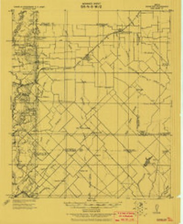
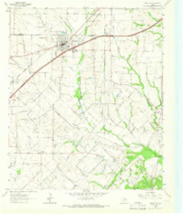
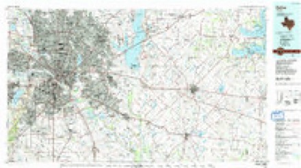
11 topographic sheets cover this place, the earliest surveyed in 1919 and the latest in 1986. It stands in the South Rockwall census division. It lies in ZIP code area 75189. The Survey maps it on the Royse City quadrangle.
Topographic sheets covering this place
5 surveys from 11 printed sheetsMatched by testing this settlement's coordinate against the published boundary of every sheet in the United States Geological Survey's historical collection. Each opens the scanned sheet at the Survey.
- 1919 USGS Royse City quadrangle1:62500
- 1954 USGS Dallas quadrangle1:250000, 4 printings
- 1958 USGS Dallas quadrangle1:250000
- 1963 USGS Royse City quadrangle1:24000, 2 printings
- 1986 USGS Dallas quadrangle1:100000, 3 printings
Fires near this place
114 since 2004Regional context, not property-specific evidence. The federal wildfire occurrence database lists 114 fires within 5 miles of Blackland between 2004 and 2018, burning about 600 acres in total. 1 started naturally. None was recorded as arson. Distance is straight-line from the map coordinates, so a fire counted here may appear on a neighbouring settlement's page as well.
| Reported cause | Fires |
|---|---|
| Debris and open burning | 60 |
| Missing data/not specified/undetermined | 24 |
| Equipment and vehicle use | 14 |
| Misuse of fire by a minor | 7 |
| Smoking | 5 |
| Power generation/transmission/distribution | 2 |
| Recreation and ceremony | 1 |
| Natural | 1 |
The most recent of them, most recent first, with the day each was reported and the service that recorded it.
| Date | Cause | Size | Reported by | Name on the report |
|---|---|---|---|---|
| 9 September 2006 | Equipment and vehicle use | 6.0 acres | Texas A & M Forest Service | not named |
| 8 September 2011 | Debris and open burning | 1.0 acres | Texas A & M Forest Service | HOLIDAY |
| 5 September 2013 | Debris and open burning | 50 acres | Texas A & M Forest Service | BRUSH FIRE |
| 4 September 2011 | Missing data/not specified/undetermined | 6.0 acres | Texas A & M Forest Service | HWY 66 & FM 1138 - 11075351 |
| 28 September 2005 | Natural | 2.0 acres | Texas A & M Forest Service | not named |
| 24 September 2011 | Debris and open burning | 1.0 acres | Texas A & M Forest Service | SKYE LANE |
| 22 September 2012 | Missing data/not specified/undetermined | 1.0 acres | Texas A & M Forest Service | 2012-638 |
| 18 September 2011 | Debris and open burning | 1.0 acres | Texas A & M Forest Service | CARRINGTON |
Settlements close enough to share some of these fires:
Storms near this place
9 since 2003Regional context, not property-specific evidence. The National Weather Service names Blackland in 9 storm reports between 2003 and 2026: 6 hail, 2 thunderstorm wind, 1 tornado. The reports record 3 injuries. Each account below is quoted exactly as the forecast office filed it, from the NOAA Storm Events Database, and each date opens the federal record of that event.
| When | Event | Place named | Harm | What the report says |
|---|---|---|---|---|
| April 2012 | Tornado (EF3) | Blackland | 3 hurt, $15,000,000 | An EF-3 tornado began in eastern Rockwall County and traveled northeast into Hunt County before lifting. The tornado touched down to the southwest of the intersection of FM 548 and Bent Rd in Rockwall County. The tornado quickly moved into a subdivision and severely damaged or destroyed several homes. The worst of the damage in this subdivision occurred along Laci Ln. Trees and shrubs northeast of these houses by a half mile or so were completely debarked and had no vegetation remaining. The tornado continued northeast and produced damage to homes along Country Manor Rd. There was one house that had a large portion of its roof/top story completely removed. A couple of small barns were also destroyed, one which contained a classic car which ended up blown into the back of a neighbors house. The tornado continued northeast where it crossed Hwy 276 and sideswiped a cabinet factory. Part of the outside metal walls were crumbled. There was an incredible amount of industrial debris downstream of this factory north of the highway. The tornado continued northeast and demolished one mobile home and damaged another right at the Rockwall/Hunt County line. In total, 8 homes in Rockwall County were deemed destroyed, 17 sustained major damage, and 8 sustained minor damage. The path length of the tornado in Rockwall County was nearly 2.4 miles, but the total path length was 3.3 miles. Maximum estimated winds were 150 mph and the tornado was approximately 400 yards wide. Three people sustained minor injuries when their doublewide mobile home was struck near the Rockwall/Hunt County line. |
| April 2012 | Hail | Blackland | $1,500,000 | Hail up to the size of tea cups fell in eastern Rockwall County. This large hail was falling from the tornadic supercell that also produced the EF-2 tornado south of Royse City. |
| April 2026 | Hail | Blackland | $20,000 | Report of 2 inch hail from mPING. |
| May 2024 | Thunderstorm Wind | Blackland | $15,000 | Broken trees, roof damage, and a collapsed carport were reported on Weldon Lane in Royse City. |
| August 2003 | Thunderstorm Wind | Blackland | $5,000 | A truck was overturned and power lines were blown down by high winds. |
| April 2026 | Hail | Blackland | - | Report of 1.5 inch hail from mPING. |
| December 2022 | Hail | Blackland | - | A trained spotter reported ping-pong ball sized hail about 5 miles southeast of Fate, TX. |
| January 2016 | Hail | Blackland | - | A social media report indicated penny sized hail near the town of Blackland, TX. |
| November 2012 | Hail | Blackland | - | Nickel to Quarter sized hail south of Fate, near the intersections of FM551 and State Highway 276. |
Nearest settlements
The eight closest, with where each one stands in the county. Distances are straight-line, computed from the Geographic Names Information System coordinates.
| Map | Place | Distance | Sheets |
|---|---|---|---|
| Munson | 2.7 miles | 11 | |
| Fate | 3.3 miles | 16 | |
| Mobile City | 3.6 miles | 16 | |
| McLendon | 4.3 miles | 13 | |
| McLendon-Chisholm | 4.3 miles | 13 | |
| Chisholm | 4.4 miles | 10 | |
| Royse City | 5.3 miles | 11 | |
| Rockwall | 6.2 miles | 16 |
Provenance
This settlement is recorded in the Geographic Names Information System as feature 1378014. The sheet list is computed by point-in-boundary test against the United States Geological Survey's historical topographic inventory. Both are works of the United States government and carry no copyright under 17 U.S.C. 105.
Wildfire. Short, Karen C. 2022. Spatial wildfire occurrence data for the United States, 1992-2020 [FPA_FOD_20221014]. 6th Edition. Fort Collins, CO: Forest Service Research Data Archive. https://doi.org/10.2737/RDS-2013-0009.6 Collected with United States Government funding and usable without additional permissions or fees.
Storms. NOAA National Centers for Environmental Information, Storm Events Database https://www.ncei.noaa.gov/stormevents/ A work of the United States government, no copyright under 17 U.S.C. 105. Narratives are quoted verbatim from the National Weather Service report and are not edited or summarised.