 Block
BlockBorger, Texas
8 topographic sheets cover this place, the earliest surveyed in 1953 and the latest in 1986. It stands in the Borger census division. It lies in ZIP code area 79007. The Survey maps it on the Borger quadrangle. 12,551 people lived here at the 2020 count. It stands 3,077 feet above sea level.
Research this city
Population over time
2 figuresBorger fell from 13,251 to 12,551 between 2010 and 2020. These are the recorded population figures Wikidata holds for this place, reached through the Geographic Names Information System number this page is keyed on rather than by name, so they belong to this place and not to another of the same name. Most are census counts, but not all are: an early figure may be a founding or settlement estimate, and an estimate published within five years of a census is left out. The change column is computed, and is left blank where more than 20 years separate a figure from the one before it, because a gap that long is not a change between two counts.
| Year | People | Change |
|---|---|---|
| 2010 | 13,251 | |
| 2020 | 12,551 | -700 (-5%) |
Topographic sheets covering this place
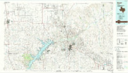
5 surveys from 8 printed sheetsMatched by testing this settlement's coordinate against the published boundary of every sheet in the United States Geological Survey's historical collection. Each opens the scanned sheet at the Survey.
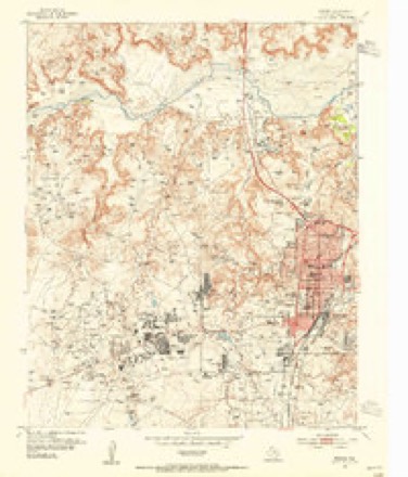
- 1953 USGS Borger quadrangle1:24000
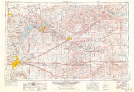
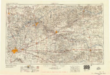
- 1954 USGS Amarillo quadrangle1:250000, 2 printings
- 1958 USGS Amarillo quadrangle1:250000
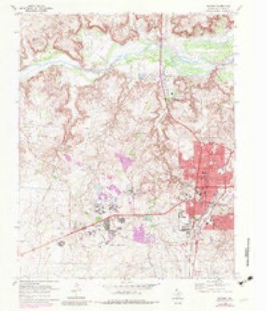
- 1970 USGS Borger quadrangle1:24000, 2 printings
- 1986 USGS Borger quadrangle1:100000, 2 printings
Fires near this place
234 since 2004Regional context, not property-specific evidence. The federal wildfire occurrence database lists 234 fires within 5 miles of Borger between 2004 and 2020, burning about 484,210 acres in total. 9 started naturally. 11 were recorded as arson. Distance is straight-line from the map coordinates, so a fire counted here may appear on a neighbouring settlement's page as well.
| Reported cause | Fires |
|---|---|
| Missing data/not specified/undetermined | 119 |
| Power generation/transmission/distribution | 45 |
| Equipment and vehicle use | 17 |
| Misuse of fire by a minor | 12 |
| Arson/incendiarism | 11 |
| Natural | 9 |
| Debris and open burning | 9 |
| Smoking | 7 |
| Recreation and ceremony | 3 |
| Railroad operations and maintenance | 2 |
The most recent of them, most recent first, with the day each was reported and the service that recorded it.
| Date | Cause | Size | Reported by | Name on the report |
|---|---|---|---|---|
| 7 September 2010 | Debris and open burning | 7.0 acres | Texas A & M Forest Service | LITTLE MUD |
| 4 September 2009 | Natural | 4.0 acres | Texas A & M Forest Service | LIGHTNING |
| 3 September 2011 | Missing data/not specified/undetermined | under an acre | Texas A & M Forest Service | DCP FIRE |
| 29 September 2015 | Missing data/not specified/undetermined | 2.0 acres | Texas A & M Forest Service | JONES FIRE |
| 29 September 2010 | Missing data/not specified/undetermined | under an acre | Texas A & M Forest Service | EARLS 1559 |
| 29 September 2009 | Power generation/transmission/distribution | 1.0 acres | Texas A & M Forest Service | WEST 3RD CEDAR FIRE |
| 24 September 2011 | Misuse of fire by a minor | under an acre | Texas A & M Forest Service | YET AGAIN |
| 20 September 2019 | Power generation/transmission/distribution | 1.0 acres | Texas A & M Forest Service | MUDDY ROAD |
Settlements close enough to share some of these fires:
Mines and quarries near this place
4 within 5 milesRegional context, not property-specific evidence. The federal mineral resources record lists 4 workings within 5 miles of Borger: 3 producers, 1 unknown. 3 still produce. What was taken out: Sand and Gravel, Construction, Sulfur. Distance is straight-line from the map coordinates, so a quarry counted here may appear on a neighbouring settlement's page as well.
| Where | Site | Commodity | Status | Recorded |
|---|---|---|---|---|
| Borger Sulfur Plant | Sulfur | Producer | ||
| Baker Pit | Sand and Gravel, Construction | Producer | ||
| Borger Pit & Plant | Sand and Gravel, Construction | Producer | ||
| Dees and Parker | Sand and Gravel, Construction | Unknown |
Storms near this place
60 of 244 shownRegional context, not property-specific evidence. The National Weather Service names Borger in 244 storm reports between 1993 and 2026: 164 hail, 63 thunderstorm wind, 7 tornado, 5 flash flood. No death or injury is recorded in these reports. Each account below is quoted exactly as the forecast office filed it, from the NOAA Storm Events Database, and each date opens the federal record of that event.
| When | Event | Place named | Harm | What the report says |
|---|---|---|---|---|
| July 2002 | Thunderstorm Wind | Borger | $800,000 | Numerous trees and powerlines were reported down in the city of Borger. Major structural damage reported to buildings. No injuries were reported. |
| June 2013 | Thunderstorm Wind | Borger | $250,000 | Two thunderstorms merged northwest of Borger (Hutchinson County) around the 9 PM CST hour before collapsing upon it's own updraft. This produced an estimated 94 mph microburst in Borger (Hutchinson County) which blew the roof completely off of a build in town. This microburst also bent a metal flag pole to a 45 degree angle off of the vertical, and 3 utility poles in a 10 square block in northwest Borger. The microburst wind continued to move across the town producing widespread wind damage. |
| September 2004 | Flash Flood | Borger | $240,000 | Three to five homes in the towns of Borger and Bunavista had to be evacuated due to rapidly rising water with another four to six homes threatened by the flash flooding. The flash flooding also closed down several streets including Texas Highway 136. |
| May 1995 | Hail | Borger | $200,000 | no account filed |
| September 2006 | Flash Flood | Borger | $140,000 | Vehicles reported washed down the streets with flood damage in downtown Borger. Nine houses were reported flooded along with seventeen vehicles moved by the flood waters on Austin Street. The Wesleyan Church was also reported flooded on McGee Street with two feet of water. |
| June 2005 | Hail | Borger | $96,000 | Numerous windows and skylights broken along with many roofs damaged in the city of Borger. |
| April 2001 | Thunderstorm Wind | Borger | $50,000 | Two large metal storage tanks were pulled out of the ground and tossed around and a motor home was overturned...along with two barns being destroyed. One half of a roof was also torn off of a house. Electric poles were snapped and down for two miles. |
| August 1999 | Thunderstorm Wind | Borger | $50,000 | A barn was blown onto Farm to Market Road 2171 and damage occurred in the Borger Industrial Park. |
| September 1993 | Hail | Borger | $50,000 | no account filed |
| September 2009 | Flood | Borger | $39,000 | Nearly two inches of rain fell at the Borger ASOS station located two miles north of Borger Texas between 1630 CST and 1800 CST. Local officials closed the intersection of Farm to Market Road 1551 and Texas State Highway 136 due to flooding. The accident occurred at about 1730 CST on Texas State Highway 136 north of Borger. One vehicle hydroplaned and collided with the other vehicle resulting in the deaths of two people. |
| August 2011 | Thunderstorm Wind | Borger | $35,000 | The Hutchinson County Emergency Managers Office reported that several trees and power lines were blown by the thunderstorm wind gust. Also, a metal carport was blown over. There were no reports of injuries or fatalities. |
| May 2002 | Tornado (F1) | Borger | $35,000 | A damage assessment was made on this tornado. A mobile home was completely destroyed and a pickup truck was heavily damaged. Fences and power poles were damaged within a radius of about fifty yards from the home site. Damage to trees was confined to those near the home site. |
| June 2005 | Hail | Borger | $29,000 | Report of broken windows and skylights along with roof damage. |
| June 2005 | Hail | Borger | $29,000 | Several homes with broken windows and skylights along with some roof damage. |
| June 2004 | Thunderstorm Wind | Borger | $25,000 | Roofs were damaged by the high winds. |
| May 2002 | Hail | Borger | $25,000 | The large hail damaged several vehicles. |
| June 2005 | Hail | Borger | $16,000 | One home reported to have broken windows and tree limbs which were three inches in diameter were broken. |
| August 2002 | Thunderstorm Wind | Borger | $15,000 | The high winds damaged tents near the Borger Community Activity Center. |
| May 1995 | Hail | Borger | $15,000 | no account filed |
| July 1998 | Thunderstorm Wind | Borger | $10,000 | Several large tree branches along with signs and power poles were reported down. A tree was also reported down on a house. |
| May 1995 | Hail | Borger | $10,000 | no account filed |
| June 2009 | Thunderstorm Wind | Borger | $9,000 | The public reported that thunderstorm wind gusts estimated to be near sixty-one knots blew the roof off of a home in Borger. |
| May 2000 | Hail | Borger | $6,000 | The Emergency Manager's Office in Borger reported damage to several vehicles. |
| August 2025 | Thunderstorm Wind | Borger | $500 | Six to seven inch diameter tree branches were blown down in the area. |
| April 2012 | Thunderstorm Wind | Borger | $300 | A trained spotter reported that two inch diameter tree limbs were broken off by the strong thunderstorm wind gusts. No injuries and no other damage were reported. |
| June 2025 | Thunderstorm Wind | Borger | $200 | Multiple tree branches were snapped with some that measured one inch in diameter or larger. |
| April 2026 | Thunderstorm Wind | Borger | - | The mesonet site located seven miles east of Borger measured a wind gust of 58mph at 8:09pm CDT. However, the strongest wind gust occurred at 8:29pm which was 65mph. |
| June 2025 | Hail | Borger | - | ICECHIP research team provided this measurement. |
| August 2024 | Thunderstorm Wind | Borger | - | This wind gust was in association with the outflow boundary moving through the area. |
| July 2023 | Thunderstorm Wind | Borger | - | A metal fence was blown out of the ground and into the roadway. |
| July 2022 | Thunderstorm Wind | Borger | - | A box trailer was partially blown over onto a parked vehicle, and a warehouse garage door was relocated to inside the building. |
| July 2022 | Hail | Borger | - | Reports were received of nickel to half dollar size hail in Borger. |
| July 2022 | Thunderstorm Wind | Borger | - | Windows blown out, hotel roof blown onto parking lot, major damage to vehicles due to the destroyed roof. |
| August 2021 | Thunderstorm Wind | Borger | - | Also had a 66 mph wind gust measured at this mesonet at 2136 lst as well. |
| April 2020 | Hail | Borger | - | Ping pong ball size hail was reported. |
| June 2020 | Hail | Borger | - | Quarter size hail fell 1 mile southwest of Borger. |
| June 2019 | Thunderstorm Wind | Borger | - | Emergency manager reported roof blown off of a house and power poles down in Borger. |
| June 2019 | Thunderstorm Wind | Borger | - | An Emergency Manager reported an 86 mph wind gust measured by a Davis Instrument. tree limbs were reported down throughout the city. |
| June 2019 | Hail | Borger | - | Late report of golf ball size hail. Time was estimated from radar. |
| June 2019 | Hail | Borger | - | Loose objects were tossed around and small tree branches were broken. Quarter size hail. |
| June 2019 | Hail | Borger | - | Picture of the hail was shared on Twitter. |
| June 2019 | Hail | Borger | - | Late report of 3 inch hail in the Keeler Heights subdivision of Borger. Time was estimated from radar. |
| June 2019 | Thunderstorm Wind | Borger | - | Late report of trailer flipped over at the Phillips 66 plant northeast of Borger. Time was estimated from radar. |
| June 2019 | Thunderstorm Wind | Borger | - | Loose objects tossed around and small tree branches broken. Quarter size hail was reported at this time as well. |
| April 2019 | Hail | Borger | - | Penny sized hail in SW Borger. |
| April 2019 | Hail | Borger | - | Borger fire dept reported accumulating hail ranging from pea to dime size. |
| May 2019 | Flood | Borger | - | Street flooding causing traffic delays in Borger. |
| May 2019 | Hail | Borger | - | Late report of pea to quarter size hail with heavy rain received on Facebook. |
| May 2019 | Hail | Borger | - | Late report of quarter size hail. |
| May 2018 | Flood | Borger | - | NW Borger had approximately 6 inches of running water in flood prone roadways around 730 PM. The water quickly drained off and closed roads were reopened by 750 PM. |
| July 2017 | Thunderstorm Wind | Borger | - | Tree down on highway 152 in Borger and several traffic lights are out of service. |
| May 2016 | Hail | Borger | - | Quarter size hail was reported in Borger. |
| May 2016 | Hail | Borger | - | Dime to nickel size hail was reported in Borger. Accumulation of hail on roads occurred causing hazardous driving conditions. Hail in combination with flooding caused drifts as high as one to two feet closing some roads in the city. |
| April 2016 | Hail | Borger | - | Quarter size hail was reported 3 miles northeast of Borger. |
| April 2016 | Hail | Borger | - | Golf ball size hail was reported 2 miles east of Borger. |
| April 2016 | Hail | Borger | - | Quarter size hail was reported two miles west of Borger. |
| April 2015 | Hail | Borger | - | A storm chaser reported baseball size hail 7 miles east-northeast of Borger via Spotter Network. |
| June 2015 | Thunderstorm Wind | Borger | - | A wooden telephone pole was blown over onto a car parked in a driveway near Monroe Street and Hemlock Street. |
| August 2015 | Flash Flood | Borger | - | High water rescues were reported in Borger due to flooded roads. A trained spotter located 2 miles west-southwest of Borger reported water rushing over Farm to Market 1551 and Briarwood by Fairlanes. The water depth was reported to be a 6 to 9 inches. |
| July 2015 | Thunderstorm Wind | Borger | - | Several trees were uprooted and multiple power poles were downed throughout Borger. |
Nearest settlements
The eight closest, with where each one stands in the county. Distances are straight-line, computed from the Geographic Names Information System coordinates.
| Map | Place | Distance | Sheets |
|---|---|---|---|
| Phillips | 2.4 miles | 8 | |
| Bunavista | 2.8 miles | 8 | |
| Electric City | 3.0 miles | 8 | |
| Philrich | 3.4 miles | 8 | |
| Texroy | 5.8 miles | 8 | |
| Sanford | 7.6 miles | 9 | |
| Stekoll Camp | 7.7 miles | 6 | |
| Oil City | 8.2 miles | 9 |
Elsewhere
Matched on this settlement's Geographic Names Information System number rather than its name, so it cannot be a different place of the same name in another state.
| Wikipedia article on Borger | An encyclopaedic summary. Its text is share-alike, so it is linked here rather than copied. |
| Wikidata item Q893540 | The structured record the population and elevation above come from. Public domain (CC0). |
Provenance
This settlement is recorded in the Geographic Names Information System as feature 1352700. The sheet list is computed by point-in-boundary test against the United States Geological Survey's historical topographic inventory. Both are works of the United States government and carry no copyright under 17 U.S.C. 105.
Wildfire. Short, Karen C. 2022. Spatial wildfire occurrence data for the United States, 1992-2020 [FPA_FOD_20221014]. 6th Edition. Fort Collins, CO: Forest Service Research Data Archive. https://doi.org/10.2737/RDS-2013-0009.6 Collected with United States Government funding and usable without additional permissions or fees.
Mines and quarries. USGS Mineral Resources Data System (MRDS) https://mrdata.usgs.gov/mrds/ A work of the United States government, no copyright under 17 U.S.C. 105.
Storms. NOAA National Centers for Environmental Information, Storm Events Database https://www.ncei.noaa.gov/stormevents/ A work of the United States government, no copyright under 17 U.S.C. 105. Narratives are quoted verbatim from the National Weather Service report and are not edited or summarised.