 Block
BlockBowie, Texas
10 topographic sheets cover this place, the earliest surveyed in 1905 and the latest in 1991. It stands in the Bowie census division. It lies in ZIP code area 76230. It lies near Cougar Mountain. The Survey maps it on the Bowie quadrangle. 5,448 people lived here at the 2020 count. It stands 1,129 feet above sea level.
Research this city
Population over time
2 figuresBowie grew from 5,218 to 5,448 between 2010 and 2020. These are the recorded population figures Wikidata holds for this place, reached through the Geographic Names Information System number this page is keyed on rather than by name, so they belong to this place and not to another of the same name. Most are census counts, but not all are: an early figure may be a founding or settlement estimate, and an estimate published within five years of a census is left out. The change column is computed, and is left blank where more than 20 years separate a figure from the one before it, because a gap that long is not a change between two counts.
| Year | People | Change |
|---|---|---|
| 2010 | 5,218 | |
| 2020 | 5,448 | +230 (+4%) |
Topographic sheets covering this place
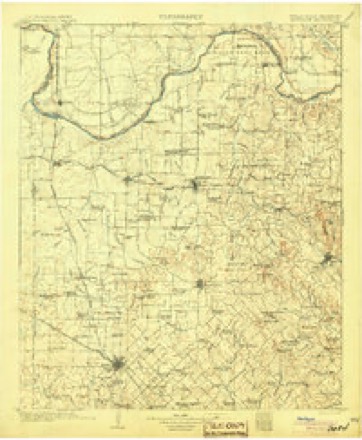
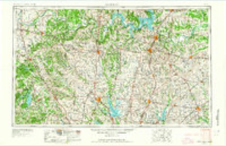
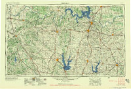
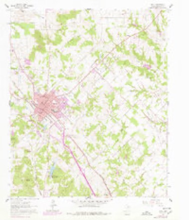
6 surveys from 10 printed sheetsMatched by testing this settlement's coordinate against the published boundary of every sheet in the United States Geological Survey's historical collection. Each opens the scanned sheet at the Survey.
- 1905 USGS Montague quadrangle1:125000, 3 printings
- 1954 USGS Sherman quadrangle1:250000, 2 printings
- 1958 USGS Sherman quadrangle1:250000
- 1961 USGS Bowie quadrangle1:24000, 2 printings
- 1985 USGS Gainesville quadrangle1:100000
- 1991 USGS Gainesville quadrangle1:100000
Fires near this place
78 since 2005Regional context, not property-specific evidence. The federal wildfire occurrence database lists 78 fires within 5 miles of Bowie between 2005 and 2020, burning about 4,303 acres in total. 1 started naturally. None was recorded as arson. Distance is straight-line from the map coordinates, so a fire counted here may appear on a neighbouring settlement's page as well.
| Reported cause | Fires |
|---|---|
| Missing data/not specified/undetermined | 42 |
| Debris and open burning | 17 |
| Equipment and vehicle use | 8 |
| Power generation/transmission/distribution | 4 |
| Railroad operations and maintenance | 4 |
| Smoking | 2 |
| Natural | 1 |
The most recent of them, most recent first, with the day each was reported and the service that recorded it.
| Date | Cause | Size | Reported by | Name on the report |
|---|---|---|---|---|
| 9 September 2011 | Power generation/transmission/distribution | under an acre | Texas A & M Forest Service | POLK POWERLINE |
| 8 September 2011 | Missing data/not specified/undetermined | under an acre | Texas A & M Forest Service | THREE DAUGHTERS GRASS |
| 8 September 2011 | Smoking | 2.0 acres | Texas A & M Forest Service | WATKINS GRASS |
| 7 September 2009 | Missing data/not specified/undetermined | 12 acres | Texas A & M Forest Service | ALLISON |
| 30 September 2011 | Power generation/transmission/distribution | 200 acres | Texas A & M Forest Service | JACKSON RD |
| 3 September 2011 | Railroad operations and maintenance | under an acre | Texas A & M Forest Service | PINK WILSON RR GRASS |
| 3 September 2011 | Railroad operations and maintenance | under an acre | Texas A & M Forest Service | LIPSCOMBS RR GRASS |
| 11 September 2011 | Missing data/not specified/undetermined | under an acre | Texas A & M Forest Service | WILLIAMS BUSH FIRE |
Settlements close enough to share some of these fires:
Mines and quarries near this place
1 within 5 milesRegional context, not property-specific evidence. The federal mineral resources record lists 1 working within 5 miles of Bowie: 1 producer. All of them still produce. What was taken out: Sand and Gravel, Construction. Distance is straight-line from the map coordinates, so a quarry counted here may appear on a neighbouring settlement's page as well.
| Where | Site | Commodity | Status | Recorded |
|---|---|---|---|---|
| Sadler Sand and Gravel Co Pit-Plant | Sand and Gravel, Construction | Producer |
Storms near this place
60 of 125 shownRegional context, not property-specific evidence. The National Weather Service names Bowie in 125 storm reports between 1994 and 2026: 70 hail, 29 thunderstorm wind, 15 flash flood, 6 tornado. The reports record 1 injury. Each account below is quoted exactly as the forecast office filed it, from the NOAA Storm Events Database, and each date opens the federal record of that event.
| When | Event | Place named | Harm | What the report says |
|---|---|---|---|---|
| May 1994 | Thunderstorm Wind | Bowie | 1 hurt, $50,000 | A mobile home was blown over by thunderstorm winds near Bowie, trapping a woman. She was treated for minor injuries. Mills County Democrat,25,2100CST,,,0,0,0,0,Hail (1.00) |
| May 2020 | Thunderstorm Wind | Bowie | $1,000,000 | Damaging straight line winds affected most of the western, northern and central portions of the City of Bowie. Straight-line wind damage was also observed northeast of Bowie along Highway 59, extending almost to the City of Montague. Within Bowie proper, large tree trunks were snapped, and many trees were uprooted. Much of this tree debris fell onto residences, resulting in roof and structural damage to these homes. Additional light structural damage, including roof, fascia and signage damage, was observed to many commercial buildings within Bowie. All of this straight-line wind damage was consistent with wind speeds ranging from 65 to 80 mph, with isolated heavier damage consistent with 80 to 90 mph winds. Within the large field of wind damage, there were some subtle indications that a brief tornado also occurred in Bowie. |
| May 2020 | Tornado (EF1) | Bowie | $500,000 | Within a larger swath of damaging thunderstorms winds in Bowie, subtle evidence of a tornado was discovered. Beginning near the Best Western Hotel near Highway 59 and US 287, the orientation of damage suggested weak convergence. The intensity of the damage also suggested higher wind speeds on the order of 90 to 95 mph. Similar indicators were noted from this area northeast along a mile-long path into the central business district of Bowie, where substantial roof damage and wall damage occurred to single story and multi-story buildings. This damage was suggestive of estimated tornado wind speeds topping out around 95 mph. |
| April 2016 | Hail | Bowie | $500,000 | Emergency management reported 3 inch diameter hail in Bowie, TX near the Highway 287 exit. |
| March 2007 | Flash Flood | Bowie | $100,000 | Several roads were under water and closed across the county. In addition, four briges were washed out, and sinkholes developed on North Johnson Loop, Poss Dyer Road, Lake Valley Road, and Denver Road. The sinkhole on Denver Road was six feet deep and twenty-five feet wide. |
| September 2001 | Thunderstorm Wind | Bowie | $80,000 | Widespread trees and power lines blown down, roof damage to homes, and an 18 wheeler blown over in town. One house was destroyed, three with major damage, and sixty-eight with light to moderate damage. Two businesses were destroyed, fifteen with major damage, and thirty-five with light to moderate damage. There was also damage to six vehicles. |
| March 2007 | Flash Flood | Bowie | $60,000 | Significant flooding occurred in Bowie as heavy rain fell and storm drains backed up. Several houses had water inside, and a pick-up truck had to be parked on top of a manhole cover to keep it closed. One to two feet of water was reported over Highway 82 west of Nocona and Interstate 75 south of Nocona. |
| August 2023 | Hail | Bowie | $50,000 | Emergency management reported golf ball sized hail on Highway 81 approximately 2 miles north of Bowie, TX. |
| May 2020 | Hail | Bowie | $50,000 | Hen egg sized hail was reported in the city of Bowie on Pelham and Lee streets. |
| June 2016 | Flash Flood | Bowie | $50,000 | Hood County Emergency Management reported major flooding in the city of Bowie, TX with high water rescues on streets and highways and people trapped in homes. |
| June 2004 | Lightning | Bowie | $30,000 | Lightning strikes blew two big breakers and damaged two houses. |
| August 1997 | Lightning | Bowie | $30,000 | Lightning reportedly struck an oil tank and started a fire that engulfed two such tanks. |
| May 2015 | Flash Flood | Bowie | $25,000 | Emergency Management reported that the Bowie EMS was responding to a family which was evacuating their home due to flooding. The home was on Applegate Rd just off Hwy 81. |
| March 2004 | Thunderstorm Wind | Bowie | $25,000 | A silo was moved off it's foundation, a greenhouse was destroyed, several buildings were unroofed, and trees were damaged. |
| May 2015 | Flash Flood | Bowie | $20,000 | Emergency management reported that 2 vehicles were submerged on N Mills St at the railroad underpass in Bowie, TX. |
| June 2015 | Flash Flood | Bowie | $20,000 | Numerous roads in Bowie were covered with water and impassable. Some roads north of Bowie were also flooded. |
| September 2011 | Thunderstorm Wind | Bowie | $20,000 | A roof was blown of a house and a trailer was blown across Highway 81 at Polk Road. Just up the road near Highway 81 and Indian Hills Road, a large tree was uprooted and several large, healthy tree branches were snapped off a tree. |
| March 2007 | Lightning | Bowie | $20,000 | Two transformers were knocked out by lightning. An electrical worker burned his retinas as an arc came off the wires while he was repairing them. |
| May 2012 | Thunderstorm Wind | Bowie | $17,000 | Large trees and tree limbs were blown down in Bowie. Some of the tree limbs were nearly a foot in diameter. One large tree limb fell on a garage. Minor building damage was also reported and downed power lines resulted in power outages. The winds were estimated to be between 65 and 75 mph. |
| March 2007 | Thunderstorm Wind | Bowie | $15,000 | Roof damage to a building on Montague Street was reported. |
| August 1995 | Thunderstorm Wind | Bowie | $15,000 | Trees and power lines were blown down by high winds, causing widespread power outages. Some windows were broken in businesses and tin roofs were blown off outbuildings. |
| April 2011 | Hail | Bowie | $10,000 | Ping pong to golfball sized hail fell over Bowie. |
| June 2009 | Thunderstorm Wind | Bowie | $10,000 | A 46 diameter tree was knocked onto a storage building on Sanders Street in Bowie. The storage building was heavily damaged. |
| July 2007 | Flash Flood | Bowie | $10,000 | Tarrant, Patterson, Mill, Rock, and Nelson Streets were flooded by about a foot of water. More than two inches of rain fell in 45 minutes. Saturated limbs fell from trees and hit power lines, causing outages for about an hour. |
| May 2020 | Hail | Bowie | $8,000 | no account filed |
| May 2024 | Hail | Bowie | $7,000 | Emergency management reported tennis-ball sized hail at Leona Road west of Bowie, TX. |
| April 2013 | Hail | Bowie | $5,000 | Golf ball sized hail was covering the ground near Highway 59 and Frog Hollar Road. |
| May 2010 | Flash Flood | Bowie | $5,000 | A few roads were briefly closed in the city of Bowie due to high water. One car was stranded at the Mill Street underpass. |
| March 2004 | Thunderstorm Wind | Bowie | $5,000 | An old gas station was unroofed and a power pole was snapped off. |
| June 1997 | Thunderstorm Wind | Bowie | $5,000 | Strong winds blew windows out of a store. |
| May 2025 | Hail | Bowie | $3,000 | A few different sources reported several minutes of ping pong ball sized hail in and around Bowie. |
| May 2025 | Thunderstorm Wind | Bowie | $3,000 | Emergency management reported that two overhead doors were damaged by high winds at the volunteer Fire Department approximately 1 mile south of Bowie on Highway 59. |
| June 2009 | Hail | Bowie | $3,000 | Golfball size hail was reported 1 mile north of Bowie. |
| June 2005 | Lightning | Bowie | $3,000 | A power surge due to lightning caused a fire in a residential home. |
| April 2016 | Hail | Bowie | $2,000 | Ping pong ball sized hail was reported south of Bowie. |
| June 2005 | Thunderstorm Wind | Bowie | $2,000 | A tree fell onto a patio cover. |
| July 2004 | Thunderstorm Wind | Bowie | $2,000 | Tree limbs were blown into power lines. |
| April 1996 | Thunderstorm Wind | Bowie | $2,000 | no account filed |
| May 2019 | Thunderstorm Wind | Bowie | $500 | Bowie Police Department reported a power pole down across Highway 59 approximately 2 miles northeast of the city of Bowie, TX. |
| February 2009 | Hail | Bowie | $500 | Quarter size hail was covering the ground in Bowie. |
| April 2026 | Hail | Bowie | - | Trained spotter reported quarter size hail 3 miles southwest of Bowie. |
| April 2026 | Tornado (EF0) | Bowie | - | Video evidence confirms a brief tornado developed east of Highway 59 near the Montague/Clay County line. Tree damage can be seen in the video. |
| May 2025 | Hail | Bowie | - | Report from mPING: Quarter (1.00 in.). |
| April 2025 | Flash Flood | Bowie | - | The city of Bowie Police Department closed Nelson Street at Mill Street, Nelson Street at the railroad bridge, and Decatur Street due to flash flooding. Social media video also indicated several flooded roads throughout the city of Bowie. |
| April 2025 | Flash Flood | Bowie | - | Emergency management reported several roads flooded across the city of Bowie. |
| May 2024 | Hail | Bowie | - | Emergency management reported quarter to half dollar sized hail falling within the City of Bowie, with hail covering the ground just south of the city along Highway 287. |
| May 2024 | Hail | Bowie | - | Quarter size hail reported via mping. |
| March 2023 | Hail | Bowie | - | Dime sized hail was reported in Bowie. |
| August 2023 | Hail | Bowie | - | Emergency management reported ping pong ball sized hail near the intersection of Theater Road and Highway 81 north of Bowie, TX. |
| August 2023 | Thunderstorm Wind | Bowie | - | Emergency management reported significant tree damage near the community center in Bowie, TX. |
| March 2022 | Tornado (EF1) | Bowie | - | The tornado began on the north side of Lake Amon G. Carter along Hanging Tree Rd. where damage was found to multiple small barns and farm outbuildings, roof damage to several single family homes in the area, and tree damage resulting in snapped tree trunks and large broken limbs. A partially full water tank was transported from Hanging Tree Rd to Farm to Market Road 2583 as the storm continued east-northeast. As the tornado moved northeast of the lake to Timber Oaks Ct. it caused heavy damage to a farm outbuilding where the roof was lifted and multiple walls collapsed. The tornado is believed to have lifted after crossing Elgin Road. Maximum estimated winds were 95 mph. |
| June 2021 | Thunderstorm Wind | Bowie | - | A 61 mph wind gust was measured on an anemometer. |
| October 2021 | Thunderstorm Wind | Bowie | - | A trained spotter reported reported a 60 MPH wind gust approximately 4 miles north-northwest of the city of Bowie, TX on Highway 81. |
| February 2019 | Hail | Bowie | - | A social media report indicated nickel-sized hail in the northern part of the city of Bowie, TX. |
| March 2019 | Thunderstorm Wind | Bowie | - | The Bowie, TX Automated Weather Observation System measured a wind gust of 61 MPH. |
| April 2019 | Hail | Bowie | - | A social media report indicated penny size hail immediately southeast of the city of Bowie, TX. |
| April 2019 | Hail | Bowie | - | Fire and rescue reported quarter size hail approximately 2 miles southwest of the city of Bowie, TX along Hanging Tree Road. |
| April 2019 | Hail | Bowie | - | Emergency management reported nickel size hail at the EOC in Bowie, TX. |
| April 2019 | Hail | Bowie | - | Emergency management reported nickel size hail approximately 7 miles southwest of the city of Bowie along Scout Road. |
| March 2018 | Hail | Bowie | - | Emergency management reported pea to dime-sized hail covering the ground with a few stones up to quarter-sized near the intersection of Cole Rd at Brushy Rd approximately 2 miles southeast of the city of Bowie, TX. |
Nearest settlements
The eight closest, with where each one stands in the county. Distances are straight-line, computed from the Geographic Names Information System coordinates.
Elsewhere
Matched on this settlement's Geographic Names Information System number rather than its name, so it cannot be a different place of the same name in another state.
| Wikipedia article on Bowie | An encyclopaedic summary. Its text is share-alike, so it is linked here rather than copied. |
| Wikidata item Q973724 | The structured record the population and elevation above come from. Public domain (CC0). |
Provenance
This settlement is recorded in the Geographic Names Information System as feature 1352736. The sheet list is computed by point-in-boundary test against the United States Geological Survey's historical topographic inventory. Both are works of the United States government and carry no copyright under 17 U.S.C. 105.
Wildfire. Short, Karen C. 2022. Spatial wildfire occurrence data for the United States, 1992-2020 [FPA_FOD_20221014]. 6th Edition. Fort Collins, CO: Forest Service Research Data Archive. https://doi.org/10.2737/RDS-2013-0009.6 Collected with United States Government funding and usable without additional permissions or fees.
Mines and quarries. USGS Mineral Resources Data System (MRDS) https://mrdata.usgs.gov/mrds/ A work of the United States government, no copyright under 17 U.S.C. 105.
Storms. NOAA National Centers for Environmental Information, Storm Events Database https://www.ncei.noaa.gov/stormevents/ A work of the United States government, no copyright under 17 U.S.C. 105. Narratives are quoted verbatim from the National Weather Service report and are not edited or summarised.