 Block
BlockBridge City, Texas
16 topographic sheets cover this place, the earliest surveyed in 1943 and the latest in 1986. It stands in the Bridge City-Orangefield census division. It lies in ZIP code area 77611. The Survey maps it on the Orangefield quadrangle. 9,546 people lived here at the 2020 count. It stands 10 feet above sea level.
On record in Bridge City
Buildings and businesses the archive holds for this place. Each opens its own page, with the source record it came from.
On the National Register 1 record
- Cow Bayou Swing Bridgelisted 2010
Population over time
2 figuresBridge City grew from 7,840 to 9,546 between 2010 and 2020. These are the recorded population figures Wikidata holds for this place, reached through the Geographic Names Information System number this page is keyed on rather than by name, so they belong to this place and not to another of the same name. Most are census counts, but not all are: an early figure may be a founding or settlement estimate, and an estimate published within five years of a census is left out. The change column is computed, and is left blank where more than 20 years separate a figure from the one before it, because a gap that long is not a change between two counts.
| Year | People | Change |
|---|---|---|
| 2010 | 7,840 | |
| 2020 | 9,546 | +1,706 (+22%) |
Topographic sheets covering this place
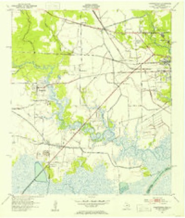
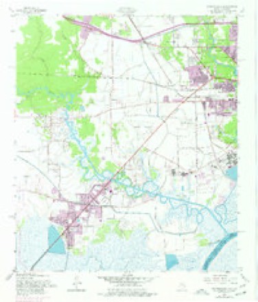
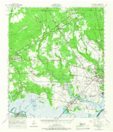
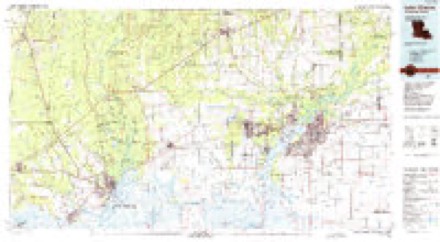
6 surveys from 16 printed sheetsMatched by testing this settlement's coordinate against the published boundary of every sheet in the United States Geological Survey's historical collection. Each opens the scanned sheet at the Survey.
- 1943 USGS Orangefield quadrangle1:24000
- 1952 USGS Lake Charles quadrangle1:250000
- 1954 USGS Lake Charles quadrangle1:250000, 3 printings
- 1957 USGS Orangefield quadrangle1:24000, 7 printings
- 1957 USGS Orangefield quadrangle1:62500, 2 printings
- 1986 USGS Lake Charles quadrangle1:100000, 2 printings
Fires near this place
10 since 1998Regional context, not property-specific evidence. The federal wildfire occurrence database lists 10 fires within 5 miles of Bridge City between 1998 and 2009, burning about 51 acres in total. None started naturally. 1 was recorded as arson. Distance is straight-line from the map coordinates, so a fire counted here may appear on a neighbouring settlement's page as well.
| Reported cause | Fires |
|---|---|
| Debris and open burning | 4 |
| Missing data/not specified/undetermined | 4 |
| Railroad operations and maintenance | 1 |
| Arson/incendiarism | 1 |
The most recent of them, most recent first, with the day each was reported and the service that recorded it.
| Date | Cause | Size | Reported by | Name on the report |
|---|---|---|---|---|
| 23 September 1999 | Missing data/not specified/undetermined | 2.0 acres | Texas A & M Forest Service | not named |
| 21 September 1999 | Missing data/not specified/undetermined | 6.0 acres | Texas A & M Forest Service | not named |
| 5 August 1998 | Missing data/not specified/undetermined | 5.0 acres | Texas A & M Forest Service | not named |
| 13 August 2000 | Arson/incendiarism | 4.0 acres | Texas A & M Forest Service | WOODVILLE - 503 |
| 10 June 2006 | Debris and open burning | 5.0 acres | Texas A & M Forest Service | 588 F 8 |
| 2 March 2009 | Debris and open burning | 3.0 acres | Texas A & M Forest Service | WOODVILLE - 59 |
| 24 February 1999 | Debris and open burning | 4.0 acres | Texas A & M Forest Service | not named |
| 20 February 2009 | Debris and open burning | 3.0 acres | Texas A & M Forest Service | WOODVILLE - 46 |
Settlements close enough to share some of these fires:
Mines and quarries near this place
1 within 5 milesRegional context, not property-specific evidence. The federal mineral resources record lists 1 working within 5 miles of Bridge City: 1 producer. All of them still produce. What was taken out: Sand and Gravel, Construction. Distance is straight-line from the map coordinates, so a quarry counted here may appear on a neighbouring settlement's page as well.
| Where | Site | Commodity | Status | Recorded |
|---|---|---|---|---|
| R A Mann Bayon Sand Pit | Sand and Gravel, Construction | Producer |
Storms near this place
28 since 1997Regional context, not property-specific evidence. The National Weather Service names Bridge City in 28 storm reports between 1997 and 2024: 10 flash flood, 9 hail, 3 flood, 3 thunderstorm wind. The reports record 11 deaths. Each account below is quoted exactly as the forecast office filed it, from the NOAA Storm Events Database, and each date opens the federal record of that event.
| When | Event | Place named | Harm | What the report says |
|---|---|---|---|---|
| August 2017 | Flash Flood | Bridge City | 10 killed, $1,500,000,000 | Widespread 30 to 50 inches of rainfall fell across Orange County during Harvey. This resulted in 27,742 homes being flooded. The hardest hit areas were Orange, Vidor, Orangefield, Pine Forest, West Orange, Rose City, Mauriceville, Rose City, and Lake View. Record crests occurred on the lower Neches and Cow Bayou. The Sabine River was at its highest level since Hurricane Ike in 2008. Water covered and closed portions of Interstate 10 in the county. Only 1 home was reported not flooded in Rose City and the community's drinking water was interrupted for near a month. 10 people perished during the event with 2 of them being from electrocution in a flooded home. |
| March 2012 | Flood | Bridge City | 1 killed, $1,000 | The line of slow moving storms finally departed Southeast Texas in the early morning hours. As water receded a car was found in a ditch in Orange near the Lake Cypress-Mauriceville High School the next day. The driver had driven into the ditch after the rain had stopped during the night and drown. The flood waters from the heavy rain event took a week to recede. |
| October 2013 | Tornado (EF1) | Bridge City | $100,000 | The tornado began south of West Round Bunch Road near Susan Circle and traveled generally west and crossed Highway 87/73 south of Cow Bayou. The tornado then turned northwest to parallel Highway 87/73 after crossing the bayou and moved across FM 1006 and lifted before reaching Western AVE. The tornado was strongest before crossing Highway 87/73 and produced EF1 damage to homes and trees. EF0 damage was done after crossing 87/73. Roofs, carports, sheds and trees were damaged along the path. |
| June 1997 | Heavy Rain | Bridge City | $40,000 | no account filed |
| July 1998 | Thunderstorm Wind | Bridge City | $30,000 | no account filed |
| April 2009 | Flash Flood | Bridge City | $20,000 | KFDM-TV and the public reported widespread flash flooding across Orange County. Several homes in Bridge City and West Orange received minor flooding. |
| October 1998 | Flash Flood | Bridge City | $20,000 | no account filed |
| January 1998 | Flash Flood | Bridge City | $20,000 | no account filed |
| September 2004 | Flash Flood | Bridge City | $10,000 | no account filed |
| September 1997 | Flood | Bridge City | $10,000 | no account filed |
| July 2009 | Thunderstorm Wind | Bridge City | $1,000 | Local media reported power lines blown down in Bridge City. |
| June 2024 | Flash Flood | Bridge City | - | Multiple streets flooded in Bridge City including East Young Drive and Katherine Avenue. Water also covered yards and approached homes. |
| July 2022 | Flash Flood | Bridge City | - | Several inches of rainfall provided mostly minor flooding in Orange and Bridge City, however several streets were closed during the event. |
| September 2021 | Flash Flood | Bridge City | - | Multiple streets in Orange County were flooded while Nicholas moved through the region. Most flooded roads were in West Orange. |
| June 2017 | Flash Flood | Bridge City | - | Posts to social media indicated extensive street flooding in Bridge City and Orange. Many streets were impassable and water approached some structures. |
| September 2017 | Flood | Bridge City | - | Heavy rain from Tropical Storm Harvey caused record or near record flooding along the lower Sabine and Neches Rivers. While the crests of the rivers was during the last couple days of August to the first days of September the rivers remained in major flood stage through the first week. Some roadways and residences remained flooded near the rivers through the first week of the month. |
| April 2016 | Flash Flood | Bridge City | - | Media relayed a video of flooding along Cormier and Cherokee Streets in Vidor. Flooding was also reported along some streets in Pinehurst. Over 5 inches of rain was reported in Orange near the Sabine River. |
| February 2014 | Hail | Bridge City | - | The thunderstorm that produced quarter sized hail in Orangefield traveled east and produced nickel sized hail in Bridge City. |
| August 2010 | Funnel Cloud | Bridge City | - | KBMT-TV reported a funnel cloud in Bridge City, which was confirmed by photos and video. |
| April 2009 | Hail | Bridge City | - | Bridge City Police Department reported penny size hail lasted two minutes. |
| December 2007 | Hail | Bridge City | - | no account filed |
| March 2003 | Hail | Bridge City | - | no account filed |
| August 2003 | Hail | Bridge City | - | no account filed |
| May 2002 | Thunderstorm Wind | Bridge City | - | no account filed |
| May 1999 | Hail | Bridge City | - | no account filed |
| May 1999 | Hail | Bridge City | - | no account filed |
| January 1998 | Hail | Bridge City | - | no account filed |
| March 1998 | Hail | Bridge City | - | no account filed |
Nearest settlements
The eight closest, with where each one stands in the county. Distances are straight-line, computed from the Geographic Names Information System coordinates.
| Map | Place | Distance | Sheets |
|---|---|---|---|
| Orangefield | 3.8 miles | 16 | |
| Bessie Heights | 4.3 miles | 16 | |
| Tulane | 5.2 miles | 16 | |
| Oilla | 5.8 miles | 16 | |
| Francis | 6.0 miles | 16 | |
| Doc Brown | 6.1 miles | 16 | |
| West Orange | 6.3 miles | 16 | |
| Cove | 6.6 miles | 19 |
Elsewhere
Matched on this settlement's Geographic Names Information System number rather than its name, so it cannot be a different place of the same name in another state.
| Wikipedia article on Bridge City | An encyclopaedic summary. Its text is share-alike, so it is linked here rather than copied. |
| Wikidata item Q913618 | The structured record the population and elevation above come from. Public domain (CC0). |
Provenance
This settlement is recorded in the Geographic Names Information System as feature 1331256. The sheet list is computed by point-in-boundary test against the United States Geological Survey's historical topographic inventory. Both are works of the United States government and carry no copyright under 17 U.S.C. 105.
Wildfire. Short, Karen C. 2022. Spatial wildfire occurrence data for the United States, 1992-2020 [FPA_FOD_20221014]. 6th Edition. Fort Collins, CO: Forest Service Research Data Archive. https://doi.org/10.2737/RDS-2013-0009.6 Collected with United States Government funding and usable without additional permissions or fees.
Mines and quarries. USGS Mineral Resources Data System (MRDS) https://mrdata.usgs.gov/mrds/ A work of the United States government, no copyright under 17 U.S.C. 105.
Storms. NOAA National Centers for Environmental Information, Storm Events Database https://www.ncei.noaa.gov/stormevents/ A work of the United States government, no copyright under 17 U.S.C. 105. Narratives are quoted verbatim from the National Weather Service report and are not edited or summarised.