 Block
BlockBurkburnett, Texas
15 topographic sheets cover this place, the earliest surveyed in 1915 and the latest in 1985. It stands in the Burkburnett census division. It lies in ZIP code area 76354. The Survey maps it on the Burkburnett quadrangle. 10,939 people lived here at the 2020 count. It stands 1,060 feet above sea level.
Research this city
Population over time
2 figuresBurkburnett grew from 10,811 to 10,939 between 2010 and 2020. These are the recorded population figures Wikidata holds for this place, reached through the Geographic Names Information System number this page is keyed on rather than by name, so they belong to this place and not to another of the same name. Most are census counts, but not all are: an early figure may be a founding or settlement estimate, and an estimate published within five years of a census is left out. The change column is computed, and is left blank where more than 20 years separate a figure from the one before it, because a gap that long is not a change between two counts.
| Year | People | Change |
|---|---|---|
| 2010 | 10,811 | |
| 2020 | 10,939 | +128 (+1%) |
Topographic sheets covering this place
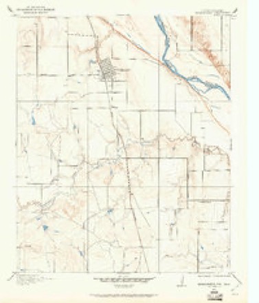
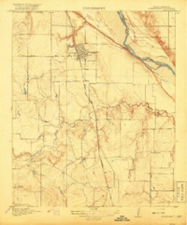
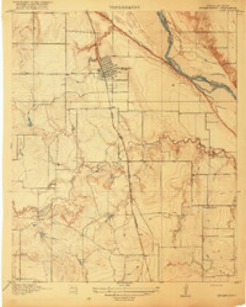
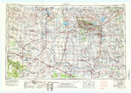
7 surveys from 15 printed sheetsMatched by testing this settlement's coordinate against the published boundary of every sheet in the United States Geological Survey's historical collection. Each opens the scanned sheet at the Survey.
- 1915 USGS Burkburnett quadrangle1:24000
- 1918 USGS Buckburnett quadrangle1:31680
- 1918 USGS Burkburnett quadrangle1:31680, 2 printings
- 1955 USGS Lawton quadrangle1:250000, 5 printings
- 1957 USGS Burkburnett quadrangle1:62500
- 1972 USGS Burkburnett quadrangle1:24000, 3 printings
- 1985 USGS Burkburnett quadrangle1:100000, 2 printings
Fires near this place
300 since 2000Regional context, not property-specific evidence. The federal wildfire occurrence database lists 300 fires within 5 miles of Burkburnett between 2000 and 2020, burning about 6,033 acres in total. 7 started naturally. 2 were recorded as arson. Distance is straight-line from the map coordinates, so a fire counted here may appear on a neighbouring settlement's page as well.
| Reported cause | Fires |
|---|---|
| Missing data/not specified/undetermined | 191 |
| Power generation/transmission/distribution | 39 |
| Equipment and vehicle use | 36 |
| Debris and open burning | 23 |
| Natural | 7 |
| Arson/incendiarism | 2 |
| Smoking | 1 |
| Misuse of fire by a minor | 1 |
The most recent of them, most recent first, with the day each was reported and the service that recorded it.
| Date | Cause | Size | Reported by | Name on the report |
|---|---|---|---|---|
| 8 September 2015 | Missing data/not specified/undetermined | 1.0 acres | Texas A & M Forest Service | DRAGGING 44 FIRE |
| 7 September 2011 | Power generation/transmission/distribution | 3.0 acres | Texas A & M Forest Service | CARNES |
| 5 September 2013 | Missing data/not specified/undetermined | under an acre | Texas A & M Forest Service | I44 DANIELS |
| 5 September 2013 | Missing data/not specified/undetermined | under an acre | Texas A & M Forest Service | I44 ACCESS NB |
| 3 September 2020 | Power generation/transmission/distribution | 3.0 acres | Texas A & M Forest Service | MUD FIRE |
| 3 September 2012 | Equipment and vehicle use | 1.0 acres | Anadarko Agency | KIOWA 3021 |
| 29 September 2016 | Power generation/transmission/distribution | 1.0 acres | Texas A & M Forest Service | ELECTRICAL BUSH FIRE |
| 25 September 2020 | Equipment and vehicle use | 1.0 acres | Texas A & M Forest Service | I44 FLAT TIRE |
Settlements close enough to share some of these fires:
Mines and quarries near this place
5 within 5 milesRegional context, not property-specific evidence. The federal mineral resources record lists 5 workings within 5 miles of Burkburnett: 4 past producers, 1 occurrence. None of them still produces. What was taken out: Sand and Gravel, Construction, Uranium, Copper, Uranium. Distance is straight-line from the map coordinates, so a quarry counted here may appear on a neighbouring settlement's page as well.
| Where | Site | Commodity | Status | Recorded |
|---|---|---|---|---|
| Eastman Prospect | Uranium, Copper | Past Producer | 1954 | |
| Uranium Prospect | Uranium | Occurrence | ||
| Unknown Sand Pit | Sand and Gravel, Construction | Past Producer | ||
| Unknown Sand Pit | Sand and Gravel, Construction | Past Producer | ||
| Unknown Sand and Gravel Pit | Sand and Gravel, Construction | Past Producer |
Storms near this place
60 of 195 shownRegional context, not property-specific evidence. The National Weather Service names Burkburnett in 195 storm reports between 1993 and 2026: 115 hail, 63 thunderstorm wind, 12 tornado, 3 flash flood. The reports record 2 injuries. Each account below is quoted exactly as the forecast office filed it, from the NOAA Storm Events Database, and each date opens the federal record of that event.
| When | Event | Place named | Harm | What the report says |
|---|---|---|---|---|
| May 2012 | Thunderstorm Wind | Burkburnett | 1 hurt, $15,000 | A semi was blown off of Daniels road. The driver sustained minor injuries. Damages are estimated. |
| July 1998 | Lightning | Burkburnett | 1 hurt, $3,000 | no account filed |
| August 2008 | Flash Flood | Burkburnett | $25,000,000 | Major flooding occurred over northern Wichita county. At Wichita Falls, numerous homes were flooded with residents having to be evacuated by boat. A 3.5 mile stretch of railroad track from Wichita Falls to Burkburnett was washed out in several spots, making it impassable. At Burkburnett, the Reilly Ranch Loop was closed just south of Morgan Road and Highway 368, as well Highway 240. Interstate 44 was closed from Wichita Falls to the Red River due to as much as two feet of water flowing over top of it. Significant residential flooding was also reported along Business Highway 287 at Iowa Park. In total over the affected areas, at least 118 homes were flooded, 19 of which were destroyed. Burkburnett and Iowa Park were completely isolated for a few hours during the initial flooding because of street flooding. There was no access to or from these two cities. Monetary damages were estimated, and based on input from Wichita County officials. |
| May 2006 | Thunderstorm Wind | Burkburnett | $750,000 | Numerous streets were closed due to trees being blown over into the street. Numerous trees were also blown on top of houses. Four power poles were snapped. Several camp trailers were flipped and power poles snapped on Holeman Road. A service station canopy was blown onto the road at the Interstate 44 and Interstate 240 intersection. TXU Electic also reported five to six feeder lines were downed. |
| July 1996 | Thunderstorm Wind | Burkburnett | $500,000 | no account filed |
| March 2004 | Thunderstorm Wind | Burkburnett | $100,000 | Widespread damage was reported across town. Roofs were damaged or blown away. Many trees and power lines were downed. |
| June 2002 | Thunderstorm Wind | Burkburnett | $100,000 | A roof was partially blown off a business complex in the 100 block of Red River Expressway. One vehicle was crushed by the debris, and two others were damaged. A travel trailer was blown over on Vaughn Road. Several large trees were uprooted, blocking roads. Several storage buildings were destroyed, and several utility poles were snapped in half. |
| March 1993 | Thunderstorm Wind | Burkburnett | $50,000 | no account filed |
| September 2000 | Thunderstorm Wind | Burkburnett | $40,000 | A section of roof was blown off 2 homes, one on Holman Road and the other on Schmoker Road. Twenty-eight power poles were downed in western and downtown parts of the city. In addition, small sheds were destroyed; trees were downed, and windows were blown out of 6 mobile homes. |
| October 2021 | Thunderstorm Wind | Burkburnett | $25,000 | Numerous trees downed, a couple of trees on homes, several buildings with moderate to major damage, nearly a dozen campers/trailers damaged. |
| April 2002 | Thunderstorm Wind | Burkburnett | $25,000 | Several power poles were downed on the east side, and one power pole was downed on the south side. The roof of a metal building was blown off near Highway 240 and Daniels Road. The roof of a house was partially blown off on Highway 240. |
| May 2000 | Thunderstorm Wind | Burkburnett | $25,000 | Two cars were damaged by a fallen tree. |
| April 2002 | Hail | Burkburnett | $20,000 | Several mobile homes sustained broken windows on the northwest sides of Burkburnett, and several vehicles sustained minor damage. |
| June 1997 | Tornado (F1) | Burkburnett | $20,000 | A survey conducted by a National Weather Service meteorologist confirmed that an F1 tornado touched down briefly about 5 miles southeast of Burkburnett (or 1.5 miles north of the north end of Sheppard AFB). One mobile home was completely destroyed on Bobby Point Road, prompting an F1 rating. Several other mobile homes in the area sustained minor damage, and homes to the east on Carriage Lane also received minor damage. Maximum path length was about 3/4 mile and the width was 50 to 60 yards. |
| June 2025 | Thunderstorm Wind | Burkburnett | $15,000 | Three power poles were broken near the intersection of Texas State Highway 240 and FM368. The report was relayed by amateur radio. The event time is estimated from radar observations. |
| April 2010 | Thunderstorm Wind | Burkburnett | $15,000 | Five power poles sustained damage near Highway 240 and FM 369. A metal roof was blown off of a trailer at FM 269 and Kramer Road. Monetary damages were estimated. |
| May 2020 | Tornado (EF1) | Burkburnett | $10,000 | A brief tornado heavily damaged an outbuilding and damaged trees just north of State Highway 240. |
| May 2017 | Thunderstorm Wind | Burkburnett | $10,000 | Large tree limbs downed. Resident lost 3 windows due to hail and tree limbs. Also, major hail damage to vehicles. |
| June 2008 | Thunderstorm Wind | Burkburnett | $10,000 | Numerous tree limbs were blown down. A garage door was also blown in. Monetary damages were estimated. |
| September 1996 | Thunderstorm Wind | Burkburnett | $8,000 | no account filed |
| February 2000 | Thunderstorm Wind | Burkburnett | $7,000 | The roof was blown off a pressbox at the football stadium at Burkburnett High School, and a shed also at the school was blown over. |
| July 1998 | Thunderstorm Wind | Burkburnett | $7,000 | no account filed |
| September 2018 | Thunderstorm Wind | Burkburnett | $5,000 | Trees and powerlines downed. Reports of roof damage as well. |
| October 2018 | Flash Flood | Burkburnett | $5,000 | Multiple intersections with water flowing over them. There was at least one high water rescue. |
| May 2016 | Thunderstorm Wind | Burkburnett | $5,000 | Large tree limbs around 2 inches in diameter snapped. |
| June 1995 | Tornado (F0) | Burkburnett | $5,000 | no account filed |
| April 1995 | Thunderstorm Wind | Burkburnett | $5,000 | no account filed |
| September 2011 | Thunderstorm Wind | Burkburnett | $4,000 | Numerous large tree limbs and power poles were blown down. Monetary damages were estimated. |
| September 1998 | Lightning | Burkburnett | $3,000 | Lightning struck and killed a 6 year old horse, and knocked all the radios off the air at the police station. |
| June 2004 | Thunderstorm Wind | Burkburnett | $2,500 | Power lines were downed. |
| April 2024 | Tornado (EF0) | Burkburnett | $2,000 | A tornado was observed by storm chasers and research meteorologists. The tornado initially developed in northern Wichita County and damaged a couple of power poles along Thrift Road to the north-northwest of Burkburnett. The tornado moved east-northeast crossing the Red River into far southeastern Tillman County Oklahoma. |
| March 2018 | Thunderstorm Wind | Burkburnett | $2,000 | Downed power pole. |
| September 2016 | Thunderstorm Wind | Burkburnett | $2,000 | Power line/poles downed. |
| June 2014 | Thunderstorm Wind | Burkburnett | $2,000 | At least one large tree was downed. Reported via KFDX. |
| August 2002 | Thunderstorm Wind | Burkburnett | $2,000 | Power poles were downed. |
| August 1996 | Thunderstorm Wind | Burkburnett | $2,000 | no account filed |
| July 1996 | Thunderstorm Wind | Burkburnett | $2,000 | no account filed |
| July 2004 | Thunderstorm Wind | Burkburnett | $1,500 | Metal roofs were damaged near the intersection of Highway 240 and Farm to Market Road 369. |
| July 2004 | Thunderstorm Wind | Burkburnett | $1,000 | A metal roof was damaged on Copper Road. |
| May 1999 | Thunderstorm Wind | Burkburnett | $1,000 | no account filed |
| June 1994 | Thunderstorm Wind | Burkburnett | $500 | A thunderstorm in the western part of North Texas produced damaging winds during the late afternoon hours on the 19th. Thunderstorm winds destroyed an out building and knocked down two- to three-inch-diameter tree limbs three miles east of Burkburnett. |
| June 1997 | Thunderstorm Wind | Burkburnett | $100 | Severe thunderstorm winds in Burkburnett toppled several large trees and damaged limbs, signs, and fences throughout town. Also, the second story of the press box at the high school football stadium was blown off and scattered across the playing field. |
| April 2026 | Hail | Burkburnett | - | Maximum hail size increased from quarter to golf ball during the event time. An image showing a ruler-measured hailstone was also shared. The location is approximate. |
| April 2026 | Hail | Burkburnett | - | The report was relayed through mPING. |
| May 2025 | Hail | Burkburnett | - | Hailfall occurred near the intersection of County Roads 240 and 368. The report was relayed by amateur radio. |
| May 2025 | Hail | Burkburnett | - | The report was relayed through mPING. |
| May 2025 | Hail | Burkburnett | - | The report was relayed by amateur radio. |
| May 2025 | Hail | Burkburnett | - | The report was relayed by amateur radio. The location is approximate. |
| April 2025 | Thunderstorm Wind | Burkburnett | - | Estimated wind gust. Amateur radio relayed the report. |
| August 2025 | Hail | Burkburnett | - | The report was relayed by amateur radio. The location is approximate. |
| October 2025 | Thunderstorm Wind | Burkburnett | - | A large tree limb, approximately 6 to 8 inches in diameter, was blown onto the roof of a house. The report was relayed through Spotter Network. The event time is estimated from radar observations. |
| April 2024 | Hail | Burkburnett | - | MPing report. |
| April 2024 | Hail | Burkburnett | - | MPing report. |
| November 2024 | Hail | Burkburnett | - | MPing report. |
| July 2024 | Thunderstorm Wind | Burkburnett | - | Multiple 6-inch diameter tree limbs blown down. Time is radar estimated. |
| April 2024 | Hail | Burkburnett | - | MPing report. |
| May 2024 | Hail | Burkburnett | - | Relayed by amateur radio. Time is radar estimated. |
| May 2020 | Hail | Burkburnett | - | Mping report. |
| May 2020 | Thunderstorm Wind | Burkburnett | - | Dime sized hail also reported. |
| March 2015 | Thunderstorm Wind | Burkburnett | - | No damage was reported. |
Nearest settlements
The eight closest, with where each one stands in the county. Distances are straight-line, computed from the Geographic Names Information System coordinates.
| Map | Place | Distance | Sheets |
|---|---|---|---|
| Thrift | 3.4 miles | 9 | |
| Cashion Community | 5.7 miles | 15 | |
| Clara | 6.7 miles | 12 | |
| Bacon | 7.3 miles | 9 | |
| Pleasant Valley | 11.0 miles | 9 | |
| Iowa Park | 11.4 miles | 11 | |
| Wichita Falls | 13.3 miles | 10 | |
| Fowlkes | 15.7 miles | 10 |
Elsewhere
Matched on this settlement's Geographic Names Information System number rather than its name, so it cannot be a different place of the same name in another state.
| Wikipedia article on Burkburnett | An encyclopaedic summary. Its text is share-alike, so it is linked here rather than copied. |
| Wikidata item Q638841 | The structured record the population and elevation above come from. Public domain (CC0). |
Provenance
This settlement is recorded in the Geographic Names Information System as feature 1353321. The sheet list is computed by point-in-boundary test against the United States Geological Survey's historical topographic inventory. Both are works of the United States government and carry no copyright under 17 U.S.C. 105.
Wildfire. Short, Karen C. 2022. Spatial wildfire occurrence data for the United States, 1992-2020 [FPA_FOD_20221014]. 6th Edition. Fort Collins, CO: Forest Service Research Data Archive. https://doi.org/10.2737/RDS-2013-0009.6 Collected with United States Government funding and usable without additional permissions or fees.
Mines and quarries. USGS Mineral Resources Data System (MRDS) https://mrdata.usgs.gov/mrds/ A work of the United States government, no copyright under 17 U.S.C. 105.
Storms. NOAA National Centers for Environmental Information, Storm Events Database https://www.ncei.noaa.gov/stormevents/ A work of the United States government, no copyright under 17 U.S.C. 105. Narratives are quoted verbatim from the National Weather Service report and are not edited or summarised.