 Block
BlockWichita Falls, Texas
10 topographic sheets cover this place, the earliest surveyed in 1954 and the latest in 1985. It stands in the Wichita Falls census division. It lies in ZIP code area 76301. It stands on Plum Creek. The Survey maps it on the Wichita Falls East quadrangle. 102,316 people lived here at the 2020 count. It stands 948 feet above sea level.
On record in Wichita Falls
Buildings and businesses the archive holds for this place. Each opens its own page, with the source record it came from.
On the National Register 12 of 13 shown
 Depot Square Historic Districtlisted 2004
 William Benjamin Hamilton Houselisted 1983
 Hodges-Hardy-Chambers Houselisted 1985
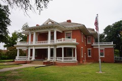 Frank Kell Houselisted 1978
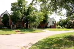 Morningside Historic Districtlisted 1985
 Joe and Lois Perkins Houselisted 2015
 Wichita Falls Route Buildinglisted 1978
- American Trust Building-Holiday Innlisted 2022
- Bailey-Moline-Filgo Buildinglisted 2020
- First Wichita National Banklisted 2023
- W.A. Freear Furniture Company-Maskat Shrine Temple Buildinglisted 2018
- Indiana Avenue Historic Districtlisted 2023
Population over time
2 figuresWichita Falls fell from 104,553 to 102,316 between 2010 and 2020. These are the recorded population figures Wikidata holds for this place, reached through the Geographic Names Information System number this page is keyed on rather than by name, so they belong to this place and not to another of the same name. Most are census counts, but not all are: an early figure may be a founding or settlement estimate, and an estimate published within five years of a census is left out. The change column is computed, and is left blank where more than 20 years separate a figure from the one before it, because a gap that long is not a change between two counts.
| Year | People | Change |
|---|---|---|
| 2010 | 104,553 | |
| 2020 | 102,316 | -2,237 (-2%) |
Topographic sheets covering this place
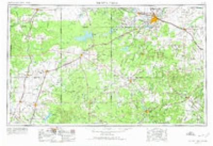
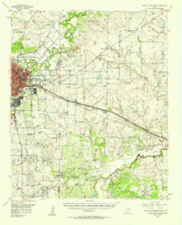
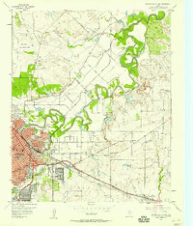
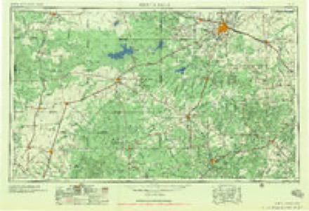
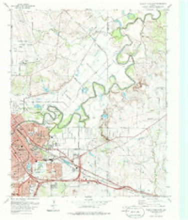
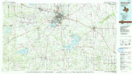
6 surveys from 10 printed sheetsMatched by testing this settlement's coordinate against the published boundary of every sheet in the United States Geological Survey's historical collection. Each opens the scanned sheet at the Survey.
- 1954 USGS Wichita Falls quadrangle1:250000, 3 printings
- 1957 USGS Wichita Falls East quadrangle1:62500
- 1957 USGS Wichita Falls East quadrangle1:24000
- 1958 USGS Wichita Falls quadrangle1:250000
- 1972 USGS Wichita Falls East quadrangle1:24000, 2 printings
- 1985 USGS Wichita Falls quadrangle1:100000, 2 printings
Fires near this place
440 since 2005Regional context, not property-specific evidence. The federal wildfire occurrence database lists 440 fires within 5 miles of Wichita Falls between 2005 and 2020, burning about 5,720 acres in total. 1 started naturally. 17 were recorded as arson. Distance is straight-line from the map coordinates, so a fire counted here may appear on a neighbouring settlement's page as well.
| Reported cause | Fires |
|---|---|
| Missing data/not specified/undetermined | 241 |
| Debris and open burning | 101 |
| Power generation/transmission/distribution | 23 |
| Equipment and vehicle use | 22 |
| Smoking | 21 |
| Arson/incendiarism | 17 |
| Misuse of fire by a minor | 6 |
| Recreation and ceremony | 4 |
| Railroad operations and maintenance | 2 |
| Natural | 1 |
| Other causes | 1 |
| Fireworks | 1 |
The most recent of them, most recent first, with the day each was reported and the service that recorded it.
| Date | Cause | Size | Reported by | Name on the report |
|---|---|---|---|---|
| 9 September 2012 | Missing data/not specified/undetermined | under an acre | Texas A & M Forest Service | 401 MLK |
| 8 September 2012 | Missing data/not specified/undetermined | under an acre | Texas A & M Forest Service | 1908 WILSON |
| 7 September 2008 | Equipment and vehicle use | 10 acres | Texas A & M Forest Service | not named |
| 26 September 2013 | Smoking | under an acre | Texas A & M Forest Service | CENTRAL FWY @ BACON SWITCH |
| 24 September 2012 | Power generation/transmission/distribution | under an acre | Texas A & M Forest Service | 3011 CUMBERLAND |
| 22 September 2015 | Debris and open burning | 1.0 acres | Texas A & M Forest Service | SUE LANE GRASS FIRE |
| 18 September 2013 | Missing data/not specified/undetermined | under an acre | Texas A & M Forest Service | 1613 POLK |
| 13 September 2013 | Natural | under an acre | Texas A & M Forest Service | 2700 TAFT |
Settlements close enough to share some of these fires:
Storms near this place
60 of 305 shownRegional context, not property-specific evidence. The National Weather Service names Wichita Falls in 305 storm reports between 1993 and 2026: 188 hail, 92 thunderstorm wind, 11 flash flood, 7 lightning. The reports record 2 injuries. Each account below is quoted exactly as the forecast office filed it, from the NOAA Storm Events Database, and each date opens the federal record of that event.
| When | Event | Place named | Harm | What the report says |
|---|---|---|---|---|
| July 2000 | Wildfire | Wichita Falls | 2 hurt, $40,000 | A wildfire developed just outside the city limits of Wichita Falls on the east side near Harding Street, and started when a resident in the area began to burn trash in his back yard. The dry conditions and strong winds allowed the fire to spread rapidly northward up a hill toward Mesa Street. Dozens of acres of pasture burned, along with 13, old, unoccupied homes, outbuildings, sheds, and 2 vehicles. Several hours were required to gain control of the fire which received assistance from 14 volunteer fire departments. Two firefighters sufferred heat stroke and were taken to a local hospital for treatment. |
| March 2004 | Thunderstorm Wind | Wichita Falls | $750,000 | Roof and structural damage was reported on the west side of the city, with three homes destroyed. Many power poles and lines were downed. Many trees were also uprooted and snapped. A semi hauling an empty trailer was also overturned on the southbound overhead freeway near Holliday Road. The roof of a portable classroom at Rider High School was ripped off. Fowler Elementary also lost a corner of its roof. |
| June 1996 | Lightning | Wichita Falls | $750,000 | no account filed |
| May 2000 | Hail | Wichita Falls | $600,000 | no account filed |
| June 2004 | Thunderstorm Wind | Wichita Falls | $250,000 | A damage path about 60 yards wide was reported in the area of the Kickapoo Airpark on the south side of the city. Six hangars were destroyed at the airport. These hangars were made of sheet metal and were old. Two aircraft were also damaged. Several power poles were downed with a few pulled out of the ground. |
| May 2000 | Hail | Wichita Falls | $250,000 | no account filed |
| April 2001 | Tornado (F1) | Wichita Falls | $150,000 | This tornado developed on the south side of Wichita Falls, a short distance from Lake Wichita. Most of the damage was minor, consisting of downed trees, fences and signs, however near the junction of US Highway 281 and US Highway 287, a machine shop composed of sheet metal sustained significant damage to the walls and frame when the roof was pushed upward, allowing the walls to cave in slightly. Also nearby, about 10 utility poles were snapped near the top with debris falling on fences and other sheet metal buildings. The maximum F-scale rating is F1, however most damage was rated F0. |
| May 1997 | Flash Flood | Wichita Falls | $150,000 | Portions of Wichita Falls received up to 5 inches of rain in less than one hour, resulting in widespread flash flooding throughout the city. As many as 100 homes in the Faith Village area and off of Jacksboro Highway in south Wichita Falls reported some sort of flooding. Numerous roads in and around Wichita Falls were closed due to high water, some for over 12 hours. With water up to 6 feet deep, several cars became stranded and were washed away. In one instance an ambulance on its way to rescue a wheelchair-confined man from his flooding house stalled in water that rose to the depth of the ambulance's windshield. (The handicapped man was helped safely from his house by his neighbors.) |
| August 2023 | Thunderstorm Wind | Wichita Falls | $100,000 | Numerous images/videos showing significant damage to a strip mall. This included full roof removal of a large section of the building, causing interior walls to collapse. A large educational building across the street from this location also had significant roof damage, including a portion of its roof removed. Time is radar estimated. |
| July 1997 | Lightning | Wichita Falls | $75,000 | Ligtning struck and set fire to a house, completely destroying the home and its contents. |
| April 1999 | Flash Flood | Wichita Falls | $60,000 | High water from heavy rain flooded several homes at the corner of Stevens and Featherston Avenues. Several people had to be rescued by boat. |
| August 2023 | Thunderstorm Wind | Wichita Falls | $50,000 | The corner of an apartment building had its roof removed and partial wall collapse of second floor unit. Time is radar estimated. |
| July 1995 | Thunderstorm Wind | Wichita Falls | $50,000 | Severe thunderstorms produced damaging winds across Wichita and northern Clay Counties during the evening of the 20th. At Sheppard Air Force Base (SPS) in Wichita County, wind gusts reached as high as 106 mph, and a single-engine aircraft that had been tied down was flipped over. Almost one hour later, wind speeds in Wichita Falls were measured at 61 to 78 mph at a local TV station. Damage in Wichita Falls from the evening's storms included eight inch branches down, outbuildings damaged, shingles blown off houses, a tree felled onto a car, and heavy metal awnings blown over. In Clay County in Charlie, winds up to 65 mph knocked out power to Charlie and Dean. |
| May 1995 | Thunderstorm Wind | Wichita Falls | $50,000 | no account filed |
| July 2000 | Thunderstorm Wind | Wichita Falls | $42,000 | Significant damage was sustained to the roof of City View High School, and a large tree was uprooted, falling on a gazebo. |
| August 2023 | Thunderstorm Wind | Wichita Falls | $40,000 | Relayed image showing a large (500-foot tall) radio tower collapsed. Time is radar estimated. |
| August 1998 | Thunderstorm Wind | Wichita Falls | $30,000 | no account filed |
| July 1997 | Lightning | Wichita Falls | $25,000 | According to witnesses, lightning struck an antenna on a house, sending a fireball into the air which landed on a nearby apartment and set the apartment building on fire. |
| June 2007 | Thunderstorm Wind | Wichita Falls | $20,000 | Several power lines and large trees were downed throughout town. A roof was blown off a mobile home on the north side of town. Monetary damages were estimated. |
| June 1997 | Thunderstorm Wind | Wichita Falls | $20,000 | Severe thunderstorm winds moved through the Wichita Falls area, downing trees, limbs, and power poles. One tree near a house fell onto a power line, causing an electrical surge that set the kitchen of the house on fire. A furniture warehouse was also destroyed when severe winds tore the back wall and roof off of the building. At Sheppard Air Force Base, winds up to 70 mph tore countless limbs from trees and knocked out windows on some base housing units. |
| September 2007 | Thunderstorm Wind | Wichita Falls | $16,000 | Six power poles were blown down by an apparent microburst just west of intersection of FM 171 road and Rogers Lane. Monetary damages were estimated. |
| August 2003 | Thunderstorm Wind | Wichita Falls | $15,000 | Power poles were downed in the northwest portion of town. The steel roof of a business was peeled back. An air conditioning unit was also blown off the roof of an auto shop where it fell on top of a car, damaging the windshield and denting the hood. Some minor roof damage to some buildings was also reported. |
| April 2001 | Thunderstorm Wind | Wichita Falls | $15,000 | Straight-line winds blew a carport off a house, which then struck a nearby house, causing a portion of the roof to rip off. |
| August 1998 | Thunderstorm Wind | Wichita Falls | $15,000 | no account filed |
| March 2000 | Thunderstorm Wind | Wichita Falls | $12,000 | The roof of a gas station and electrical equipment inside the store were damaged. |
| August 2023 | Thunderstorm Wind | Wichita Falls | $10,000 | Relayed image showing large garage doors of a metal building blown inward. Time is radar estimated. |
| August 2023 | Thunderstorm Wind | Wichita Falls | $10,000 | Overturned semi-trailer on Interstate 44 near Old Iowa Park road. Time is radar estimated. |
| August 2023 | Thunderstorm Wind | Wichita Falls | $10,000 | Power poles blown down on Old Iowa Park Road between Loop 11 and Central Freeway. Time is radar estimated. |
| May 2005 | Hail | Wichita Falls | $10,000 | Hail caused damage on the southeast side of the city to automobile windshields and a few broken windows in homes. |
| August 2005 | Thunderstorm Wind | Wichita Falls | $10,000 | Damage occurred on the south side of the city around the Kickapoo Airport. Roofs and hanger doors were damaged at the airport. A residential garage was also damaged within a mile of the airport. |
| June 1999 | Flash Flood | Wichita Falls | $10,000 | no account filed |
| August 1998 | Flash Flood | Wichita Falls | $6,000 | no account filed |
| May 2023 | Thunderstorm Wind | Wichita Falls | $5,000 | Canopy blown down at Clinics of North Texas building. Time estimated via radar. |
| April 2016 | Thunderstorm Wind | Wichita Falls | $5,000 | Winds blew over a 12-inch diameter tree and snapped 10 power poles. |
| June 2014 | Thunderstorm Wind | Wichita Falls | $5,000 | Measured at Kickapoo airport. Several trees downed in Wichita Falls. |
| June 2004 | Thunderstorm Wind | Wichita Falls | $5,000 | Power lines were reported down. |
| May 2001 | Thunderstorm Wind | Wichita Falls | $5,000 | Windows were blown out of buildings in downtown. |
| May 1994 | Thunderstorm Wind | Wichita Falls | $5,000 | no account filed |
| February 1994 | Thunderstorm Wind | Wichita Falls | $5,000 | no account filed |
| December 2004 | Thunderstorm Wind | Wichita Falls | $3,500 | Power poles were downed at Southwest Parkway and Kemp Boulevard. |
| May 2015 | Thunderstorm Wind | Wichita Falls | $3,000 | Power lines down at Holiday and Jacksboro intersection. |
| May 2010 | Thunderstorm Wind | Wichita Falls | $3,000 | Several large tree limbs were downed by the high winds. Monetary damages were estimated. |
| August 2020 | Thunderstorm Wind | Wichita Falls | $2,000 | Eight inch tree fell on house on Wyoming St. |
| December 2018 | Thunderstorm Wind | Wichita Falls | $2,000 | Roof blown off of a small extension on the west side of a building near KFDX studio. |
| June 2014 | Thunderstorm Wind | Wichita Falls | $2,000 | Large tree reported down at Sondra Drive off Callfield. Reported via KFDX. |
| September 1999 | Lightning | Wichita Falls | $2,000 | Lightning struck a large distribution transformer knocking out power for a short period of time. |
| June 1996 | Thunderstorm Wind | Wichita Falls | $1,500 | no account filed |
| April 2016 | Thunderstorm Wind | Wichita Falls | $1,000 | Gas station sign was destroyed. |
| September 2010 | Thunderstorm Wind | Wichita Falls | $1,000 | The wind gust was reported near the intersection of US Highway 287 and Loop 11. Small tree limbs, mostly less than 2 inches in diameter, were downed around town. Monetary damages were estimated. |
| May 2007 | Lightning | Wichita Falls | $1,000 | A large tree was downed by a lightning strike. The tree was located at Elmwood Avenue near Maplewood Avenue. Monetary damages were estimated. |
| June 1998 | Lightning | Wichita Falls | $1,000 | Lightning struck a house, setting fire to the attic. The fire was contained and damage was estimated at $1,000. |
| May 1997 | Thunderstorm Wind | Wichita Falls | $1,000 | Winds of around 70 mph downed small trees and destroyed part of the fence at the stadium sports complex on the southwest side of town. |
| May 1997 | Thunderstorm Wind | Wichita Falls | $500 | A small metal shed was blown about 75 feet and limbs were blown down. |
| May 2001 | Lightning | Wichita Falls | $300 | Lightning struck a shed in the 5110 block of Bahama causing a large fire. |
| May 2000 | Thunderstorm Wind | Wichita Falls | $200 | Trees were downed. |
| April 2026 | Hail | Wichita Falls | - | The location is approximate. |
| April 2026 | Hail | Wichita Falls | - | The report was relayed through mPING. |
| April 2026 | Hail | Wichita Falls | - | The report was relayed through mPING. |
| April 2026 | Hail | Wichita Falls | - | The report was relayed through mPING. |
| April 2026 | Hail | Wichita Falls | - | The location is approximate. |
Nearest settlements
The eight closest, with where each one stands in the county. Distances are straight-line, computed from the Geographic Names Information System coordinates.
| Map | Place | Distance | Sheets |
|---|---|---|---|
| Pleasant Valley | 5.4 miles | 9 | |
| Bacon | 6.2 miles | 9 | |
| Allendale | 6.6 miles | 10 | |
| Cashion Community | 8.4 miles | 15 | |
| Iowa Park | 9.6 miles | 11 | |
| Burkburnett | 13.3 miles | 15 | |
| Valley View | 14.6 miles | 7 | |
| Thrift | 16.2 miles | 9 |
Elsewhere
Matched on this settlement's Geographic Names Information System number rather than its name, so it cannot be a different place of the same name in another state.
| Wikipedia article on Wichita Falls | An encyclopaedic summary. Its text is share-alike, so it is linked here rather than copied. |
| Wikidata item Q128349 | The structured record the population and elevation above come from. Public domain (CC0). |
Provenance
This settlement is recorded in the Geographic Names Information System as feature 1376776. The sheet list is computed by point-in-boundary test against the United States Geological Survey's historical topographic inventory. Both are works of the United States government and carry no copyright under 17 U.S.C. 105.
Wildfire. Short, Karen C. 2022. Spatial wildfire occurrence data for the United States, 1992-2020 [FPA_FOD_20221014]. 6th Edition. Fort Collins, CO: Forest Service Research Data Archive. https://doi.org/10.2737/RDS-2013-0009.6 Collected with United States Government funding and usable without additional permissions or fees.
Storms. NOAA National Centers for Environmental Information, Storm Events Database https://www.ncei.noaa.gov/stormevents/ A work of the United States government, no copyright under 17 U.S.C. 105. Narratives are quoted verbatim from the National Weather Service report and are not edited or summarised.