 Block
BlockCanadian, Texas
5 topographic sheets cover this place, the earliest surveyed in 1954 and the latest in 1982. It stands in the Canadian North census division. It lies in ZIP code area 79014. It stands on Red Deer Creek. The Survey maps it on the Canadian West quadrangle. 2,339 people lived here at the 2020 count. It stands 2,425 feet above sea level.
Research this city
Population over time
2 figuresCanadian fell from 2,649 to 2,339 between 2010 and 2020. These are the recorded population figures Wikidata holds for this place, reached through the Geographic Names Information System number this page is keyed on rather than by name, so they belong to this place and not to another of the same name. Most are census counts, but not all are: an early figure may be a founding or settlement estimate, and an estimate published within five years of a census is left out. The change column is computed, and is left blank where more than 20 years separate a figure from the one before it, because a gap that long is not a change between two counts.
| Year | People | Change |
|---|---|---|
| 2010 | 2,649 | |
| 2020 | 2,339 | -310 (-12%) |
Topographic sheets covering this place
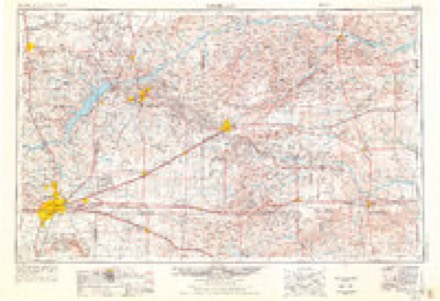
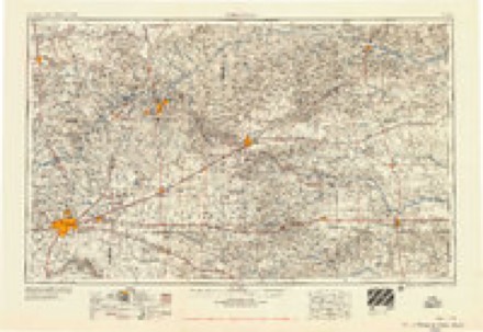
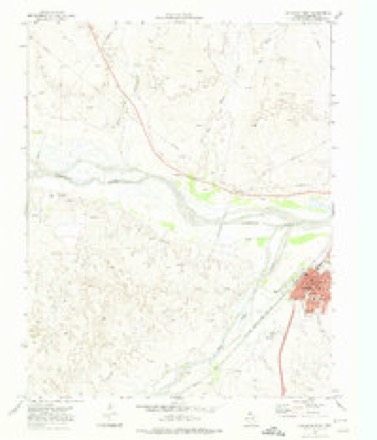
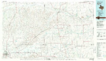
4 surveys from 5 printed sheetsMatched by testing this settlement's coordinate against the published boundary of every sheet in the United States Geological Survey's historical collection. Each opens the scanned sheet at the Survey.
- 1954 USGS Amarillo quadrangle1:250000, 2 printings
- 1958 USGS Amarillo quadrangle1:250000
- 1972 USGS Canadian West quadrangle1:24000
- 1982 USGS Pampa quadrangle1:100000
Fires near this place
48 since 2006Regional context, not property-specific evidence. The federal wildfire occurrence database lists 48 fires within 5 miles of Canadian between 2006 and 2017, burning about 2,261 acres in total. 5 started naturally. None was recorded as arson. Distance is straight-line from the map coordinates, so a fire counted here may appear on a neighbouring settlement's page as well.
| Reported cause | Fires |
|---|---|
| Equipment and vehicle use | 24 |
| Debris and open burning | 8 |
| Power generation/transmission/distribution | 5 |
| Natural | 5 |
| Missing data/not specified/undetermined | 4 |
| Railroad operations and maintenance | 2 |
The most recent of them, most recent first, with the day each was reported and the service that recorded it.
| Date | Cause | Size | Reported by | Name on the report |
|---|---|---|---|---|
| 13 September 2007 | Equipment and vehicle use | 1.0 acres | Texas A & M Forest Service | not named |
| 4 August 2010 | Power generation/transmission/distribution | 1.0 acres | Texas A & M Forest Service | GENE HOWE |
| 25 August 2011 | Equipment and vehicle use | 2.0 acres | Texas A & M Forest Service | EAGLE ROCK JARVIS |
| 25 August 2009 | Equipment and vehicle use | 1.0 acres | Texas A & M Forest Service | EXHIBITION ROAD & US 60 |
| 23 August 2006 | Equipment and vehicle use | 1.0 acres | Texas A & M Forest Service | not named |
| 21 August 2010 | Equipment and vehicle use | 15 acres | Texas A & M Forest Service | MICHEAL BENTLY |
| 16 August 2009 | Debris and open burning | 1.0 acres | Texas A & M Forest Service | ISAACS RACH RECALL TREES |
| 14 August 2009 | Railroad operations and maintenance | 4.0 acres | Texas A & M Forest Service | ISAACS RANCH RAIL ROAD |
Settlements close enough to share some of these fires:
Storms near this place
60 of 191 shownRegional context, not property-specific evidence. The National Weather Service names Canadian in 191 storm reports between 1993 and 2025: 123 hail, 55 thunderstorm wind, 6 flash flood, 4 tornado. The reports record 3 deaths and 9 injuries. Each account below is quoted exactly as the forecast office filed it, from the NOAA Storm Events Database, and each date opens the federal record of that event.
| When | Event | Place named | Harm | What the report says |
|---|---|---|---|---|
| June 2014 | Flood | Canadian | 2 killed | Reports state two female horseback riders (one 24 years old the other 6 years old) traveling along the banks went missing prior to noon on Monday June 23rd. By 7 PM that day, search and rescue crews located the still saddled horse the females were last seen riding downstream of the US 60 bridge spanning the Canadian River. Roughly 15 minutes later the remains of the 6 year old were recovered. The remains of the 24 year old female were recovered 5 days later 2 miles downstream from the US 60 bridge. Preliminary autopsy results showed the cause of death to be drowning. |
| March 2007 | Tornado (EF3) | Canadian | 1 killed, 1 hurt, $3,000,000 | The tornado developed in southwestern Hemphill County approximately sixteen miles south southwest of Canadian. The tornado moved north northwest at twenty miles an hour and encountered an area of active oil drilling rigs. The tornado hit two drilling rigs. An employee of the first drilling rig that was hit was residing in a single-wide mobile home that was anchored into the ground. The mobile home was destroyed and displaced one hundred yards from its original location and the employee was thrown approximately fifty yards. A semi trailer used for storage was blown over. A structure used to lift the oil-well casing onto the oil derrick was also blown down and severely damaged. The tornado rolled a railroad boxcar one hundred and fifty yards. A series of power poles along County Road W covering a distance of zero point six miles was also blown down.|A second oil drilling rig and production facility were hit by the tornado where another unoccupied and anchored single-wide mobile home was rolled over. Nearby...two goose neck fifth-wheel camper trailers were parked...both unanchored with one occupied. This person was critically injured and later died from his injuries. The camper trailer that was occupied rolled forty-five yards to the northeast while a second unoccupied trailer was blown thirty yards before coming to rest on an oilfield production unit.|By 2041 CST...the tornado was crossing U.S. Highway 60...resulting in severe tree damage. Texas Department of Transportation officials...using light tree damage as an indicator...measured a damage width of zero point eight miles along U.S. Highway 60. At the center of this swath were numerous hardwood trees with trunks that had been broken off halfway up the tree. On the periphery of this area was a home located thirteen miles south southwest of Canadian that suffered only minor damage due to trees falling on the home. Many large trees were snapped twenty feet in the air. A second well built home suffered severe damage to the roof structure. The majority of the steel roofing structure was completely removed and six feet of brick chimney toppled onto the house. Several cedar beams were removed from the roof structure as well as several rafters despite being tied down by hurricane clips. Additionally...a steel feed bunk containing twenty six thousand pounds of feed was turned over on its side.|At 2045 CST...a Burlington Northern Santa Fe train was derailed with over fifty cars blown over. The tornado dissipated around 2055 CST. |
| August 2006 | Thunderstorm Wind | Canadian | 4 hurt, $32,000 | no account filed |
| May 1998 | Thunderstorm Wind | Canadian | 3 hurt, $25,000 | An unofficial report from the public of 91 knot winds in the Gem community of Hemphill county about 15 miles southeast of Canadian as reported in the Canadian newspaper. There was tree damage reported in the county. |
| June 1997 | Flash Flood | Canadian | 1 hurt | Van and truck washed off road after hitting 3 feet of water at junction of Highways 83 and 60. One female injured. |
| August 1993 | Thunderstorm Wind | Canadian | $500,000 | no account filed |
| June 2003 | Thunderstorm Wind | Canadian | $250,000 | Tractor trailer rig was overturned and totaled by the strong winds. |
| June 2003 | Flash Flood | Canadian | $125,000 | Numerous reports of street flooding in the city of Canadian along with three homes flooded. No injuries were reported from the flash flooding. |
| June 2008 | Thunderstorm Wind | Canadian | $120,000 | Law enforcement officials reported that two barns were destroyed by the thunderstorm wind gusts. |
| May 2002 | Thunderstorm Wind | Canadian | $45,000 | Barns were destroyed by the high winds and a cattle trailer was blown over. Also...part of an abandoned home had been destroyed along with some metal pipes and horse trough-type things had been twisted and scattered. One had been blown up U.S. Highway 83 about two hundred yards and to the west of the highway. A couple of fairly large trees on the west side of the highway were blown down. |
| August 2008 | Thunderstorm Wind | Canadian | $22,000 | A National Weather Service Cooperative Observer reported that shingles were torn from roofs and also that tree limbs of three to four inches in diameter were blown down. |
| June 2002 | Thunderstorm Wind | Canadian | $15,000 | Numerous trees and powerlines were reported down. |
| May 2001 | Thunderstorm Wind | Canadian | $15,000 | Trees and power poles were reported blown down. |
| November 2024 | Flood | Canadian | $8,000 | Marshall Drive (County Road P) was closed due to part of the road being washed out one mile east of where the pavement section of the road ends. Road P was washed out at Elk Creek. The flood was likely 200 feet wide where the road crosses Elk Creek. |
| May 2002 | Thunderstorm Wind | Canadian | $8,000 | Numerous trees and powerlines were reported down. |
| May 2002 | Thunderstorm Wind | Canadian | $8,000 | Numerous trees and powerlines were reported down. |
| March 2021 | Flash Flood | Canadian | $5,000 | Twitter picture of a car halfway under water. |
| April 2025 | Hail | Canadian | $2,000 | Hail fell across Canadian with penny size hail in town and ping pong ball size hail about two miles southeast of Canadian. |
| March 2021 | Thunderstorm Wind | Canadian | - | Downed power lines have forced the closure | of US HWY 83 at the intersection of | US HWY 60 and US HWY 83. |
| May 2020 | Hail | Canadian | - | Nickel to quarter size hail fell in Canadian. This public report was relayed by broadcast media. The time is estimated from radar. |
| May 2020 | Hail | Canadian | - | Nickle size hail was reported 1 mile south-southeast of Canadian. |
| April 2020 | Hail | Canadian | - | A trained spotter and storm chaser reported one inch hail just south of Canadian. |
| April 2020 | Hail | Canadian | - | A trained spotter 7 miles south-southwest of Lake Marvin reported quarter size hail. |
| April 2020 | Hail | Canadian | - | Quarter sized hail was observed 10 miles east-northeast of Lora. |
| June 2020 | Hail | Canadian | - | Quarter size hail lasted a few minutes around 2 miles south-southwest of Canadian. |
| November 2020 | Hail | Canadian | - | Accumulating hail up to an inch or two deep was reported, with the largest size being one inch in diameter. |
| July 2019 | Hail | Canadian | - | Social media report of 1 hail in Canadian. Report relayed by local media. |
| June 2018 | Thunderstorm Wind | Canadian | - | Canadian West Texas Mesonet reported wind gust. |
| May 2018 | Hail | Canadian | - | Pea to quarter sized hail. |
| May 2018 | Hail | Canadian | - | Mostly pea to quarter size. Found one stone that was the size of a ping pong ball. |
| May 2018 | Hail | Canadian | - | Mostly nickel size hail with a few quarters at the Canadian Golf Course. |
| May 2018 | Flood | Canadian | - | Water has filled the bar ditches and is flowing over the road about 1 to 2 inches. |
| May 2017 | Hail | Canadian | - | Pea to nickel size hail. |
| June 2017 | Hail | Canadian | - | Tennis ball sized hail reported at 555 PM. |
| June 2017 | Hail | Canadian | - | Quarter sized hail reported east of Canadian. |
| July 2017 | Thunderstorm Wind | Canadian | - | Thunderstorm wind gust up to 60 MPH. |
| July 2017 | Thunderstorm Wind | Canadian | - | Thunderstorm wind gust measured up to 62 MPH with storm. |
| May 2016 | Thunderstorm Wind | Canadian | - | Trees were reported down in Canadian. |
| May 2016 | Hail | Canadian | - | Quarter size hail fell 6 miles north of Canadian. |
| May 2016 | Tornado (EF0) | Canadian | - | A narrow tornado track of tree damage was found by the survey team. The tornado was reported by several chasers and spotters. Tree damage was consistent with EF-0 damage and estimated peak wind of 75 mph. |
| May 2016 | Thunderstorm Wind | Canadian | - | The West Texas Mesonet site located 6 miles east of Canadian measured a 74 mph wind gust. |
| August 2016 | Thunderstorm Wind | Canadian | - | Trees blown down. |
| June 2015 | Thunderstorm Wind | Canadian | - | The automated weather observing station at the Canadian airport measured a wind gust of 60 mph. |
| June 2015 | Thunderstorm Wind | Canadian | - | The West Texas Mesonet site located 6 miles east of Canadian measured a wind gust of 77 mph. |
| May 2015 | Hail | Canadian | - | Trained spotters reported golf ball size hail 5 miles west-southwest of Glazier. The hail started as quarter size and then became larger. |
| May 2015 | Flash Flood | Canadian | - | Heavy rain from slow moving thunderstorms caused flooding on Highway 83 near Big Timber Creek. Two feet of water was reported across the highway by Law Enforcement. Highway 83 approximately 6 miles north of Canadian was closed due to the flash flooding. |
| June 2014 | Thunderstorm Wind | Canadian | - | A cluster of thunderstorms moved out of the Oklahoma Panhandle and into the Texas Panhandle during the evening hours of the 30th. As this cluster of thunderstorms moved near the town of Canadian (Hemphill County), a local law enforcement officer reported that an estimated 64 mph downburst downed trees which are blocking Highway 33 between County Roads 17 and 18 (Hemphill County). After producing this downburst the cluster of thunderstorms continued to move to the southeast. |
| June 2014 | Thunderstorm Wind | Canadian | - | A cluster of thunderstorms moved out of the Oklahoma Panhandle and into the Texas Panhandle during the evening hours of the 30th. As this cluster of thunderstorms moved near the town of Canadian (Hemphill County), the West Texas Mesonet site 6 miles east of Canadian (Hemphill County) reported a 64 mph downburst gust. After producing this downburst the cluster of thunderstorms continued to move to the southeast. |
| June 2014 | Thunderstorm Wind | Canadian | - | A cluster of thunderstorms moved out of the Oklahoma Panhandle and into the Texas Panhandle during the evening hours of the 30th. As this cluster of thunderstorms moved near the town of Canadian (Hemphill County), a local law enforcement officer reported that an estimated 64 mph downburst downed powerlines at the intersection of 3rd Street and Elsie Ave (Hemphill County). After producing this downburst the cluster of thunderstorms continued to move to the southeast. |
| June 2014 | Hail | Canadian | - | A slow moving supercell moved out of the Oklahoma Panhandle and into the northeastern Texas Panhandle during the evening hours of the 22nd. As the supercell moved over the town of Canadian (Hemphill County), the local fire department reported quarter size hail (1.00 inch) in town. After producing this hail the supercell continue it's slow track southward across the eastern Texas Panhandle. |
| June 2014 | Thunderstorm Wind | Canadian | - | A cluster of discrete thunderstorms moving across the Texas Panhandle transitioned into a broken linear structure during the late evening hours of the 6th. As this broken line of storms moved over the town of Canadian (Hemphill County), a storm chaser estimated a 60 mph downburst gusts in town. After producing this gust the line of thunderstorms continued moving eastward across the Panhandle. |
| June 2014 | Thunderstorm Wind | Canadian | - | A cluster of discrete thunderstorms moving across the Texas Panhandle transitioned into a broken linear structure during the late evening hours of the 6th. As this broken line of storms where near the town of Canadian (Hemphill County), the West Texas Mesonet site 6 miles east of Canadian (Hemphill County) reported a 73 mph downburst gust. After producing this gust the line of thunderstorms continued moving eastward across the Panhandle. |
| June 2014 | Hail | Canadian | - | A slow moving supercell moved out of the Oklahoma Panhandle and into the northeastern Texas Panhandle during the evening hours of the 22nd. As the supercell moved over the town of Canadian (Hemphill County), the fire department reported quarter size hail (1.00 inch) in town. After producing this hail the supercell continue it's slow track southward across the eastern Texas Panhandle. |
| May 2013 | Thunderstorm Wind | Canadian | - | The West Texas Mesonet site 6 miles east of Canadian measured a 63 mph gust as a squall line moved toward Canadian. |
| June 2013 | Thunderstorm Wind | Canadian | - | A cluster of thunderstorms developed along a stalling cold front during the evening hours of the 8th. This cluster of thunderstorms moved to the south across the northern Texas Panhandle. A trained storm spotter 5 miles west-southwest of Glazier (Hemphill County) reported a 70 mph downburst. The storm that produced this downburst continued moving to the south across the county. |
| April 2008 | Hail | Canadian | - | Three quarter inch hail was reported at the Canadian River Bridge on U.S. Highway 83. |
| March 2007 | Hail | Canadian | - | Roads reportedly covered in large hail at the intersection of U.S. Highway 83 and U.S. Highway 60. |
| July 2004 | Hail | Canadian | - | Reported three miles northeast of Gem City. |
| July 2004 | Hail | Canadian | - | Reported two miles east of Gem City. |
| May 2002 | Tornado (F0) | Canadian | - | The tornado remained over open country and no damage or injuries were reported. The tornado path length and width were estimated. |
Nearest settlements
The eight closest, with where each one stands in the county. Distances are straight-line, computed from the Geographic Names Information System coordinates.
| Map | Place | Distance | Sheets |
|---|---|---|---|
| Clear Creek | 3.5 miles | 5 | |
| Glazier | 9.3 miles | 6 | |
| Mendota | 9.8 miles | 5 | |
| Springers Ranch (historical) | 10.5 miles | 6 | |
| Gem | 16.3 miles | 5 | |
| Dreyfoos | 18.8 miles | 5 |
Elsewhere
Matched on this settlement's Geographic Names Information System number rather than its name, so it cannot be a different place of the same name in another state.
| Wikipedia article on Canadian | An encyclopaedic summary. Its text is share-alike, so it is linked here rather than copied. |
| Wikidata item Q970397 | The structured record the population and elevation above come from. Public domain (CC0). |
Provenance
This settlement is recorded in the Geographic Names Information System as feature 1372905. The sheet list is computed by point-in-boundary test against the United States Geological Survey's historical topographic inventory. Both are works of the United States government and carry no copyright under 17 U.S.C. 105.
Wildfire. Short, Karen C. 2022. Spatial wildfire occurrence data for the United States, 1992-2020 [FPA_FOD_20221014]. 6th Edition. Fort Collins, CO: Forest Service Research Data Archive. https://doi.org/10.2737/RDS-2013-0009.6 Collected with United States Government funding and usable without additional permissions or fees.
Storms. NOAA National Centers for Environmental Information, Storm Events Database https://www.ncei.noaa.gov/stormevents/ A work of the United States government, no copyright under 17 U.S.C. 105. Narratives are quoted verbatim from the National Weather Service report and are not edited or summarised.