 Block
BlockCarlsbad, Texas
9 topographic sheets cover this place, the earliest surveyed in 1954 and the latest in 1986. It stands in the West Tom Green census division. It lies in ZIP code area 76934. It stands on Sulpher Draw. The Survey maps it on the Carlsbad quadrangle. 622 people lived here at the 2020 count. It stands 2,024 feet above sea level.
Population over time
2 figuresCarlsbad fell from 719 to 622 between 2010 and 2020. These are the recorded population figures Wikidata holds for this place, reached through the Geographic Names Information System number this page is keyed on rather than by name, so they belong to this place and not to another of the same name. Most are census counts, but not all are: an early figure may be a founding or settlement estimate, and an estimate published within five years of a census is left out. The change column is computed, and is left blank where more than 20 years separate a figure from the one before it, because a gap that long is not a change between two counts.
| Year | People | Change |
|---|---|---|
| 2010 | 719 | |
| 2020 | 622 | -97 (-13%) |
Topographic sheets covering this place
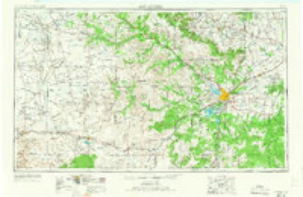
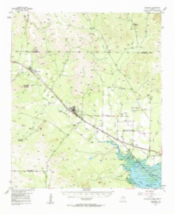
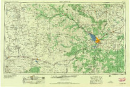
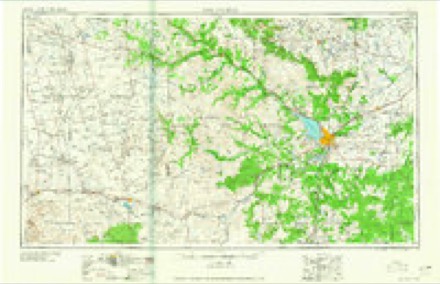
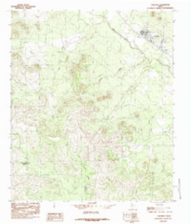
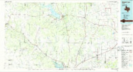
6 surveys from 9 printed sheetsMatched by testing this settlement's coordinate against the published boundary of every sheet in the United States Geological Survey's historical collection. Each opens the scanned sheet at the Survey.
- 1954 USGS San Angelo quadrangle1:250000, 2 printings
- 1957 USGS Carlsbad quadrangle1:62500, 2 printings
- 1958 USGS San Angelo quadrangle1:250000
- 1965 USGS San Angelo quadrangle1:250000
- 1984 USGS Carlsbad quadrangle1:24000
- 1986 USGS Robert Lee quadrangle1:100000, 2 printings
Fires near this place
80 since 2005Regional context, not property-specific evidence. The federal wildfire occurrence database lists 80 fires within 5 miles of Carlsbad between 2005 and 2020, burning about 1,482 acres in total. None started naturally. None was recorded as arson. Distance is straight-line from the map coordinates, so a fire counted here may appear on a neighbouring settlement's page as well.
| Reported cause | Fires |
|---|---|
| Debris and open burning | 41 |
| Missing data/not specified/undetermined | 18 |
| Equipment and vehicle use | 11 |
| Power generation/transmission/distribution | 5 |
| Smoking | 3 |
| Misuse of fire by a minor | 1 |
| Recreation and ceremony | 1 |
The most recent of them, most recent first, with the day each was reported and the service that recorded it.
| Date | Cause | Size | Reported by | Name on the report |
|---|---|---|---|---|
| 3 September 2009 | Debris and open burning | under an acre | Texas A & M Forest Service | 14TH & LLANO |
| 11 September 2019 | Missing data/not specified/undetermined | 1.0 acres | Texas A & M Forest Service | GRASS FIRE |
| 9 August 2011 | Debris and open burning | 1.0 acres | Texas A & M Forest Service | BURMA W CARLSBAD LOOP FIRE |
| 8 August 2009 | Equipment and vehicle use | 1.0 acres | Texas A & M Forest Service | 10539 GLASS CT. |
| 26 August 2009 | Debris and open burning | under an acre | Texas A & M Forest Service | 9500 N. US HWY 87 |
| 25 August 2019 | Missing data/not specified/undetermined | 1.0 acres | Texas A & M Forest Service | GRASS FIRE |
| 23 August 2010 | Missing data/not specified/undetermined | under an acre | Texas A & M Forest Service | 9140 PARADISE LN. |
| 19 August 2011 | Debris and open burning | 1.0 acres | Texas A & M Forest Service | 4TH ST. FIRE |
Settlements close enough to share some of these fires:
Storms near this place
60 of 72 shownRegional context, not property-specific evidence. The National Weather Service names Carlsbad in 72 storm reports between 1993 and 2025: 40 hail, 21 thunderstorm wind, 8 flash flood, 2 tornado. The reports record 1 injury. Each account below is quoted exactly as the forecast office filed it, from the NOAA Storm Events Database, and each date opens the federal record of that event.
| When | Event | Place named | Harm | What the report says |
|---|---|---|---|---|
| July 2014 | Thunderstorm Wind | Carlsbad | 1 hurt | A powerful microburst struck about 5 miles northeast of Grape Creek and produced one injury and extensive damage across the Indian Creek neighborhood located near the intersection of Glass Road and Grape Creek Road. ||Shingles were blown off several residences, a single wide mobile home was moved off its blocks, and several windows of mobile homes and vehicles were broken by the wind-driven hail. Mobile home skirting was blown out by the strong thunderstorm winds. In addition, several outbuildings were destroyed, a large metal building housing large hay bales was also destroyed as the metal was strewn a couple of hundred yards into a nearby field. |
| June 2017 | Thunderstorm Wind | Carlsbad | $7,000,000 | Afternoon highs reached well above 100 degrees across a large part of West Central Texas. San Angelo measured 109 degrees. A cold front moving south across the region triggered thunderstorms. Several of these storms produced damaging thunderstorm winds. A line of storms formed just north of San Angelo and quickly began producing damaging downbursts winds across San Angelo and the Concho Valley. ||A National Weather Service Damage Survey team found evidence of downburst thunderstorm winds of 75 to 85 mph with some gusts to around 95 mph between Grape Creek and the San Angelo State Park. The downburst winds extended across San Angelo and was approximately 35 miles long and about 20 miles wide. At 7:44 PM CDT the damaging winds began near Grape Creek and snapped or fell about 24 power poles. These damaged poles were located near the baptist church on the south side of Grape Creek and they continued southeast along U.S. Highway 87. At 7:45 PM CDT, the West Texas Mesonet located just south of Grape Creek measured a 69 mph wind gust. By 7:54 PM CDT, these winds reached Mathis Field where the NWS San Angelo ASOS measured 78 mph. There was widespread roof damage across San Angelo. Lots of shingles and metal roofs were blown off, some windows were broken in homes, businesses and vehicles, a few garage doors were blown out, and many utility poles and power lines also were also blown down. Lots of trees were uprooted and large trunks were broken. A couple of hotels in downtown San Angelo, Shannon Hospital, and several apartment buildings lost some of their roofs. An apartment complex off of North Bryant near the Walmart lost a lot of roofing material. One of the walls on the north side of this apartment complex lost its brick veneer as it collapsed when the roof was slightly lifted. The ASOS at Mathis Field in San Angelo measured its last severe sustained wind of 58 mph at 8:16 PM CDT, along with a wind gust of 77 mph. |
| March 2004 | Tornado (F1) | Carlsbad | $200,000 | About eight manufactured homes were destroyed in the community of Carlsbad from a tornado. Other structures received minor damage. |
| May 2007 | Thunderstorm Wind | Carlsbad | $10,000 | Severe thunderstorm winds lasted for several minutes. |
| May 2007 | Hail | Carlsbad | $9,000 | Golf ball size hail fell for several minutes. Only minor damage was noted. |
| May 2007 | Thunderstorm Wind | Carlsbad | $8,000 | Winds peaked out at close to 75 MPH. The high winds peeled back part of the roof at Grape Creek Middle school.| |
| May 2007 | Hail | Carlsbad | $6,000 | Hail lasted for several minutes. The roar of the hail was heard well before the hail actually reached the observers location. Shingle damage was reported. |
| May 2007 | Flash Flood | Carlsbad | $5,000 | Heavy rains over the past couple of days combined with heavy rains of about 2 inches in 50 minutes resulted in water rising into a home in Grape Creek. |
| April 2025 | Hail | Carlsbad | - | The public reported 3 inch diameter hail in Carlsbad. The picture of the hailstone was on social media. |
| April 2025 | Tornado (EF1) | Carlsbad | - | A supercell thunderstorm moved across Grape Creek Saturday |evening, producing a brief tornado that damaged numerous trees, |and uprooted at least two trees. The tornado also blew off many |roof shingles from a house, uplifted metal roofing panels from a |small outbuilding, moved a metal carport at least 15 feet, moved |and blew over a trash dumpster, and pushed a trailer a few feet |off its parked location on a stationary block. |
| April 2025 | Hail | Carlsbad | - | Public reported tennis ball size hail on social media. The very large hail fell between 9 and 930 pm. |
| April 2025 | Thunderstorm Wind | Carlsbad | - | A trained spotter reported a wind gust of 74 mph in Grape Creek. |
| July 2025 | Flash Flood | Carlsbad | - | Public video of a yard flooded at least a foot deep in Grape Creek. |
| July 2025 | Flash Flood | Carlsbad | - | Law enforcement reported flooding in a home at 8200 North U.S. Highway 87 near Grape Creek. |
| November 2025 | Hail | Carlsbad | - | Public reported quarter size hail. |
| February 2024 | Hail | Carlsbad | - | Public reported quarter size hail in Grape Creek. |
| May 2024 | Thunderstorm Wind | Carlsbad | - | Delayed report: There were several public reports of wind damage in the Carlsbad area, including large tree limbs and small trees knocked down. |
| May 2024 | Hail | Carlsbad | - | Public reported quarter size hail. |
| November 2024 | Flash Flood | Carlsbad | - | Law enforcement reported flash flooding at the intersection of FM 2288 and US 87 northbound. |
| November 2024 | Flash Flood | Carlsbad | - | Public reported on social media that a low water crossing on East Carlsbad Loop Road was flooded. |
| November 2024 | Flash Flood | Carlsbad | - | Public reported on social media that a home was flooded in Grape Creek. |
| November 2024 | Hail | Carlsbad | - | Public reported half dollar coin size hail. |
| November 2024 | Hail | Carlsbad | - | Public report of baseball size hail in Grape Creek from social media. The time was estimated by radar. |
| November 2024 | Thunderstorm Wind | Carlsbad | - | Trained spotter reported power flashes at the intersection of US 87 and Grape Creek Road. |
| May 2022 | Hail | Carlsbad | - | The public reported golf ball size hail in Carlsbad. |
| May 2022 | Hail | Carlsbad | - | Also, the winds were estimated at 45 mph. |
| September 2020 | Flood | Carlsbad | - | A low water crossing at Walnut Grove road and Ricci Acres was flooded with three feet of deep water. |
| April 2019 | Hail | Carlsbad | - | A Facebook video showed ping pong ball size hail in Carlsbad. |
| April 2019 | Hail | Carlsbad | - | A tweeted picture of quarter to half dollar size hail was relayed by the media. |
| June 2019 | Hail | Carlsbad | - | The member of the public posted a photo of the hail via Tweetdeck. |
| June 2018 | Thunderstorm Wind | Carlsbad | - | A trained spotter measured a wind gust of 87 mph. |
| June 2017 | Thunderstorm Wind | Carlsbad | - | A trained spotter reported a 65 mph wind gust in Grape Creek. |
| August 2015 | Thunderstorm Wind | Carlsbad | - | Damaging thunderstorm winds broke several tree limbs and the largest tree limb was 4 inches in diameter. |
| May 2015 | Thunderstorm Wind | Carlsbad | - | An amateur radio operator measured a thunderstorm wind gust of 71 mph in Grape Creek. |
| December 2015 | Thunderstorm Wind | Carlsbad | - | The winds were estimated at 60 mph with a few tree limbs blown down. |
| June 2014 | Thunderstorm Wind | Carlsbad | - | A National Weather Service employee estimated a thunderstorm wind gust at 60 mph in Grape Creek. |
| June 2014 | Thunderstorm Wind | Carlsbad | - | The damaging wind gust caused a building to collapse. |
| May 2013 | Thunderstorm Wind | Carlsbad | - | A part of a metal roof was damaged on Glass Court Road. |
| June 2011 | Hail | Carlsbad | - | Dime to nickel size hail was reported. |
| May 2010 | Hail | Carlsbad | - | Dime size hail was reported at Grape Creek Middle School. |
| May 2010 | Thunderstorm Wind | Carlsbad | - | The damaging thunderstorm winds blew shingles off some roofs and broke some tree limbs. |
| May 2010 | Thunderstorm Wind | Carlsbad | - | An amateur radio spotter reported this wind gust. |
| October 2010 | Hail | Carlsbad | - | A trained spotter reported nickel to quarter size hail covering the ground. |
| May 2007 | Hail | Carlsbad | - | Severe golfball size hail fell in Carlsbad for several minutes. |
| May 2007 | Hail | Carlsbad | - | Severe quarter size hail fell for several minutes in the Grape Creek community. |
| May 2007 | Flash Flood | Carlsbad | - | Heavy Rains of 2 to 5 inches fell in the immediate vicinity of Carlsbad and produced enough rise to flood the East Carlsbad Loop in a short amount of time. |
| July 2007 | Flash Flood | Carlsbad | - | Intense rainfall of about 3 inches in just over an hour produced localized flash flooding of a small, normally dry stream, just to the south of Grape Creek. Water was observed flowing rapidly across a low spot on Old Sterling City Highway. |
| March 2004 | Thunderstorm Wind | Carlsbad | - | Severe thunderstorm wind gust was measured from a mesonet site at the Grape Creek high school. |
| October 1993 | Hail | Carlsbad | - | Ham radio operators and storm spotters reported severe weather in and near San Angelo late on the 17th. In North San Angelo, two mobile homes were demolished, with other roofs, fences, power lines, and outbuildings damaged. Two people in one the the trailers sustained minor cuts and bruises. The damage was believed to be caused by a microburst. Golfball-size hail was reported by a spotter in Carlsbad at 2112 CST. Around 2210 CST, another microburst damaged an athletic supply building and the roof of a high school in north San Angelo. Later, quarter-size hail was reported in north San Angelo by a NWS employee. At 2345 CST, a NWS employee reported Ping-Pong-size hail 4 miles northeast of the San Angelo airport. |
| June 2019 | Hail | Carlsbad | - | no account filed |
| May 2014 | Hail | Carlsbad | - | no account filed |
| May 2014 | Hail | Carlsbad | - | no account filed |
| May 2014 | Hail | Carlsbad | - | no account filed |
| May 2014 | Hail | Carlsbad | - | no account filed |
| May 2013 | Hail | Carlsbad | - | no account filed |
| October 2012 | Hail | Carlsbad | - | no account filed |
| May 2010 | Hail | Carlsbad | - | no account filed |
| April 2008 | Hail | Carlsbad | - | no account filed |
| April 2008 | Hail | Carlsbad | - | no account filed |
| April 2008 | Hail | Carlsbad | - | no account filed |
Nearest settlements
The eight closest, with where each one stands in the county. Distances are straight-line, computed from the Geographic Names Information System coordinates.
| Map | Place | Distance | Sheets |
|---|---|---|---|
| Grape Creek | 5.4 miles | 11 | |
| Water Valley | 5.8 miles | 9 | |
| San Angelo | 14.7 miles | 17 | |
| Alvery Junction | 14.7 miles | 17 | |
| S N Junction | 15.9 miles | 17 | |
| Orient | 16.9 miles | 15 | |
| Tankersley | 17.7 miles | 17 | |
| Harriet | 17.7 miles | 15 |
Elsewhere
Matched on this settlement's Geographic Names Information System number rather than its name, so it cannot be a different place of the same name in another state.
| Wikipedia article on Carlsbad | An encyclopaedic summary. Its text is share-alike, so it is linked here rather than copied. |
| Wikidata item Q979881 | The structured record the population and elevation above come from. Public domain (CC0). |
Provenance
This settlement is recorded in the Geographic Names Information System as feature 1353826. The sheet list is computed by point-in-boundary test against the United States Geological Survey's historical topographic inventory. Both are works of the United States government and carry no copyright under 17 U.S.C. 105.
Wildfire. Short, Karen C. 2022. Spatial wildfire occurrence data for the United States, 1992-2020 [FPA_FOD_20221014]. 6th Edition. Fort Collins, CO: Forest Service Research Data Archive. https://doi.org/10.2737/RDS-2013-0009.6 Collected with United States Government funding and usable without additional permissions or fees.
Storms. NOAA National Centers for Environmental Information, Storm Events Database https://www.ncei.noaa.gov/stormevents/ A work of the United States government, no copyright under 17 U.S.C. 105. Narratives are quoted verbatim from the National Weather Service report and are not edited or summarised.