 Block
BlockClairemont, Texas
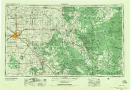
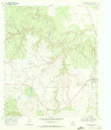
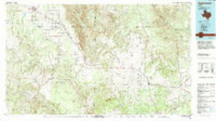
6 topographic sheets cover this place, the earliest surveyed in 1954 and the latest in 1985. It stands in the Jayton South census division. It lies in ZIP code area 79549. The Survey maps it on the Clairemont West quadrangle. 15 people lived here at the 2008 count. It stands 2,126 feet above sea level.
Topographic sheets covering this place
3 surveys from 6 printed sheetsMatched by testing this settlement's coordinate against the published boundary of every sheet in the United States Geological Survey's historical collection. Each opens the scanned sheet at the Survey.
- 1954 USGS Lubbock quadrangle1:250000, 4 printings
- 1969 USGS Clairemont West quadrangle1:24000
- 1985 USGS Aspermont quadrangle1:100000
Fires near this place
1 since 2009Regional context, not property-specific evidence. The federal wildfire occurrence database lists 1 fire within 5 miles of Clairemont in 2009, burning about 3 acres in total. None started naturally. None was recorded as arson. Distance is straight-line from the map coordinates, so a fire counted here may appear on a neighbouring settlement's page as well.
| Reported cause | Fires |
|---|---|
| Power generation/transmission/distribution | 1 |
The most recent of them, most recent first, with the day each was reported and the service that recorded it.
| Date | Cause | Size | Reported by | Name on the report |
|---|---|---|---|---|
| 5 August 2009 | Power generation/transmission/distribution | 3.0 acres | Texas A & M Forest Service | WALLACE |
Storms near this place
54 since 1995Regional context, not property-specific evidence. The National Weather Service names Clairemont in 54 storm reports between 1995 and 2025: 30 hail, 11 tornado, 8 thunderstorm wind, 3 flash flood. No death or injury is recorded in these reports. Each account below is quoted exactly as the forecast office filed it, from the NOAA Storm Events Database, and each date opens the federal record of that event.
| When | Event | Place named | Harm | What the report says |
|---|---|---|---|---|
| June 2005 | Tornado (F2) | Clairemont | $150,000 | The National Weather Service in Lubbock, TX conducted a damage survey in Kent County, approximately 8 miles to the northeast of Clairemont. In collaboration with the Center for Severe Weather Research in Boulder, CO and Texas Tech University meteorologists assessing the tornadoes across the county with Doppler-On-Wheels (DOW) data, a better understanding of the wind fields and tornado timing was achieved. The area of assessed damage was bounded by a triangle comprised of FM2320 to the south, FM1228 to the east, and CR112 to the west. There was a damage path characterized by tree damage across the zone. The path of the damage was oriented from a northeast-east to southwest-west direction. DOW data confirmed the large, wedge tornado initially propagated to the east and northeast, became nearly stationary, then rotate southward around the west side of the parent mesocyclone. The tornado moved to the southwest, then south and crossed FM1228 from the north/northeast to the south/southwest. The path of the tornado was between 0.6 to 0.7 miles wide. In assessing the damage, a circulatory patter was evident in a wheat field owned by a private farmer, with all of the wheat laying down to the south. Along this quadrant of the circulation, large farm equipment (tractors and cotton trailers) were tossed and mangled. An 80,000 lb box car was shaken by the tornado and the associated strong wind but was not moved from its location, however the contents inside were disturbed. The farm vehicles were tossed briefly a few times as there were scar marks and impact marks in the field as the equipment was blown to the south. The front-end of one tractor was snapped off after the second impact with the ground, as the vehicle was likely too heavy to remain airborne and was dragged and rolled by the tornadic wind and circulation. On the east side of the circulation, there were tree branches not grown in that immediate area that were stripped clean of bark. A cotton trailer (lighter than the other equipment) was lifted from its original location and was tossed to the north and mangled upon impact. The equipment was tossed approximately 3/10 of a mile within the circulation. It was evident from the damage pattern and debris, the circulation was multi-vortex in nature. The DOW measured wind speeds ranging from 45, 65 and 90 meters per second at various stages of the tornado life cycle at heights between 3 and 50 meters above ground level. |
| May 2006 | Thunderstorm Wind | Clairemont | $50,000 | many large mesquite limbs were snapped from trees along U.S. Highway 380 near Clairemont. A local bed and breakfast inn suffered wind damage when several windows and a sliding glass door were blown out. Roof damage also occurred when a large tree was uprooted, and fell onto the south and southwest side of the building . A small grain silo also was destroyed. |
| May 2017 | Thunderstorm Wind | Clairemont | $30,000 | South Plains Electric Cooperative reported that ten power poles were blown over along State Highway 70 just south of US Highway 380 southwest of Jayton. Furthermore, a sheriff's deputy with Kent County reported that windows in a barn were destroyed; most likely by wind driven hail. |
| June 2009 | Hail | Clairemont | $30,000 | Very large baseball size hail stones were reported by storm chasers in Clairemont. These hail stones were produced by a prolific supercell thunderstorm that developed over the Clairemont vicinity along a pre-existing outflow boundary. The storm moved very little for almost an hour. Minor damages to vehicles and roofs were reported. |
| June 2004 | Thunderstorm Wind | Clairemont | $30,000 | Strong thunderstorm wind destroyed a trailer. |
| June 2009 | Hail | Clairemont | $20,000 | Multiple reports of large hail were received from the Clairemont vicinity as a large supercell thunderstorm developed along a pre-existing outflow boundary and remained almost stationary. Local fire department officials initially reported golfball size hail east of Clairemont along U.S. Highway 380 at 13:47 CST. By 13:58, very large hail was reported in Clairemont as the storm grew in coverage and intensity and effectively back built toward the town. Nickel size hail continued to fall near Clairemont until 14:37 CST. Although minor damage to vehicles and roofs occurred, no major damage was reported. |
| May 2004 | Hail | Clairemont | $10,000 | The Kent County Sheriff's Office reported golfball size hail. |
| June 1999 | Thunderstorm Wind | Clairemont | $5,000 | Strong thunderstorm wind blew down at least two power poles. |
| June 2025 | Hail | Clairemont | - | A storm chaser reported two inch diameter hail north of Clairmont along Texas State Highway 208. No damage was reported at the time. |
| June 2025 | Funnel Cloud | Clairemont | - | A storm chaser observed a brief funnel cloud north of Clairmont. |
| June 2023 | Hail | Clairemont | - | A storm chaser reported golf ball size hail east of Clairemont along US Highway 380. |
| May 2021 | Hail | Clairemont | - | Several reports of hail up to baseball size were received from storm chasers in a swath from about nine miles southwest of Girard to the town of Girard. No damage was reported. |
| October 2021 | Hail | Clairemont | - | A storm chaser measured hail up to ping pong ball size along US Highway 380 in Kent County. |
| May 2020 | Hail | Clairemont | - | A report was received via mPING of quarter size hail near the intersection of Farm to Market Roads 2320 and 1081. |
| April 2019 | Hail | Clairemont | - | No damage was reported. |
| June 2018 | Hail | Clairemont | - | No damage was reported. |
| May 2017 | Hail | Clairemont | - | Storm chasers observed severe hail ranging in size from quarters to as great as two inches in diameter within a hail swath estimated to be 23 miles in length. The largest hail report occurred at 1652 CST, about nine miles southeast of Clairemont on Highway 70. It is likely that vehicles along Highways 380 and 70 sustained hail damage, but no specific information was available. |
| April 2016 | Hail | Clairemont | - | A storm chaser reported two inch hail along US Highway 380 about two miles southwest of Clairemont. No damage was reported. |
| April 2016 | Tornado (EF0) | Clairemont | - | Storm chasers documented a brief EF-0 tornado west of US Highway 208 about 8.5 miles southwest of Girard. No damage survey was conducted as the tornado remained over undeveloped land. |
| November 2011 | Thunderstorm Wind | Clairemont | - | Kent County law enforcement estimated a wind gust to 60 mph. A few tree limbs were reported to be downed. |
| July 2010 | Heavy Rain | Clairemont | - | Scattered showers and thunderstorms initially began to produce rainfall around midday on the 1st. This activity gradually evolved toward heavy tropical downpours, especially during the evening hours of the 3rd through the morning hours of the 4th.||The Texas Tech University West Texas Mesonet site near Jayton recorded a storm total rainfall of 6.30 inches. No significant flooding or flash flooding was reported. |
| June 2010 | Hail | Clairemont | - | Law enforcement officials reported golf ball size hail northeast of Clairemont shortly before 18:00 CST. |
| April 2009 | Tornado (EF0) | Clairemont | - | The previously tornadic supercell that impacted Justiceburg (southeastern Garza County) continued to move northeastward into western Kent County. A local rancher interviewed during a post-storm National Weather Service survey witnessed a brief tornado in open ranch land. The tornado occurred immediately south of U.S. Highway 380 and just east of the Garza and Kent County line. No damage was reported, but the rancher reported hearing a loud roar as the tornado passed. |
| April 2009 | Tornado (EF0) | Clairemont | - | An intense Doppler radar indicated low-level circulation developed within the southwestern flank of an evolving convective complex over remote areas of northwestern Kent County shortly after 20:30 CST. No visual observations of a tornado were received. A post-storm National Weather Service survey, however, discovered tumble weeds and other vegetative debris suspended in utility wires just south of Farm to Market Road 2320 and east of that roadways intersection with Farm to Market Road 1081, approximately eleven miles northwest of Clairemont. This evidence of a localized wind event was consistent with survey observation where a well-documented tornado crossed a major U.S. highway in northwestern Lubbock County earlier in the evening, and is well correlated to the intense radar derived tornadic vortex signature. Event time is estimated per radar. |
| April 2009 | Hail | Clairemont | - | Skywarn storm spotters reported golfball size hail along Texas Farm to Market Road 1081 northwest of Clairemont. |
| April 2009 | Hail | Clairemont | - | Local ranchers interviewed during a post-storm National Weather Service survey reported that a swath of golfball size hail fell from the Garza and Kent County line along U.S. Highway 380 to near the intersection of Farm to Market Roads 1081 and 2320. Large swaths of de-leafed mesquite trees were evident within the reported hail swath, but no property damage was reported. The parent storm was the same supercell thunderstorm that earlier produced giant hail near Justiceburg and Lake Alan Henry in Garza County. |
| June 2006 | Hail | Clairemont | - | Motorists returning to their rural residence between Texas Highway 70 and Farm to Market Road 208 in southern Kent County encountered three-quarter inch diameter hail covering the ground in drifts. Event time is estimated by radar given that the severe storm that produced the hail had already departed the area when the hail drifts were discovered. |
| June 2006 | Thunderstorm Wind | Clairemont | - | A trained storm spotter estimated severe thunderstorm wind gusts in excess of 70 MPH in association with a microburst over extreme southwestern Kent County. |
| June 2006 | Hail | Clairemont | - | The public reported ping-pong ball size hail in Clairemont. |
| May 2006 | Hail | Clairemont | - | The Kent County Sheriff's Office reported golfball size hail along U.S. Highway 380 southwest of Clairemont. |
| June 2005 | Tornado (F0) | Clairemont | - | NWS meteorologist report of a tornado on the ground for around three minutes. |
| June 2005 | Tornado (F0) | Clairemont | - | University of Oklahoma Graduate Student and Storm Chasers report of a tornado. |
| June 2005 | Tornado (F0) | Clairemont | - | NWS meteorologist and University of Oklahoma Graduate Student and Storm Chasers report of a tornado. |
| June 2005 | Tornado (F0) | Clairemont | - | NWS meteorologist and University of Oklahoma Graduate Student and Storm Chasers report of a tornado. |
| June 2005 | Tornado (F0) | Clairemont | - | University of Oklahoma Graduate Student and Storm Chasers report of a tornado. |
| June 2005 | Tornado (F0) | Clairemont | - | University of Oklahoma Graduate Student and Storm Chasers report of a tornado. |
| June 2004 | Flash Flood | Clairemont | - | The intersection of Highway 208 and Farm-to-Market Road 2320 was under several feet of water. |
| June 2003 | Thunderstorm Wind | Clairemont | - | The Kent County Sheriff's Office reported 70 mph thunderstorm wind gusts. |
| May 2001 | Thunderstorm Wind | Clairemont | - | An off-duty NWS meteorologist estimated 65 mph thunderstorm wind on Highway 380. |
| June 1999 | Flash Flood | Clairemont | - | Kent County Sheriff's Office reported deep water flowing across FM 208. |
| May 1999 | Tornado (F0) | Clairemont | - | A brief tornado touchdown in open country was reported by law enforcement officials. No NWS survey was conducted. |
| June 1998 | Hail | Clairemont | - | Dime-sized hail was reported near Clairemont by the public. |
| September 2005 | Hail | Clairemont | - | no account filed |
| May 2004 | Hail | Clairemont | - | no account filed |
| April 2000 | Hail | Clairemont | - | no account filed |
| May 1999 | Hail | Clairemont | - | no account filed |
| January 1998 | Hail | Clairemont | - | no account filed |
| June 1997 | Hail | Clairemont | - | no account filed |
| June 1997 | Flash Flood | Clairemont | - | no account filed |
| May 1996 | Hail | Clairemont | - | no account filed |
| May 1996 | Hail | Clairemont | - | no account filed |
| May 1995 | Hail | Clairemont | - | no account filed |
| June 1995 | Hail | Clairemont | - | no account filed |
| October 1995 | Hail | Clairemont | - | no account filed |
Nearest settlements
The eight closest, with where each one stands in the county. Distances are straight-line, computed from the Geographic Names Information System coordinates.
Elsewhere
Matched on this settlement's Geographic Names Information System number rather than its name, so it cannot be a different place of the same name in another state.
| Wikipedia article on Clairemont | An encyclopaedic summary. Its text is share-alike, so it is linked here rather than copied. |
| Wikidata item Q5125373 | The structured record the population and elevation above come from. Public domain (CC0). |
Provenance
This settlement is recorded in the Geographic Names Information System as feature 1354539. The sheet list is computed by point-in-boundary test against the United States Geological Survey's historical topographic inventory. Both are works of the United States government and carry no copyright under 17 U.S.C. 105.
Wildfire. Short, Karen C. 2022. Spatial wildfire occurrence data for the United States, 1992-2020 [FPA_FOD_20221014]. 6th Edition. Fort Collins, CO: Forest Service Research Data Archive. https://doi.org/10.2737/RDS-2013-0009.6 Collected with United States Government funding and usable without additional permissions or fees.
Storms. NOAA National Centers for Environmental Information, Storm Events Database https://www.ncei.noaa.gov/stormevents/ A work of the United States government, no copyright under 17 U.S.C. 105. Narratives are quoted verbatim from the National Weather Service report and are not edited or summarised.