 Block
BlockClifton, Texas
12 topographic sheets cover this place, the earliest surveyed in 1888 and the latest in 1985. It stands in the Clifton census division. It lies in ZIP code area 76634. The Survey maps it on the Clifton quadrangle. 3,465 people lived here at the 2020 count. It stands 673 feet above sea level.
On record in Clifton
Buildings and businesses the archive holds for this place. Each opens its own page, with the source record it came from.
On the National Register 12 of 32 shown
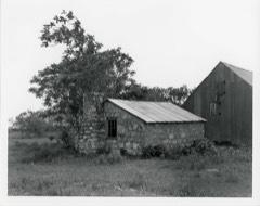 Brogdon Farmlisted 1983
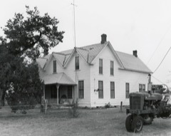 Bronstad Houselisted 1983
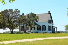 Peder Dahl Farmlisted 1983
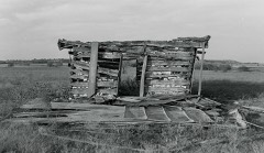 Adolf and Christine Godager Homesitelisted 1983
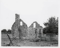 Wilson Homesitelisted 1983
- J. H. Bekken Houselisted 1983
- Brandhagen Houseslisted 1983
- John and Mary Colwick Farmlisted 1983
- Ellingson Farmlisted 1983
- Even and Petrine Erickson Farmlisted 1983
- Ole and Elizabeth Finstad Homesitelisted 1983
- Gunsten and Lofise Grimland Houselisted 1983
Population over time
2 figuresClifton grew from 3,442 to 3,465 between 2010 and 2020. These are the recorded population figures Wikidata holds for this place, reached through the Geographic Names Information System number this page is keyed on rather than by name, so they belong to this place and not to another of the same name. Most are census counts, but not all are: an early figure may be a founding or settlement estimate, and an estimate published within five years of a census is left out. The change column is computed, and is left blank where more than 20 years separate a figure from the one before it, because a gap that long is not a change between two counts.
| Year | People | Change |
|---|---|---|
| 2010 | 3,442 | |
| 2020 | 3,465 | +23 (+1%) |
Topographic sheets covering this place
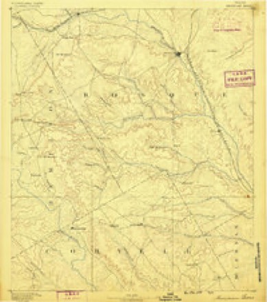
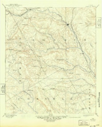
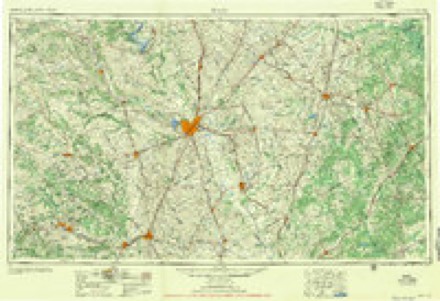
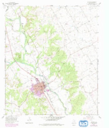
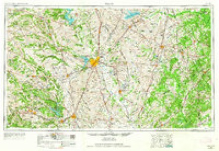
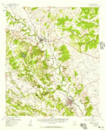
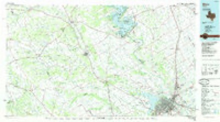
7 surveys from 12 printed sheetsMatched by testing this settlement's coordinate against the published boundary of every sheet in the United States Geological Survey's historical collection. Each opens the scanned sheet at the Survey.
- 1888 USGS Meridian quadrangle1:125000
- 1894 USGS Meridian quadrangle1:125000, 3 printings
- 1954 USGS Waco quadrangle1:250000, 2 printings
- 1955 USGS Clifton quadrangle1:24000, 2 printings
- 1955 USGS Waco quadrangle1:250000
- 1956 USGS Clifton quadrangle1:62500
- 1985 USGS Waco quadrangle1:100000, 2 printings
Fires near this place
121 since 2005Regional context, not property-specific evidence. The federal wildfire occurrence database lists 121 fires within 5 miles of Clifton between 2005 and 2020, burning about 683 acres in total. 2 started naturally. 2 were recorded as arson. Distance is straight-line from the map coordinates, so a fire counted here may appear on a neighbouring settlement's page as well.
| Reported cause | Fires |
|---|---|
| Debris and open burning | 65 |
| Missing data/not specified/undetermined | 26 |
| Equipment and vehicle use | 11 |
| Power generation/transmission/distribution | 9 |
| Smoking | 3 |
| Arson/incendiarism | 2 |
| Recreation and ceremony | 2 |
| Natural | 2 |
| Railroad operations and maintenance | 1 |
The most recent of them, most recent first, with the day each was reported and the service that recorded it.
| Date | Cause | Size | Reported by | Name on the report |
|---|---|---|---|---|
| 9 September 2017 | Debris and open burning | 2.0 acres | Texas A & M Forest Service | RUDY PAUL |
| 9 September 2014 | Debris and open burning | 4.0 acres | Texas A & M Forest Service | SAMMY LEACH |
| 9 September 2011 | Missing data/not specified/undetermined | 2.0 acres | Texas A & M Forest Service | GRASS |
| 8 September 2011 | Debris and open burning | 300 acres | Texas A & M Forest Service | FIRE 219 |
| 23 September 2017 | Equipment and vehicle use | 1.0 acres | Texas A & M Forest Service | RONNY LAIRDON |
| 21 September 2014 | Debris and open burning | 1.0 acres | Texas A & M Forest Service | UNKNOWN |
| 20 September 2015 | Debris and open burning | 50 acres | Texas A & M Forest Service | FM 2136 |
| 18 September 2013 | Arson/incendiarism | 2.0 acres | Texas A & M Forest Service | CHEMICAL LIME PLANT |
Settlements close enough to share some of these fires:
Storms near this place
51 since 1993Regional context, not property-specific evidence. The National Weather Service names Clifton in 51 storm reports between 1993 and 2026: 24 hail, 12 thunderstorm wind, 9 flash flood, 4 tornado. No death or injury is recorded in these reports. Each account below is quoted exactly as the forecast office filed it, from the NOAA Storm Events Database, and each date opens the federal record of that event.
| When | Event | Place named | Harm | What the report says |
|---|---|---|---|---|
| April 2016 | Flash Flood | Clifton | $500,000 | The Bosque County emergency manager reported Farm to Market Road 219 at SH 6 was closed due to flash flooding. During the late morning hours, some homes in Clifton had to be evacuated due to rising flood waters. |
| December 2006 | Tornado (F2) | Clifton | $400,000 | The National Weather Service in Fort Worth conducted a damage survey and concluded a tornado formed east of Clifton. The tornado took a northeast track and went on to damage trees along CR 3355 just south of FM 708. The tornado also heavily damaged a turkey farm at the intersection of CR 3355 and FM 708. Debris from the turkey farm was scattered over a quarter mile northeast of the farm. The tornado continued northeast and heavily damaged two barns on CR 3440 south of the Womack community. Trees and fences were damaged along CR 3410 and CR 3415 just south and east of Womack. The tornado then crossed FM 219 east of Womack and dissipated near the intersection of FM 219 and Highway 22. |
| November 1996 | Thunderstorm Wind | Clifton | $100,000 | no account filed |
| January 2017 | Tornado (EF1) | Clifton | $90,000 | The City of Clifton emergency manager reported a tornado in the city of Clifton. A National Weather Service damage survey crew found evidence consistent with EF-1 type winds. Approximately 40 homes suffered some sort of damage to the home, with two homes with roof damage. Numerous tree, power line, and sign damage was noted in the small and narrow damage path from southwest to northeast. |
| April 2016 | Flash Flood | Clifton | $80,000 | The Bosque County emergency manager reported several cars stalled out in downtown Clifton, due to quickly rising water. |
| April 2011 | Thunderstorm Wind | Clifton | $50,000 | A home in Clifton was damaged by a falling tree, and a tree fell against an apartment complex on 5th street. The business sign for Womack Hall on east Hwy 219 was ripped down and tossed several hundred feet. The front plate glass at the Bosque Emporium was blown in. The city park had to be closed due to extensive tree and wind damage to the park. Several trees in the city were uprooted or split in half. Extensive roof damage also occurred to barns at Texas Safari outside of Clifton. Multiple trees and power poles were also downed throughout the county. |
| September 1994 | Thunderstorm Wind | Clifton | $50,000 | A camper shell was destroyed and the wooden frame of a barn was blown down by high winds. |
| October 2015 | Flash Flood | Clifton | $25,000 | The intersection of State Highway 6 and FM 219 was flooded in Clifton. By this time, over 7 inches of rain had fallen since the rain began the morning of the 23rd. |
| April 2008 | Flash Flood | Clifton | $20,000 | Floodwaters removed portions of pavement from the road at the intersection of Pecan Street and North Avenue F. |
| March 2007 | Flash Flood | Clifton | $20,000 | Numerous roads were flooded with water as high as two-feet across the county. Highways 6 and 281 were closed, and people were stranded in a car. At least one car was submerged in floodwaters. |
| March 2007 | Flash Flood | Clifton | $10,000 | In Clifton, the intersection of State Highway 6 and FM 219 was under about two feet of water. Near Smith's Bend, FM 2490 was flooded and closed, stranding a state trooper. Numerous motorists were also stranded. |
| June 2007 | Flash Flood | Clifton | $10,000 | Highway 6 was shut down due to flooding between Clifton and Valley Mills. Also, the intersections of CR 3455 and CR 3125, FM 219 at Womack Street, FM 2490 and FM 1637L were flooded. Two high water rescues were required. |
| December 2006 | Tornado (F0) | Clifton | $10,000 | The National Weather Service in Fort Worth conducted a damage survey and concluded that a weak tornado touched down east-southeast of Clifton. Tree damage and minor roof and window damage was noted along CR 3350 and CR 3355. |
| April 2009 | Lightning | Clifton | $5,000 | Lightning struck a two-story house between Clifton and Valley Mills. Insulation in the walls caught on fire and was the only damage reported to the home. |
| August 2007 | Thunderstorm Wind | Clifton | $5,000 | Trees were blown down and power was out in the Valley Mills area. |
| March 2004 | Thunderstorm Wind | Clifton | $5,000 | Power lines were blown down in Clifton. |
| July 2018 | Thunderstorm Wind | Clifton | $2,000 | Emergency management reported tree damage and a garage door blown-in just east of the city of Clifton, TX. |
| December 2006 | Tornado (F0) | Clifton | $2,000 | The National Weather Sevice in Fort Worth conducted a storm survey and concluded a tornado formed approximately two miles south of the Canyons subdivision on the west shore of Lake Whitney. Only tree damage was found, and the tornado dissipated after traveling less than a mile. |
| April 2008 | Thunderstorm Wind | Clifton | $1,000 | A large pecan tree was split at the intersection of Avenue H and Pecan Street. |
| October 2013 | Thunderstorm Wind | Clifton | $500 | Three power poles were downed near Clifton High School. |
| April 2026 | Hail | Clifton | - | Facebook photos from a storm chaser showed hail up to quarters 3 miles south of Clifton. |
| May 2025 | Flash Flood | Clifton | - | Law enforcement reported that water was covering some roads in Clifton. |
| April 2025 | Hail | Clifton | - | Clifton PD reported half dollar size hail in Clifton. |
| April 2021 | Hail | Clifton | - | Dime sized hail reported via mPing. |
| July 2020 | Flood | Clifton | - | A report of street flooding in Clifton was relayed by broadcast media via social media. |
| April 2018 | Hail | Clifton | - | Emergency Management reported quarter sized hail in the city of Clifton, TX. |
| April 2018 | Hail | Clifton | - | A public report indicated quarter-sized hail approximately 1 mile west of the city of Clifton, TX. |
| April 2017 | Hail | Clifton | - | Clifton Police Department reported golf ball sized hail at the high school in Clifton, TX. |
| April 2017 | Hail | Clifton | - | A public report of quarter-sized hail was received just north of Clifton Middle School. |
| September 2011 | Thunderstorm Wind | Clifton | - | A large tree was blown down along Farm-to-Market Road 1991 east of Clifton. |
| June 2003 | Thunderstorm Wind | Clifton | - | Two large trees were blown down by high winds. |
| December 2002 | Hail | Clifton | - | Hail covered highways caused several vehicles to slide off Highway 6 south of Clifton. |
| March 1998 | Flash Flood | Clifton | - | The gage on the North Bosque River at Clifton measured the second highest volume of water since records began in 1923. Only minor damage was reported. |
| January 1995 | Hail | Clifton | - | Nickel-size hail covered the ground two inches deep on Highway 6. |
| June 1995 | Thunderstorm Wind | Clifton | - | Highway 174 between Morgan and Meridian was flooded. |
| April 1993 | Hail | Clifton | - | At Clifton, hail covered the ground three inches deep. |
| February 2024 | Hail | Clifton | - | no account filed |
| March 2021 | Hail | Clifton | - | no account filed |
| November 2004 | Hail | Clifton | - | no account filed |
| February 2003 | Hail | Clifton | - | no account filed |
| April 2002 | Hail | Clifton | - | no account filed |
| March 2001 | Hail | Clifton | - | no account filed |
| March 2000 | Hail | Clifton | - | no account filed |
| May 2000 | Hail | Clifton | - | no account filed |
| May 2000 | Hail | Clifton | - | no account filed |
| May 1999 | Hail | Clifton | - | no account filed |
| January 1998 | Hail | Clifton | - | no account filed |
| May 1998 | Hail | Clifton | - | no account filed |
| January 1995 | Hail | Clifton | - | no account filed |
| October 1993 | Thunderstorm Wind | Clifton | - | no account filed |
| October 1993 | Hail | Clifton | - | no account filed |
Nearest settlements
The eight closest, with where each one stands in the county. Distances are straight-line, computed from the Geographic Names Information System coordinates.
| Map | Place | Distance | Sheets |
|---|---|---|---|
| Pendell | 5.1 miles | 12 | |
| Bosque | 5.2 miles | 12 | |
| Norse | 5.4 miles | 13 | |
| Womack | 5.7 miles | 15 | |
| Crossroad Store | 5.8 miles | 12 | |
| Cayote | 6.4 miles | 15 | |
| Valley Mills | 10.1 miles | 16 | |
| Meridian | 10.6 miles | 13 |
Elsewhere
Matched on this settlement's Geographic Names Information System number rather than its name, so it cannot be a different place of the same name in another state.
| Wikipedia article on Clifton | An encyclopaedic summary. Its text is share-alike, so it is linked here rather than copied. |
| Wikidata item Q982843 | The structured record the population and elevation above come from. Public domain (CC0). |
Provenance
This settlement is recorded in the Geographic Names Information System as feature 1332988. The sheet list is computed by point-in-boundary test against the United States Geological Survey's historical topographic inventory. Both are works of the United States government and carry no copyright under 17 U.S.C. 105.
Wildfire. Short, Karen C. 2022. Spatial wildfire occurrence data for the United States, 1992-2020 [FPA_FOD_20221014]. 6th Edition. Fort Collins, CO: Forest Service Research Data Archive. https://doi.org/10.2737/RDS-2013-0009.6 Collected with United States Government funding and usable without additional permissions or fees.
Storms. NOAA National Centers for Environmental Information, Storm Events Database https://www.ncei.noaa.gov/stormevents/ A work of the United States government, no copyright under 17 U.S.C. 105. Narratives are quoted verbatim from the National Weather Service report and are not edited or summarised.