 Block
BlockCollege Hill, Texas
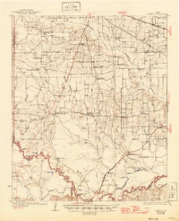
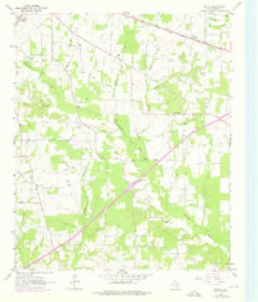
11 topographic sheets cover this place, the earliest surveyed in 1930 and the latest in 1992. It stands in the Dalby Springs-Simms census division. It lies in ZIP code area 75559. The Survey maps it on the Malta quadrangle.
Topographic sheets covering this place
6 surveys from 11 printed sheetsMatched by testing this settlement's coordinate against the published boundary of every sheet in the United States Geological Survey's historical collection. Each opens the scanned sheet at the Survey.
- 1930 USGS Bassett quadrangle1:62500, 2 printings
- 1953 USGS Texarkana quadrangle1:250000, 4 printings
- 1956 USGS Texarkana quadrangle1:250000
- 1965 USGS Malta quadrangle1:24000, 2 printings
- 1986 USGS Texarkana quadrangle1:100000
- 1992 USGS Texarkana quadrangle1:100000
Fires near this place
269 since 1992Regional context, not property-specific evidence. The federal wildfire occurrence database lists 269 fires within 5 miles of College Hill between 1992 and 2020, burning about 3,264 acres in total. 4 started naturally. 25 were recorded as arson. Distance is straight-line from the map coordinates, so a fire counted here may appear on a neighbouring settlement's page as well.
| Reported cause | Fires |
|---|---|
| Debris and open burning | 173 |
| Missing data/not specified/undetermined | 35 |
| Arson/incendiarism | 25 |
| Equipment and vehicle use | 22 |
| Power generation/transmission/distribution | 7 |
| Natural | 4 |
| Railroad operations and maintenance | 1 |
| Smoking | 1 |
| Misuse of fire by a minor | 1 |
The most recent of them, most recent first, with the day each was reported and the service that recorded it.
| Date | Cause | Size | Reported by | Name on the report |
|---|---|---|---|---|
| 9 September 2019 | Missing data/not specified/undetermined | 25 acres | Texas A & M Forest Service | BAIRD 2 |
| 9 September 2006 | Debris and open burning | 1.0 acres | Texas A & M Forest Service | not named |
| 8 September 2019 | Equipment and vehicle use | 25 acres | Texas A & M Forest Service | BAIRD |
| 7 September 2019 | Debris and open burning | under an acre | Texas A & M Forest Service | 528 |
| 6 September 2018 | Debris and open burning | 1.5 acres | Texas A & M Forest Service | BACKYARD |
| 4 September 2011 | Debris and open burning | 2.0 acres | Texas A & M Forest Service | 561 |
| 4 September 1993 | Equipment and vehicle use | 7.0 acres | Texas A & M Forest Service | not named |
| 3 September 2002 | Debris and open burning | 190 acres | Texas A & M Forest Service | LINDEN - 176 |
Settlements close enough to share some of these fires:
Storms near this place
7 since 2009Regional context, not property-specific evidence. The National Weather Service names College Hill in 7 storm reports between 2009 and 2021: 4 thunderstorm wind, 2 tornado, 1 flash flood. No death or injury is recorded in these reports. Each account below is quoted exactly as the forecast office filed it, from the NOAA Storm Events Database, and each date opens the federal record of that event.
| When | Event | Place named | Harm | What the report says |
|---|---|---|---|---|
| January 2018 | Tornado (EF2) | College Hill | $2,500,000 | An EF-2 tornado with maximum estimated winds around 125 mph touched down along Highway 259 just southwest of Dekalb and tracked northeast across the intersection of County Road 4231 and Farm to Market Road 44. Here, it caused significant damage to a well constructed two-story home shifting it off its foundation, and significantly damaging eight chicken houses, two of which were destroyed. The tornadic storm continued northeast where it crossed County Road 4230 and significantly damaged the Dekalb Water Treatment Plant, before crossing the intersection of Farm to Market Road 990 and Farm to Market Road 1840 where a one-story home had its roof removed and several hardwood and softwood trees were snapped or uprooted. As the tornado tracked across County Road 4228, there were signs of it widening where the snapped hardwood trees and downed power lines were more noticeable. Once the tornado tracked across Highway 82, hardwood trees snapped at its base and significant damage to roofs of a church and nearby one and two-story homes were prevalent. The tornadic storm continued to move northeast across County Road 3201 where numerous hardwood trees were downed and a camper was destroyed. The tornado continued northeast where it crossed County Road 3203, uplifting a metal roof from a home and destroyed seven chicken farm buildings. Once it crossed northeast across County Road 3202, it split and twisted hardwood trees and destroyed an outbuilding before finally dissipating.||In all, 16 single family homes were damaged, 9 suffering minor damage, and 7 with major damage, with 32 mobile homes damaged, 25 suffering minor damage, 4 with major damage, and 3 mobile homes destroyed. The Dekalb Water Treatment Plant suffered about $500,000 in damage, with another $500,000 damage done to the chicken houses that were destroyed, as well to an auto repair shop and a gun shop that were significantly damaged. Approximately 200,000 chickens were killed, and 1 cow was killed as well. |
| March 2021 | Thunderstorm Wind | College Hill | - | A tree was blown down in the southbound lane of Highway 259 at the intersection of CR 4235. |
| April 2020 | Thunderstorm Wind | College Hill | - | Trees were blown down across County Road 4230, FM 990, and the intersection of Highway 259 and FM 2735. |
| February 2018 | Flash Flood | College Hill | - | A vehicle was washed off of County Road 4115 off of FM 990 southeast of Dekalb. |
| July 2016 | Thunderstorm Wind | College Hill | - | Trees were downed on power lines along Highway 259 south of Dekalb. |
| October 2010 | Thunderstorm Wind | College Hill | - | Numerous trees and powerlines were downed across the western portion of Bowie County, Texas. |
| May 2009 | Tornado (EF0) | College Hill | - | Several trees were uprooted and snapped along County Road 4250 and near County Road 4245 next to a house. No structural damage was noted. |
Nearest settlements
The eight closest, with where each one stands in the county. Distances are straight-line, computed from the Geographic Names Information System coordinates.
| Map | Place | Distance | Sheets |
|---|---|---|---|
| Ward Creek | 3.5 miles | 11 | |
| Hubbard | 3.8 miles | 11 | |
| Siloam | 4.2 miles | 11 | |
| Dalby Springs | 4.8 miles | 11 | |
| New Hope | 5.1 miles | 11 | |
| Tuckers Corner | 5.2 miles | 11 | |
| Old Salem | 5.2 miles | 11 | |
| Hodgson | 5.5 miles | 11 |
Provenance
This settlement is recorded in the Geographic Names Information System as feature 1379576. The sheet list is computed by point-in-boundary test against the United States Geological Survey's historical topographic inventory. Both are works of the United States government and carry no copyright under 17 U.S.C. 105.
Wildfire. Short, Karen C. 2022. Spatial wildfire occurrence data for the United States, 1992-2020 [FPA_FOD_20221014]. 6th Edition. Fort Collins, CO: Forest Service Research Data Archive. https://doi.org/10.2737/RDS-2013-0009.6 Collected with United States Government funding and usable without additional permissions or fees.
Storms. NOAA National Centers for Environmental Information, Storm Events Database https://www.ncei.noaa.gov/stormevents/ A work of the United States government, no copyright under 17 U.S.C. 105. Narratives are quoted verbatim from the National Weather Service report and are not edited or summarised.