 Block
BlockComstock, Texas
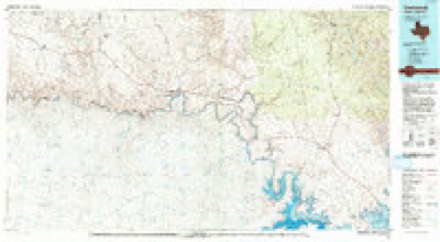
7 topographic sheets cover this place, the earliest surveyed in 1941 and the latest in 1985. It stands in the Del Rio Northwest census division. It lies in ZIP code area 78837. The Survey maps it on the Comstock quadrangle. It stands 1,549 feet above sea level.
Topographic sheets covering this place
5 surveys from 7 printed sheetsMatched by testing this settlement's coordinate against the published boundary of every sheet in the United States Geological Survey's historical collection. Each opens the scanned sheet at the Survey.
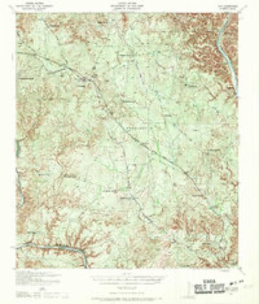
- 1941 USGS Feely quadrangle1:62500
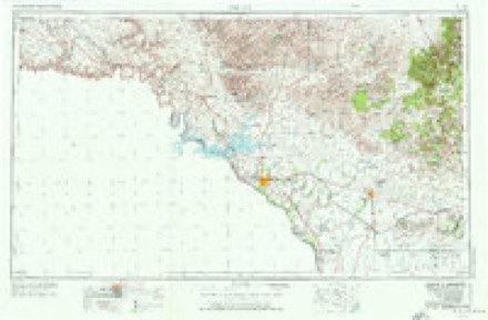
- 1958 USGS Del Rio quadrangle1:250000, 2 printings
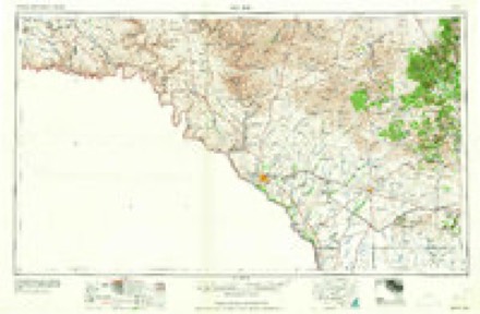
- 1964 USGS Del Rio quadrangle1:250000
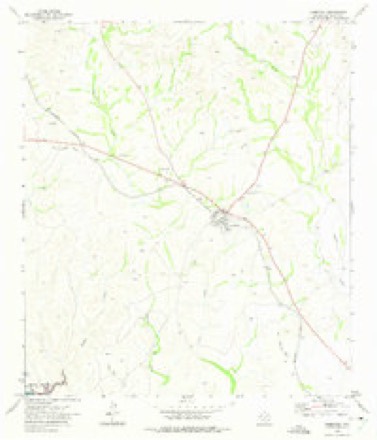
- 1972 USGS Comstock quadrangle1:24000
- 1985 USGS Comstock quadrangle1:100000, 2 printings
Fires near this place
6 since 2005Regional context, not property-specific evidence. The federal wildfire occurrence database lists 6 fires within 5 miles of Comstock between 2005 and 2008, burning about 377 acres in total. 3 started naturally. None was recorded as arson. Distance is straight-line from the map coordinates, so a fire counted here may appear on a neighbouring settlement's page as well.
| Reported cause | Fires |
|---|---|
| Natural | 3 |
| Missing data/not specified/undetermined | 2 |
| Railroad operations and maintenance | 1 |
The most recent of them, most recent first, with the day each was reported and the service that recorded it.
| Date | Cause | Size | Reported by | Name on the report |
|---|---|---|---|---|
| 31 August 2005 | Natural | 25 acres | Texas A & M Forest Service | not named |
| 29 August 2005 | Missing data/not specified/undetermined | 200 acres | Texas A & M Forest Service | not named |
| 12 March 2008 | Railroad operations and maintenance | 2.0 acres | Texas A & M Forest Service | not named |
| 3 January 2008 | Missing data/not specified/undetermined | 12 acres | Texas A & M Forest Service | not named |
| 29 January 2006 | Natural | 69 acres | Texas A & M Forest Service | not named |
| 28 January 2006 | Natural | 69 acres | Texas A & M Forest Service | not named |
Storms near this place
60 of 63 shownRegional context, not property-specific evidence. The National Weather Service names Comstock in 63 storm reports between 1993 and 2026: 32 hail, 14 thunderstorm wind, 9 flash flood, 5 flood. No death or injury is recorded in these reports. Each account below is quoted exactly as the forecast office filed it, from the NOAA Storm Events Database, and each date opens the federal record of that event.
| When | Event | Place named | Harm | What the report says |
|---|---|---|---|---|
| May 2004 | Hail | Comstock | $75,000 | The first supercell began to produce severe weather near 6 pm in Comstock. The combination of large hail and damaging winds broke windows in nearly every home and vehicle in Comstock. In addition, the hail caused widespread minor roof damage. One house had major roof damage. As this supercell thunderstorm began to move to the east-northeast...a second supercell thunderstorm formed to its southwest and began to move toward the city of Del Rio. |
| February 1998 | Thunderstorm Wind | Comstock | $50,000 | A severe downburst destroyed a building east of Comstock, also damaging trees and vegetation in the area. |
| June 1994 | Thunderstorm Wind | Comstock | $50,000 | Storm produced winds estimated at over 60 mph at Mayfield. It blew over a small building that had been anchored in the ground. At Comstock, winds estimated at over 60 mph blew down numerous power lines. |
| May 2004 | Thunderstorm Wind | Comstock | $25,000 | no account filed |
| June 2014 | Thunderstorm Wind | Comstock | $10,000 | A thunderstorm produced wind gusts estimated at 75 mph that blew the roof off of a house. |
| July 2009 | Thunderstorm Wind | Comstock | $5,000 | A thunderstorm produced winds estimated at 50 mph which broke off tree limbs and damaged the roof of a trailer. This storm also produced pea size hail. |
| May 1999 | Thunderstorm Wind | Comstock | $5,000 | Large limbs were blown out of trees by high winds. |
| May 1999 | Thunderstorm Wind | Comstock | $5,000 | Large limbs were blown out of trees by high winds. |
| March 1993 | Hail | Comstock | $5,000 | Several severe thunderstorms moved across Val Verde County during the afternoon. The first reported of large hail was made in Langtry. Tennis ball-size hail was later reported in Langtry, a few cars were damaged along with some house windows. As the storm moved southeast it continued to produce large hail. A Federal Express truck was damaged between Langtry and Comstock. A funnel cloud was reported north of Comstock by the Sheriffs Office. A motorist that was drive under the storm at the time reported golfball-size hail and damage to her car. Golfball-size hail was next reported north of Del Rio at the Greenwood Ranch. As the next set of storms moved across the County a motorist reported golfball-size hail on Highway 377 northeast of Del rio. Golfball-size hail was reported on the LaGrand Ranch Northwest of Comstock. |
| March 1993 | Hail | Comstock | $5,000 | Several severe thunderstorms moved across Val Verde County during the afternoon. The first reported of large hail was made in Langtry. Tennis ball-size hail was later reported in Langtry, a few cars were damaged along with some house windows. As the storm moved southeast it continued to produce large hail. A Federal Express truck was damaged between Langtry and Comstock. A funnel cloud was reported north of Comstock by the Sheriffs Office. A motorist that was drive under the storm at the time reported golfball-size hail and damage to her car. Golfball-size hail was next reported north of Del Rio at the Greenwood Ranch. As the next set of storms moved across the County a motorist reported golfball-size hail on Highway 377 northeast of Del rio. Golfball-size hail was reported on the LaGrand Ranch Northwest of Comstock. |
| June 1995 | Hail | Comstock | $3,000 | ,Large hail reported at Bakers Crossing. |
| June 1995 | Hail | Comstock | $3,000 | ,Large hail reported at Bakers Crossing. |
| May 2012 | Thunderstorm Wind | Comstock | $1,000 | A thunderstorm produced wind gusts estimated at 50 mph that tore off a four inch diameter branch from a healthy Palo Verde tree at Seminole Canyon State Park. |
| April 2026 | Hail | Comstock | - | A thunderstorm produced ping pong ball size hail in Comstock. |
| May 2025 | Thunderstorm Wind | Comstock | - | A thunderstorm produced wind gusts measured at 51 kts by the mesonet station at Gray Ranch north of Comstock. |
| June 2025 | Thunderstorm Wind | Comstock | - | A thunderstorm produced wind gusts measured at 55 kts by a mesonet station at Gray Ranch northwest of Comstock. |
| June 2024 | Thunderstorm Wind | Comstock | - | A thunderstorm produced wind gusts measured at 53 kts by the Gray Ranch mesonet station. |
| February 2023 | Thunderstorm Wind | Comstock | - | A thunderstorm produced wind gusts of 71 mph that were measured by the West Texas Mesonet site southwest of Comstock. |
| May 2023 | Thunderstorm Wind | Comstock | - | A thunderstorm produced wind gusts measured at 50 kts by a West Texas Mesonet site along the Rio Grande southwest of Comstock. |
| June 2023 | Hail | Comstock | - | A thunderstorm produced dime to quarter size hail at Seminole Canyon State Park. |
| May 2021 | Hail | Comstock | - | A Border Patrol officer reported a thunderstorm produced quarter size hail near Comstock. |
| May 2020 | Flood | Comstock | - | Thunderstorms produced heavy rain that flooded Hwy 163 near Dead Mans Creek north of Comstock. A storm chaser sent a video showing several inches of water over the road. |
| May 2019 | Tornado (EFU) | Comstock | - | A storm chaser reported a tornado in open country approximately nine miles northeast of Comstock. No damage was reported. |
| April 2017 | Hail | Comstock | - | A thunderstorm produced golf ball size hail near Comstock. The report was forwarded to us by Laughlin AFB weather from the Border Patrol. |
| April 2017 | Hail | Comstock | - | A thunderstorm produced quarter size hail at Seminole Canyon State Park. |
| April 2017 | Hail | Comstock | - | A thunderstorm produced ping pong ball size hail at Seminole Canyon State Park. |
| September 2013 | Flash Flood | Comstock | - | Road closed at HWY 163 AND 90W with 1 to 2ft of water over roadway. |
| May 2012 | Thunderstorm Wind | Comstock | - | A thunderstorm produced wind gusts estimated at 60 mph. |
| May 2012 | Hail | Comstock | - | A thunderstorm produced hail that covered the ground. The largest hail was quarter size. |
| May 2012 | Flash Flood | Comstock | - | Thunderstorms produced heavy rain that flooded low water crossings, closing FM 1024 and Highway 163. Numerous dirt roads were also washed out by the rain. |
| July 2010 | Flash Flood | Comstock | - | Thunderstorms produced heavy rain which caused flash flooding. One and a half feet of water covered Ranch Road 1024 at Cow Creek. |
| March 2008 | Hail | Comstock | - | The COOP observer in Comstock relayed a report from the public of golf ball size hail. The hail size in the storm ranged from ping-pong ball to golf ball. |
| May 2008 | Hail | Comstock | - | Penny size hail was reported by Border Patrol agents. |
| April 2007 | Flash Flood | Comstock | - | Early morning thunderstorms produced between 2 and 3 inches of rain across central Val Verde County. Up to 5 inches fell near Comstock, closing SH163 and FM1024 due to flash flooding. |
| June 2007 | Flood | Comstock | - | The Devils River at Pafford Crossing near Comstock crested at 9.4 feet at 1015cst on June 10, where 5 feet is flood stage. |
| July 2007 | Flash Flood | Comstock | - | The thunderstorms from Kinney County spread northwestward into Val Verde County by mid morning and covered an area from Del Rio to Comstock. A general 2 to 3 inch rain along this part of the Rio Grande River, with flash flooding closing SH163, FM2523 and several roads in the city of Del Rio through late morning. |
| June 2007 | Flood | Comstock | - | The Devils River at Bakers Crossing crested at 9.9 feet at 0700cst on June 29, where 6 feet is flood stage. |
| May 2007 | Flood | Comstock | - | Devils River at Bakers Crossing crested at 9.87 ft on 0700 CST on May 7, where flood stage is 6 ft. |
| May 2007 | Flood | Comstock | - | The Devils River at Bakers Crossing crested at 8.65 ft on 0845 CST on May 10, where flood stage is 6 ft. |
| May 2007 | Flash Flood | Comstock | - | Scattered showers and thunderstorms produced general 1 to 2 inch rain amounts over southern Val Verde County, with up to 5 inches near Del Rio. Many of the roads in the southern part of the county were closed, including FM1024 and FM163. |
| March 2007 | Flash Flood | Comstock | - | TxDOT reported many roads and highways in the Comstock area under water and closed due to rainfall in the early morning hours of between 3 and 5 inches. |
| September 2004 | Flash Flood | Comstock | - | Very slow-moving thunderstorms formed in the Comstock area in the late afternoon and produced between 2 and 3 inches of rain around the town. The Sheriff's Department reported portions of FM1024 and SH163 briefly closed in the Comstock area. |
| October 2004 | Funnel Cloud | Comstock | - | The public in Comstock reported a short-lived funnel cloud near Comstock. An observer noted that it "looked just like a small snake coming down." The funnel did not touch down. |
| October 2004 | Flash Flood | Comstock | - | Heavy rainfall from late on the night of the 4th through the early morning of the 5th resulted in rainfall of 1 to 2 inches from Comstock to Langtry, with totals of 3 to 4 inches near Langtry. Flash flooding closed FM2523 15 miles northeast of Del Rio near 2330 CST. Barricades were put up in Del Rio near 0130 CST. |
| March 2002 | Tornado (F0) | Comstock | - | This small and short-lived tornado was spotted by Val Verde County Sheriff's Deputies in open country north of Comstock. It caused no damage. |
| March 1993 | Hail | Comstock | - | Several severe thunderstorms moved across Val Verde County during the afternoon. The first reported of large hail was made in Langtry. Tennis ball-size hail was later reported in Langtry, a few cars were damaged along with some house windows. As the storm moved southeast it continued to produce large hail. A Federal Express truck was damaged between Langtry and Comstock. A funnel cloud was reported north of Comstock by the Sheriffs Office. A motorist that was drive under the storm at the time reported golfball-size hail and damage to her car. Golfball-size hail was next reported north of Del Rio at the Greenwood Ranch. As the next set of storms moved across the County a motorist reported golfball-size hail on Highway 377 northeast of Del rio. Golfball-size hail was reported on the LaGrand Ranch Northwest of Comstock. |
| April 1993 | Hail | Comstock | - | A National Park Service Ranger and the sheriff's office reported tennis ball-size hail in the Spur 406 Campgrounds on the West side of Lake Amistad. A Park Ranger also reported 3.00-inch hail in the San Pedro Canyon Estates, northwest of Del Rio. An estimated $112,000 dollars in damage was reported to home in the area. The sheriff's office reported golf ball-size hail covering the ground on Highway 277 north of Del Rio. |
| March 2017 | Hail | Comstock | - | no account filed |
| March 2016 | Hail | Comstock | - | no account filed |
| March 2016 | Hail | Comstock | - | no account filed |
| April 2015 | Hail | Comstock | - | no account filed |
| May 2012 | Hail | Comstock | - | no account filed |
| April 2008 | Hail | Comstock | - | no account filed |
| May 2002 | Hail | Comstock | - | no account filed |
| February 2001 | Hail | Comstock | - | no account filed |
| May 2001 | Hail | Comstock | - | no account filed |
| April 2000 | Hail | Comstock | - | no account filed |
| March 1998 | Hail | Comstock | - | no account filed |
| May 1997 | Hail | Comstock | - | no account filed |
| May 1997 | Hail | Comstock | - | no account filed |
Nearest settlements
The eight closest, with where each one stands in the county. Distances are straight-line, computed from the Geographic Names Information System coordinates.
| Map | Place | Distance | Sheets |
|---|---|---|---|
| Lull | 7.9 miles | 7 | |
| Box Canyon Estates | 10.8 miles | 7 | |
| Amistad Acres | 11.7 miles | 7 | |
| Rough Canyon Colonia | 12.9 miles | 8 | |
| Devils Shores | 13.3 miles | 8 | |
| Shumla | 13.6 miles | 7 | |
| Amistad Village | 17.2 miles | 9 | |
| Bakers Crossing | 19.2 miles | 7 |
Elsewhere
Matched on this settlement's Geographic Names Information System number rather than its name, so it cannot be a different place of the same name in another state.
| Wikipedia article on Comstock | An encyclopaedic summary. Its text is share-alike, so it is linked here rather than copied. |
| Wikidata item Q5157684 | The structured record the population and elevation above come from. Public domain (CC0). |
Provenance
This settlement is recorded in the Geographic Names Information System as feature 1333194. The sheet list is computed by point-in-boundary test against the United States Geological Survey's historical topographic inventory. Both are works of the United States government and carry no copyright under 17 U.S.C. 105.
Wildfire. Short, Karen C. 2022. Spatial wildfire occurrence data for the United States, 1992-2020 [FPA_FOD_20221014]. 6th Edition. Fort Collins, CO: Forest Service Research Data Archive. https://doi.org/10.2737/RDS-2013-0009.6 Collected with United States Government funding and usable without additional permissions or fees.
Storms. NOAA National Centers for Environmental Information, Storm Events Database https://www.ncei.noaa.gov/stormevents/ A work of the United States government, no copyright under 17 U.S.C. 105. Narratives are quoted verbatim from the National Weather Service report and are not edited or summarised.