 Block
BlockCoyanosa, Texas
8 topographic sheets cover this place, the earliest surveyed in 1931 and the latest in 1986. It stands in the Imperial census division. It lies in ZIP code area 79730. The Survey maps it on the Coyanosa quadrangle. 155 people lived here at the 2020 count. It stands 2,608 feet above sea level.
Population over time
3 figuresCoyanosa grew from 138 to 155 between 2000 and 2020. These are the recorded population figures Wikidata holds for this place, reached through the Geographic Names Information System number this page is keyed on rather than by name, so they belong to this place and not to another of the same name. Most are census counts, but not all are: an early figure may be a founding or settlement estimate, and an estimate published within five years of a census is left out. The change column is computed, and is left blank where more than 20 years separate a figure from the one before it, because a gap that long is not a change between two counts.
| Year | People | Change |
|---|---|---|
| 2000 | 138 | |
| 2010 | 163 | +25 (+18%) |
| 2020 | 155 | -8 (-5%) |
Topographic sheets covering this place
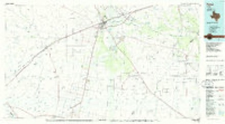
5 surveys from 8 printed sheetsMatched by testing this settlement's coordinate against the published boundary of every sheet in the United States Geological Survey's historical collection. Each opens the scanned sheet at the Survey.
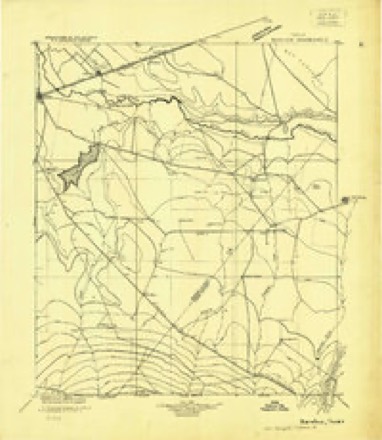
- 1931 USGS Barstow quadrangle1:125000
- 1954 USGS Pecos quadrangle1:250000, 3 printings
- 1957 USGS Pecos quadrangle1:250000
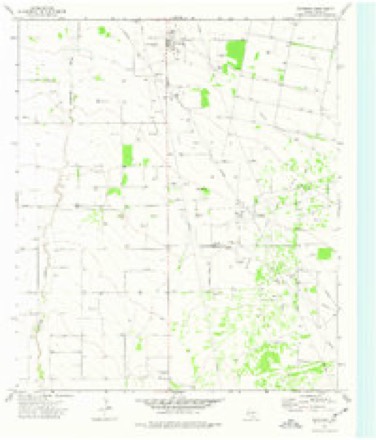
- 1974 USGS Coyanosa quadrangle1:24000
- 1986 USGS Pecos quadrangle1:100000, 2 printings
Fires near this place
2 since 2008Regional context, not property-specific evidence. The federal wildfire occurrence database lists 2 fires within 5 miles of Coyanosa in 2008, burning about 9 acres in total. None started naturally. None was recorded as arson. Distance is straight-line from the map coordinates, so a fire counted here may appear on a neighbouring settlement's page as well.
| Reported cause | Fires |
|---|---|
| Debris and open burning | 1 |
| Missing data/not specified/undetermined | 1 |
The most recent of them, most recent first, with the day each was reported and the service that recorded it.
| Date | Cause | Size | Reported by | Name on the report |
|---|---|---|---|---|
| 11 August 2008 | Missing data/not specified/undetermined | 1.0 acres | Texas A & M Forest Service | not named |
| 11 February 2008 | Debris and open burning | 7.8 acres | Texas A & M Forest Service | not named |
Mines and quarries near this place
1 within 5 milesRegional context, not property-specific evidence. The federal mineral resources record lists 1 working within 5 miles of Coyanosa: 1 producer. All of them still produce. What was taken out: Sulfur. Distance is straight-line from the map coordinates, so a quarry counted here may appear on a neighbouring settlement's page as well.
| Where | Site | Commodity | Status | Recorded |
|---|---|---|---|---|
| Coyanosa Complex Sulphur Plant | Sulfur | Producer |
Storms near this place
56 since 1997Regional context, not property-specific evidence. The National Weather Service names Coyanosa in 56 storm reports between 1997 and 2025: 26 hail, 17 thunderstorm wind, 9 flash flood, 2 heavy rain. The reports record 1 injury. Each account below is quoted exactly as the forecast office filed it, from the NOAA Storm Events Database, and each date opens the federal record of that event.
| When | Event | Place named | Harm | What the report says |
|---|---|---|---|---|
| May 2000 | Thunderstorm Wind | Coyanosa | 1 hurt, $50,000 | The initial thunderstorm of the afternoon produced a dry microburst in the town of Coyanosa. One mobile home was overturned, a second mobile home sustained roof damage, while a hole was incurred in the side a third mobile home. One person received minor injuries. |
| June 2025 | Flash Flood | Coyanosa | $200,000 | Several inches of runoff over FM 1776 with at least 10 low water crossings between Coyanosa and US 285. Time is estimated based on radar and reports. The property cost damage is an estimation. |
| May 2008 | Thunderstorm Wind | Coyanosa | $40,000 | Strong thunderstorm winds downed powerlines and destroyed a camper trailer in Coyanosa. |
| May 2002 | Hail | Coyanosa | $20,000 | Multiple reports from the community of Coyanosa indicated ping-pong ball to baseball size hail fell in and just south of that town for extended periods of time, ranging from 45 minutes to one hour. This resulted in the devastation of melon, onion, and pecan crops. An NWS damage survey also indicated that windows were broken out of vehicles, and roofs were damaged. |
| October 2015 | Thunderstorm Wind | Coyanosa | $16,000 | A thunderstorm moved across Pecos County and produced wind damage in Coyanosa. A roof was torn off the Coyanosa Food Center and a pecan tree was knocked down from wind gusts. The cost of damage is a very rough estimate. |
| June 2017 | Thunderstorm Wind | Coyanosa | $10,000 | A thunderstorm moved across Pecos County and produced wind damage. The power was knocked out in Coyanosa. The cost of damage is a very rough estimate. |
| May 2015 | Flash Flood | Coyanosa | $10,000 | Heavy rain moved across Pecos County and produced a flash flood near Coyanosa. Several cars were reported to have swept off the road. There was a high water rescue by the Pecos County Sheriff's Department of a woman and two children in a car but no injuries were reported. The flood gauge on the road showed that the water was four feet deep. The Texas Tech Mesonet site located about two miles north of Coyanosa reported more than four inches of rain during the evening. The cost of damage is a very rough estimate. |
| October 1997 | Flash Flood | Coyanosa | $10,000 | Heavy rains in the Coyanosa Draw watershed evolved into a raging torrent of water in the draw which flows north into the Pecos River. A man in an 18-wheel truck narrowly escape with his life when his truck was overturned by the flood waters. The truck was attempting to cross the running draw on a dirt road west of FM 1776 when the strong flow lifted and overturned the vehicle. The truck rested on its side in the flooding waters. The truck was carrying forklifts to an oil rig and was on the wrong road. Due to the rural nature of the area and late time the man was not noticed for quite some time.By the time rescue personnel arrived, they saw the man standing in knee-deep water, but then realized that he was standing on the side of his overturned cab. The flood waters were estimated at ten feet deep. The County Sheriff who rescued the man said that the flow was so wide that the rescue was very difficult, and the roar of the water was so loud that they could not communicate with the man verbally. By the time the man was rescued he had been trapped in the flood waters for 2 1/2 hours. EMS personnel said the man was in good health (just very cold), and he was not transported to the hospital.WSR-88D archive showed that most of the rain had fallen earlier and that when the accident happened the rain had been out of the area for over an hour. 88D rainfall estimates were as high as 7.1 inches upstream of the accident. |
| May 2019 | Hail | Coyanosa | $5,000 | A thunderstorm produced baseball sized hail in Coyanosa. The hail resulted in broken windshields. The cost of damage is a very rough estimate. |
| October 2002 | Hail | Coyanosa | $5,000 | The public reported large hail resulting in dents on vehicles traveling on Highway 18 in northern Pecos County. Hail stones were estimated to be the size of half dollars. |
| May 2015 | Thunderstorm Wind | Coyanosa | $4,000 | A thunderstorm moved across Pecos County and produced wind damage near Coyanosa. A storm damage survey was conducted in the area and it was determined that the damage was caused by limited straight-line winds. Telephone poles were snapped at a few locations and were all blown down facing south. Based on the damage, the winds were estimated to be 80 to 100 mph. Hail drifts were also reported with this storm. The cost of damage is a very rough estimate. |
| May 2025 | Thunderstorm Wind | Coyanosa | - | The Texas Tech Mesonet station 2N Coyanosa measured a 63 mph wind gust. |
| April 2025 | Hail | Coyanosa | - | A report of penny size hail was received from mPING. Time is estimated from radar. |
| June 2025 | Thunderstorm Wind | Coyanosa | - | The West Texas Mesonet station 63 2N Coyanosa recorded a 61 mph wind gust, along with a couple of other severe gusts. |
| August 2022 | Thunderstorm Wind | Coyanosa | - | A thunderstorm produced a 59 mph wind gust at the Coyanosa Mesonet site. |
| September 2022 | Thunderstorm Wind | Coyanosa | - | A thunderstorm produced a 60 mph wind gust at the Coyanosa Mesonet site. |
| May 2020 | Tornado (EF0) | Coyanosa | - | A thunderstorm moved across Pecos County and produced a landspout tornado eight miles east of Coyanosa. The time and location of the tornado were estimated by radar. No damage was reported. |
| May 2019 | Thunderstorm Wind | Coyanosa | - | A thunderstorm moved across Pecos County and produced a 61 mph wind gust one mile north of Coyanosa. |
| May 2019 | Tornado (EF0) | Coyanosa | - | A thunderstorm produced a tornado approximately 13 miles north of Fort Stockton, just east of State Highway 18 over open country. The tornado became rain-wrapped which caused difficulty in viewing the entire life cycle of the tornado. The tornado continued to around 12 miles north northeast of Fort Stockton. No damage was reported with this tornado. The peak wind was estimated to be around 80 mph. |
| June 2018 | Thunderstorm Wind | Coyanosa | - | A thunderstorm moved across Pecos County and produced a 69 mph wind gust near Coyanosa. |
| June 2018 | Heavy Rain | Coyanosa | - | Very heavy rain was reported on US Highway 285 twenty miles northwest of Fort Stockton. There was very low visibility due to the rain and the bar ditches were full. |
| April 2017 | Hail | Coyanosa | - | Quarter size hail reported along US 285 about 1 mile south of the Reeves and Pecos county line. |
| July 2017 | Thunderstorm Wind | Coyanosa | - | A thunderstorm moved across Pecos County and produced a 61 mph wind gust near Coyanosa. |
| June 2016 | Thunderstorm Wind | Coyanosa | - | A thunderstorm moved across Pecos County and produced a 66 mph wind gust as recorded by the mesonet by Coyanosa. |
| October 2015 | Thunderstorm Wind | Coyanosa | - | A thunderstorm moved across Pecos County and produced a 72 mph wind gust north of Coyanosa as recorded by the local mesonet station. |
| May 2015 | Heavy Rain | Coyanosa | - | Heavy rain fell north of Coyanosa in Pecos County. Three inches of rain were recorded by the mesonet in 30 minutes and 4.15 inches total were recorded. |
| August 2015 | Thunderstorm Wind | Coyanosa | - | A storm moved across Pecos County and produced a 58 mph wind gust as recorded by the local mesonet station. |
| July 2004 | Flash Flood | Coyanosa | - | An ambulance crew traveling between Coyanosa and Monahans reported flash flooding that caused high water to flow over Farm to Market Road 1776 in several locations between Coyanosa and the Pecos/Ward County line. |
| September 2003 | Flash Flood | Coyanosa | - | The intersection of Farm to Market Roads 1776 and 1450 was closed due to high water. |
| May 2002 | Flash Flood | Coyanosa | - | Street flooding was reported in Coyanosa. |
| May 2002 | Flash Flood | Coyanosa | - | Flooding was reported on Farm to Market Road 1776. |
| May 2002 | Hail | Coyanosa | - | A second severe thunderstorm moved along the same track as the previous storm. The second storm was less intense, resulting in dime size hail. |
| June 2000 | Flash Flood | Coyanosa | - | Flooding continued in Pecos County near the community of Coyanosa on Farm to Market Roads 1776 and 1450. Flood waters receded by 7 pm CST. |
| May 2023 | Hail | Coyanosa | - | no account filed |
| August 2023 | Thunderstorm Wind | Coyanosa | - | no account filed |
| May 2022 | Hail | Coyanosa | - | no account filed |
| May 2021 | Hail | Coyanosa | - | no account filed |
| April 2019 | Hail | Coyanosa | - | no account filed |
| May 2019 | Hail | Coyanosa | - | no account filed |
| May 2019 | Hail | Coyanosa | - | no account filed |
| April 2017 | Hail | Coyanosa | - | no account filed |
| May 2015 | Hail | Coyanosa | - | no account filed |
| May 2015 | Hail | Coyanosa | - | no account filed |
| May 2015 | Hail | Coyanosa | - | no account filed |
| May 2015 | Hail | Coyanosa | - | no account filed |
| May 2015 | Hail | Coyanosa | - | no account filed |
| June 2014 | Hail | Coyanosa | - | no account filed |
| September 2012 | Hail | Coyanosa | - | no account filed |
| June 2011 | Thunderstorm Wind | Coyanosa | - | no account filed |
| October 2010 | Hail | Coyanosa | - | no account filed |
| June 2009 | Hail | Coyanosa | - | no account filed |
| May 2007 | Hail | Coyanosa | - | no account filed |
| June 2004 | Hail | Coyanosa | - | no account filed |
| October 2004 | Hail | Coyanosa | - | no account filed |
| August 2002 | Hail | Coyanosa | - | no account filed |
| May 2000 | Flash Flood | Coyanosa | - | no account filed |
Nearest settlements
The eight closest, with where each one stands in the county. Distances are straight-line, computed from the Geographic Names Information System coordinates.
| Map | Place | Distance | Sheets |
|---|---|---|---|
| Imperial Colonia | 19.6 miles | 8 | |
| Imperial | 19.8 miles | 8 | |
| Abell City | 21.5 miles | 8 | |
| Guild | 22.2 miles | 11 | |
| Buena Vista | 22.6 miles | 8 | |
| Little Mexico Colonia | 24.5 miles | 11 | |
| Bodieville Colonia | 25.2 miles | 11 | |
| Fort Stockton | 26.0 miles | 11 |
Elsewhere
Matched on this settlement's Geographic Names Information System number rather than its name, so it cannot be a different place of the same name in another state.
| Wikipedia article on Coyanosa | An encyclopaedic summary. Its text is share-alike, so it is linked here rather than copied. |
| Wikidata item Q969750 | The structured record the population and elevation above come from. Public domain (CC0). |
Provenance
This settlement is recorded in the Geographic Names Information System as feature 1355271. The sheet list is computed by point-in-boundary test against the United States Geological Survey's historical topographic inventory. Both are works of the United States government and carry no copyright under 17 U.S.C. 105.
Wildfire. Short, Karen C. 2022. Spatial wildfire occurrence data for the United States, 1992-2020 [FPA_FOD_20221014]. 6th Edition. Fort Collins, CO: Forest Service Research Data Archive. https://doi.org/10.2737/RDS-2013-0009.6 Collected with United States Government funding and usable without additional permissions or fees.
Mines and quarries. USGS Mineral Resources Data System (MRDS) https://mrdata.usgs.gov/mrds/ A work of the United States government, no copyright under 17 U.S.C. 105.
Storms. NOAA National Centers for Environmental Information, Storm Events Database https://www.ncei.noaa.gov/stormevents/ A work of the United States government, no copyright under 17 U.S.C. 105. Narratives are quoted verbatim from the National Weather Service report and are not edited or summarised.