 Block
BlockCrane, Texas
9 topographic sheets cover this place, the earliest surveyed in 1928 and the latest in 1986. It stands in the Crane South census division. It lies in ZIP code area 79731. The Survey maps it on the Crane quadrangle. 3,478 people lived here at the 2020 count. It stands 2,575 feet above sea level.
Research this city
Population over time
4 figuresCrane grew from 1,420 to 3,478 between 1940 and 2020. These are the recorded population figures Wikidata holds for this place, reached through the Geographic Names Information System number this page is keyed on rather than by name, so they belong to this place and not to another of the same name. Most are census counts, but not all are: an early figure may be a founding or settlement estimate, and an estimate published within five years of a census is left out. The change column is computed, and is left blank where more than 20 years separate a figure from the one before it, because a gap that long is not a change between two counts.
| Year | People | Change |
|---|---|---|
| 1940 | 1,420 | |
| 2000 | 3,191 | |
| 2010 | 3,353 | +162 (+5%) |
| 2020 | 3,478 | +125 (+4%) |
Topographic sheets covering this place
5 surveys from 9 printed sheetsMatched by testing this settlement's coordinate against the published boundary of every sheet in the United States Geological Survey's historical collection. Each opens the scanned sheet at the Survey.
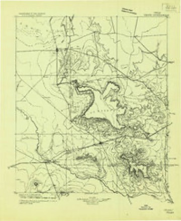
- 1928 USGS Crane quadrangle1:125000
- 1954 USGS Pecos quadrangle1:250000, 3 printings
- 1957 USGS Pecos quadrangle1:250000
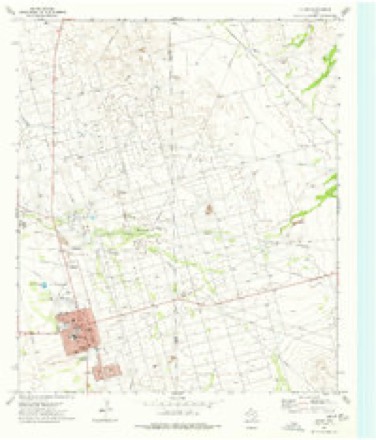
- 1974 USGS Crane quadrangle1:24000
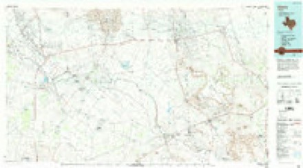
- 1986 USGS Crane quadrangle1:100000, 3 printings
Fires near this place
2 since 2008Regional context, not property-specific evidence. The federal wildfire occurrence database lists 2 fires within 5 miles of Crane between 2008 and 2011, burning about 510 acres in total. 1 started naturally. None was recorded as arson. Distance is straight-line from the map coordinates, so a fire counted here may appear on a neighbouring settlement's page as well.
| Reported cause | Fires |
|---|---|
| Missing data/not specified/undetermined | 1 |
| Natural | 1 |
The most recent of them, most recent first, with the day each was reported and the service that recorded it.
| Date | Cause | Size | Reported by | Name on the report |
|---|---|---|---|---|
| 27 June 2008 | Natural | 110 acres | Texas A & M Forest Service | YOLANDA |
| 4 April 2011 | Missing data/not specified/undetermined | 400 acres | Texas A & M Forest Service | CRANE WEST FIRE |
Mines and quarries near this place
1 within 5 milesRegional context, not property-specific evidence. The federal mineral resources record lists 1 working within 5 miles of Crane: 1 producer. All of them still produce. What was taken out: Sulfur. Distance is straight-line from the map coordinates, so a quarry counted here may appear on a neighbouring settlement's page as well.
| Where | Site | Commodity | Status | Recorded |
|---|---|---|---|---|
| Crane Sulfur Plant | Sulfur | Producer |
Storms near this place
60 of 114 shownRegional context, not property-specific evidence. The National Weather Service names Crane in 114 storm reports between 1993 and 2025: 71 hail, 29 thunderstorm wind, 12 flash flood, 2 tornado. No death or injury is recorded in these reports. Each account below is quoted exactly as the forecast office filed it, from the NOAA Storm Events Database, and each date opens the federal record of that event.
| When | Event | Place named | Harm | What the report says |
|---|---|---|---|---|
| October 1995 | Hail | Crane | $170,000 | no account filed |
| May 2015 | Hail | Crane | $100,000 | A thunderstorm moved across Crane County and produced baseball sized hail in Crane. A damage survey was conducted the next day. Many vehicles had hail damage ranging from broken windshields to numerous dents. The majority of the damage was to vehicles, however there was damage noted at several homes. The cost of damage is a very rough estimate. |
| June 1995 | Hail | Crane | $75,000 | The two supercells that hammered northern Pecos County moved east-northeast into southern Crane County. The first storm had golf ball-size hail in the city of Crane that lasted about 15 minutes and the second storm, which hit Tubbs Corner, had hail up to softball-size that lasted 10 minutes. |
| June 2005 | Thunderstorm Wind | Crane | $20,000 | Severe thunderstorm winds downed at least four utility poles along Farm to Market Road 1601 north of Texas Highway 329 in east-central Crane County. Damaging winds spread east toward Crane, where several large trees were blown down. |
| June 2000 | Thunderstorm Wind | Crane | $20,000 | A severe thunderstorm produced very strong winds and caused damage across the city of Crane. There were numerous reports of roof damage, carport damage, broken windows, and tree damage. An electric meter was knocked off a house and a water line was broken by a falling tree. |
| May 2015 | Hail | Crane | $10,000 | A thunderstorm moved across Crane County and produced golf ball sized hail south of Crane on Highway 385. There were reports of broken windows and some damage to cars. The cost of damage is a very rough estimate. |
| May 2008 | Hail | Crane | $10,000 | Quarter to golfball sized hail fell in Crane. |
| May 2005 | Thunderstorm Wind | Crane | $10,000 | Severe thunderstorm winds downed power lines in Crane. |
| August 2005 | Thunderstorm Wind | Crane | $10,000 | The Crane County Sheriff's Office and the public reported 60 mph winds that blew down power lines. |
| May 2008 | Hail | Crane | $10,000 | no account filed |
| October 1995 | Hail | Crane | $10,000 | no account filed |
| October 1995 | Thunderstorm Wind | Crane | $10,000 | no account filed |
| July 2017 | Thunderstorm Wind | Crane | $7,000 | A thunderstorm moved across Crane County and produced wind damage in the City of Crane. There were downed powerlines at W. 6th Street and Katherine Street. The cost of damage is a very rough estimate. |
| May 2014 | Thunderstorm Wind | Crane | $6,000 | A thunderstorm moved over Crane and produced wind damage. Utility poles were snapped inside the city limits of Crane along Highway 385. The cost of damage is a rough estimate. |
| June 2003 | Thunderstorm Wind | Crane | $5,000 | Severe thunderstorm winds at the Rio Pecos Power Plant resulted in damage to Power Unit #5. |
| June 2004 | Hail | Crane | $5,000 | no account filed |
| April 1997 | Thunderstorm Wind | Crane | $4,000 | Downburst winds from a thunderstorm knocked down trees and powerlines, and caused roof damage to a few houses. |
| May 1993 | Hail | Crane | $500 | no account filed |
| May 1993 | Hail | Crane | $500 | no account filed |
| November 1993 | Thunderstorm Wind | Crane | $50 | no account filed |
| May 2025 | Hail | Crane | - | A report from the public of tennis ball-size hail in Crane was shared on social media. |
| June 2022 | Thunderstorm Wind | Crane | - | A thunderstorm produced a 69 mph wind gust at the Crane Mesonet site. |
| April 2021 | Hail | Crane | - | A thunderstorm produced ping pong to two inch hail stones near Crane, TX. |
| June 2021 | Thunderstorm Wind | Crane | - | A thunderstorm produced a 58 mph wind gust near Crane at the mesonet site. |
| May 2021 | Thunderstorm Wind | Crane | - | A thunderstorm produced a 61 mph wind gust ten miles south of Penwell. |
| May 2021 | Thunderstorm Wind | Crane | - | A thunderstorm produced a 65 mph wind gust five miles west of Crane. |
| March 2019 | Thunderstorm Wind | Crane | - | A thunderstorm moved across Crane County and produced a 62 mph wind gust one mile north northwest of Crane. |
| August 2019 | Thunderstorm Wind | Crane | - | A thunderstorm moved across Crane County and produced a 64 mph wind gust one mile north northwest of Crane at the Mesonet site. |
| May 2015 | Hail | Crane | - | A thunderstorm moved across Crane County and produced one inch hail in Roadside Park south of Crane on Highway 385. |
| April 2012 | Thunderstorm Wind | Crane | - | A thunderstorm moved over Crane County and produced a wind gust of 65 mph four miles west of Crane. |
| May 2008 | Tornado (EF0) | Crane | - | Local law enforcement relayed a trained spotter report of a tornado west of Crane. No damage was reported. |
| March 2007 | Hail | Crane | - | Marble to golfball size hail fell along U.S. Highway 385 north of Crane. |
| March 2007 | Hail | Crane | - | Penny size hail was reported on Farm to Market Road 1601 northwest of Crane. |
| April 2007 | Flash Flood | Crane | - | Several cars were stalled in one to two feet of water at the intersection of U.S. 385 and Texas Route 329. |
| April 2007 | Hail | Crane | - | Quarter to golfball size hail fell in a swath south of Crane. |
| October 2007 | Hail | Crane | - | Penny to nickel sized hail fell at the Chevron--Warren Petroleum plant and along Texas State Highway 1053. |
| July 2007 | Flash Flood | Crane | - | The Crane Police reported flooding at the intersection of 8th and Gaston streets. Due to the high water, the interstection was rendered impassible and therefore barricaded by the police. |
| March 2006 | Thunderstorm Wind | Crane | - | A trained spotter at a petroleum plant in rural Crane county reported 60 mph wind gusts. No damage was reported. |
| May 2006 | Hail | Crane | - | Penny size hail fell two miles north of Tubbs Corner in western Crane County on Farm to Market Road 1053. |
| May 2006 | Hail | Crane | - | Golfball to baseball size hail fell along U.S. Highway 385 north of Crane. |
| May 2006 | Hail | Crane | - | Nickel size hail fell at the intersection of Farm to Market Roads 1053 and 1233. |
| August 2006 | Flash Flood | Crane | - | Six inches of water was flowing over Gaston Street in Crane. |
| July 2005 | Hail | Crane | - | A National Weather Service cooperative observer reported large hail falling for over 30 minutes. At times, strong winds blew the hail horizontally. |
| August 2005 | Flash Flood | Crane | - | Flash flooding was reported on Farm to Market Road 1233 west of Crane. |
| July 2005 | Hail | Crane | - | Nickel to quarter size hail was reported by the public. |
| August 2005 | Hail | Crane | - | A trained spotter reported nickel size hail on U.S. Highway 385 at the Crane/Ector county line. |
| August 2005 | Flash Flood | Crane | - | The public reported over half a foot of water running across the intersection of Texas Highway 329 and Farm to Market Road 1601. The Crane county Sheriff's office reported water flowing over low water crossings across the county. |
| June 2004 | Tornado (F0) | Crane | - | The Odessa Police Department reported a tornado (landspout) in northeast Crane County near U.S. Highway 385.A series of at least four landspout tornadoes developed as outflow from two isolated severe thunderstorms interacted with a pre-existing boundary remnant from the previous night's convection. Strong towering cumulus clouds above the boundary interactions provided sufficient vertical stretching to result in narrow dust filled vortices that visually extended toward the cloud bases. These landspouts were observed by many people in Midland and law officials in Odessa resulting in numerous reports from both public and local emergency officials. |
| August 2004 | Flash Flood | Crane | - | Strong thunderstorms and locally heavy rainfall resulted in flash flooding for the second consecutive day over northeastern Crane County on the 31st. Local officials reported flood waters flowing over U.S. Highway 385 north of Crane. |
| August 2004 | Flash Flood | Crane | - | Local officials reported one foot deep flood waters crossing U.S. Highway 385 north of Crane. |
| August 2004 | Hail | Crane | - | Golfball size hail was reported at a trailer park along U.S. Highway 385 in northeastern Crane County. |
| October 2004 | Flash Flood | Crane | - | Local law enforcement officials reported that a fifty foot section of U.S. Highway 385 was inundated by flood waters north of Crane. |
| August 2003 | Flash Flood | Crane | - | Flash flooding resulted in high water covering Farm to Market Road 1601 just north of the intersection with Farm to Market Road 1233. |
| June 2003 | Hail | Crane | - | Reported at the intersection of Farm to Market Roads 1053 and 1233. |
| June 2003 | Thunderstorm Wind | Crane | - | Reported at intersection of Farm to Market Roads 1233 and 1053. |
| May 2002 | Flash Flood | Crane | - | Up to three inches of rainfall produced flooding along Farm to Market Road 1233, between Farm to Market Road 1601 and Highway 385. A large ranch in this area also reported several ranch roads were washed out due to flooding. |
| March 2000 | Hail | Crane | - | Hail reported at FM 1233 and Fm 1601. |
| October 2000 | Flash Flood | Crane | - | Major street flooding reported by an amateur radio operator. |
| April 1999 | Hail | Crane | - | A short line of thunderstorms developed along the dryline with one of the strongest cells moving over the city of Crane. |
| October 1998 | Hail | Crane | - | This storm developed on the south flank of the storm that went through Culberson, Reeves, and Winkler Counties. This storm took about a 290 degree track while the storm to the north moved at about 270 degrees. |
Nearest settlements
The eight closest, with where each one stands in the county. Distances are straight-line, computed from the Geographic Names Information System coordinates.
| Map | Place | Distance | Sheets |
|---|---|---|---|
| Tubbs Corner | 14.2 miles | 8 | |
| Horsehead Crossing (historical) | 22.2 miles | 8 |
Elsewhere
Matched on this settlement's Geographic Names Information System number rather than its name, so it cannot be a different place of the same name in another state.
| Wikipedia article on Crane | An encyclopaedic summary. Its text is share-alike, so it is linked here rather than copied. |
| Wikidata item Q982574 | The structured record the population and elevation above come from. Public domain (CC0). |
Provenance
This settlement is recorded in the Geographic Names Information System as feature 1355307. The sheet list is computed by point-in-boundary test against the United States Geological Survey's historical topographic inventory. Both are works of the United States government and carry no copyright under 17 U.S.C. 105.
Wildfire. Short, Karen C. 2022. Spatial wildfire occurrence data for the United States, 1992-2020 [FPA_FOD_20221014]. 6th Edition. Fort Collins, CO: Forest Service Research Data Archive. https://doi.org/10.2737/RDS-2013-0009.6 Collected with United States Government funding and usable without additional permissions or fees.
Mines and quarries. USGS Mineral Resources Data System (MRDS) https://mrdata.usgs.gov/mrds/ A work of the United States government, no copyright under 17 U.S.C. 105.
Storms. NOAA National Centers for Environmental Information, Storm Events Database https://www.ncei.noaa.gov/stormevents/ A work of the United States government, no copyright under 17 U.S.C. 105. Narratives are quoted verbatim from the National Weather Service report and are not edited or summarised.